25 February 2014
Mount La Perouse rock avalanche: more images
Posted by Dave Petley
The Mount La Perouse rock avalanche
The Mount La Perouse rock avalanche nine days ago is a very interesting landslide. My original post, based on the seismic data of Colin Stark, Clément Hibert and Goran Ekstrom is here; the first images of it, as collected by Drake Olson, are here.
Satellite data
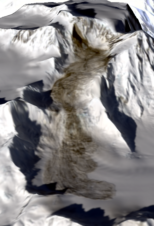
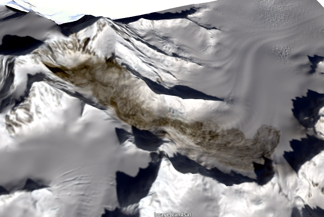
Landsat 8 passed over the landslide on Saturday; nature was kind to us by providing a cloud-free day, so the landslide has been images well. Colin Stark has run a quick initial process of the data, which reveal the following parameters for the Mount La Perouse rock avalanche:
- Maximum length (from the crown to the toe: about 7,400 metres
- Maximum elevation (i.e. height of the crown of the source area): about 2,800 metres
- Minimum elevation (i.e. the height of the toe of the landslide): about 1060 metres
Colin has draped the Landsat 8 data on to a digital elevation model to provide a view of the dynamics of the landslide:

Copyright Colin Stark, used with permission. Image: Landsat 8
..

Copyright Colin Stark, used with permission. Image: Landsat 8
..
Some additional images of the Mount La Perouse rock avalanche
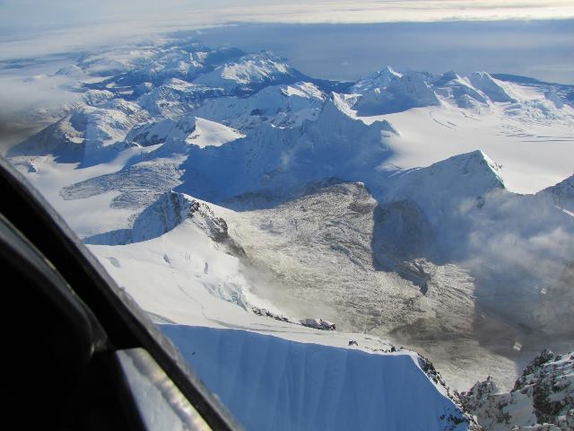
Drake Olson, via Marten Geertsema at UNBC, has provided some additional photographs of the landslide. First, this is a view of the landslide from the air. Note the remarkable super-elevation of the landslide (i.e. the way in which it has run up the sides of the valley):

Copyright Drake Olson – used with permission
..
This is a really vast landslide. To give an impression of the scale, this is the landslide toe. If you look carefully you will just be able to see Drake’s aircraft:

Copyright Drake Olson – used with permission
..
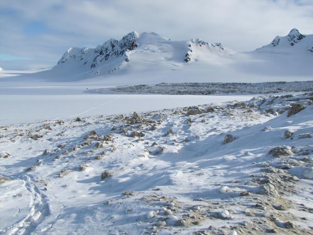
We are all indebted to Drake for collecting these wonderful images. Here he is sitting on the landslide debris:

Copyright Drake Olson – used with permission
..
Acknowledgements
This post uses images and information collected by Colin Stark. He would like to acknowledge NSF, which funded the research under the following schemes:
- Geomorphology and Land-use Dynamics & Geophysics programs under award #1227083
- Division of Civil, Mechanical, and Manufacturing Innovation and the Hazards SEES program under award #1331499


 Dave Petley is the Vice-Chancellor of the University of Hull in the United Kingdom. His blog provides commentary and analysis of landslide events occurring worldwide, including the landslides themselves, latest research, and conferences and meetings.
Could this be a slush avalanche? I’m wondering because of the apparent lateral run up height on the sides and the extremely low run out angle. In case of a slush avalanche, this might possibly have been released by an impulse from an ice avalanche than entered into water saturated snow in the valley. It would be interesting to check the weather conditions at the time.
Krister
I find it interesting how the slide mass near the end of the runout zone has split into parallel ribbons of what appear to be relatively intact material seperated by discrete shears. Is this a common phenomenon?