
6 April 2011
Mount Washington 5: glacial features & views
Busy days here in DC and northern Virginia… Blogging time has been limited.
A few more shots from this past summer’s time at Mount Washington, to fill the void…
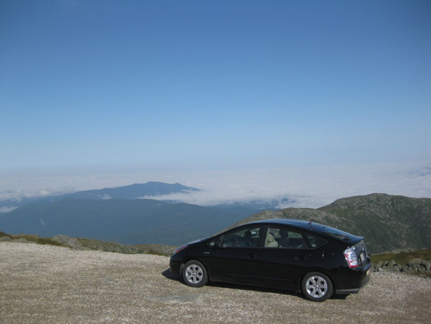
Prius atop mountain:
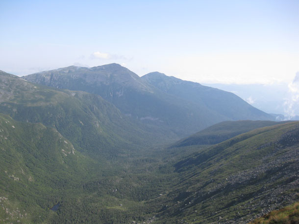
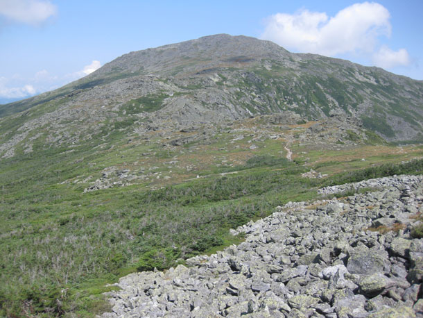
The Great Gulf:
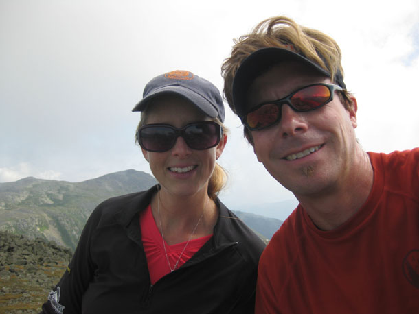
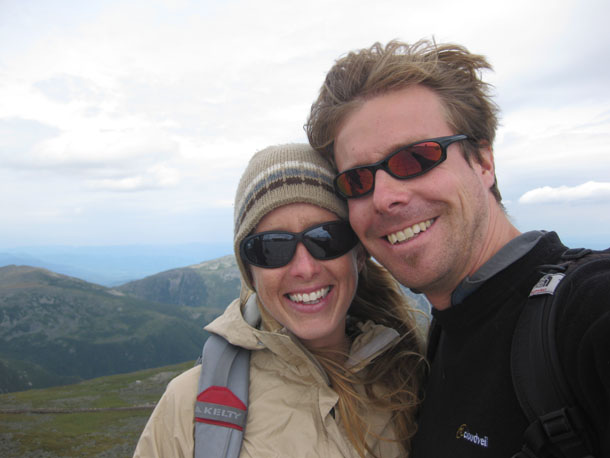
Hikers in relatively warm weather:
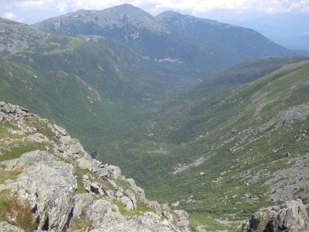
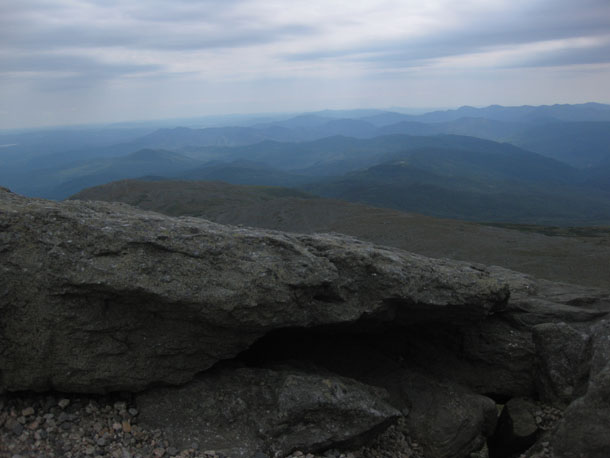
Another look down the Great Gulf:
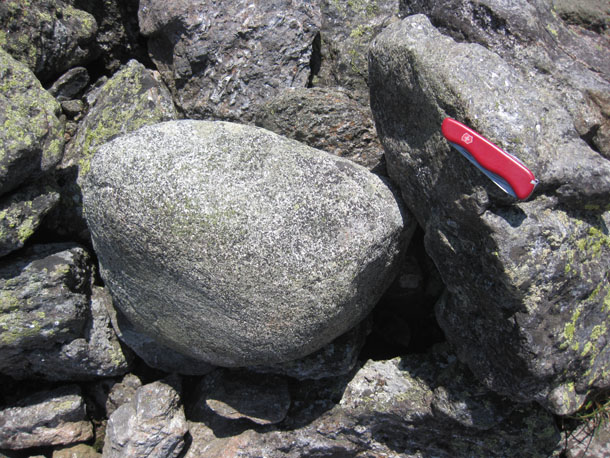
Glacial cobble of diorite, exotic to the top of the Presidential Range, and therefore icily transported there from a distant source.
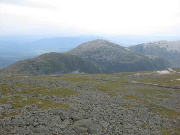
Mount Jefferson, as viewed from Mount Clay:
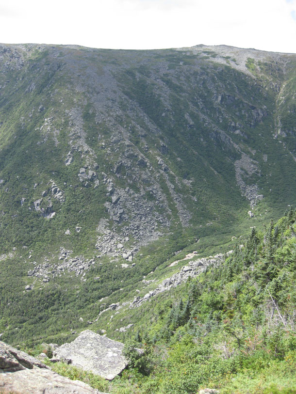
Deep valley:
Cog railway track:
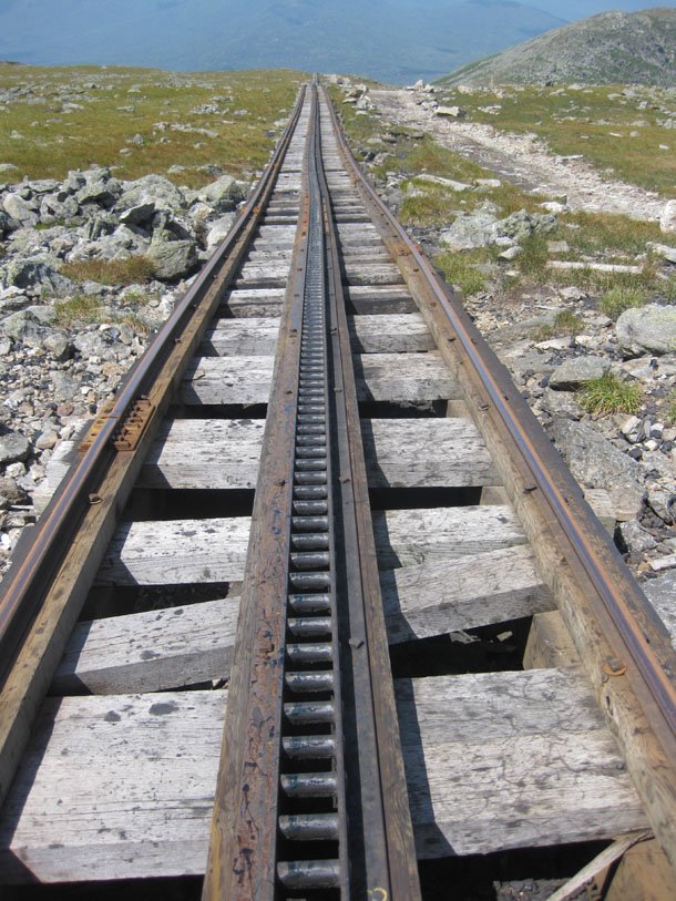
Two trains use it. One is “green” and emits no visible plume of smoke:
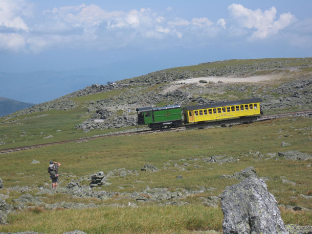
The other is an abomination of industrial design, emitting huge plumes of coal soot into the air as it nosily chugs its way up the mountain. Absolutely disgusting, and unworthy of a photo.
Animated panorama from the summit of Mount Washington, looking north at (left to right) Clay, Jefferson, Adams, and Madison:
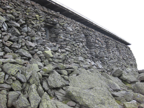
Building atop Mount Washington, made of local rock:
Hikers in relatively cool weather:
New Hampshire has mountains:
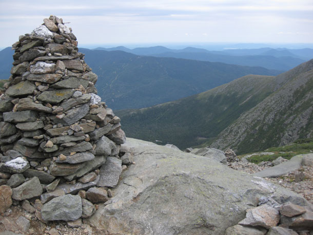
Cairn on the trail down towards Tuckerman Ravine (in background):
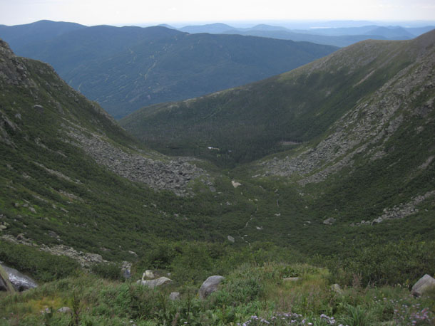
Tuckerman Ravine, looking east:
More later — I’ll at least be able to squeeze out one more blog post this week…
1 April 2011
Friday fold: “Hinges Cemetery” by José Julian Esteban

Cretaceous calcarenite layers, folded along the coast of Spain (?).
From the repository of geological images hosted by the European Geological Union, Imaggeo.
I was reminded of Imaggeo earlier this week, and it’s a great place to go browse around for cool photos of geological things. It could use a better search interface, but oh well. It’s worth it to see images that are both geologically informative and beautiful, like this one.
I suppose yesterday’s post about folded granite dikes in Tuckerman Ravine, New Hampshire, could also have served as this week’s Friday fold, but Señor Esteban’s photo is so much more beautiful, that I think we should let it lead us into the weekend instead.
31 March 2011
Mount Washington 4: folded granite dikes
We now return to Mount Washington, New Hampshire, where our intrepid heroes summit the mountain in a mere three hours (from Pinkham Notch via the Lion Head):
To refresh your memory of the story so far, we had seen metamorphosed turbidites, like this one (new image):
…and checked out some gorgeous metamorphic porphyroblasts of “pseudoandalusite,” like these (new image):
… and some lovely folds in the metamorphic foliation.
Now we descended into Tuckerman Ravine where we espied some more lovely folds, this time deforming a series of petite granite dikelets:
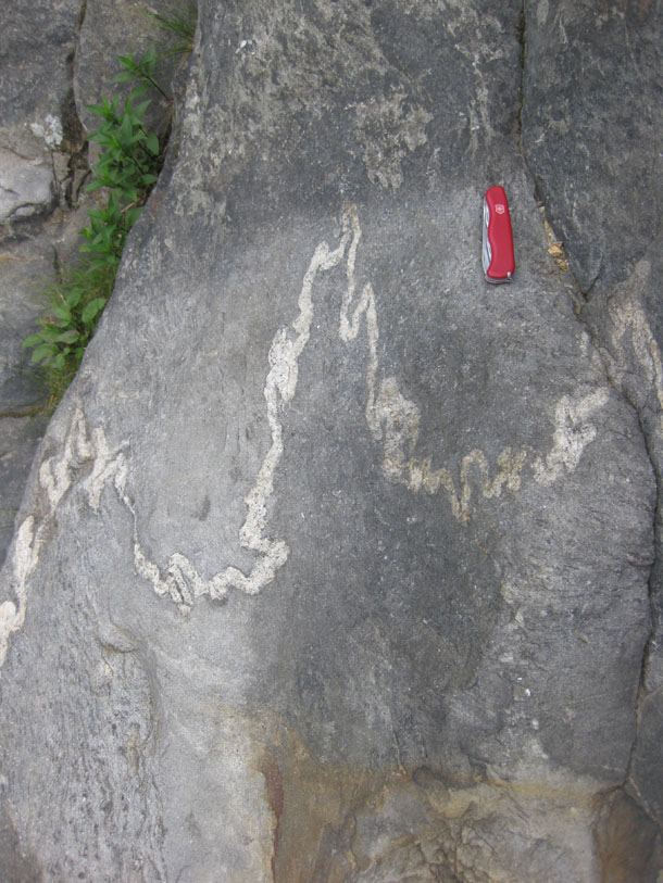
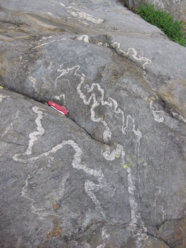
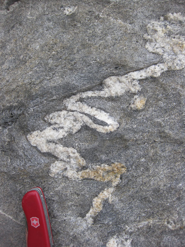
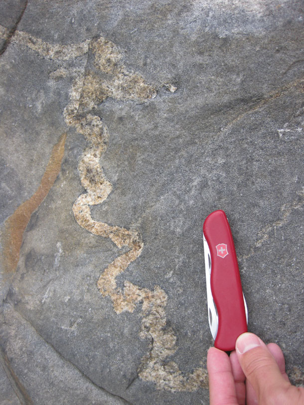
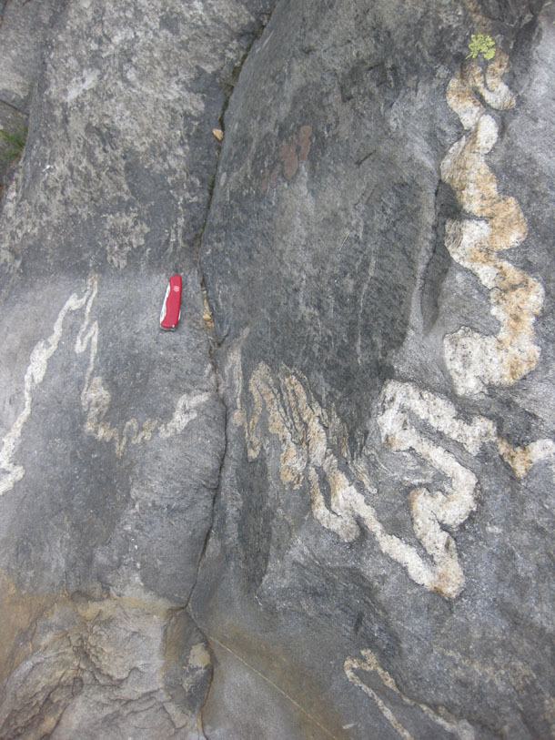
Intense! Intestine-like! Parasitic! Ptygmatic! …Groovy!
30 March 2011
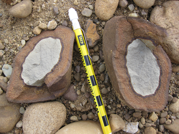
Rusty rinds on peely rocks
Another group of interesting cobbles from the same sand and gravel pit that I described earlier in the week:

Here’s the same sample, gone all animated, for your perspectivizing pleasure:
What we’re seeing here is some fine-grained gray colored rock (siltstone, I guess?) that’s developed a pronounced weathering rind marked by a large amount of rust. This rusty rind is tougher than the original, unaltered rock, and it peels off, like an orange peel. There were a lot of these in that gravel pit for some reason…
Here’s one that split down the middle, like an apple halved by a meat cleaver:
My favorite one — as a certifiable “purty rock,” I brought it home as a little gift for Lily:
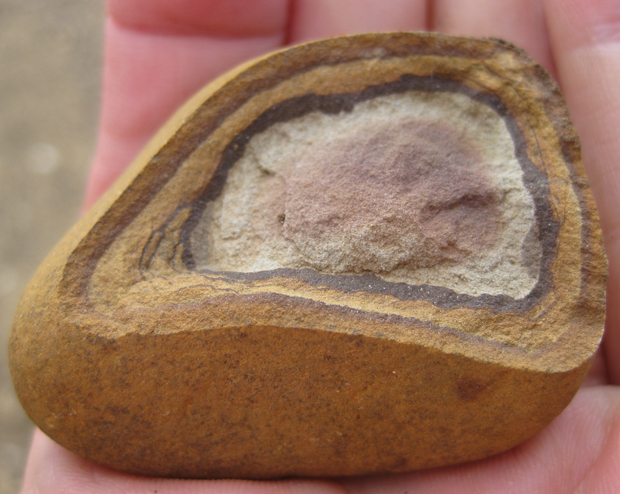
There’s a little bit of Liesegang banding going on in the lower left “corner” of this one — this suggests groundwater soaking in to the cobble and leaving a hematite deposit at the “soaking front.”
29 March 2011
Tillite in outwash
Hoo boy. This one made me yelp…
While on the glacial geology of western Pennsylvania trip last Saturday, we visited a gravel quarrying operation. The operators were extracting gravel from a glacial lake delta deposit, and it was full of glacial outwash — sediments washed out from the melting front of the Erie lobe of the Laurentide ice sheet.
We were there to look at the Pleistocene features, but several of us twitched uncontrollably, to be so close to so many interesting looking cobbles, and we were soon rock-hounding it, checking out what the glaciers had brought to this location from so far away. We found mylonites and diabases, and sandstones, and limestones, granites and gneisses, most bearing distinctive glacial scratches and facets.
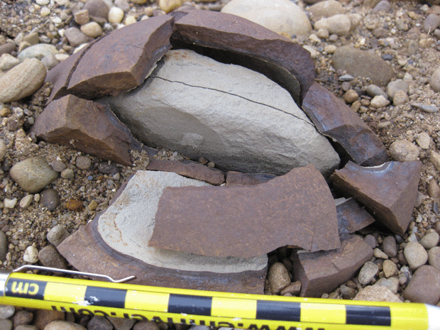
But this one… this one took the cake:
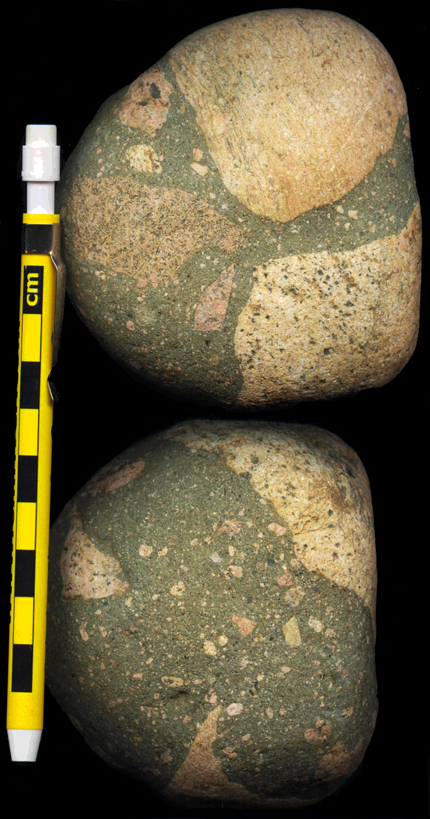
Yes, that’s one rock: The image gives you two views. I scanned the front and back, and used Photoshop to turn the two scans into a single image (with, of course, my awesome LRRD scale pencil for scale). A much bigger version is here.
With its poor sorting, dark matrix, and mix of rounded and angular clasts (many of distinctive pink granite), that looks to me like the Gowganda Tillite, a Paleoproterozoic “Snowball Earth” deposit from central Ontario.My student Robin picked it up on the field trip, right next to the feet of my student Troy! (Troy is pissed that he didn’t spot it first, let me tell you!)
Get what’s so cool about it? This rock is made of sediment that was deposited by a glacier in central Ontario ~2.5 billion years ago. Then that till (poorly sorted glacial sediment) was lithified into tillite, and then well nigh on 2.5 billion years later, a piece of it got plucked off by a Pleistocene glacier, and the cobble was carried south, across what would eventually be declared the U.S. border. It melted out of the ice in western Pennsylvania. A stream carried it into a lake at the margin of the glacier, where it was deposited amid an assortment of sediment that strongly resembled its own internal texture. There it remained, buried until unearthed by the excavations of the gravel company. Then we came along, and Robin picked it up: it’s a twice-glaciated rock!
Technically, the Pleistocene glacial deposit was outwash, rather than moraine (“till”), so it’s not a perfect match for the same depositional process acting at two times. But it was deposited twice by glaciers, glaciers whose ages are separated by half the age of the Earth. Neat, eh?
28 March 2011
A glacial delta complex in western Pennsylvania
A week ago Saturday, my three Honors students and I went on a field trip led by Gary Fleeger of the Pennsylvania Geological Survey, to examine some cool glacial features in western Pennsylvania. The trip was associated with the joint meeting of the northeastern & north-central sections of the Geological Society of America, held in Pittsburgh.
My favorite part of the trip was examining a glacial delta complex near Jacksville, Pennsylvania. We started off with a real treat: checking out the Jacksville Esker:
Here’s a link to a much bigger version of this photograph.
This was my first-ever actual real-life esker. It was pretty cool. Here’s a Google Map “terrain” view:
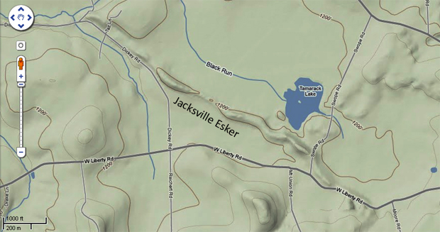
The first photo was taken from W. Liberty road, a bit east of the intersection with Dickey Road, looking north.
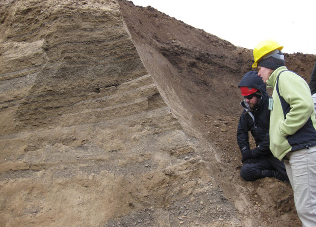
The sediment that comprises this esker was deposited by a stream flowing within glacial ice, and transporting meltwater (and its entrained sediment) out and away from the glacier, in this case towards the southeast. There, the meltwater reached a lake that had formed in front of the glacier (a so-called proglacial lake), where the sediment was deposited in a large delta that grew (“prograded“) out into the lake over time. The lake here has long since drained away, just as the glacier that produced it has melted, but the sediment is still there. This is not the superlatively-poorly-sorted glacial sediment that we call “till,” but a more washed, tumbled, processed, sorted, and overall mature package known as “outwash.” Because it’s concentrated in sand and gravel (and relatively deficient in boulders and mud), outwash deposits make for good places for people to get the sand and gravel we need for construction. The Glacial Sand and Gravel Company is quarrying the delta deposits near Jacksville, and they were kind enough to let us visit their operation to check out the sediments. Here’s some of our crew in the gravel pit:
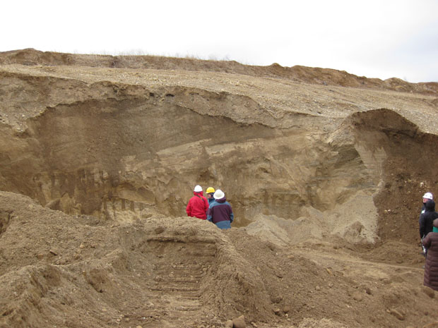
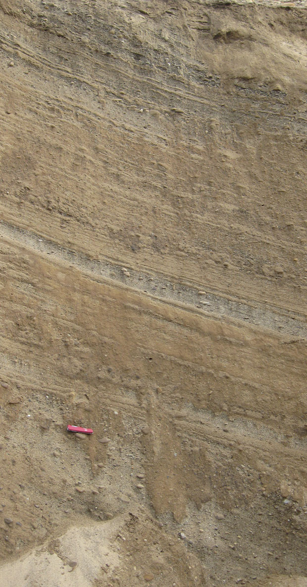
See those tilted layers? Those are foreset beds from the proglacial delta. They aren’t horizontal beds that were later tectonically tilted — this is more or less the inclination at which they were deposited.
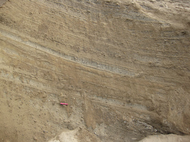
As a river flows into a calm body of water like the ocean or a proglacial lake, the water loses velocity. It can’t carry as much sediment when it’s flowing slowly, so the sediment gets deposited. This forms a delta. Some of the sediment gets deposited at the bottom of the delta’s multiple channels, called distributaries. These distributary deposits are more or less horizontal, and relatively thin in spite of being coarser-grained (because they are in the fastest moving current). They are called topset beds. Sediment dumped off the advancing “nose” of the delta (at the outer tip of the distributaries) is deposited at a slight angle, and these are the foreset beds you see in the picture above. In the deeper, calmer water, we get more horizontal beds, but they are finer-grained due to calmer depositional conditions. These are the bottomset beds.
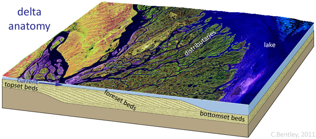
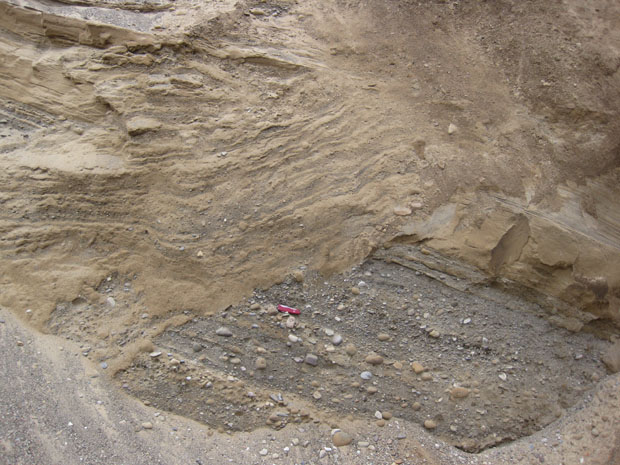
Over time, the delta will grow out into the lake (progradation), and this will be recorded by horizontal bottomset beds overlain by tilted foresets, overlain by horizontal topsets. All three types of delta beds are found in the sand and gravel pit near Jacksville. (Here’s another example, from Maine.) The excavations at the gravel pit allowed us to get in and examine these delta deposits up close and personal:
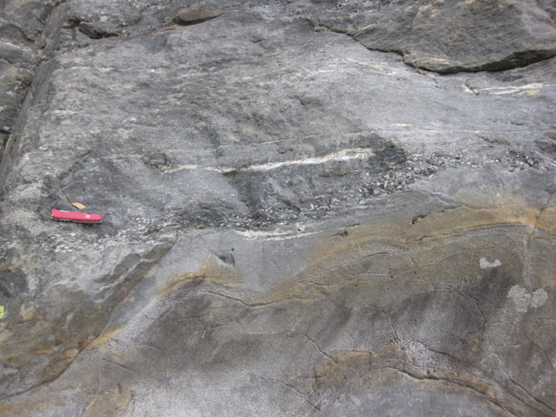
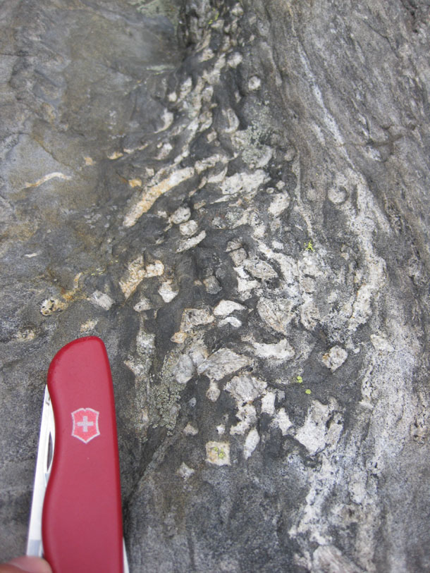
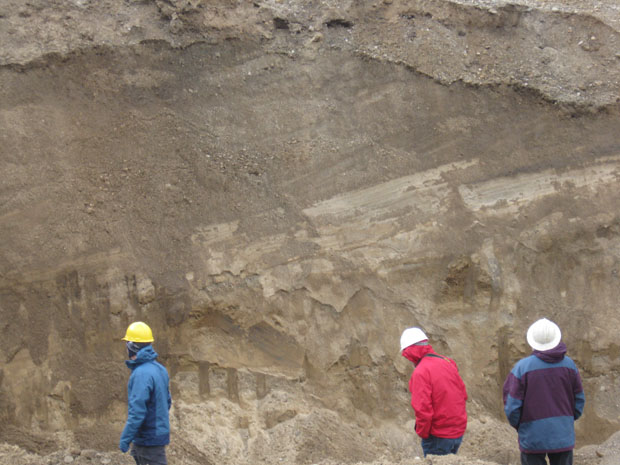
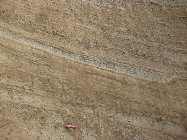
Here’s some more shots of the different exposures of foresets, with my Swiss Army knife for scale (about 8 cm in length):
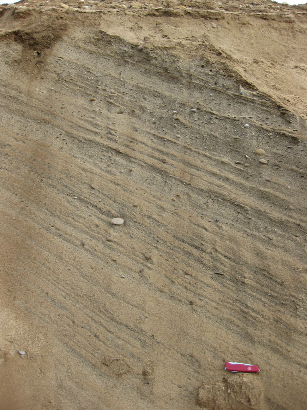
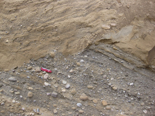
This last outcrop is pretty interesting:
If you zoom in here, you can see a lower, earlier, higher-energy deposit dipping off to the right, overlain by a higher, younger, lower-energy deposit dipping to the left. I’m imagining this as a couple of distributary lobes that overlap at different stages of delta progradation. In other words, first you had a relatively-fast moving distributary channel at this location, cooking along at a rapid enough clip to entrain cobbles and gravel. The current was flowing towards the right. Then the channel must have been abandoned, probably through the current’s avulsion to a shorter (steeper) channel, and that is recorded in the sudden drop in particle size towards the right side of the lower sequence (reflecting the loss of energy to that particular channel). Then, later, another distributary channel took over the job of dumping sediment at this location, and it approached from a different direction, and so the foreset beds dip the other way. This more recent episode came from a more gently-flowing distributary, since it’s mainly sand in those left-dipping layers, and very little of the big stuff (gravel, cobbles) that takes more energy to move.
Thanks to Gary and his co-leaders for a fun trip!
25 March 2011
Bulletin board
A few items for your perusal…
- Simon Winchester wrote an article that made a lot of geologists cringe; then he wrote another that dug the hole deeper. If you haven’t been following the conversation on Twitter, then you can play catch up. Some of us geobloggery types are submitting a letter to the Newsweek editor and one of the authors Winchester cites (while misspelling her name) is writing to the Daily Beast. If you see some holes in Winchester’s claims, feel free to let the editors of those respective publications know. Update: Christie Rowe published a guest column in Scientific American‘s blog on this topic.
- If you read this blog and you live in the DC metropolitan area, you might be interested in following DC Geology Events, a “bulletin board” blog with announcements about seminars and field trips in the area.
- David B. Williams, author of Stories in Stone, asked me to use Mountain Beltway to ask you all:
I am starting work on a project about rock cairns, those wonderful piles of rocks that mark trails. One thing that interests me is how different types of rocks form different types of cairns. Are some better than others? How do rounded stones work versus angular ones. How does rock type influence the angle of repose? What about different weathering processes and their affect on stone qualities?
My question then is this: Any suggestion of someone to contact that might be able to offer a some thoughts on what might be called the geology of cairns?
If you have any feedback for David, drop him a note.
That’s it for today’s grab bag. Enjoy your weekend.
Friday fold: conference samples
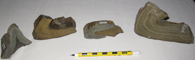
At last weekend’s northeastern / north-central GSA meeting in Pittsburgh, David Saja of the Cleveland Museum of Natural History presented a talk entitled, “Geometric Analysis of Folded Greywacke Layers from Pacheco Pass, California.” [Abstract link]
In addition to the standard PowerPoint presentation that 99% of GSA speakers use, David also brought in some hand-samples (what we in the business like to call pocket folds) to display. As his title implies, these are graywacke layers a few cm thick that were deposited with shale layers as part of a turbidite sequence. They were gracefully deformed when they got scraped off the Farallon Plate and slathered onto the western nose of the North American continent during Mesozoic subduction and the accompanying development of the accretionary wedge that makes up the Coast Ranges of California. They are part of the Franciscan complex.
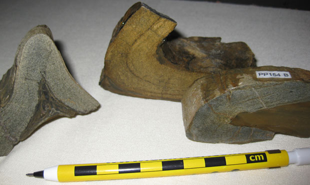
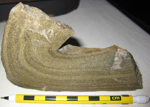
David obligingly granted me permission to photograph the specimens and share them with you via this blog.
Happy Friday to all!
24 March 2011
North Pole, South Pole, by Gillian Turner
 I was sent a review copy of a new book about the Earth’s magnetism, and I finished reading it last week. It’s called North Pole, South Pole: The Epic Quest to Solve the Great Mystery of Earth’s Magnetism, and the author is Gillian Turner, a senior lecturer in physics and geophysics at Victoria University in Wellington, New Zealand.
Here’s a link to the book on Amazon.
It’s a book about the history of our understanding of magnetism, and specifically the magnetic field generated by the planet Earth. As such, it will be of interest to historians of science, geologists, and physicists. Turner’s job (which she is reputed to be quite good at) is to make science understandable, and she succeeds in this book of developing scientific ideas over time, and telling this evolutionary tale as a narrative story, with characters and context, insights and false leads. You hear how scientists like Ampère, Celsius, Faraday, Gauss, and Galvani all contributed to our growing understanding of the magnetic phenomenon, as well as luminaries like Ben Franklin and Pliny the Elder.
The magnetic field is a fascinating thing. Just watch:
[youtube=http://www.youtube.com/watch?v=CgDYx3B8c_I]
Turner describes how early workers experimented with magnets, interested in magnetic induction via electricity, and the fact that when you break a magnet in half, the two halves act like miniature versions of the magnet they were derived from: they each have a north pole and a south pole.
All well and good, but the part that attracted (pun intended) my attention the most was the latter half of the book, wherein Turner describes the scientific story of how magnetism has catalyzed new geologic knowledge.
A key insight of pioneering geo-magneticists was the idea of the apparent polar wander path. This notion was that if you queried a stack of rocks from one place (say, the layers of lava flows on the side of a middle-aged volcano), and “asked” them where the North Pole was at the time they crystallized, the sequence of “answers” will indicate the apparent “wanderings” of the North Pole.
Here’s a charming image from a 1954 issue from Time magazine that Turner uses to simultaneously communicate the scientific idea of apparent polar wander (from the perspective of Britain), but also –thanks to the quaint style of the graphic– to communicate the time (1950’s) that this idea was germinating:
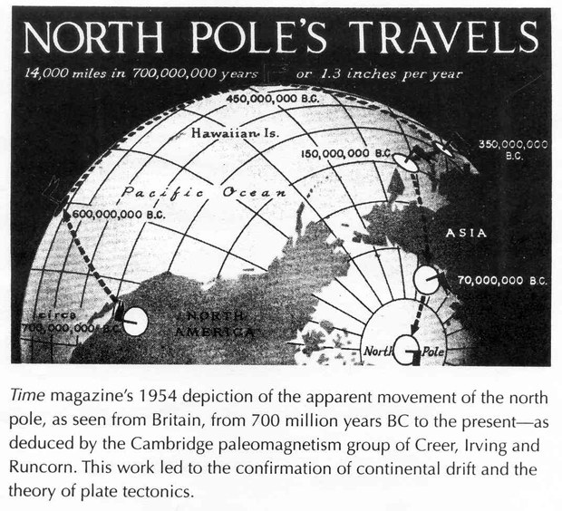
This was a critical insight for plate tectonic theory, as different continents (or indeed, different parts of the same continent) yielded different apparent polar wander paths. Imagine a a fleet of canoes, drifting on the sea near a light house erected on a rocky shoal. From one boat’s perspective, it might appear that the lighthouse is moving to “the right” over time. The occupants of a second canoe might report that the lighthouse appears to be moving to their left. A third boat still might report the lighthouse doesn’t shift laterally at all, but it is getting smaller over time, as they drift further away. Only by correlating these different perspectives do we realize that it’s not the lighthouse that is moving; it’s the boats! Similarly, the apparent polar wander path described by a particular continent’s rocks diverges from its neighbors as you go back in time. If the continents were to remain fixed in position, this would imply that the modern North Pole was once a dozen or more poles that only just now converged and coalesced in northern Canada. On the other hand, if the magnetic field is more or less constant in its structure, and the continents are the things that do most of the moving around, then that makes for a much more understandable geo-dipole shape, and implies continental drift, to boot!
The book isn’t swimming in graphics, but there are a few other useful figures. Here’s another one that I was struck by — it shows scientists’ evolving understanding of the pattern of magnetic reversals over time, from the 1960s until today:
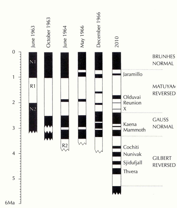
This is the evolution of a chronological record as surely as is the increasingly-fleshed-out stratigraphic column in the days of Sedgwick and Murchison. When I pause to consider a graphic like this that records the expansion of human knowledge, I get all swoony with the additive nature of our understanding. We know more now than we did before; we’ve got a better handle on this stuff. Do we have it all figured out? Nope. Do we make mistakes along the way? Quite assuredly. But over time, we sift the wheat from the chaff, and we get a chewier story, a more detailed perspective on our place in the cosmos.
Turner’s writing is solid and dependable, but without flourishes. It’s not McPhee or Winchester, but something more solid and reliable, lacking narrative indulgences. As such, it will appeal to some, and be deemed a tad on the dry side by others. It worked well enough for me — sufficiently engaging to power me through the book in short order, and thus allowing me to learn along the way.
Overall, I’m pleased to have read the book, and would recommend it to my peers in the geosciences.
23 March 2011
The visitors

Visitation statistics for Mountain Beltway over the past month and a half.
Interesting to think about the implications… Should I do more current events blogging?
 Callan Bentley is Associate Professor of Geology at Piedmont Virginia Community College in Charlottesville, Virginia. He is a Fellow of the Geological Society of America. For his work on this blog, the National Association of Geoscience Teachers recognized him with the James Shea Award. He has also won the Outstanding Faculty Award from the State Council on Higher Education in Virginia, and the Biggs Award for Excellence in Geoscience Teaching from the Geoscience Education Division of the Geological Society of America. In previous years, Callan served as a contributing editor at EARTH magazine, President of the Geological Society of Washington and President the Geo2YC division of NAGT.
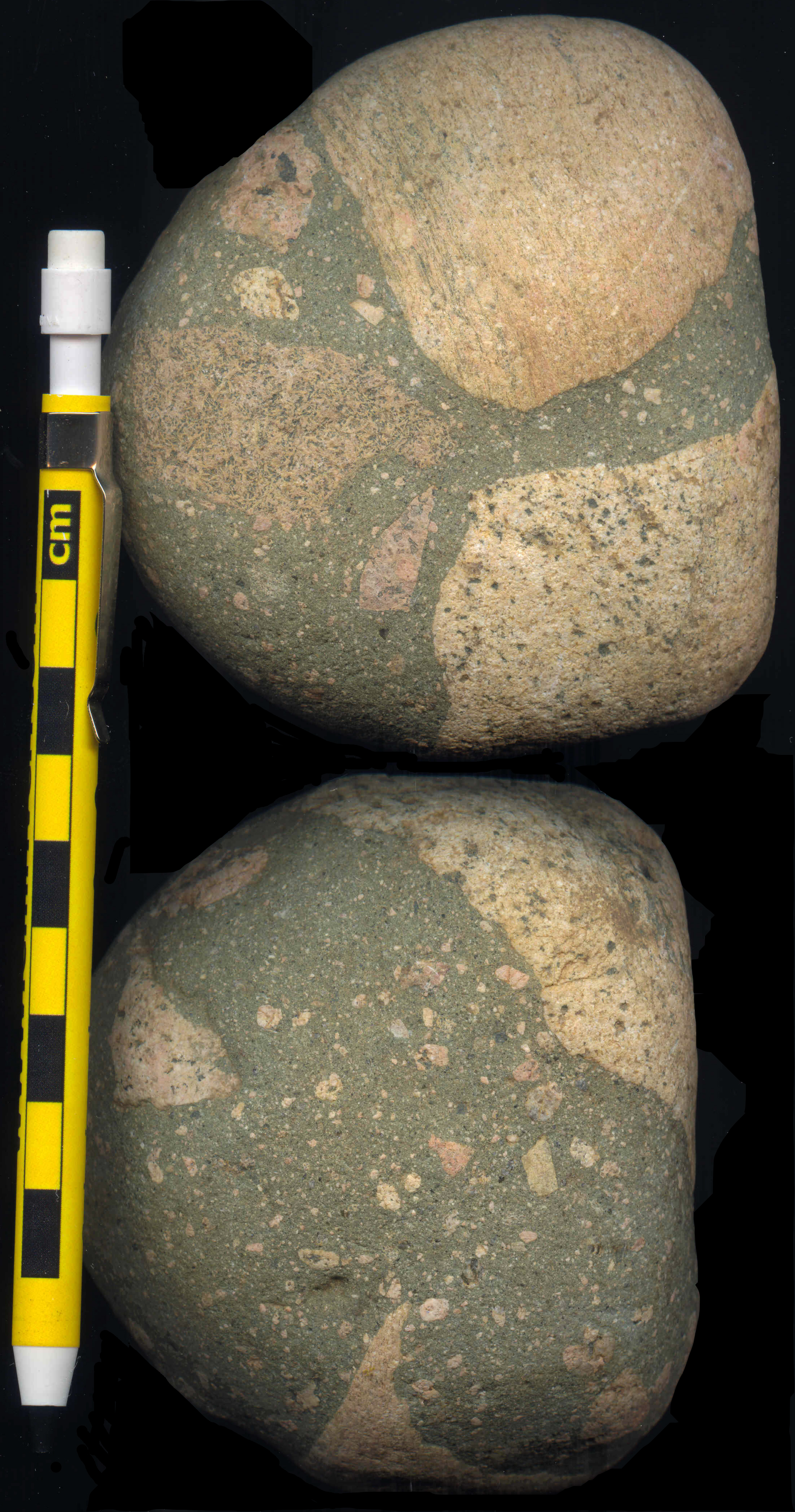