
10 November 2020
The Queja landslide at San Cristobal Verapaz: drone footage of the aftermath
The Queja landslide at San Cristobal Verapaz: drone footage of the aftermath
Over the last 24 hours further information has emerged about the Queja landslide at San Cristobal Verapaz in Guatemala. The search for the victims continues, but with little success, primarily because the debris is an estimated 15 metres deep. There seems to be a growing recognition that recovery will be impossible in the circumstances. Reuters has a report of the impact of the landslide on local Mayan families, for whom the Queja landslide is a catastrophe at every level.
Meanwhile, improved images and some high quality drone footage have been posted about the landslide. Drone footage of both the source area and the debris track and deposit were posted to Twitter:
https://twitter.com/RBCNoticiasGT/status/1325484169628184577
.
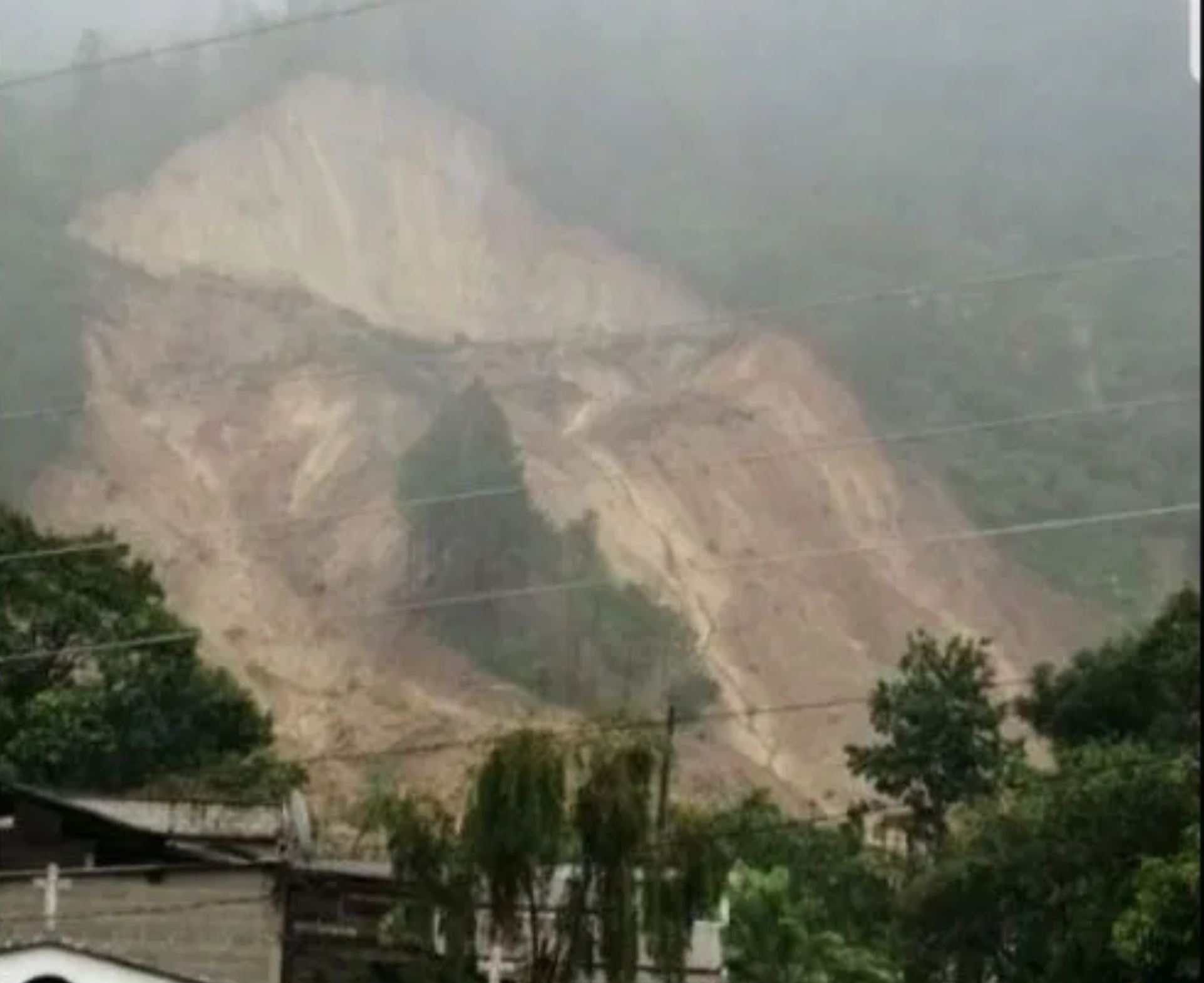
This footage has caused me to slightly change my interpretation of the event from yesterday. As I noted, it does appear that there are two main portions to the landslide, but the main impact on the communities seems to have come from the right hand, rather than the left hand, portion. The image below, posted by Yahoo News, shows this more mobile portion of the landslide:-
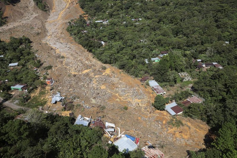
The lower portion of the Queja landslide. REUTERS/Luis Echeverria, posted by Yahoo News.
.
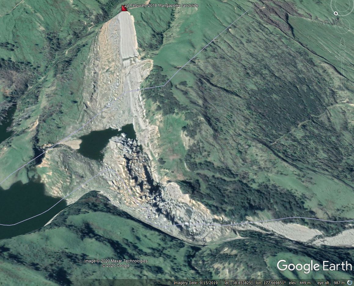
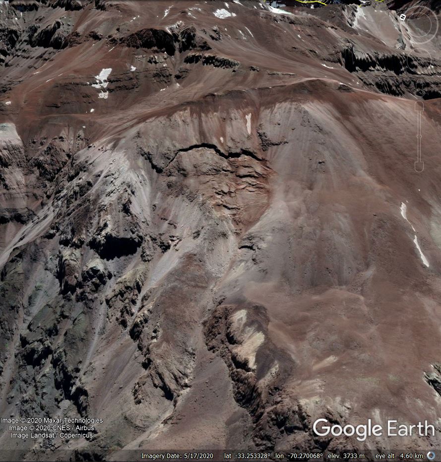
These images have made it possible to track down the source area of the Queja landslide on Google Earth, which is in the vicinity of the coordinates I posted yesterday (15.391, -90.632). The image below highlights the approximate source area of the landslide and the main damage track. Note the distinctive house with a brown and grey roof on the edge of the landslide on the image above – this can also be seen in the Google Earth image below:-
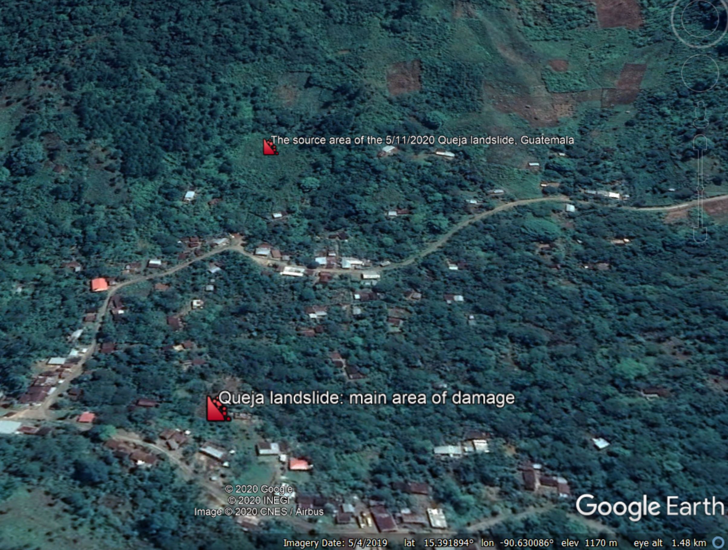
Google Earth imagery of the site of the Queja landslide.
.
Quickslide 1: Landslide induced pipeline ruptures in Ecuador prove to be extremely expensive
Reuters reports that Ecuador expects its crude oil production to miss its expected annual totals in part because of the impact of a pipeline rupture induced by a landslide:
Ecuador declared force majeure on oil exports in April after the state-run SOTE pipeline and privately held OCP pipeline burst due to a landslide in the Amazon region, forcing a temporary cut to crude production.
.
Quickslide 2: A rainfall induced landslide in Napier, New Zealand
Torrential rainfall in Napier, New Zealand yesterday triggered a landslide that destroyed a house. The occupants were lucky to survive.
9 November 2020
San Cristobal Verapaz: the deadly landslide in Guatemala triggered by Hurricane Eta
San Cristobal Verapaz: the deadly landslide in Guatemala triggered by Hurricane Eta
Over the weekend more information has emerged about the large, deadly landslide that struck San Cristobal Verapaz in Guatemala last week. The landslide, in an area that is remote and steep, destroyed a number of houses in the village of Queja. Unfortunately the area continues to be affected by heavy rainfall, and further landslides are occurring, disrupting the rescue and putting further lives at risk.
In terms of understanding this landslide, the two best images that I have found to date are below. The first, published on CP24, provides a good oversight of the source area of the landslide:-
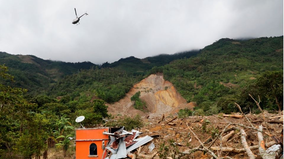
The landslide at San Cristobal Verapaz in Guatemala. Image by Esteban Biba/Pool Photo via AP, published by CP24.
.
On first inspection this appears to be a complex landslide, possibly occurring in two parts (note the stand of trees in the centre left of the landslide scar). In both elements there is possible a degree of rotational failure, but the upper portion appears to have transitioned into a slide or flow that has passed to the left of the trees (I’m using left in this case as shown in the image).
The second image is the one below, published by France 24:-
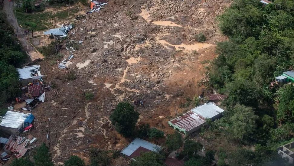
The lower portion of the landslide at San Cristobal Verapaz in Guatemala. Image by Esteban Biba/Pool Photo via AP, published by France 24.
.
This is the lower portion of the landslide; I suspect from other images that this has derived from the upper failure shown in the first image. Here the landslide appears to be a rockslide or possibly even a flow. Note the amount of standing water on the surface, but also the large boulders. The damage to the structures is clear; any building in the direct path would have been destroyed.
The number of people killed at San Cristobal Verapaz is not yet clear – to date only three victims have been recovered. However, on Friday President Alejandro Giammattei indicated up to 150 people might have been buried in the landslide. One woman has reportedly lost 22 family members in the disaster:-
“All her family is gone, she’s the only survivor. Her dad, mom, siblings, aunts and uncles, grandparents, they’re all gone. Twenty-two family members and it’s just her alive”. It is hard to imagine this level of loss.
A search for the location of Queja in San Cristobal Verapaz yields a location of: 15.391, -90.632 on the Geonames database. At present the satellite imagery is too cloudy to verify this as the correct site.
6 November 2020
Hurricane Eta: dozens killed by landslides in Central America
Hurricane Eta: dozens killed by landslides in Central America
In the last few days a major tropical storm, Hurricane Eta, has made landfall in Central America. In many ways this story has been lost in the maelstrom around the US election (and in the UK the imposition of a new lock down), but the impact has been severe. So far it appears that the greatest losses have occurred in Guatemala, where at least 50 people are reported to have been killed in landslides. Earlier news reports suggest that at least 37 of these fatalities have occurred in three landslides. The picture is quite confused, but the best report I have found so far is provided by CBS7:-
“On Thursday afternoon, Guatemalan President Alejandro Giammattei said a water-soaked mountainside in the central part of the country had slid down onto the town of San Cristobal Verapaz, burying homes and leaving at least 25 dead.
“Two other slides in Huehuetenango had killed at least 12 more, he said. The president initially said more than 50 people had died in slides, but the individual incidents he cited did not reach that total. Later, David de León, spokesman for the national disaster agency, said there were reports of 50 people missing in the Verapaz slide, but government rescue teams had not reached the site.”
News reports in Guatemala suggest that the losses at San Cristobal Verapaz may be much higher. This image apparently shows the landslide:
The landslide at San Cristóbal Verapaz in Guatemala caused by Hurricane Eta. Image by Foto Prensa Libre: Courtesy of Mayor Ovidio Choc Pop.
.
These news reports indicate that up to 75 houses might have been buried and that the loss of life might be about 100 people.
Unfortunately, the losses from landslides extend further. In Panama, five people, including two children, were killed in a landslide that buried two homes in Chiriqui province near to the border with Costa Rica. In Costa Rica itself two people were killed in a landslide. In Nicaragua, two gold miners were killed when they were buried by a collapsed slope. In Honduras, there are reports of five landslide fatalities, including a child who was killed when her house was buried in San Pedro Sula.
It is very possible that the losses will prove to be rather higher in due course. I’m reminded of the terrible impact of Hurricane Mitch in 1998. Fortunately, at the moment this event does not seem to be on a par – Mitch killed 11,000 people. This included a terrible lahar from Casita volcano in Nicaragua, which killed about 2,500 people. At the moment this event seems to be far less severe, but it is a reminder of the terrible vulnerability in Central America to these extreme rainfall events.
.
Quickslide 1: The rising impact of tropical cyclones in a warming world
Nature World News has a good article about the increasing impact of tropical cyclones as global heating continues to develop. Spoiler alert – seven out of 10 of the strongest storms have occurred since 2006.
.
Quickslide 2: The rapidly growing cost of making coal tips safe in South Wales
According to the BBC, Chris Bryant MP and Labour colleagues have written to the UK Chancellor Rishi Sunak about the costs of mitigating coal tips in south Wales. The letter reveals unpublished details from a review by the Welsh Government. It indicates that the cost of making the tips safe might exceed £500 million.
4 November 2020
The February 2018 Mangapoike landslide, New Zealand: an intriguing failure mechanism?
The February 2018 Mangapoike landslide, New Zealand: an intriguing failure mechanism?
On a morning in which the media is full of a landslide that fail to materialise, I can find solace in the real thing. On 24 February 2018 an 8 million cubic metre landslide dammed the Mangapoike River in a remote upland area of eastern North Island in New Zealand. I blogged about this landslide at the time – it is a rather beautiful example. The height of landslide dam was managed through blasting, although the landslide remains intact, leaving interesting questions about the cause of the failure. This is a Google Earth image of the landslide:-
Google Earth imagery of the 24 February 2018 Mangapoike landslide, New Zealand.
.
An interesting paper has been published in the journal Landslides about the Mangapoike landslide (McGovern et al. 2020). This is provides a detailed description and analysis of the feature, which was a wedge failure in weak rock sandstones and mudstones, with the slide surface being defined by a smoothed, northwest-dipping bedding plane. The elegant diagram below, which is an exemplar of how to use graphics to present landslide information, shows the source area of the slide:
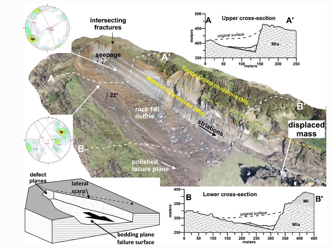
The source area of the February 2018 Mangapoike landslide, New Zealand. Diagram from McGovern et al. (2020).
.
The landslide mass itself partially disaggregated into blocks, which of course meant that the river was more effectively dammed.
The really interesting aspect of this paper though is its consideration of the causes and triggers of the Mangapoike landslide. The underlying causes are clear (and are well-explained), but what triggered the failure? McGovern et al. (2020) demonstrate clearly that there was no unusual rainfall event prior to the failure. Indeed, they are remarkably definitive about this:
“…it seems implausible that rainfall and elevated groundwater were important triggering factors”.
Instead McGovern et al. (2020) propose that fluid overpressure might have played a role. As they put it:
“The Makaretu Sandstone is a known hydrocarbon reservoir formation within the Tolaga Group, with overlying mudstone units acting [as] seals”.
There is geodetic evidence that prior to the landslide the region underwent approximately 15 mm of vertical movement, which may indicate that there was a fluid overpressurisation event occurring. The authors postulate that gas migrated vertically though the sandstones but was trapped by the mudstones at the base of the landslide, reducing the normal effective stress and triggering the failure.
This mechanism is a hypothesis, and indeed the authors state that:
“Whether fluid overpressure was a contributing factor to the Mangapoike landslide is equivocal.”
There have been previous suggestions that gas overpressurisation might be a factor in certain landslide failures. The interesting thing about this one is that the data is so good that it invites detailed modelling to understand the potential mechanism, and its efficacy, better.
Reference
McGovern, S., Brook, M.S. & Cave, M. 2020. Geomorphology and triggering mechanism of a river-damming block slide: February 2018 Mangapoike landslide, New Zealand. Landslides (2020). https://doi.org/10.1007/s10346-020-01572-7
3 November 2020
Williams Lake: 1 million cubic metre, damaging landslide in Canada
Williams Lake: 1 million cubic metre, damaging landslide in Canada
With thanks to loyal readers Charles by email and Dr Drew Brayshaw (@DrewBrayshaw) via Twitter: a large landslide occurred on 31 October 2020 in an industrial area on the outskirts of Williams Lake in British Columbia in Canada in the last few days. There are few decent pictures that capture the whole of the landslide; the best one I can find is this one, taken by Scott Nelson and published by CBC:-
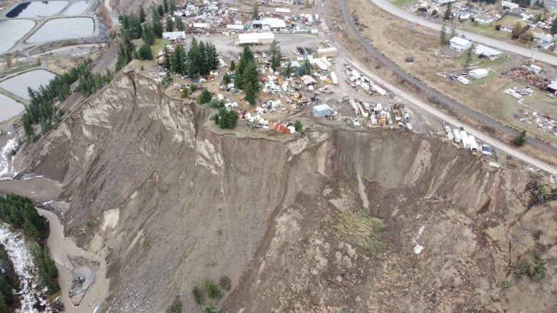
A drone image of the landslide at Williams Lake in British Columbia, Canada. Image collected by Scott Nelson and published by CBC.
.
Meanwhile, the Williams Lake Tribune has a short video of operations at the foot of the slope to keep the channel open. The area has been suffering from heavy rainfall, and thus presumably elevated river levels, in recent days, and indeed there are reports of other (smaller) landslides in the area.
The Google Earth imagery of this area suggests that this is not the first landslide on this slope – and of course the image above suggests that future failures may occur too (but with no certainty on timing):-
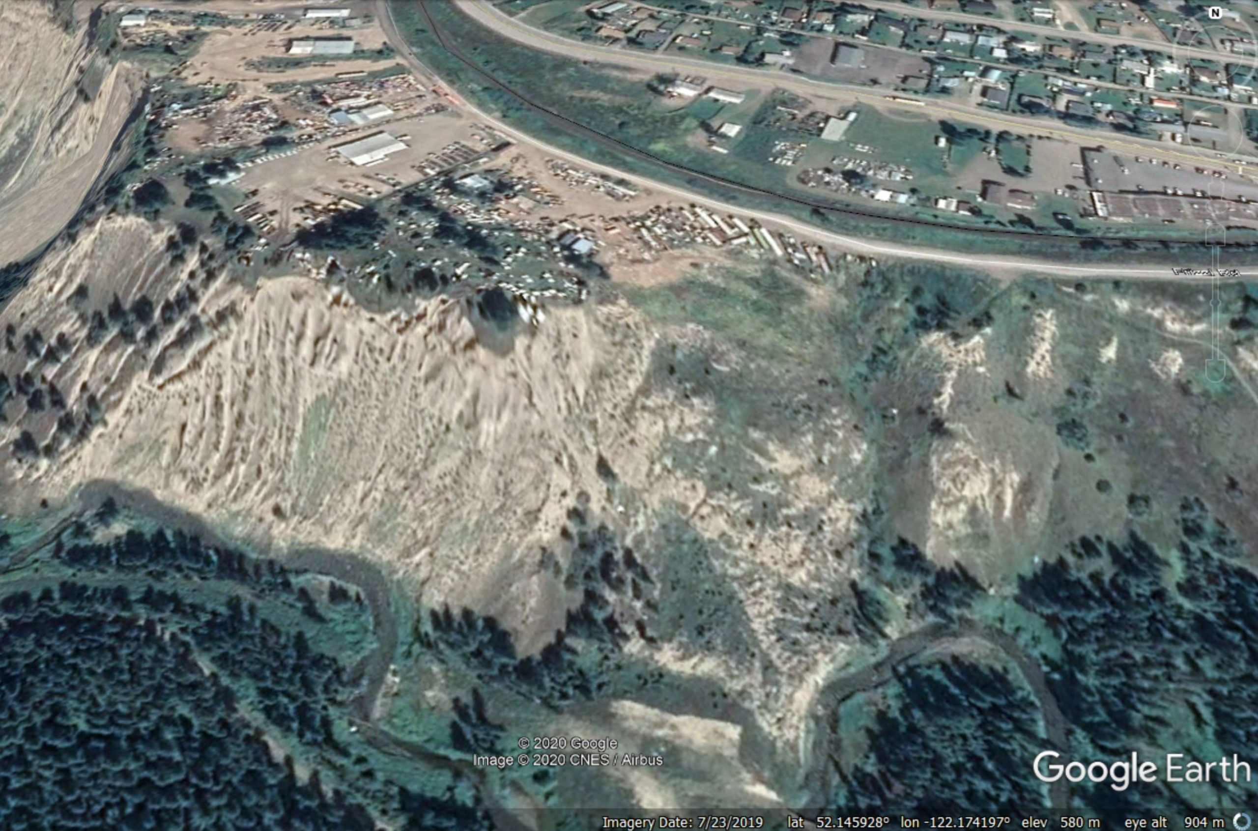
Google Earth image of the site of the landslide at Williams Lake in British Columbia, Canada.
.
There is a very nice geological map of the area on the BC Ministry of the Environment website, which suggests that this landslide has occurred in glacial deposits. That looks right to me.
.
Quickslide 1: Deforestation, construction to blame for central Vietnam landslides
VNExpress has a nice article about the underlying causes of the recent landslides in Vietnam. It concludes that deforestation and construction may be important factors:
Trinh Xuan Hoa, deputy head of the Vietnam Institute of Geosciences and Mineral Resources under the Ministry of Natural Resources and the Environment, said deforestation and construction, among other factors, were to blame for triggering landslides in central Vietnam.
“Human activities including deforestation and road construction, etc. have hastened geological changes in the area. Leveling mountains and destroying taluses for construction destabilize the terrain, create steeper slopes and sacrifice local vegetation. This fuels the risk of erosion and landslides,” he said, adding erosion occurred mainly on mountain slopes, in residential areas or along roads and other man-made structures.
.
Quickslide 2: The reopening of the Aberdeen to Dundee railway line
Three months after the fatal, landslip induced crash at Stonehaven on the Aberdeen to Dundee railway line, the track reopens today. The amount of work needed to recover the train and repair the line has been very extensive.
2 November 2020
Nejapa: a deadly channelised flow in El Salvador
Nejapa: a deadly channelised flow in El Salvador
On 29 October 2020 a deadly landslide struck the municipality of Nejapa in the San Salvador department of El Salvador. Whilst initial reports suggested a much higher death toll, the final loss appears to be ten people, one of whom remains missing.
The most telling image of the landslide is this one, tweeted by the Protección Civil de El Salvador:
La acumulación de agua en los suelos y la intensa lluvia provocaron el colapso de tierra en la zona de El Picacho en el volcán de San Salvador. pic.twitter.com/nKqJ4SIp8l
— Protección Civil de El Salvador (@PROCIVILSV) October 30, 2020
.
The accompanying text translates to: The accumulation of water in the soils and the intense rain caused the collapse of the land in the El Picacho area on the San Salvador volcano.
In total the landslide appears to have affected about 60 households, traveling for a distance of over 4 km. Protección Civil de El Salvador has also tweeted some drone footage of the impacts downstream:
Aproximadamente 4 kilómetros fue el recorrido del lodo, rocas, troncos y demás escombros que impactaron a la comunidad Los Angelitos II en Nejapa. pic.twitter.com/sJ9nPONNqJ
— Protección Civil de El Salvador (@PROCIVILSV) October 30, 2020
The landslide is visible on Planet Labs imagery collected on 31 October 2020. This is a PlanetScope image of the site – the channelised flow is clear (traveling towards the northeast), although the area impacted has some (atmospheric?) distortion:-
Planet Labs PlanetScope image of the 29 October 2020 Nejapa landslide in El Salvador. Image copyright of Planet Labs, used with permission.
.
Volcanic soils are highly susceptible to this type of failure, which probably started with a small volume slide, with some entrainment in the channel. The steep slopes and narrow channel meant that the runout was extremely long for a slide of this volume.
.
Quickslide 1: Flexible barriers at Rest and Be Thankful
Heavy rainfall at Rest and Be Thankful in Scotland triggered some further failures over the weekend. This tweet suggest that the flexible barriers at the site might have been effective:
Material caught in roadside nets as flooding reaches old road detour. #A83 and local diversion remain closed.
Photo: @NWTrunkRoads
More: https://t.co/pGs6bwy716#restandbethankful #landslides pic.twitter.com/eVji5XTR3M
— Argyllshire Advertiser (@argyllshiread) October 31, 2020
.
Quickslide 2: Landslide triggered by Typhoon Goni in the Philippines.
The likely impact of Typhoon Goni in the Philippines is becoming clear, slowly. At least two of the fatalities, a father and his son, were killed by a mudflow from Mayon Volcano.
.
Reference
Planet Team (2020). Planet Application Program Interface: In Space for Life on Earth. San Francisco, CA. https://www.planet.com/
29 October 2020
Typhoon Molave: two major landslides in Vietnam
Typhoon Molave: two major landslides in Vietnam
Over the last month I have written on a number of occasions about landslides triggered by storm rainfall in Vietnam, causing substantial loss of life. Overnight, the latest storm, Typhoon Molave, made landfall in Vietnam, bringing strong winds and intense rainfall. This will have fallen on ground that was already wet, and in some cases deformed, increasing the risk of failures.
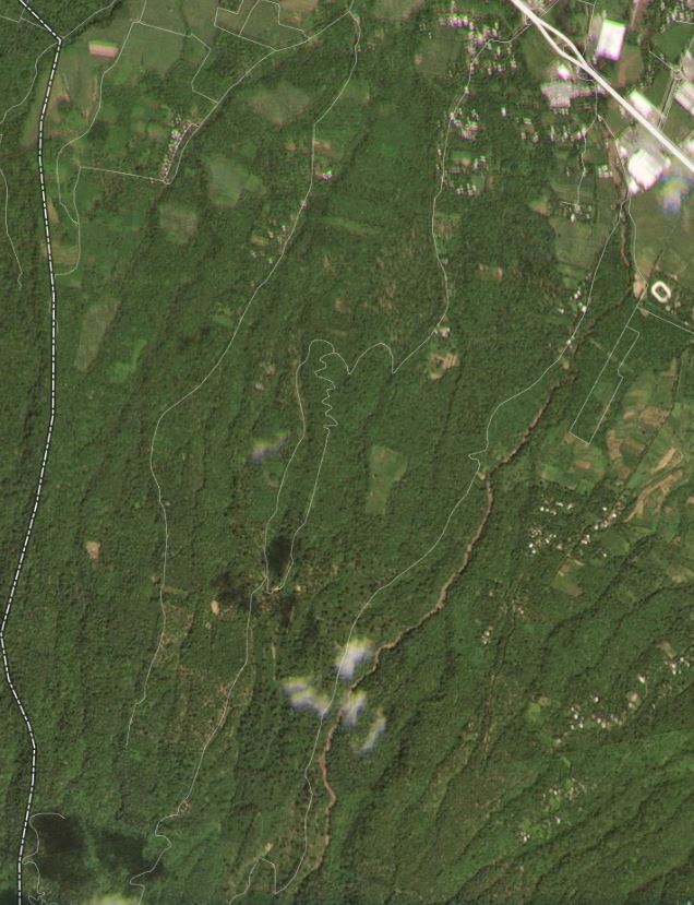
This morning, the Vietnamese media is reporting that two major landslides have been triggered by Typhoon Molave. The first is at Tra Leng Commune in Nam Tra My District. Initial reports indicate that this landslide may have left as many as 45 people missing, a district official said Wednesday night. The latest reports suggest that eight bodies have been recovered to date, although the rescue efforts are being hampered by landslides on the roads to the site.
The image below shows the location of Tra Leng Commune, as indicated by both Google Earth and Wikimapia. The coordinates are on the image if you want to take a look. I cannot pin down the precise location of the landslide itself at this point, but it appears to have occurred in a remote upland area:-
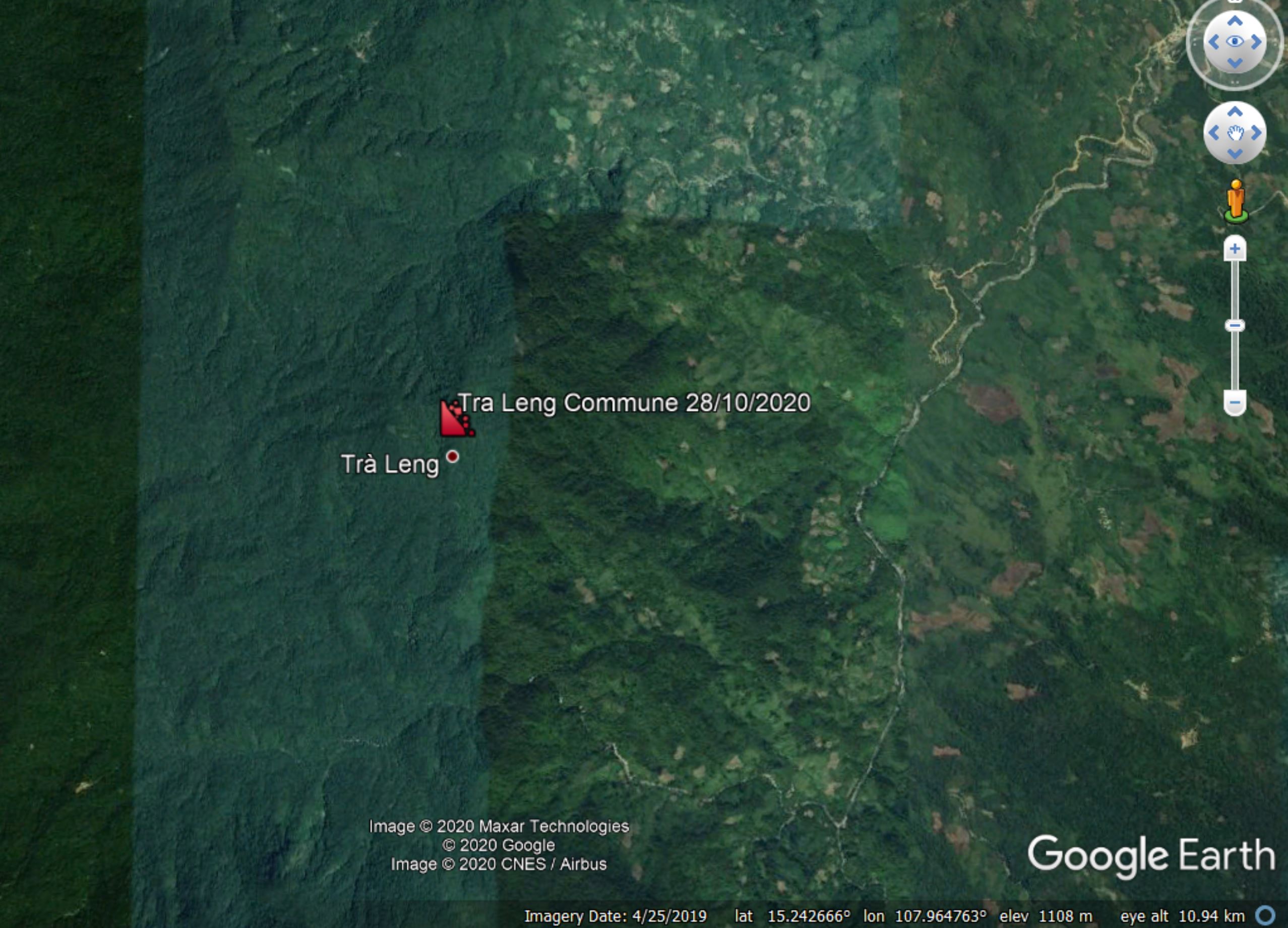
Google Earth image of the probable vicinity of the Tra Leng Commune landslide triggered by Typhoon Molave in Vietnam.
.
The other fatal landslide triggered by Typhoon Molave occurred at Tra Van Commune, also in Nam Tra My District. At this location seven bodies have been recovered to date, with a further person reported to be missing.
Some reports indicate that Typhoon Molave may have been the strongest storm to hit Vietnam in two decades, bringing 500 mm of rainfall in a single day in some locations. Heavy flooding is likely to become a major issue in the coming hours, potentially affecting millions of people.
28 October 2020
Yerba Loca – an interesting rockslide in central Chile
Yerba Loca – an interesting rockslide in central Chile
In a new paper published in the journal Landslides, Sepulveda et al. (2020) describe an interesting large rockslide in the central Andes of Chile. This is a large failure, about 2.5 million cubic metres, in volcanic rocks.
The site has a good set of images of the landslide site, both before and after the failure. This is the site prior to the failure event:
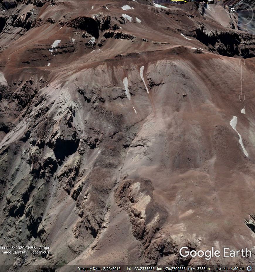
The site of the Yerba Loca rockslide prior to failure, via Google Earth
.
And this is the site after failure:
The site of the Yerba Loca rockslide after failure, via Google Earth
.
The slope, which is located at about 4000 metres above sea level, failed over a period of several days between 14 and 30 August 2018. Note however that Sepulveda et al. (2020) rightly point out that tension cracks are clearly visible in the images prior to failure (look at the area in the first image in which the rear scarp finally formed), suggesting that this was a progressive failure event. The authors note that these cracks are visible in satellite imagery right back to 2003. No clear trigger event precipitated the landslide, with failure occurring some weeks after heavy rainfall and snow melt. As such this is a classic progressive failure.
Sepulveda et al. (2020) have used InSAR to examine the development of the slope in the years prior to failure. This is one of the most interesting aspects of the InSAR technique – the ability to go back through the archive to understand the evolution of failure is fascinating. They found that movement was evident over the three year period leading up to failure, with movement rates reaching 10 centimetres per year in the seven months before the collapse.
The InSAR data also suggests that the landslide is continuing to move and that the area of deformation is expanding. Sepulveda et al. (2020) suggest that there is the possibility of a larger collapse:
“The active rock slide may derive in catastrophic failure in the near future, becoming a rock avalanche. Continuing deformations to the north-west and south of the 2018 landslide suggest that the landslide mass may grow in volume. Depending on the amount of available water in the form of snow or ice, the avalanche may derive into a debris flow that may potentially reach the Mapocho river and human settlements downstream”
Monitoring of this site is going to be important in the long term.
Reference
Sepúlveda, S.A., Alfaro, A., Lara, M. et al. 2020. An active large rock slide in the Andean paraglacial environment: the Yerba Loca landslide, central Chile. Landslides (2020). https://doi.org/10.1007/s10346-020-01564-7
26 October 2020
Landslides and roads – recent examples
Landslides and roads – recent examples
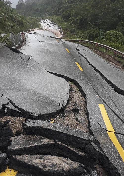
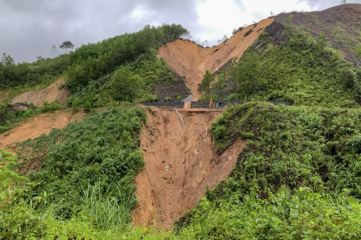
The recent extreme rainfall in Vietnam has triggered a large number of damaging landslides, with high levels of loss of life. Less well reported is the impact of these landslides on the road network of the country. VNExpress has a nice article today with a gallery of images of the damage caused by these landslides. It reports that:
The government has to spend some VND350 billion ($15 million) to repair national highways that have been destroyed by landslides during the recent floods in the central region.
The image below, which has the following caption “A section of National Highway 12A between Khe Ve Intersection and Cha Lo Border Gate in Minh Hoa District, Quang Binh Province was hit by landslide on October 19. Some 450 meters of it have been destroyed while a 100-meter stretch sank”, is a good example:
An example of landslide damage caused to a road in Vietnam. Image posted by VNExpress.
.
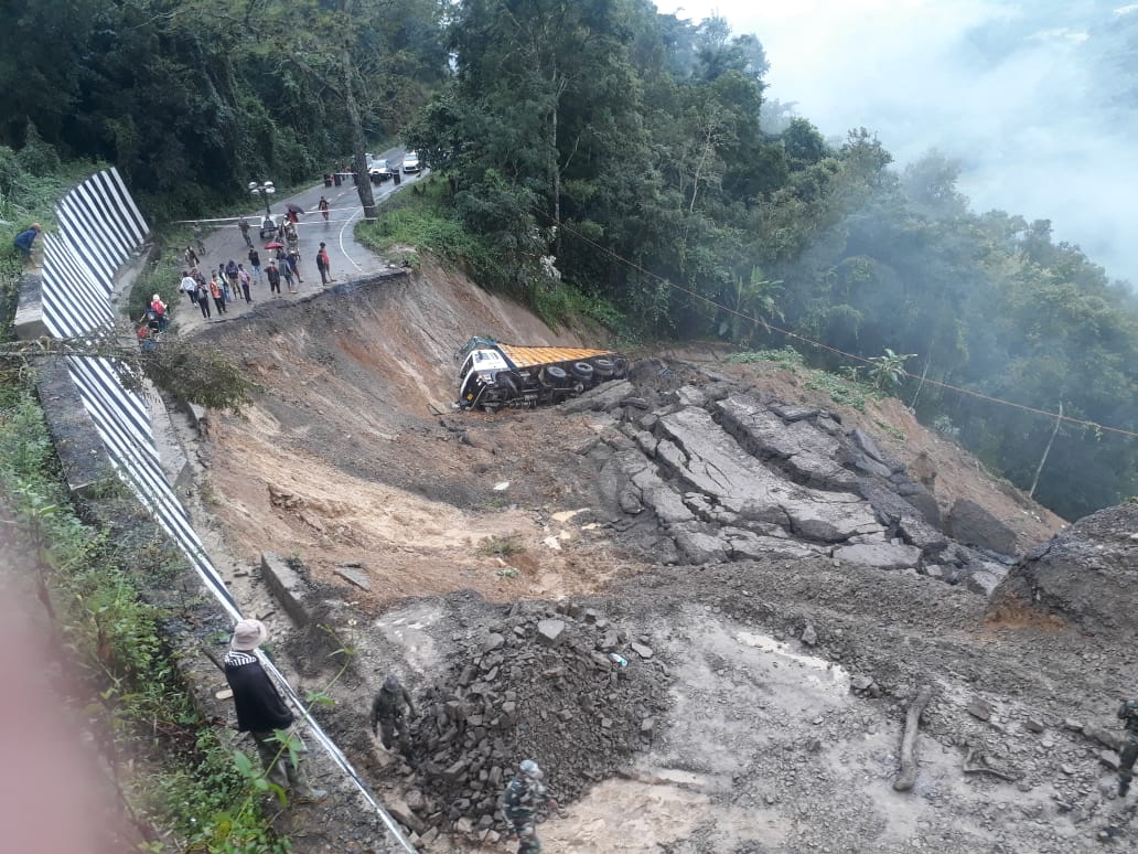
This is a classic image of landslide damage. But the damage does not have to come from below. This image shows the impact of slope instability in materials above the road bench:
An example of landslide damage caused to a road in Vietnam. Image posted by VNExpress.
.
The caption for this landslide is as follows: A hill collapsed on a section of National Highway 49 in Thua Thien-Hue Province.
Meanwhile, parts of India continue to suffer from the effects of extreme rainfall too. The image below was shared on Twitter by Devakishor Soraisam (@devakishor). It shows a section of the NH2 highway between Senapati and Lairouching in Manipur, NE India. This is an interesting landslide as the retaining wall at the rear of the road bench has remained intact. I wonder if the cause was tipping of fill on the downslope side to widen the road bench, oversteepening and loading the slope?
A landslide on NH2 between Senapati and Lairouching in Manipur. Image tweeted by @devakishor.
.
Quickslide 1: The preferred option for Rest and Be Thankful
The challenges of the landslide problem at Rest and Be Thankful continues with the local authority stating its preferred long term solution. This would be to improve an alternative routes rather than engineering a solution at the site itself.
.
Quickslide 2: Climate change is increasing rockfall risk for climbers
Outside has a nice article about the effects of climate change on rockfalls, and the danger that this is posing to climbers.
23 October 2020
Simple actions to survive a landslide
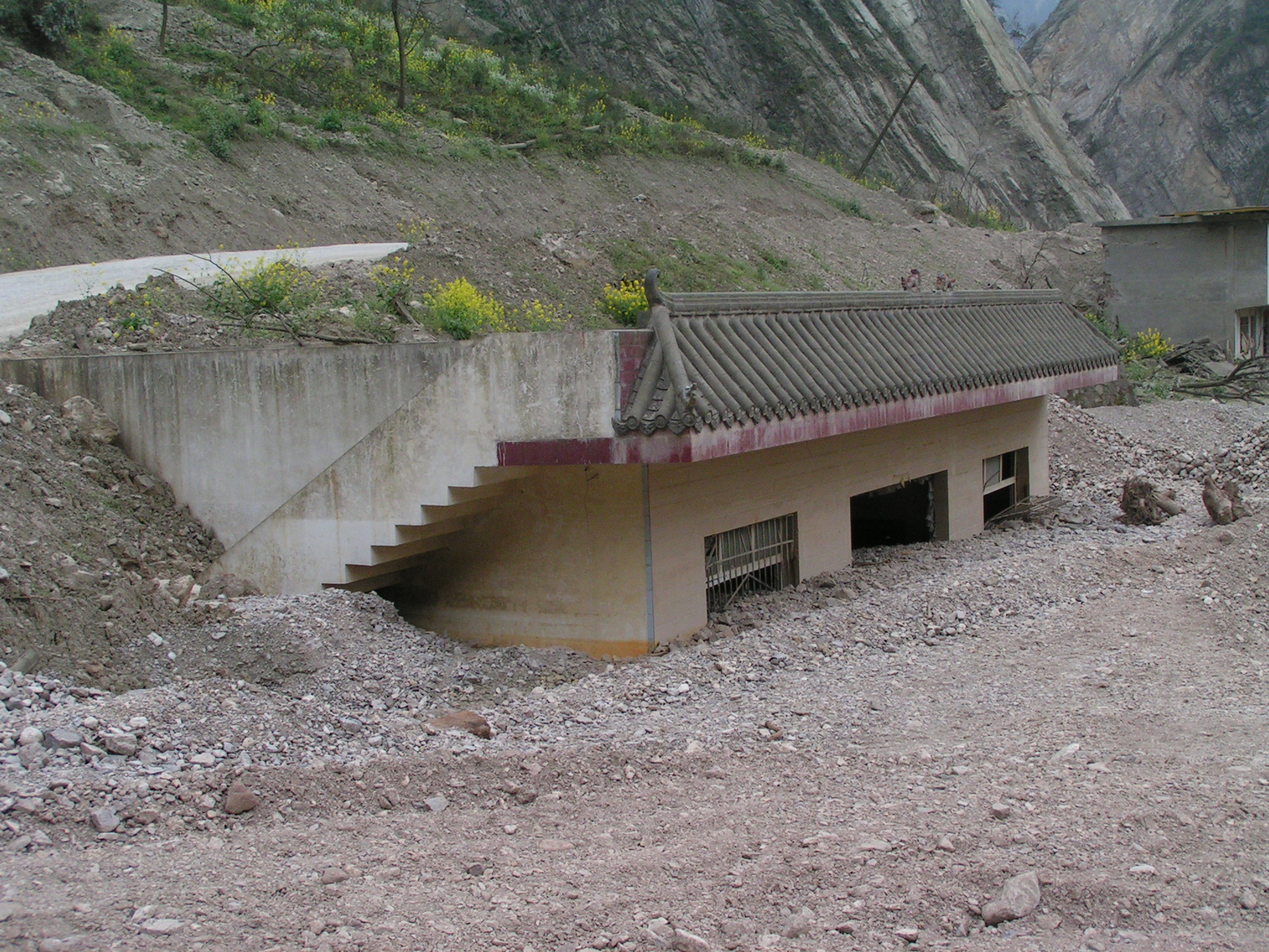
Simple actions to survive a landslide: an inundated house. Note the grate on the window – this can prevent occupants from exiting the building.
Simple actions to survive a landslide
Surviving a landslide is difficult. Victims of landslides are typically killed by blunt trauma or by asphyxiation. Mass movements involve large amounts of dense material, often traveling at high speed, and water. For the most part survival depends on either being on the periphery of the landslide or being protected by a structure, such as a building or a car. Strangely though, there have been very few systematic studies of the causes of loss of life in landslides or of the circumstances in which people survive in buildings. Understanding how and why people survive can provide valuable advice for those who find themselves at risk.
A new paper has just been published in the journal Geohealth (Pollock and Wartman 2020 – it is open access) that explores these issues. The authors have compiled a dataset of landslides that have killed people who were located in buildings. The dataset includes 38 different landslides, impacting 95 buildings involving 334 people, of whom 157 were killed. Most of the examples are from the United States, but there is information from other parts of the world as well, including India, Brazil and Australia.
There is a huge amount of richness in the data, although the authors are careful to note that there are considerable uncertainties. But it is clear that a small number of key factors can determine survival in a building. A key element is the depth of the landslide debris. If the inundation depth is over six metres then the likelihood of survival is very low. For depths of less than this survival is possible if the victim is protected by a building of appropriate strength.
On this basis Pollock and Wartman (2020) provide some advice on how to survive a landslide in a building:
- Be informed about potential hazards and talk to people who have experienced them.
- Move areas of high occupancy, such as bedrooms, upstairs, or to the downhill side of a home.
- Escape vertically (within the building – i.e. move upstairs).
- Identify and relocate to interior, unfurnished areas – these are less likely to collapse and the absence of furniture reduces the risk of being crushed.
- Open downhill doors and windows – this allows debris to exit the building.
- Continue to make noise and motion – most rescues are carried out by neighbours, but they need to be able to find you.
On the other hand, the authors also note a couple of actions that should be avoided:
- Opening a door out of curiosity.
- Sheltering behind or beside large furniture.
The latter is quite surprising perhaps, but the authors note this example:
When a debris flow in Los Angeles inundated the home of a family of four, the two teenage children almost drowned from being pinned between a bed and a wall by the force of the flow, while the parents, buoyed on the top of the bed, survived unscathed.
This is an incredibly useful contribution. I hope that it survives more studies of this type, extending the work to include more events in more locations, and to include people who are, for example, in a vehicle.
.
 Dave Petley is the Vice-Chancellor of the University of Hull in the United Kingdom. His blog provides commentary and analysis of landslide events occurring worldwide, including the landslides themselves, latest research, and conferences and meetings.
Recent Comments