13 December 2022
The Gaguney landslide in India: evolution over time
Posted by Dave Petley
The Gaguney landslide in India: evolution over time
Yesterday I wrote about the work that Save The Hills has been doing to highlight the plight of people of Pathing in northern India who are being affected by the Gaguney landslide. This landslide had been problematic for some time, but in November of this year the situation became dramatically worse, with a new area of instability threatening many more houses.
A combination of Google Earth and Planet Labs imagery provides an interesting perspective on the development of this failure. There is a good Google Earth image from 2011 – I have place the marker at the crown of the landslide at this time:-
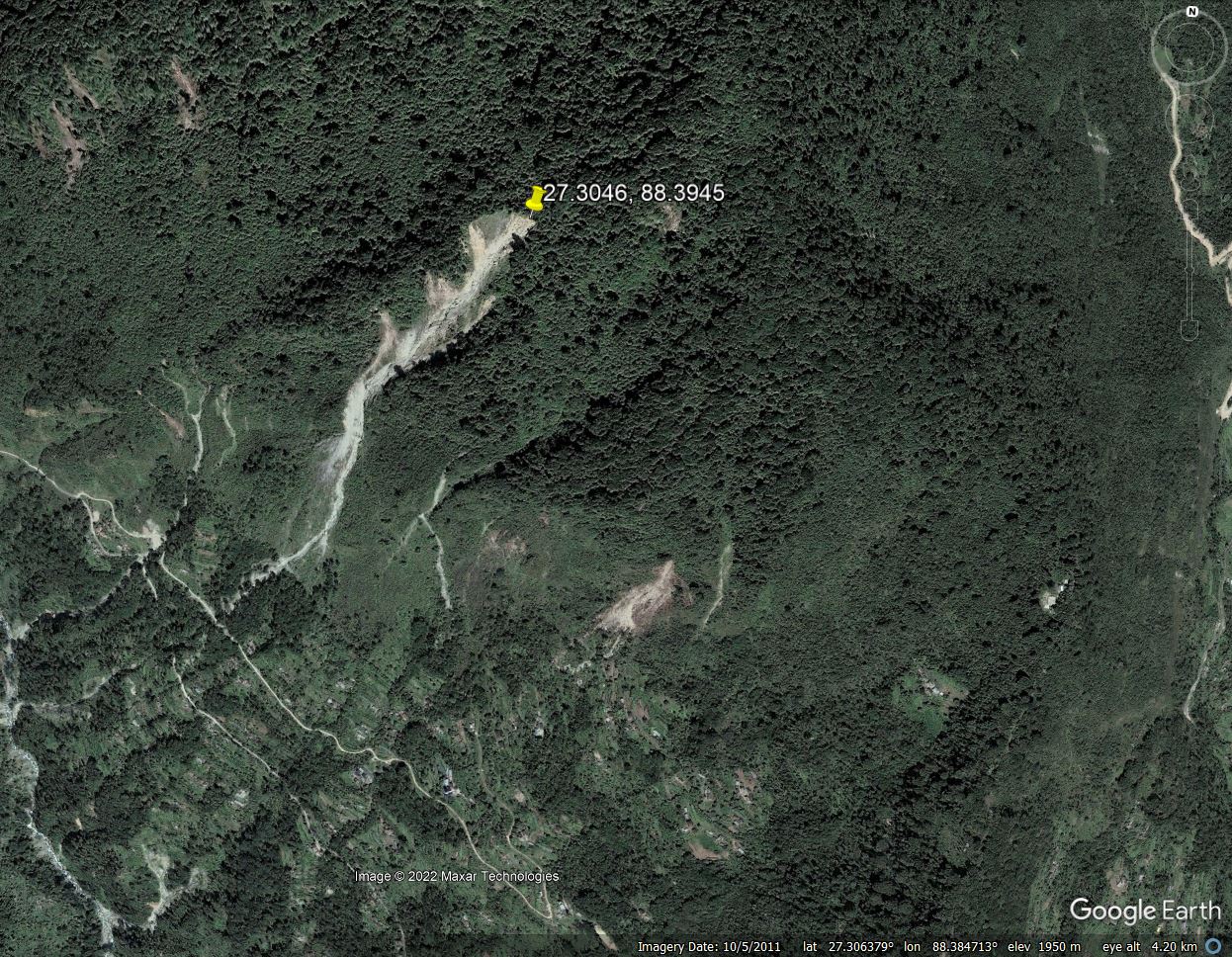
Google Earth image of the Gaguney landslide in India, collected in 2011.
.
At this point the landslide was quite well developed, but the impact on the village was quite low. The image below shows the landslide in late 2020:-
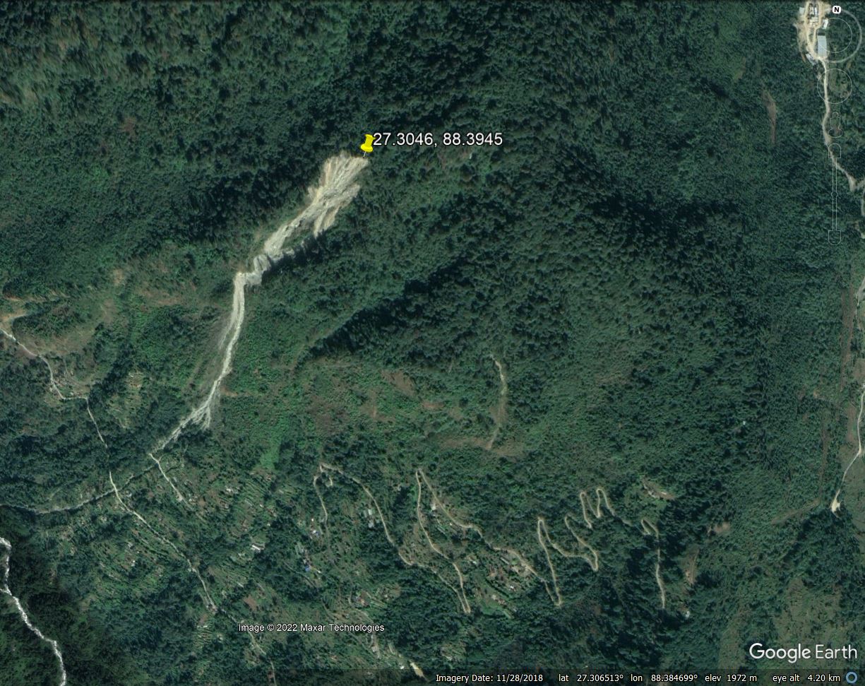
Google Earth image of the Gaguney landslide in India, collected in 2020.
.
In the intervening nine years the landslide had clearly developed considerably, but again the impact downslope was quite limited. However, from this point the situation rapidly deteriorated. This is the landslide in late 2021:-
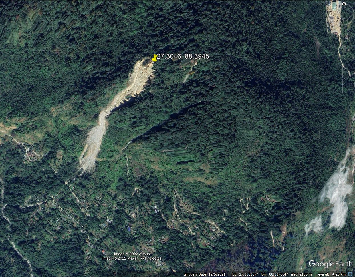
Google Earth image of the Gaguney landslide in India, collected in 2021.
.
The surface area of the landslide had expanded greatly and the debris area was large. The track into Pathing was now being affected and the village itself was being impacted.
We now switch to the lower resolution but still valuable Planet Labs PlanetScope imagery. This image is from 15 October 2022, with the marker at the same point is in the images above:-
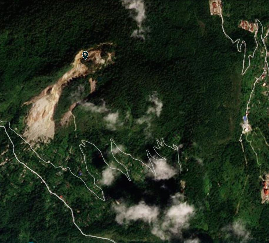
Planet Labs image of the Gaguney landslide in India, collected on 15 October 2022. Image copyright Planet Labs, used with permission.
.
The landslide had dramatically increased in size. The headscarp had retrogressed by over 200 m, bringing a huge increase of mass into the active system. A much larger area of debris is evident downslope, and the impact on the village had also increased substantially. Perhaps most worryingly, a second area of active failure had developed to the south and east of the main landslide.
The landslide subsequently developed quickly. On 27 November 2022 the increased level of activity was starkly evident:-
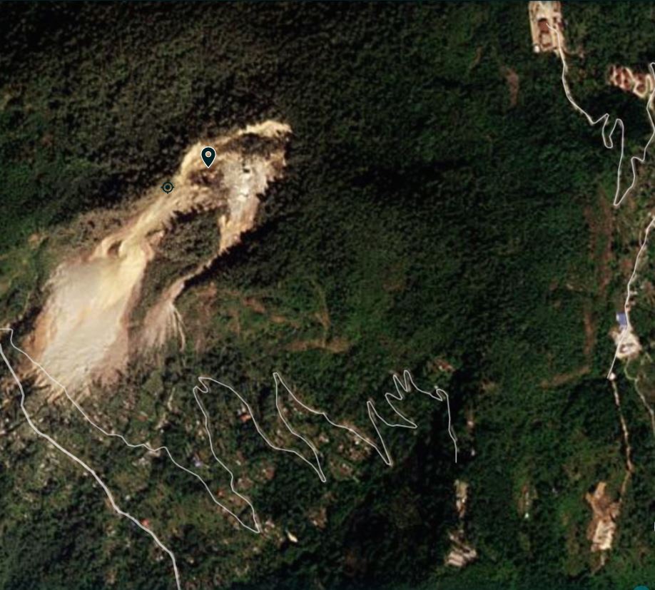
Planet Labs image of the Gaguney landslide in India, collected on 27 November 2022. Image copyright Planet Labs, used with permission.
.
The main slide had further increased in size, whilst the secondary failure had also developed considerably, and there was evidence of debris impacting much more of the village. Note the substantial part of the access track that was now covered by landslide debris.
Perhaps the most worrying sign is the large volume of displaced mass that is now in the headscarp area, directly above the smaller landslide that threatens the main part of the village. This material needs to be examined in more detail – the PlanetScope imagery has a resolution that is too low for proper analysis. The threat to the village needs to be properly assessed.
.
Reference
Planet Team (2022). Planet Application Program Interface: In Space for Life on Earth. San Francisco, CA. https://www.planet.com/


 Dave Petley is the Vice-Chancellor of the University of Hull in the United Kingdom. His blog provides commentary and analysis of landslide events occurring worldwide, including the landslides themselves, latest research, and conferences and meetings.
Looks like a large old landslide that is reactivating as the weather patterns change. The vegetated area now flanked by slides looks to be a stranded block within the old slide mass. I’d consider it suspect, now that there is activity on both flanks. The regional authority may recognize this, given the evacuation order/recommendation.
PS: The broad settled swale area to the SE appears to be a Quaternary slide mass that is mostly evacuated. I’d actually feel safer there if I had as few options as these residents appear to have. It may behave as an episodic earthflow, rather than a full-on rockslide (using Cruden and Varnes’ nomenclature)