29 April 2021
The mining-induced Jianshanying Landslide in Guizhou Province China
Posted by Dave Petley
The mining-induced Jianshanying Landslide in Guizhou Province China
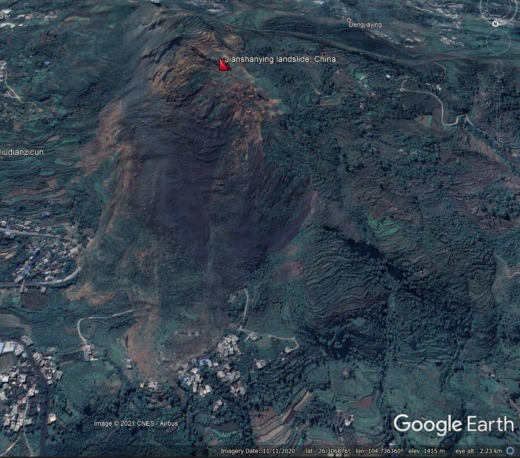
I have frequently written about mining-induced landslides. A paper just published in the journal Landslides (Chen et al. 2021) highlights an extraordinary example, the Jianshanying Landslide, which is located in Guizhou Province in China. The landslide, which has been triggered by coal mining beneath a mountain, is located at 26.308676°, 104.734385°. It is easily seen in Google Earth imagery:-

Google Earth image of the Jianshanying landslide in China.
.
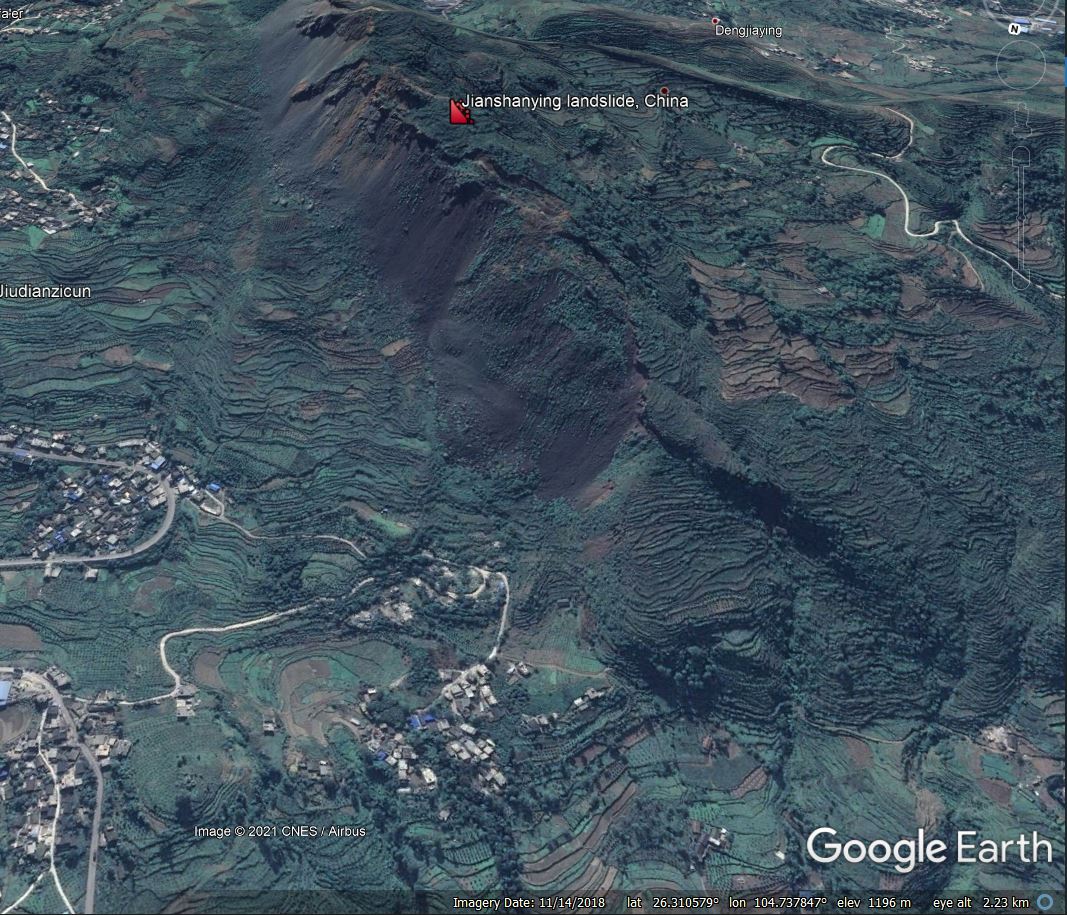
This is a very large, very active failure. Note that the toe of the landslide is engulfing inhabited areas in two different locations. Chen et al. (2021) focuses on the evolution of movement of the landslide, and does a good job. They demonstrate that the landslide has rapidly evolved with time – this is also evident from the Google Earth images. The image below was collected in November 2018:-

Google Earth image of the Jianshanying landslide in China in November 2018.
.
You should be able to compare these two images using the slider below. This evolution has occurred in just two years:-


[/caption].
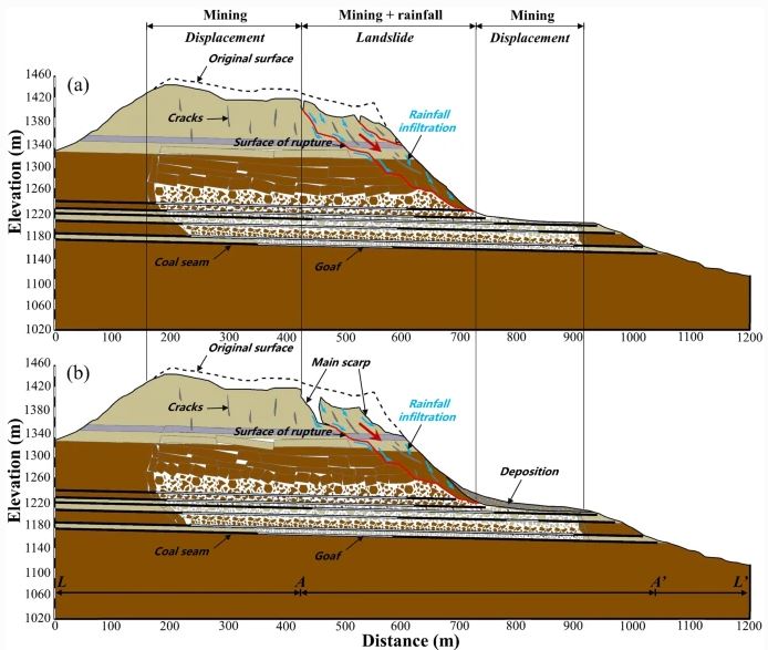
Chen et al. (2021) have provided this very beautiful and very clear diagram to illustrate the form and evolution of the landslide:-

Cross-sections illustrating the form and evolution of the Jianshanying landslide in China. Figure from Chen et al. (2021).
As the cross-section shows, mining of a thick set of coal seams has induced subsidence across the whole of the mountain top, and has induced a very deep-seated failure of the flank. Movement rates accelerates in periods of heavy rainfall. The diagram infers that considerably more deformation of the landslide is yet to occur.
The crown to toe distance of this landslide is about 1,150 metres. It is about 450 metres wide. If we assume that the average depth is 25 metres (and this might be conservative) then the volume is in the order of 25 million cubic metres. As such it is one of the largest landslides triggered by mining.
.
Reference
Chen, L., Zhao, C., Li, B. et al. 2021. Deformation monitoring and failure mode research of mining-induced Jianshanying landslide in karst mountain area, China with ALOS/PALSAR-2 images. Landslides (2021). https://doi.org/10.1007/s10346-021-01678-6


 Dave Petley is the Vice-Chancellor of the University of Hull in the United Kingdom. His blog provides commentary and analysis of landslide events occurring worldwide, including the landslides themselves, latest research, and conferences and meetings.
Is this an active operation or have the works been abandoned?