26 December 2020
The Carmen Copper Mine landslide in the Philippines – the slope evolution before failure
Posted by Dave Petley
The Carmen Copper Mine landslide in the Philippines – the slope evolution before failure
It is now clear that the ongoing post-landslide operation at the site of the Carmen Copper Mine landslide in the Philippines has transitioned from a rescue to a recovery operation. The loss of the workers feels both tragic and unnecessary; questions need to be asked as to how such a tragedy can occur in a large, apparently well-managed mine.
Meanwhile, I have been looking at the archive of Planet Labs images of the site. This is not an easy place in which to obtain satellite imagery due to the amount of moisture in the atmosphere, but I have found two good PlanetScope images that are quite revealing.
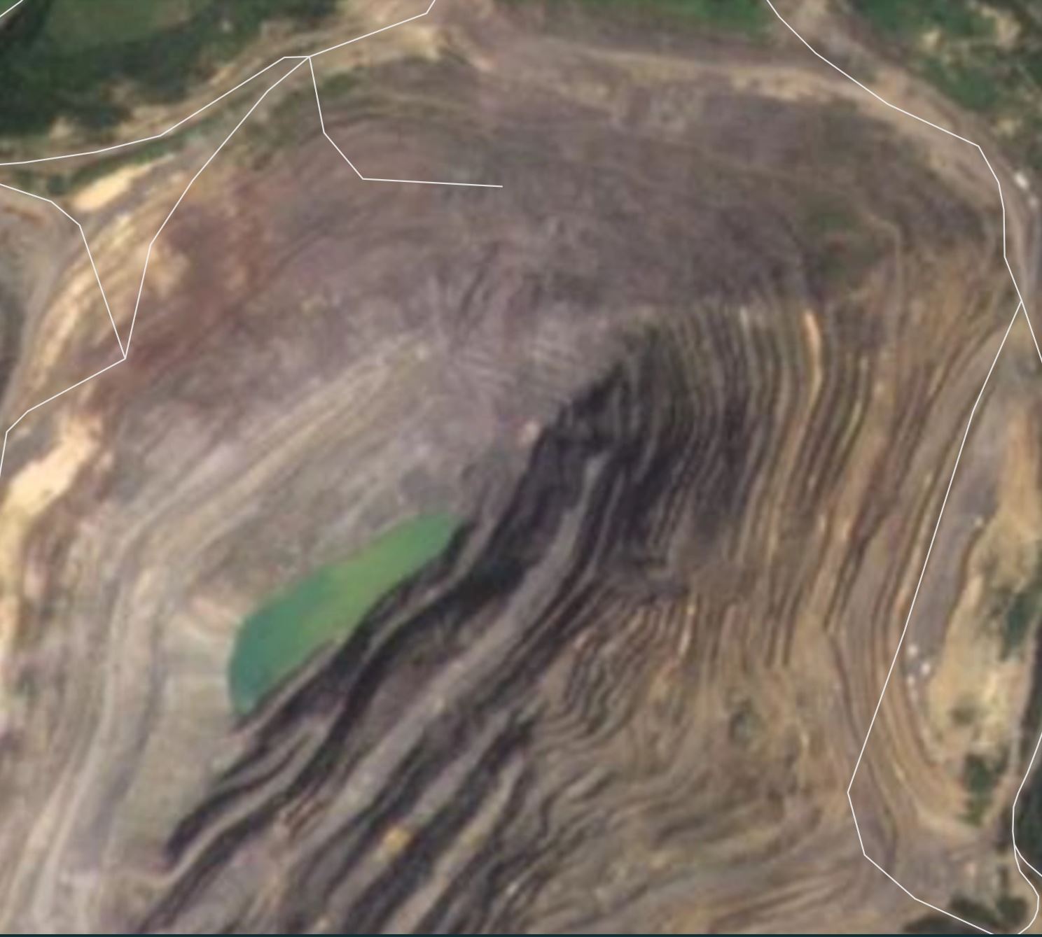
This image of the site of the Carmen Copper Mine landslide was collected on 14 October 2020:-

A Planet Labs PlanetScope image of the site of the Carmen Copper Mine in the Philippines, collected on 14 October 2020. Image copyright Planet Labs, used with permission.
.
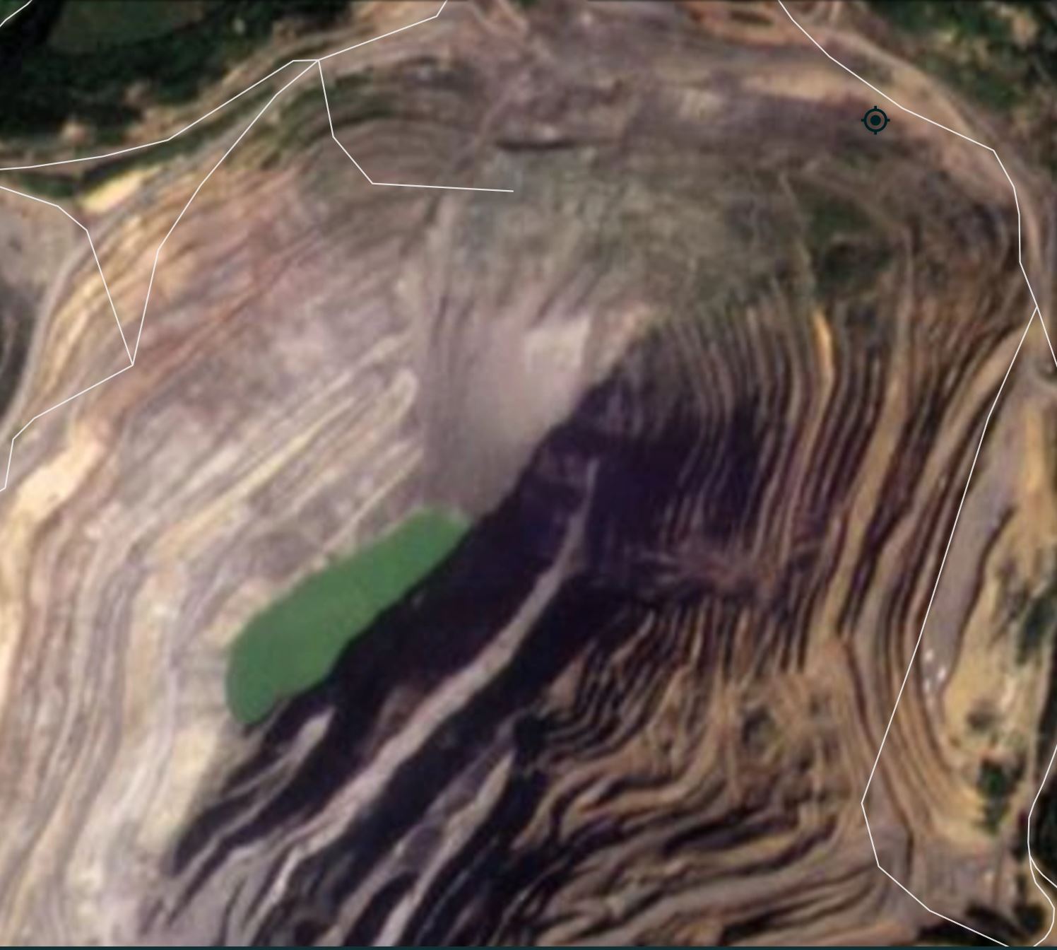
Whilst this image of the site of the Carmen Copper Mine landslide was collected on 17 December 2020, a few days before the failure:

A Planet Labs PlanetScope image of the site of the Carmen Copper Mine landslide in the Philippines, collected on 17 December 2020. Image copyright Planet Labs, used with permission.
.
The slope that failed last week is at the north end of the mine. I have created a slider that will allow a comparison of the two images, although I am not able to embed this in WordPress.
The image from October shows a slope that retained the mining benches in at least a part, and at this resolution (about 3 m per pixel) there are few obvious signs of instability. However, by December the slope had evolved dramatically. The benches had disappeared, there are signs of a scarp forming on the west side of the slope, there is a large amount of scree in the botton part of the slope and the upper portion appears to be deformed.
Thus, on the face of it I would suggest that the slope had deformed considerably, which makes the tragedy even harder to understand.
I would very much like to see some InSAR data for the site of the Carmen Copper Mine landslide over the last six months.
.
Reference and acknowledgement
Planet Team (2020). Planet Application Program Interface: In Space for Life on Earth. San Francisco, CA. https://www.planet.com/


 Dave Petley is the Vice-Chancellor of the University of Hull in the United Kingdom. His blog provides commentary and analysis of landslide events occurring worldwide, including the landslides themselves, latest research, and conferences and meetings.
Google has multiple good high-res images, none recent. However, minor failures are visible in them – some pretty significant, on the same slope that failed. The most recent one from 2016 is worth a close look. Seems like there was plenty of time to learn that this slope wasn’t happy at that angle, and also plenty of time to become complacent about what might happen.