
29 December 2020
Taku River: another very large landslide in British Columbia, Canada
Posted by Dave Petley
Taku River: another very large landslide in British Columbia, Canada
Loyal reader Hig has alerted me to two postings on Facebook by Daryl Keith Tait, who has identified another very large and very dramatic landslide in British Columbia, Canada. His two Facebook posts include a set of images of the landslide source and debris and several videos of the aftermath. This is one of the images:-
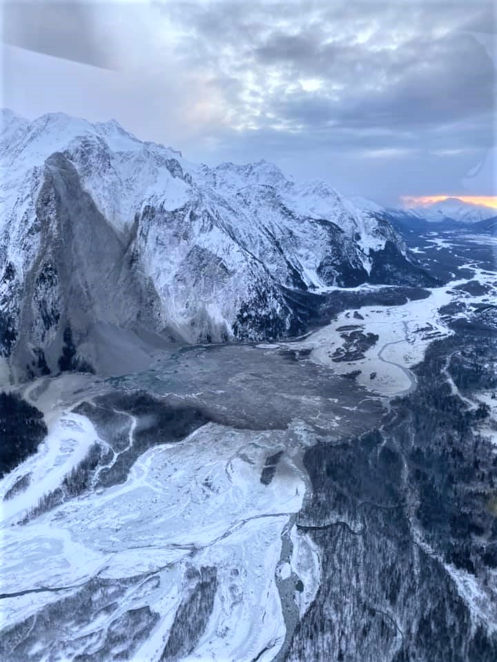
The landslide on the Taku Rover in British Columbia. Image by Darryl Keith Tait, posted to Facebook.
.
This appears to be a large rock slope failure, with a substantial mass perhaps detaching from high on the slope. If so, this mass has then triggered the failure of face of the slope below. The mass was in free-fall for a considerable distance – on impact with the valley floor it has instantaneously fragmented to create an avalanche with a long run out and considerable dispersion. There is also a large volume of scree at the foot of the slope, suggesting multiple smaller failures after the main collapse.
The videos also seem to show that the landslide deposit has lobate structures at the margins, which seem to form during late stage sliding across frozen surfaces, and hummocky mounds within the landslide mass.
Hig pointed out to me that the Facebook postings give some indication of the timing of the event. On 24 December 2020 at 19:50 UTC a M=2.9 earthquake was recorded very close to this location. It is very likely that this is the record of the landslide itself – the magnitude is about right for a rock slope failure of this scale, and of course a free-falling mass is going to have generated a really substantial release of energy.
Secondly, downstream (and across the border into Alaska) on the Taku River there is a USGS gauging station. This shows a really interesting spike in water temperature and in turbidity late on 24 December and early on 25 December. This is the graph of water temperature for example:-
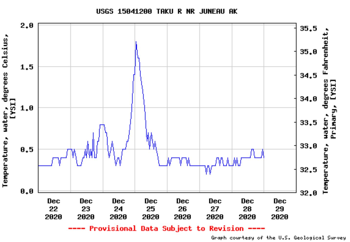
The spike in water temperature on the Taku River, downstream of the landslide. Data from the USGS.
.
It is reasonable to hypothesise that these anomalies may be the signal from the impact of the landslide on the river.
At this time of year it is very difficult to obtain satellite imagery of this area, and of course the deposit may become covered by snow. This is another site that we will probably need to wait until the Spring before we can obtain a better understanding.
Acknowledgement
Thanks to loyal reader Hig for posting this one out to me, and of course to Darryl Keith Tate for both finding it and for posting it to Facebook.
 Dave Petley is the Vice-Chancellor of the University of Hull in the United Kingdom. His blog provides commentary and analysis of landslide events occurring worldwide, including the landslides themselves, latest research, and conferences and meetings.
What are the geo coordinates of the site? Tate doesn’t say on Facebook.
[They are given in post above. D.]
update on slide from Juneau news
https://www.ktoo.org/2020/12/31/massive-mountain-rockslide-near-juneau-shakes-the-earth-on-christmas-eve/?utm_content=bufferb7f08&utm_medium=social&utm_source=twitter.com&utm_campaign=buffer
the opening line of this post misspelled jamie tait’s name. it is not TATE but TAIT
[Thanks, corrected. D.]
How will this effect the salmon run not only blocking river but there must be alot of sediment all summer long