
13 January 2020
Burundi: Planet Labs and Sentinel images of the 4 December 2019 landslide disaster
Posted by Dave Petley
Burundi: Planet Labs and Sentinel images of the 4 December 2019 landslide disaster
On 4 December 2019 intense rainfall triggered a significant, if under-reported, landslide disaster in Burundi in Africa. Whilst there were problems in many regions of the country, the most serious impacts occurred in the area around Nyempundu, in Mugina commune in Cibitoke. If you want to take a look, this is around -2.62, 29.09.
According to the Wikipedia page about the disaster, at least 38 people were killed by landslides in this event, and there was substantial damage to infrastructure such as bridges and roads, as well as loss of houses. The response has inevitably been hampered by the remote location.
This is not an area in which it is particularly easy to get good satellite imagery due to cloud and water vapour. However, Planet Labs captured this PlanetScope image on 7 December 2019 showing the landslides in the most heavily affected area:-
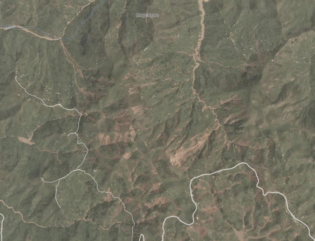
Planet Labs image of the landslides in the hills around Nyempundu, in Mugina commune in Cibitoke in Burundi, triggered on 4 December 2019. Planet Labs PlanetScope image dated 7 December 2019. Copyright Planet Labs, used with permission.
.
The imagery appears to show multiple shallow landslides with some evidence of debris mobilisation through the channel system in the form of debris flows. In some sub-catchments much of the topsoil appears to have been removed.
These are the same landslides, shown in a Sentinel-2 L1C image, via Sentinel Hub. The image is dated 14 December 2019:-
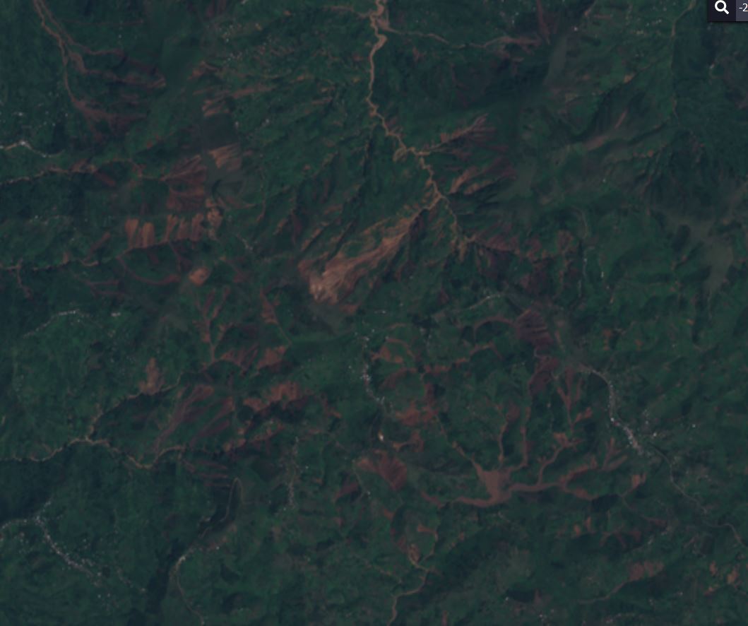
Sentinel-2 L1C image of the landslides in the hills around Nyempundu, in Mugina commune in Cibitoke in Burundi, triggered on 4 December 2019. Image dated 14 December 2019.
.
Although it is lower resolution, the advantage of Sentinel is that it is easy to generate an NDVI image, in which the contrast between vegetation (which appears red) and bare soil (which appears tan) is clear. This is an NDVI image from the above Sentinel image, which highlights the landslides:-
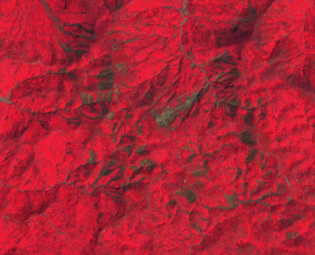
Sentinel-2 L1C NDVI image of the landslides in the hills around Nyempundu, in Mugina commune in Cibitoke in Burundi, triggered on 4 December 2019. Image dated 14 December 2019.
.
It is clear that in this area of Burundi a substantial landslide disaster has occurred. Of course the damage to the hillsides and sediment in the channel will cause long term problems for the local population.
Reference
Planet Team (2020). Planet Application Program Interface: In Space for Life on Earth. San Francisco, CA. https://www.planet.com/
 Dave Petley is the Vice-Chancellor of the University of Hull in the United Kingdom. His blog provides commentary and analysis of landslide events occurring worldwide, including the landslides themselves, latest research, and conferences and meetings.
Hi Dave,
Thanks for your blog entry. It is interesting to see these impacts of heavy rainfalls on slopes that seem to be washed away easily. However, I am a bit sceptical about the evidence you are presenting and the conclusion you are drawing. I think a satellite image from before 4th December would be helpful. Otherwise, how do you know those landslides were triggered by exactly that rain event, and not before? Also, I would be interested in reading more about the impacts on the local population you are mentioning. How far down the river are the next towns or villages? And what is the impact the sediment load exerts on them?
It would be interesting to receive your answers! Apologies if any of this is self-evident, I am not an expert on landslides nor on that scenic part of eastern Africa.
Thank you!
[I have indeed seen imagery from just before the rainfall event. The vast majority of these landslides did not pre-exist, although the largest one was active. As to the impacts – there is a lot of material in the media that can be found with a simple search. D.]
Matthias