5 July 2019
The Aizawl landslide: evidence from Google Earth of slope modification
Posted by Dave Petley
The Aizawl landslide: evidence from Google Earth of slope modification
The landslide in Aizawl in Mizoram, India earlier this week, which I featured on Wednesday, caused the death of three people, including two children. The image below, from The Sentinel, provides an interesting perspective on the landslide. Once again it emphasises how fortunate it is that the buildings did not collapse completely:-
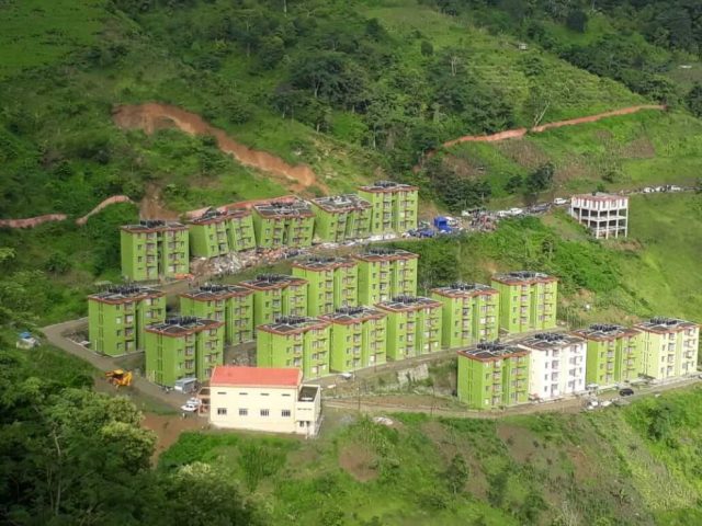
The Aizawl landslide, showing the three damaged apartment block. Image via The Sentinel.
.
There is an excellent archive of Google Earth imagery for this site. As a reminder, here is an image from December 2018 showing the completed site and the slope that ultimately failed:-
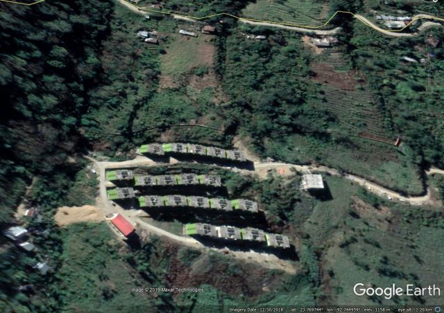
Google Earth image of the site of the Aizawl landslide. Image dated 30th December 2018.
.
By comparison, this image, dated 17th February 2006, shows the site prior to construction. Note the path across the slope that was widened to build the road:-
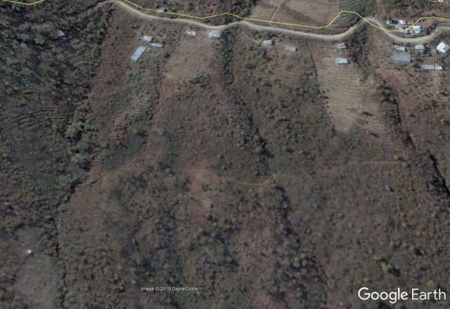
Google Earth image of the site of the Aizawl landslide. Image dated 17th February 2006.
.
But the revealing image of the side is the one below, dated 3rd December 2012, which shows the ground works at the site prior to the construction of the blocks:-
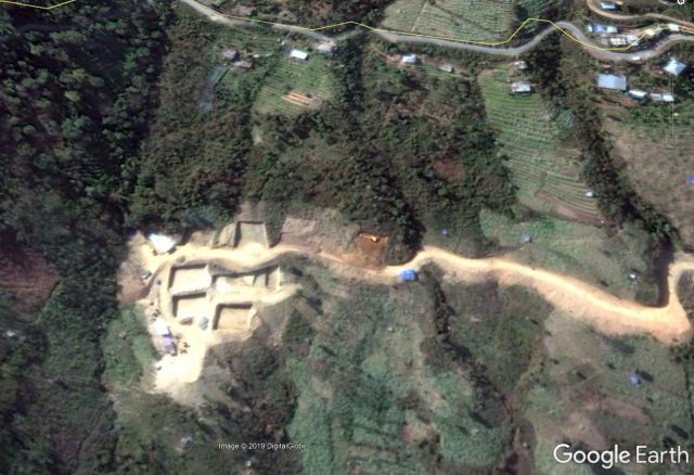
Google Earth image of the site of the Aizawl landslide. Image dated 3rd December 2012.
.
At the point at which this image was collected machinery was onsite excavating the foundation for the blocks in the row that was hit by the landslide this week. The footprint of other blocks is in place, and there is evidence of fill being emplaced lower down the slope. Note that the road has been constructed through cutting the slope and then emplacing fill on the downslope side.
A subsequent image, this time taken in 2014, appears to show that the slope was cut across the entirety of the length upslope of the apartments:-
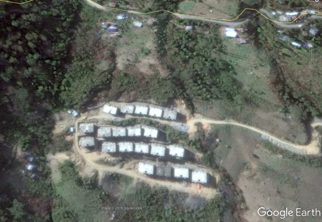
Google Earth image of the site of the Aizawl landslide. Image dated 13th January 2015.
.
It is not clear as to the level of engineering works that were used to secure this cut slope, but the subsequent failure suggests that for whatever reason they were not adequate.


 Dave Petley is the Vice-Chancellor of the University of Hull in the United Kingdom. His blog provides commentary and analysis of landslide events occurring worldwide, including the landslides themselves, latest research, and conferences and meetings.
Authority should imposed regulated control over slope cutting – be it road or building construction. The fragile sedimentary rock formed appears to have been formed by receding waves are prone to landslides when the rock laminated layers dip towards the valleys.
Heavy rains ingress into rock joints have also contributed to substantial reduction in the friction coefficient. The major contributor to the slides are disturbing the slopes by construction.
With stricter enforcement to prevent such reoccurrence will save thousand of lives which at risk. Government should take mitigation measures without delay.
En la foto de google earth de febrero de 2006 parece existir una cicatriz de deslizamiento en el sitio donde se produjo el posterior deslizamiento, además se debería revisar la escorrentía desde la vía superior como discurre vertiente abajo.
Vale la pena resaltar que la resistencia estructural de los edificios se comporto muy bien y no permitieron una tragedia mayor.
[Translates to: In the google earth photo of February 2006 there seems to be a landslide scar at the site of the subsequent landslide, and runoff from the upper road should also be checked as it runs down the slope.
It is worth noting that the structural resistance of the buildings behaved very well and did not allow a major tragedy. D.]