14 September 2017
Landslides from the Kaikoura earthquake part 1: the Seafront landslide (also wrongly known as the Seaward landslide)
Posted by Dave Petley
Landslides from the Kaikoura earthquake part 1: the Seafront Landslide
Yesterday, I was lucky enough to be able to fly over the area affected by the Kaikoura earthquake by helicopter, together with colleagues from GNS Science. Over the next few days I will post some images of the earthquake-induced landslides that I took on this flight. I am starting with the very large and very complex Seafront landslide, which is perhaps the most infamous of all the landslides triggered in this earthquake, thanks to images that went viral showing three cows trapped on a displaced raft on the landslide. For this reason the slide became known as the Cow Slide, but it is correctly termed the Seafront Landslide (also known, wrongly, as the Seaward Landslide):-
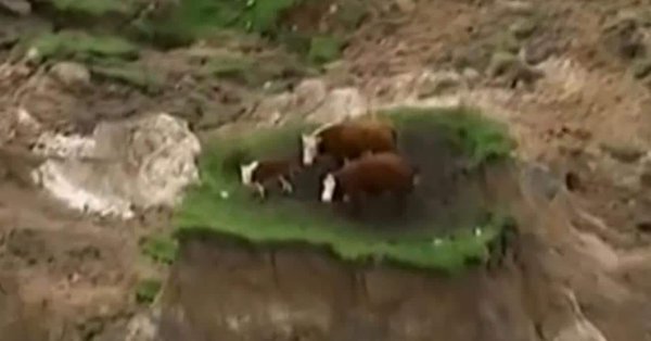
Cows trapped on the Seafront Landslide, via The Daily Telegraph
.
The cows were rescued. This is very large, very complex landslide. If you want to locate it on Google Earth it is at -42.178, 173.880. This is a view of the landslide from the north:
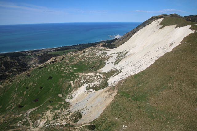
The Seafront Landslide, triggered by the Kaikoura earthquake, viewed from the north.
.
Whilst this is the landslide viewed from the south:
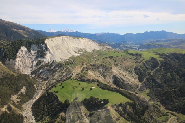
The Seafront Landslide, triggered by the Kaikoura earthquake, viewed from the south.
The images show that this is very wide, broad slump type landslide in which, quite literally, the side of the ridge has detached and slipped. At the toe the slide has broken up considerably, whilst in other sections it has remained remarkably coherent. This image shows the very complex behaviour of this displaced block. Note that some sections of the slide have been modified by the farmer to try to regain productive land:
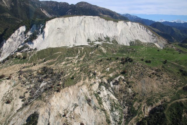
The displaced mass of the Seafront Landslide, triggered by the Kaikoura earthquake.
.
One other really interesting observation about this landslide is that the northern edge of the ridge also failed, and that a much larger section partially displaced but did not collapse:
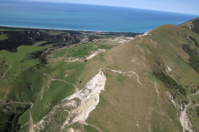
The failure at the northern end of the ridge from which the Seafront Landslide originated. Note the large, partially failed section.
.
Whilst the other (west) side of the ridge appears to be essentially undamaged, even though it is steep:
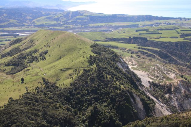
The west side of the ridge from which the Seafront Landslide originated. Note the lack of slope failures.
.
This illustrates perfectly why it is so hard to forecast the behaviour of slopes in earthquakes.


 Dave Petley is the Vice-Chancellor of the University of Hull in the United Kingdom. His blog provides commentary and analysis of landslide events occurring worldwide, including the landslides themselves, latest research, and conferences and meetings.
very nice Dave-was there 2 weeks back with grad students looking at the interaction of structural geology with failure mechanics.
I do believe its called the “Seafront” slip, not Seaward…thats what the local farmers call it anyway….
[Thanks Martin – it seems to have both names. This document also calls it the Seaward landslide. I have corrected the text to reflect this. D.]
Hi Dave, nice blog. I can confirm the correct name is Seafront slip/landslide. I know this because I mapped the fault surface rupture within a few days of the EQ as part of the urgency response. The landowner specifically requested that we use Seafront slip as the name for this one. Seafront Hill was the name given to this part of their farm and it was a very special part of their property. Other names have been used by people who haven’t quite remembered the correct name. In respect for the landowner, it would be great if you could remove ‘seaward’ completely (no need to perpetuate a problem). Thanks
[Many thanks, now done. D.]