11 August 2017
Planet Labs imagery of landslides triggered by the Jiuzhaigou Earthquake
Posted by Dave Petley
Planet Labs imagery of landslides triggered by the Jiuzhaigou Earthquake
The private satellite imagery company Planet Labs (Planet Team 2017) have very kindly made satellite data available showing the effects of the M=7.0 Jiuzhaigou earthquake in Sichuan Province, China on 8th August 2017. The impacts are dramatic and extraordinary. As I noted in my post immediately after the event, we expected that this earthquake would be efficient in terms of landslide generation, and this is indeed the case.
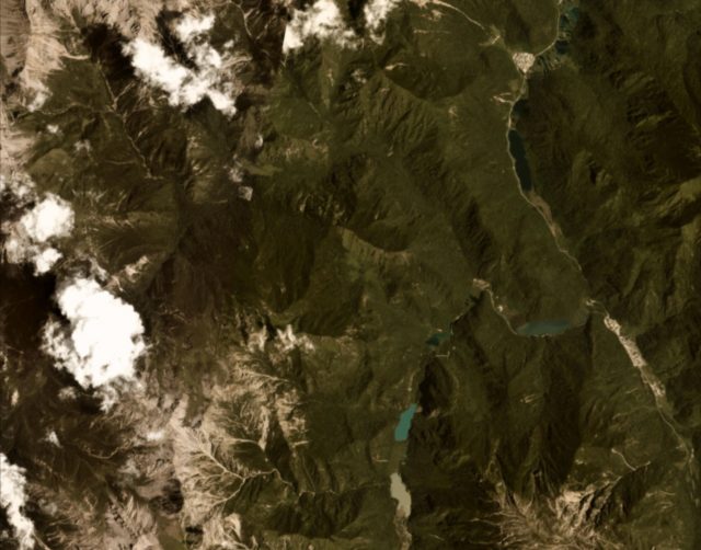
This is a Planet Labs image of the epicentral area collected the day before the earthquake:-

Planet Team (2017) image of the epicentral region of the Jiuzhaigou earthquake, dated 8th August 2017
.
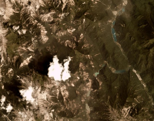
And this is the same area the day after the earthquake:

Planet Team (2017) image of the epicentral region of the Jiuzhaigou earthquake, dated 9th August 2017.
.
It is clear that the earthquake has generated a large number of landslides in the epicentral region. These slides appear to have the characteristic form of earthquake induced slides – there are large numbers in close proximity, many of which extend to the ridge lines. This reflects the effects of topographic amplification in triggering the slides at the ridges, which then travel down to the drainage line, given this landslides a long length relative to their width. Most of the slides appear to be shallow rockslides.
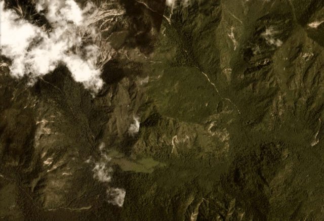
We can get a better understanding of this by zooming in to an area at the top of the image. This is the imagery of before the earthquake on 8th August 2017:-

Planet Team (2017) imagery of a part of the area affected by the Jiuzhaigou earthquake, dated 8th August 2017.
.
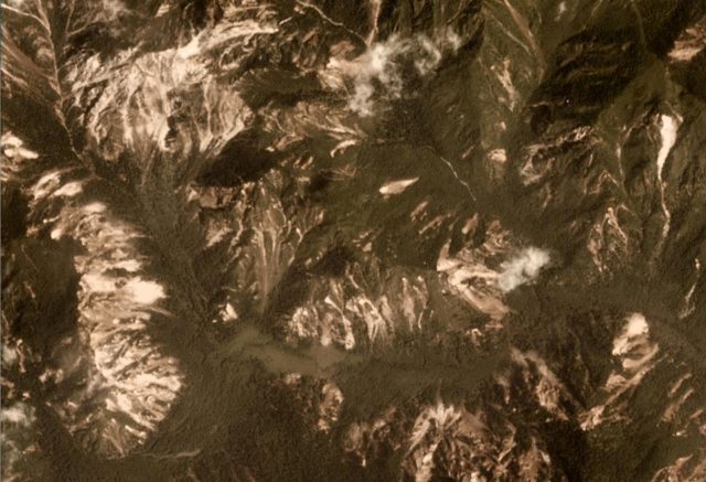
And this is the same area a day later:-

Planet Team (2017) imagery of part of the epicentral from the Jiuzhaigou earthquake, dated 9th August 2017.
.
The area affected by landsliding appears to be comparatively compact, as expected for a predominantly strike-slip event of this magnitude. In that area the landslide density is high though.
Acknowledgement
Planet Team (2017). Planet Application Program Interface: In Space for Life on Earth. San Francisco, CA. https://api.planet.com


 Dave Petley is the Vice-Chancellor of the University of Hull in the United Kingdom. His blog provides commentary and analysis of landslide events occurring worldwide, including the landslides themselves, latest research, and conferences and meetings.