
1 September 2016
An update on landslides from the M=6.2 Central Italy earthquake
Posted by Dave Petley
An update on landslides from the 2016 Central Italy earthquake
Dr Salvatore Martino has very kindly provided a further update on yesterday’s post on landslides triggered by the M=6.2 Central Italy earthquake on 24th August:-
Up to now about 150 ground effects have been inventoried, mainly consisting of rock falls and rock slides. These events occurred from both road cuts and natural scarps. The widespread forest cover considerably reduced failure occurrence in the hill zones at elevations below 1000 m a.s.l. Several interventions are in progress to opening blocked roads and restore safe conditions in the vicinity of the the damaged villages.
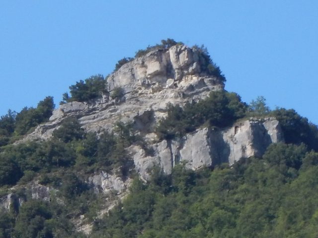
Image courtesy of Salvatore Martino
.
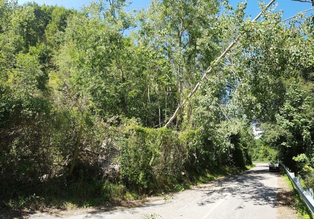
Image courtesy of Salvatore Martino
.

Image courtesy of Salvatore Martino
.
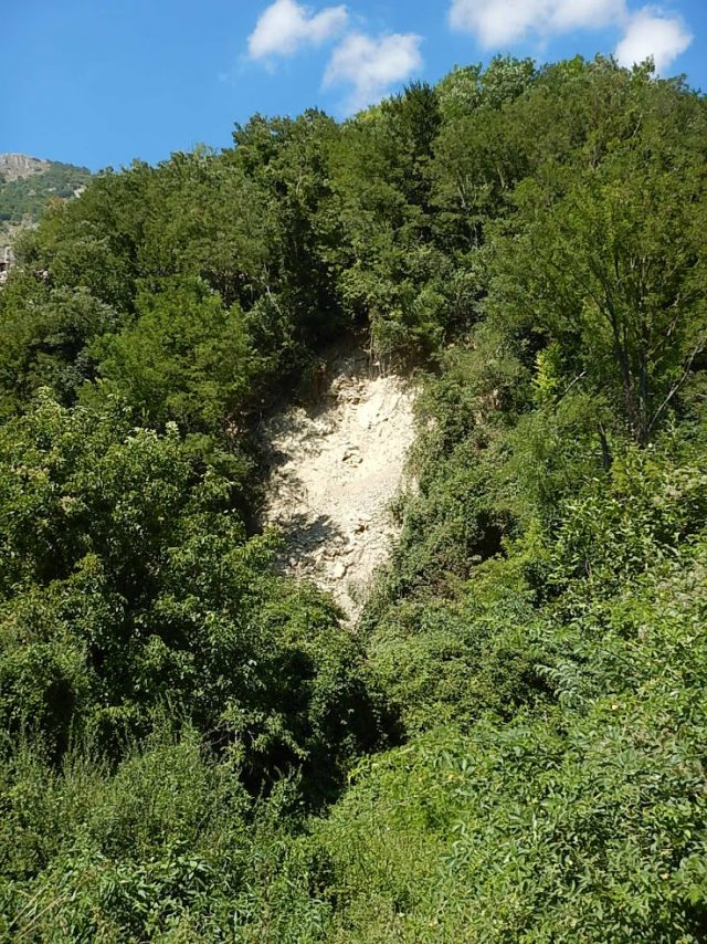
Image courtesy of Salvatore Martino
.
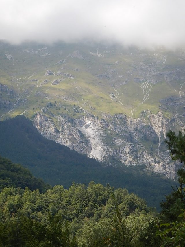
Image courtesy of Salvatore Martino
.
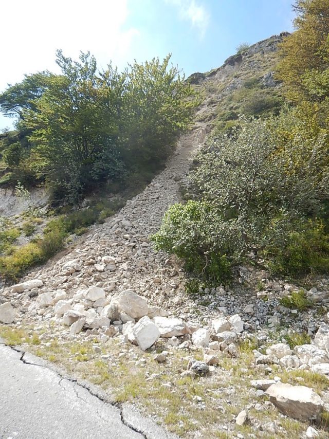
Image courtesy of Salvatore Martino
.
The following picture show a pre- and post- earthquake rock wall at the Corno Piccolo (Gran Sasso Massif):-
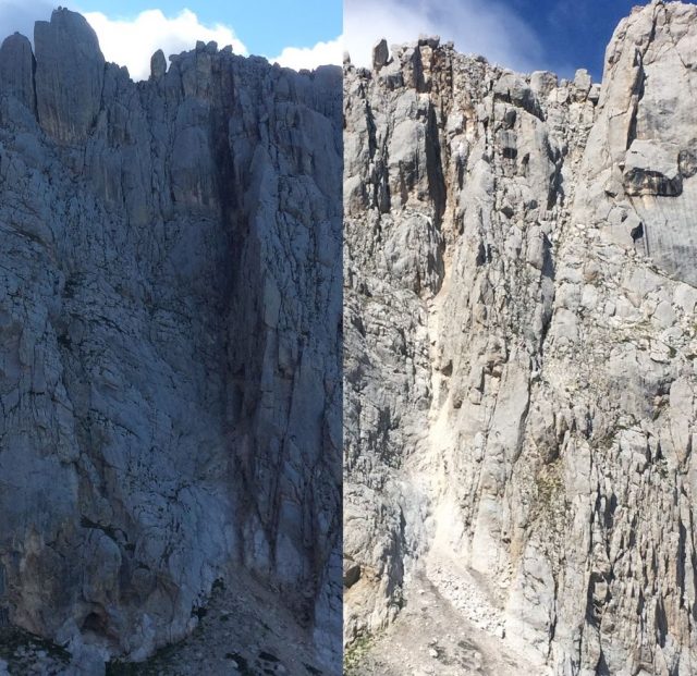
Image courtesy of Salvatore Martino
.
The distribution of these effects is particularly interesting if compared with the one of the previous 1997 Umbria-Marche and 2009 L’Aquila earthquakes as it results from the CEDIT catalogue. The area covered by the new earthquake effects is strictly between the other ones.
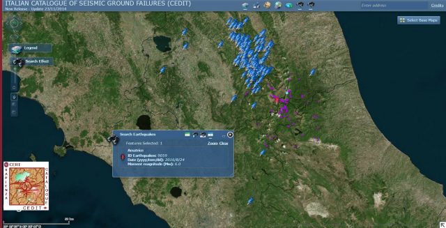
Image courtesy of Salvatore Martino
.
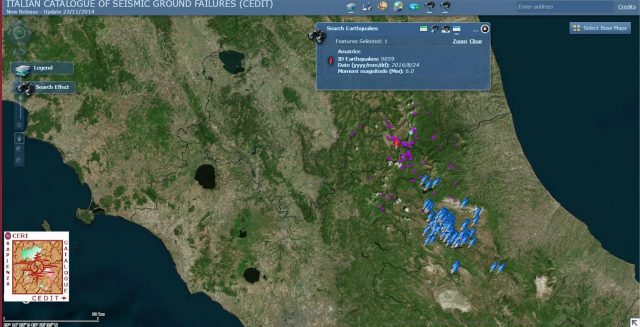
Image courtesy of Salvatore Martino
.
The municipalities which were mainly affected by the earthquake-induced landslides are Accumoli, Amatrice, Arquata del Tronto and Umbria at the borderline of three Italian regions: Lazio, Marche and Umbria.
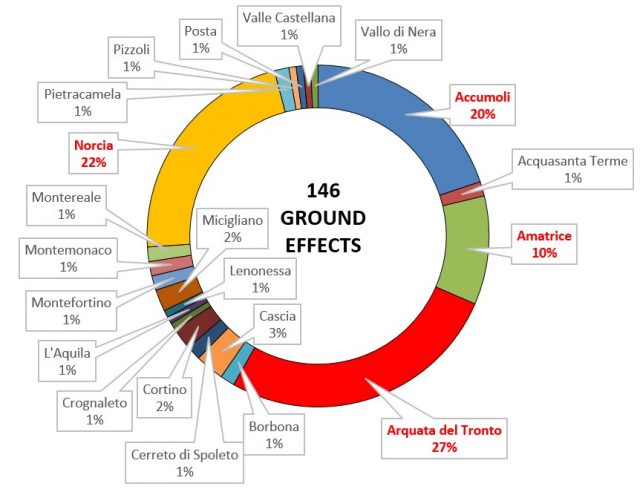
Image courtesy of Salvatore Martino
.
In the CEDIT WebGIS available on-line (http://www.ceri.uniroma1.it/index_cedit.html) each event is inventoried by a technical schedule and an associated picture. The geolocalization of the surveyed events (cartographic reference system in geographic coordinates WGS84), classified according to the level of interaction with infrastructures, is also available in both .kmz and and .shp formats. The inventory is currently updated to 29th August 2016 but further updates will follow in the next days.
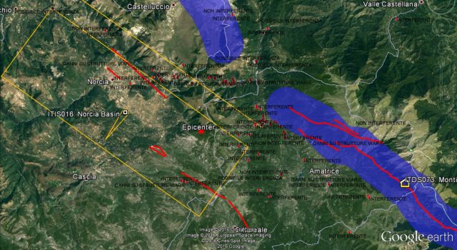
Image courtesy of Salvatore Martino
.
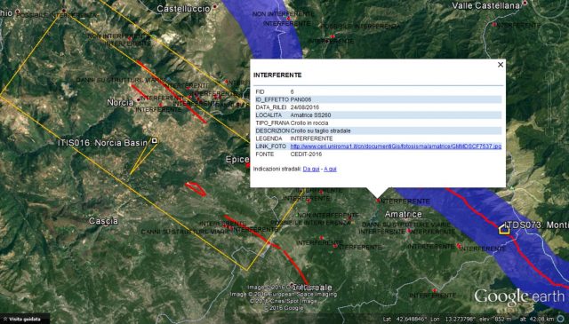
Image courtesy of Salvatore Martino
.
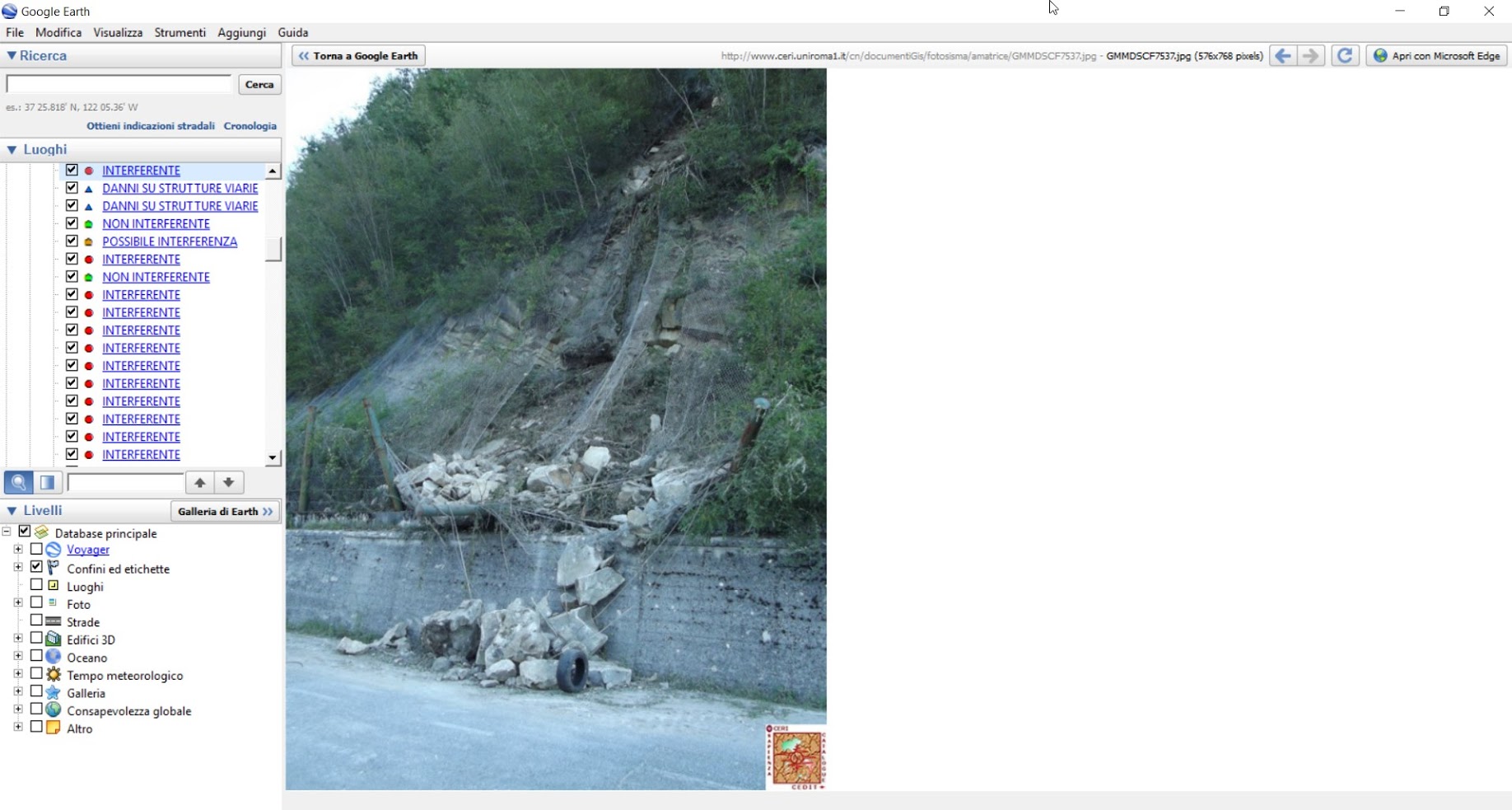
Image courtesy of Salvatore Martino
 Dave Petley is the Vice-Chancellor of the University of Hull in the United Kingdom. His blog provides commentary and analysis of landslide events occurring worldwide, including the landslides themselves, latest research, and conferences and meetings.