
7 June 2016
Review of a paper: dam break risk for the Attabad landslide
Posted by Dave Petley
Dam break risk for the Attabad landslide
In a paper just published in the journal Landslides, Chen et al. (2016) have analysed the stability of the Attabad landslide dam in northern Pakistan, and the potential impacts of such an event on downstream infrastructure. This is a very important study, given that the landslide continues to impound a vast quantity of water in a well-populated valley.
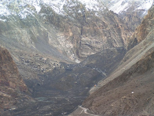
The Attabad landslide dam prior to the 2010 overtopping event
.
The paper contains some important and interesting background information, not least a graph of the water depth against time. This appears to be a similar dataset to the one that I was updating on a daily basis on the dedicated blog that I ran at the time, but the record is longer. It is not clear where the data has come from as I was not aware that there was monitoring by any other parties at the time. It’s good to see a full dataset. More importantly, the team have analysed the likelihood of a full dam break event using an empirical relationship derived from previous studies based on the so-called Dimensionless Blockage Index (DBI). Chen et al. (2016) conclude that:
The statistical analysis of the 84 natural landslide dams indicated that a dam is stable when DBI <2.75, quasi-stable when 2.75 < DBI < 3.08, and unstable when DBI >3.08…The DBI of the Attabad landslide dam is 4.62–4.85, which is greater than 3.08 and indicates that the dam is unstable and that there is a risk of a breach in the Attabad landslide dam.
However, the authors do not believe that a breach event would lead to release of all of the impounded water (this is probably correct in my view). This is fortunate as the authors have analysed the likely magnitude of a break flood at the site of the Attabad landslide dam itself. Such a full breach event would generate a calculated peak discharge of 175,145 cumecs (cubic metres per second), whilst a 50% breach would generate 44,904 cumecs. The flood would dissipate downstream, but a 50% breach is calculated to generate a peak flow of almost 16,000 cumecs at Gilgit Bridge, 100 km downstream.
Thus, the authors recommend that there is a continued need for risk management at the Attabad site. They conclude that:
In addition to continued monitoring of the upstream water inlet, lake water levels, and seepage and piping downstream of the dam, hazard zones and safe zones should be delineated in accordance with the results of the risk assessment of the Attabad landslide dam. Sanctuary sites, escape routes, and early warning signals should be pre-selected and pre-planned, and necessary material stockpiles should be prepared. A plan for construction during high-risk periods should be considered, and contingency plans for secondary disasters from the landslide lake should be distributed. The risks of disasters and potential losses should be reduced to the greatest extent possible.
I can only agree. The risks at the Attabad landslide dam site are far from negligible.
Reference
Chen, X., Cui, P., You, Y., Cheng, Z., Khan, A., Ye, C. and Zhang, S. 2016. Dam-break risk analysis of the Attabad landslide dam in Pakistan and emergency countermeasures. Landslides. Doi: 10.1007/s10346-016-0721-7
 Dave Petley is the Vice-Chancellor of the University of Hull in the United Kingdom. His blog provides commentary and analysis of landslide events occurring worldwide, including the landslides themselves, latest research, and conferences and meetings.
The photos early on make me suspect that a significant amount of the upper part of the blockage is composed of large slabs. Indeed the ripple patterns in the channel before the water steeply descends is indicative of flow over a large slab.
I wonder if this paper addresses the possibility of slabs and their effect on any partial releases. Not willing to buy access to the paper.