22 August 2015
Mount Rainier debris flows, 13th August 2015
Posted by Dave Petley
Mount Rainier debris flows
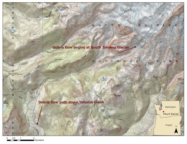
The Mount Rainier National Park Facebook page has a nice report about a series of debris flows that occurred on the flanks of the volcano, in Washington State, USA on 13th August 2015 (and there is a good press release too). These debris flows originated from the South Tahoma Glacier and rumbled down Tahoma Creek, as this Mount Rainier National Park map shows:
.
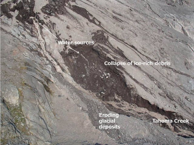
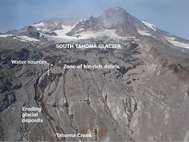
The debris flows originated as a series of collapses of ice-rich glacial sediment, triggered by the release of stored water from the glacier. This is a common type of event on the flanks of Mount Rainier – indeed the USGS has a webpage describing them. A helicopter overflight by Scott Beason of the Mount Rainer National Park identified the source of the flows quite beautifully:-
.
.
There is a stunning album of aerial photographs of this event on the Mount Rainier Flickr Page.
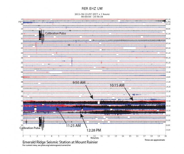
Perhaps the most exciting element of these events though was the capture of them on the local seismic monitoring network. As the Mount Rainier National Park Facebook site observes:
“Looking at seismic data from the Pacific Northwest Seismic Network, the vibrations from the debris flow are recorded on seismograms from Rainier station RER, located at Emerald Ridge overlooking Tahoma Creek. The debris flow signal starts at ~9:50 AM PDT. Signals are emergent, pulsatory, and relatively high-frequency—all characteristics of debris flows. There was a period of time from ~9:50 AM through to ~12:45 PM where signals were occurring relatively continuously, with several tens-of-minutes-long higher-amplitude bursts at 10:15-11:10, 11:25-11:50, and 12:30-12:40 that probably correspond to major debris-flow pulses. No debris-flow-like signals showed up overnight.”
This is the seismic record:
.
Liveleak has a nice video of one of the debris flow pulses passing through:
.
Acknowledgement
Thanks to Lynn Highland of the USGS for bringing this one to my attention.


 Dave Petley is the Vice-Chancellor of the University of Hull in the United Kingdom. His blog provides commentary and analysis of landslide events occurring worldwide, including the landslides themselves, latest research, and conferences and meetings.