3 August 2015
The Fukaminato River landslide in Japan
Posted by Dave Petley
The Fukaminato River landslide in Kyushu, Japan
Last week I highlighted the ongoing landslide on the Fukaminato River in Japan, including a video of one of the most recent failure events. There is now a better version of the video available on Youtube:
.
The video seems to show the main collapse event, including the initial sliding and the dramatic fragmentation of the landslide mass and, later on, the arrival of the debris flow wave downstream. There is also seem quite excellent drone footage of the site, collected from before the most recent failure, also on a Youtube video:
.
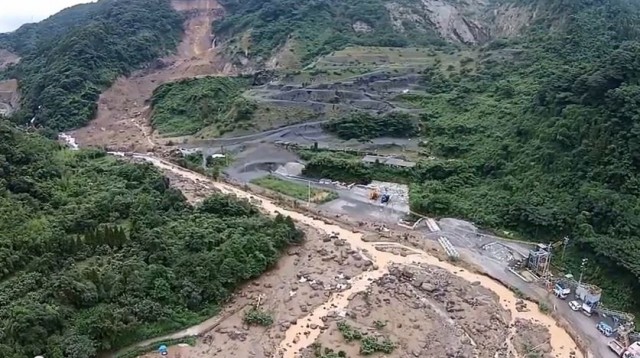
The drone footage provides a good overview of the landslide site, first looking upslope at the failure zone and upper reaches of the debris track:

Fukaminato River landslide via Youtube
.
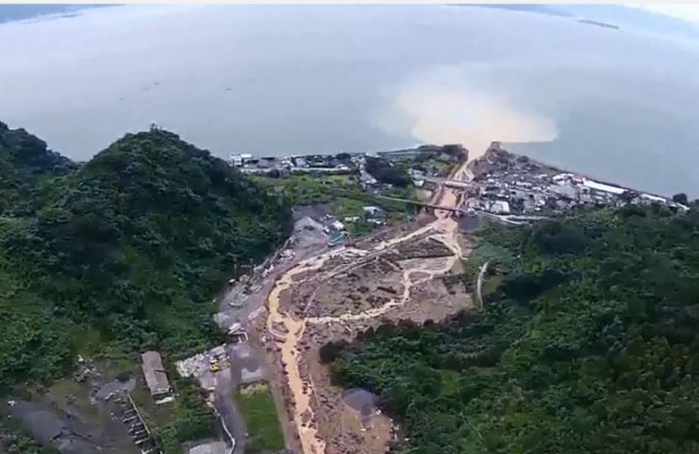
And second, looking downslope along the debris flow track. Note the plume of sediment in the bay:

Fukaminato River landslide via Youtube
.
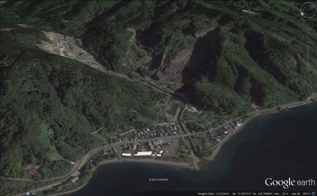
The Fukaminato River landslide is located at 31.590N, 130.795E. This is a perspective view of the landslide site, taken in 2010 via Google Earth:
.
Note the very extensive amount of quarrying that has been undertaken in this area, including at the landslide site. However, the active quarrying does not now seem to be occurring where the failures have been initiated. Perhaps the old quarrying work left the slopes in an oversteepened condition? The trigger appears to have been initiated by the prolonged heavy rainfall that this area has suffered over the last few weeks.
The Fukaminato River landslide site is close to Sakurajima volcano, which is currently very active. Whilst there is no apparent link between the volcano and the landslide, I cannot resist including some of the amazing videos of the explosive eruption of Sakurajima:
.
Acknowledgement
Thanks to Colin Stark of the Lamont-Doherty Earth Observatory at Columbia University, who did almost all the work that went into this post.


 Dave Petley is the Vice-Chancellor of the University of Hull in the United Kingdom. His blog provides commentary and analysis of landslide events occurring worldwide, including the landslides themselves, latest research, and conferences and meetings.
There is a connection between the slide and Sakurajima. The steep slope that the slide is on exists because it is the edge of Aira Caldera which formed on an eruption ~22,000 years ago. Sakurajima is the current vent for that same volcanic system. Also, in this area there are many sides because the surface geology is dominated by a fine ash (locally called shirasu) from that eruption 22000 years ago. It is generally unconsolidated but has a very high angle of repose due to the high angularity of the ash grains. Of course, when it rains a lot it often looses strength and becomes a slurry – like you see in the video. I do not know if this landslide is in the ash, but it appears that may be the case.