24 September 2014
Sunkoshi landslide – reopening the road
Posted by Dave Petley
Sunkoshi landslide
A couple of weeks ago, and with great fanfare, it was announced that the diversion roads around the Sunkoshi landslide were now open and the traffic was flowing again on the Arniko Highway, linking Kathmandu with Tibet. The timing was important as this is a key route for the flow of goods into Nepal, and there was real anxiety about the effects of having large numbers of container lorries stuck to the north of the border. From the very start I was concerned that these roads would be very vulnerable to landslides in heavy rainfall. In the last few days news about the flow of goods has gone very quiet, coinciding with a period of heavy rainfall. The obvious implications were that the roads were blocked once more, but there was little hard evidence.
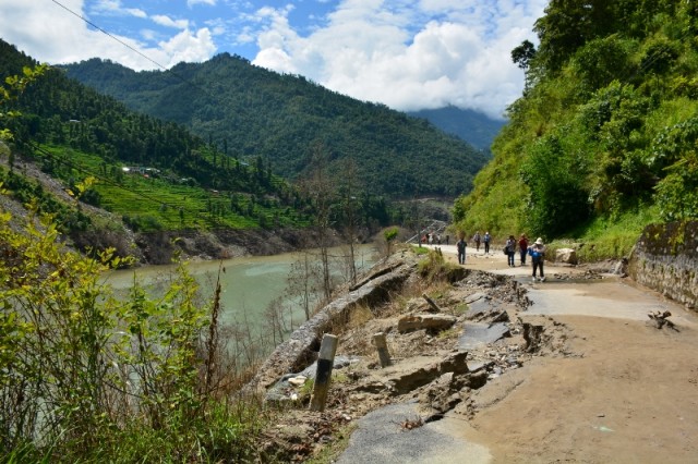
In the last few days geotechnical engineer Giorgio Maderni travelled along the highway. He has very kindly sent the following images to me (note that he retains copyright). The first shows the old Arniko Highway upstream of the dam. The level of the water prior to the breach is clear, as is the damage that the road has suffered:
.
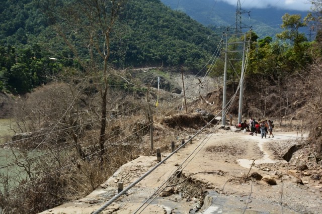
Further downstream the level of damage to the road and infrastructure, and the slow progress in putting it right, is clear:
.
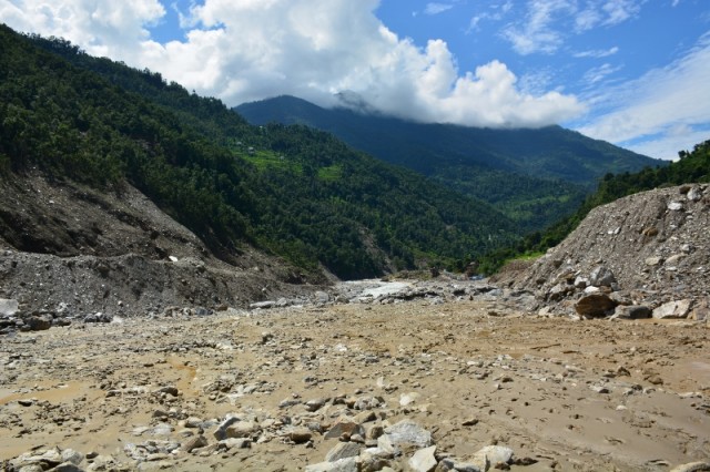
The size of the breach of the landslide dam is impressive:
.
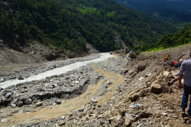
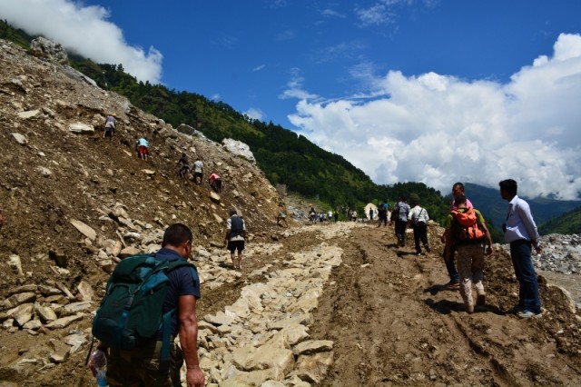
The very poor state of the track across the landslide debris is clear from this image. In the distance a long queue of trucks waiting to cross the landslide can be seen.
.
And this image shows the state of the road in more detail. It will be a difficult task to get this to a state in which it is possible to see two-way movement of large numbers of trucks:
.
At present there is no news about the alternative roads, but given that the trucks are queued up the assumption must be that these are also in a poor state,


 Dave Petley is the Vice-Chancellor of the University of Hull in the United Kingdom. His blog provides commentary and analysis of landslide events occurring worldwide, including the landslides themselves, latest research, and conferences and meetings.