4 December 2012
Super Typhoon Bopha (Pablo) makes landfall in the Philippines
Posted by Dave Petley
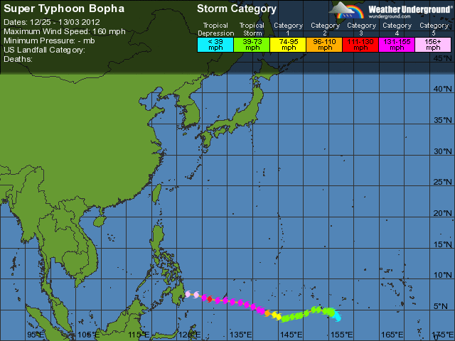
Unfortunately, Typhoon Bopha (known as Pablo in the Philippines) rapidly intensified in the few hours before making landfall,managing to achieve Super Typhoon (Category 5) status. Landfalling super typhoons have the potential to be very damaging. This storm is exceptional in many ways, as Jeff Masters outlined in his blog yesterday. In a year of extreme events worldwide I suppose another should not be a surprise.
As forecast, the storm made landfall on the Mindanao in the Philippines, and is now tracking west-northwest across the island:
In so doing it is bringing both very damaging winds and very intense rainfall. Landslides and floods are inevitable, although at this stage it is difficult to forecast how bad these will be. It will range somewhere between bad (but manageable) and catastrophic. There are too many uncertainties to know which will apply, but the precedent from the much weaker Tropical Storm Washi a year ago is not promising. The only positive sides to this story are that there has been at least some element of preparedness and that the storm is moving fast, which may reduce the rainfall. This is the most intense typhoon to strike Mindanao in recorded history though, so the outcome could be very serious.
Three sources of useful information as the storm tracks across the island:
PAGASA – the national meteorological organisation in the Philippines
NDRRMC – the national disaster management organisation in the Philippines (who are very proactive i their use of the web)
TRMM – satellite monitoring of tropical rainfall


 Dave Petley is the Vice-Chancellor of the University of Hull in the United Kingdom. His blog provides commentary and analysis of landslide events occurring worldwide, including the landslides themselves, latest research, and conferences and meetings.