4 June 2010
Photos of the development of the situation at Attabad
Posted by Dave Petley
Focus have kindly provided a new set of images of the situation at Attabad with respect to the spillway. I think that these images were taken yesterday.
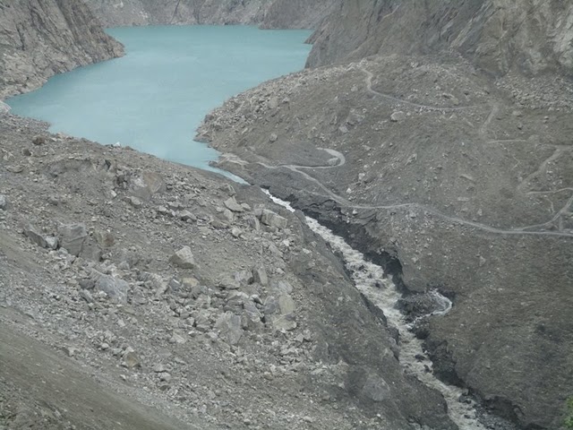
Most importantly, here is an overview image of the spillway:
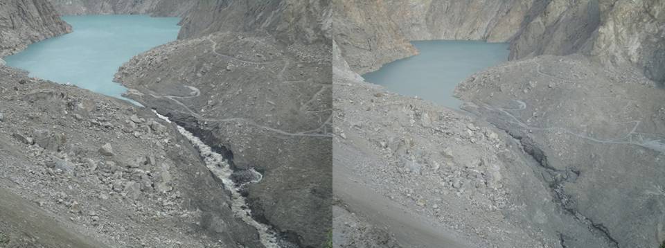
It is helpful to compare this with the image of the spillway from 1st June (right hand image):
It is clear that the situation has developed considerably over the last few days. The flow along the spillway has increased greatly, and the lower part of the channel has widened and deepened. Flow appears to still be controlled by the large boulder in the middle of the channel, although the lowering of the channel downstream will be steadily undercutting this.The development of the spring on the channel edge is also interesting.
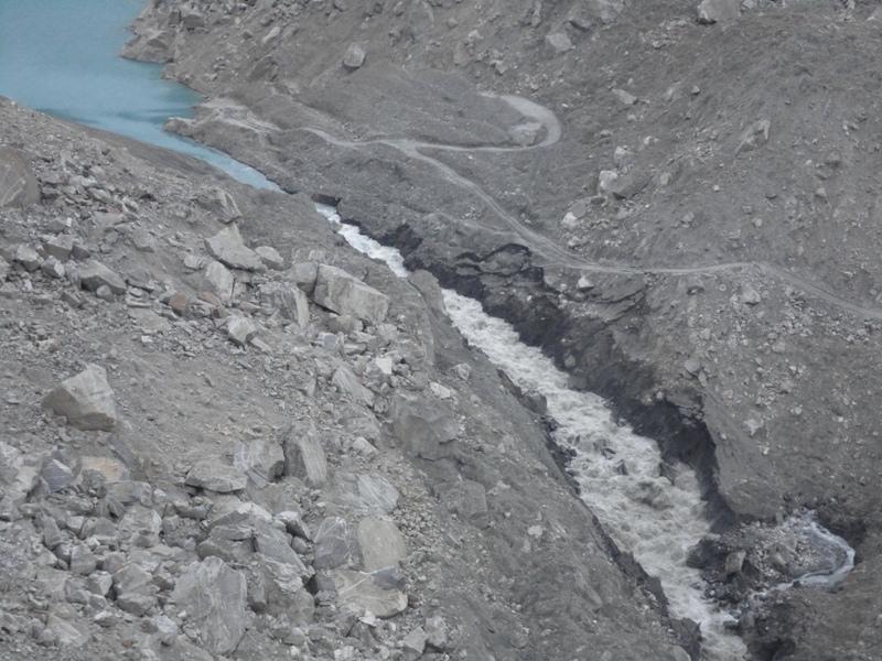
A closer view of the spillway clearly shows how widening is occurring:
The flow is undercutting the banks, which are then progressively failing. Note also just how much scour is occurring even though the bed of the channel is boulder-strewn – it is clear that at the moment the boulders are not armouring the channel.
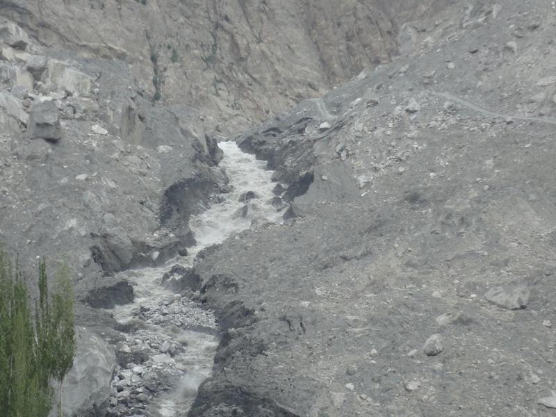
A view from the downstream side of the channel is fairly dramatic:
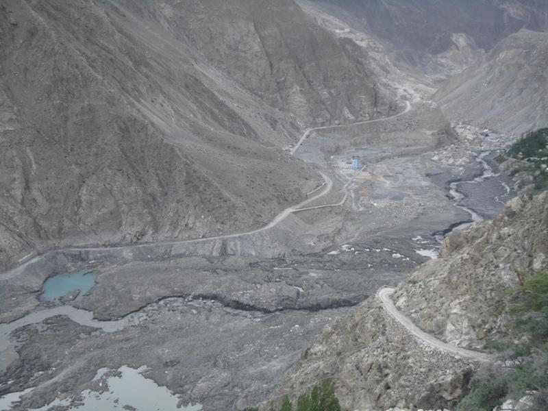
This gives the impression that there is a huge volume of water flowing. However, a look downstream towards the old landslide deposit at Salmanabad (that is the big pile of debris upper right) shows that this is not really the case:
It is clear that the flow is still rather modest, despite the huge amount of erosion that the water has achieved.


 Dave Petley is the Vice-Chancellor of the University of Hull in the United Kingdom. His blog provides commentary and analysis of landslide events occurring worldwide, including the landslides themselves, latest research, and conferences and meetings.
Thanks for excellent analysis.According to latest report from The News inflow is 3800 cusecs whereas outflow is 4160 cusecs. Also the width of spillway has increased from 18 meters to 32 meters. Lets see how long it would take to break the dam.
Someone has posted on Youtube a news report from Pakistan that went to air at 10:15am on 4 June.The other headlines in this bulletin make for interesting reading… I discovered that Obama has postponed his trip to Australia (again). Also landsliding in Skardu has killed 8 and destroyed 10 houses.
thanks David its really nice analysis and the pics are too clear. if we look at the 3rd pic very closely near the entrance of the spillway it looks a huge erosion is gonna take place possibly tonight but it depends now on the rocks there how much could it create resistance. we all pray for a smooth end of this lake.
Those boulders continue to be of particular interest. I can only hope there are enough to provide sufficient ballast. It's clearly a guessing game without a complete assay of the soil, but as long as there are sufficient boulders, and as long as the rate of flow remains below the entrainment velocity, this situation might not be as bad as many have predicted.
I think that 'spring' is the failed oxbow channel that had been the path for the spillway since May 30th. Before that it was, I believe, the largest of seepage points.It does looks to me that much the bulldozer dumps have been largely removed and all of their tread marks are gone as have their lowest access road.
The channel base is starting to look pretty bouldery. That seems like a good thing. It seems like the composition of this slide deposit is quite a bit coarser than the one in China that has been used for comparison a couple times here.