14 September 2015
Breaking down India’s monsoon
Posted by Nanci Bompey
By Katy Human

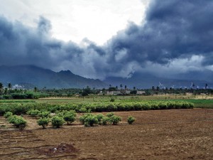
Advancing monsoon clouds and showers in Aralvaimozhy, near Nagercoil, India. A new study finds that focusing on El Niño and La Niña’s impacts on the monsoon in regions and sub-seasons—instead of all-India for the whole monsoon season—may improve rainfall forecasts.
Credit: PlaneMad/CreativeCommons
Across key breadbasket regions of India this monsoon season, not enough rain is falling. “Right now, the monsoon is 12 percent below average and dropping, and they are headed for a pretty serious dry season,” said Balaji Rajagopalan, a professor of civil, environmental and architectural engineering at the University of Colorado Boulder and a Fellow of CIRES, the Cooperative Institute for Research in Environmental Sciences.
“The rainfall deficits are even greater in some areas where food grains are grown, and that means hardships for many people,” Rajagopalan said.
Inspired by the need to better understand and forecast India’s monsoon rains, he and colleague Peter Molnar, a professor in Geological Sciences and Fellow of CIRES, and their postdoctoral researcher Emily Gill, have spent several years dissecting the relationship between El Niño and La Niña and monsoonal rainfall in that country. The conventional wisdom has been that El Niños, characterized by relatively high sea surface temperatures in the central and eastern equatorial Pacific Ocean, bring dry times; La Niñas, with cooler equatorial Pacific waters, bring strong monsoon rains.
But it’s not so simple, of course.
For example, the location of El Niño-related warming in the Pacific Ocean makes a serious difference, Rajagopalan and his colleagues found a few years ago. During one of the biggest global El Niño’s on record, 1997-1998, India’s monsoon season was nearly normal. That year, the El Niño signature warming over the Pacific was strongest in the eastern Pacific. “We found that if El-Nino-related warming is in the central Pacific, there’s a much bigger drying impact on India,” Rajagopalan said.
Now, led by Gill, who has just finished her Ph.D in Civil, Environmental and Architectural Engineering at CU-Boulder, Rajagopalan and Molnar have further found that the impact of El Niño varies by region of India and by sub-season. Specifically:
- Rainfall over the Indo-Gangetic plains and central India is more sensitive to Pacific sea surface temperatures during the early season (June).
- In parts of northern India, rainfall is sensitive to sea surface temperatures throughout the monsoon season.
- El Niño and La Niña do not have symmetric effects. Especially, El Niños tend to suppress rainfall more in the peak of the monsoon season (July-August) over much of India than La Niñas enhances it, which has been the case this year.
- But La Niñas seem to enhance rainfall more during the late season (September) than El Niños suppresses it.
The research, Gill said, has been possible because in recent years, Indian meteorologists have developed and made available detailed precipitation data combining station and satellite observations gridded at a relatively fine resolution of 1 degree by 1 degree and provided daily. “That is letting us look at these relationships spatially and sub-seasonally,” she said.
“All-India rainfall may be an easy number to latch onto, but maybe it’s time to move away from that metric, and use what we have learned about the spatial and sub-seasonal effects of El Niños and La Niñas to devise skillful spatial forecasting models,” Rajagopalan said. India is roughly one-third the size of the continental United States, so looking at the country as a whole can smear out important details. “It would be like looking at Florida and trying to make sense of what’s happening in Illinois.”
The new research is detailed in a study published online in Journal of Geophysical Research: Atmospheres, a publication of the American Geophysical Union.
Guest blogger Katy Human is Communications Director of the Cooperative Institute for Research in Environmental Sciences (CIRES) at the University of Colorado Boulder. CIRES is a partnership of NOAA and CU-Boulder.


 GeoSpace is a blog on Earth and space science, managed by AGU’s Public Information staff. The blog features posts by AGU writers and guest contributors on all sorts of relevant science topics, but with a focus on new research and geo and space sciences-related stories that are currently in the news.