
May 25, 2023
Sawyer Glacier, Tracy Arm Alaska Retreats from Tidewater
Posted by Mauri Pelto

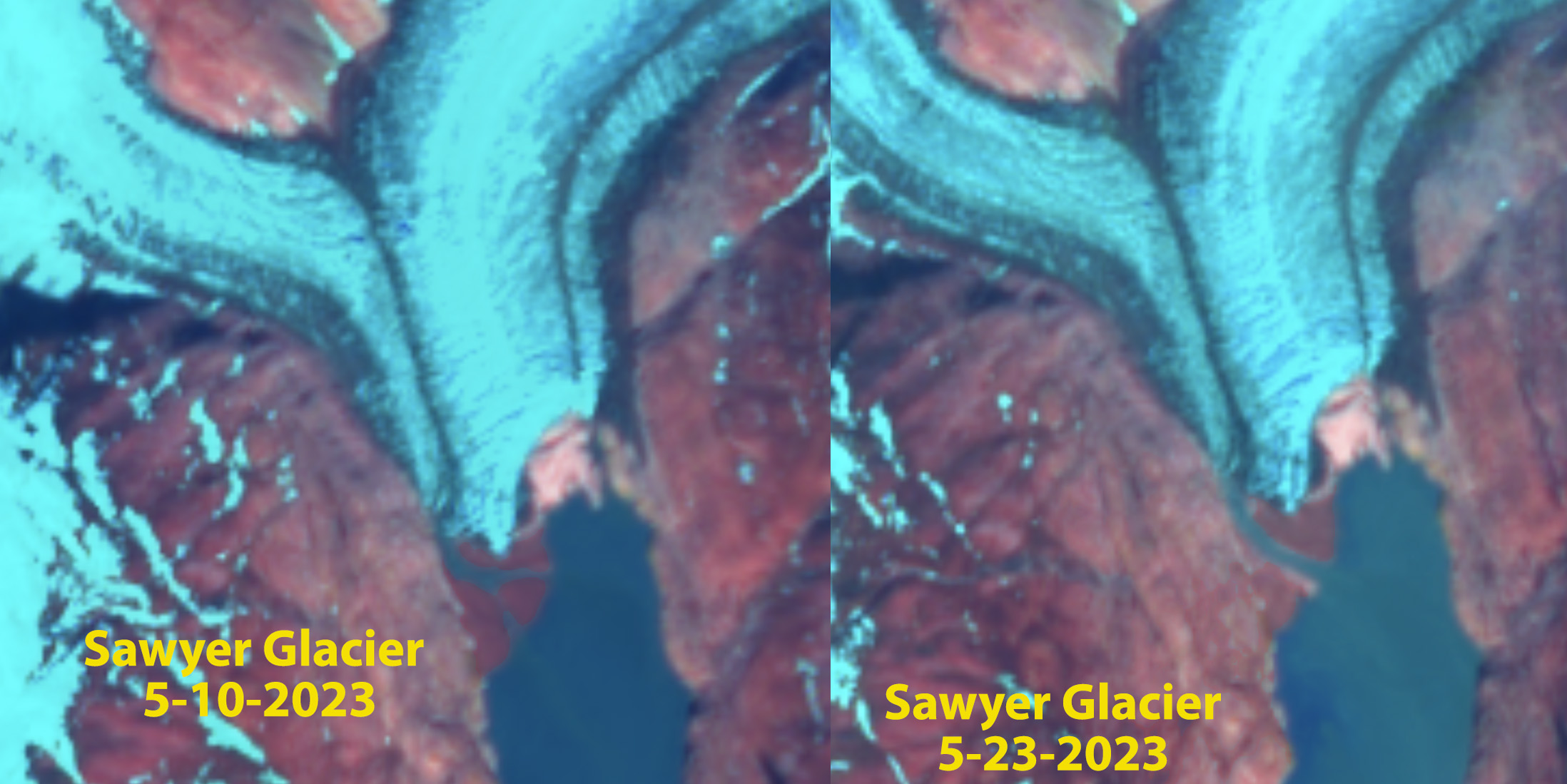
Sawyer Glacier Alaska in False Color Sentinel images from Sept. 12, 2022 and May 23, 2023. Note the the calving face in 2022 between the yellows arrows has become bare ground by May 23, 2023. TA=Tracy Arm
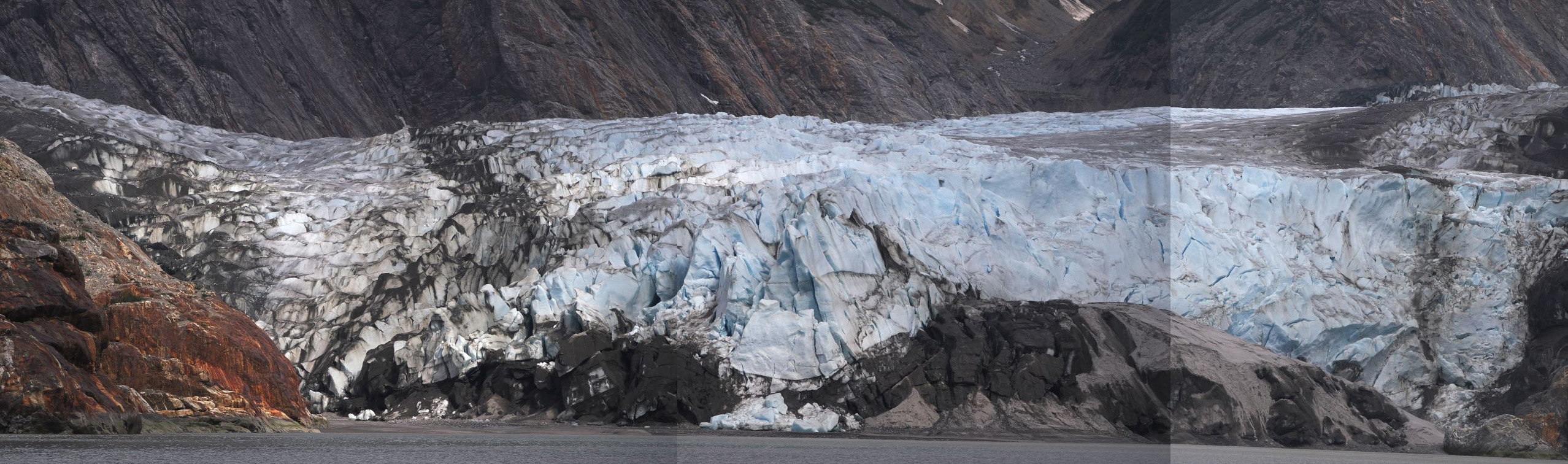
Sawyer Glacier in May 19, 2023, taken by Steve Backus (Lindblad Expeditions Naturalist), not touching tidewater.
Sawyer Glacier, is an Alaskan glacier where the retreat has long been viewed by many visitors. It is one of the two primary glaciers that calves into Tracy Arm fjord, that is often visited by cruise ships. The 3.3 km retreat from 1961-2022 has made approach to the actual terminus difficult for larger cruise ships (Lindblad Expeditions, Allen Marine Tours or Holland Amreica) . The terminus of the glacier was almost to the main arm of the fjord in 1961, USGS map below. Landsat images from 1990 to 2013 indicate retreat from the 1990 terminus, red arrow, to the 2013 terminus, yellow arrow is 2800 km, 120m/year. From 2013-2022 the retreat has been slower with ~500 m retreat, 50 m/year.
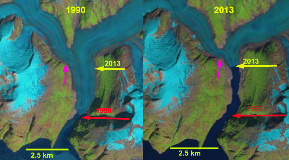
Sawyer Glacier retreat from 1990 to 2013 in Landsat images. Yellow arrow=2013 terminus; Red arrow=1990 terminus; purple arrow

Sawyer Glacier retreat from 1990 to May 10, 2023 in Landsat images. Green Arrow=2023 terminus Yellow arrow=2013 terminus; Red arrow=1990 terminus; purple arrow
From 1874 when John Muir first enthused about the calving glaciers of this fjord through 2022 their has been a calving front in the fjord. This was true as the cruise ship season ended in 2022. False color Sentinel images in Sept. and Oct. 2022 indicate a calving front that is 250 m wide. False color Sentinel images on May 10 and 23, 2023 indicate the front of the glacier entirely resting above fjords waters. High tide may touch the glacier at ts southernmost point. When I first visited the in 1982 I could not imagine it retreating from the fjord in my lifetime. Melkonian et al (2016) observed a rapid thinning of the Stikine Icefield of -0.57 m/year from 2000-2014. This loss has been driving by rising snowlines. Pelto (1987) reported a snowline of 1125 m the 1980’s, that now averages over 1300 m. The retreat here is similar to that of nearby Dawes and South Sawyer Glacier. This loss of iceberg production will impact harbor seals as they prefer icebergs to haul out on. (Alaska Department of Fish and Game ).
May 10 and 23, 2023 Sentinel images indicating bare ground across entire terminus front.
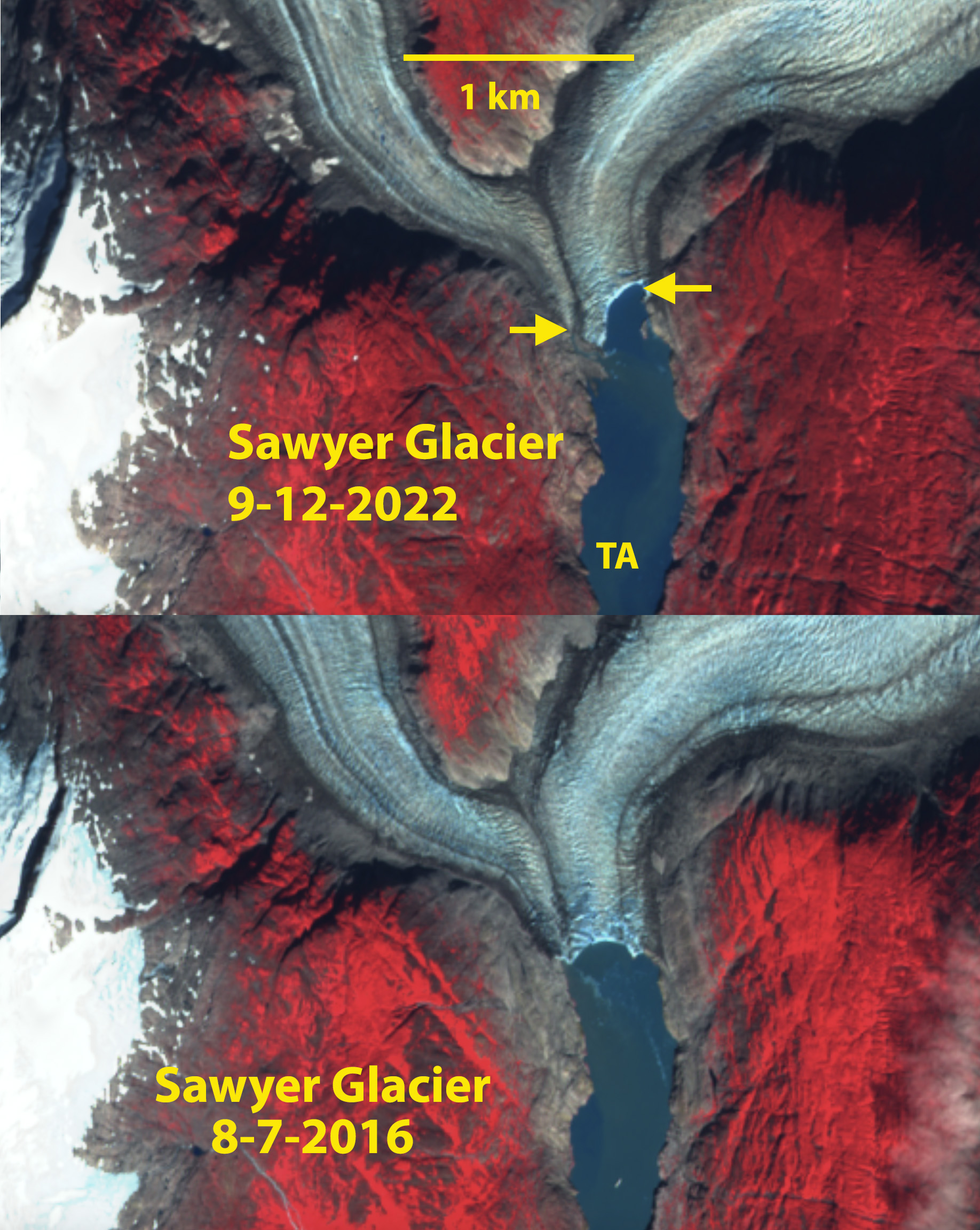
Sawyer Glacier Alaska in False Color Sentinel images from Sept 12, 2022 and Aug. 7, 2016. Note the the calving face in 2016 and 2022 between the yellows arrows.
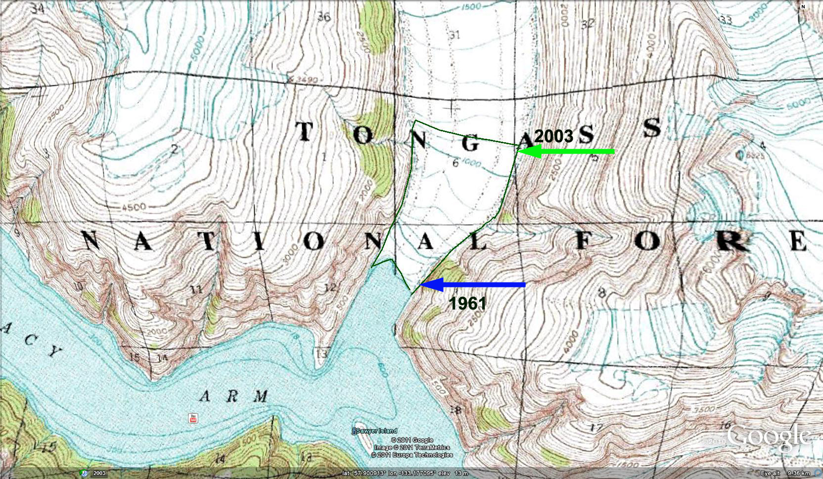
USGS 1961 topographic map showing location of terminus in 1961 and 2003.
 Dean of Academic Affairs at Nichols College and Professor of Environmental Science at Nichols College in Massachusetts since 1989. Glaciologist directing the North Cascade Glacier Climate Project since 1984. This project monitors the mass balance and behavior of more glaciers than any other in North America.
[…] End […]
Thank you for sharing these recent images of the receding Sawyer Glacier. I wrote an article in the Capital Weekly paper about the glacier grounding out in 2014 when I first saw the sands of the beach appear beneath the glacier’s calving face that spring. It was a shocking sight at the time, almost a hundred years after the publication of John Muir’s Travels in Alaska, which included descriptions from his first trip to the area in 1880. He described the glacier at that time as being set back about a half mile from the junction of the two fjords, so it apparently moved very little between then and 1961. The vertical collapse of the glaciers has been clear to see from flights over the coastal range for the past decade, as the bare grey rock and gravel exposed by the rapid melting is very visible even from several miles away. We’ve continued to ignore the warnings of atmospheric chemists and glaciologists, instead turning the fossil fuel heater up on the oceans and the ice, and it won’t be long before seeing glaciers calve and generate icebergs in Alaska is a very rare sight.