
April 4, 2019
Norðurjökull Retreats from Hvítárvatn, Langjökull, Iceland
Posted by Mauri Pelto
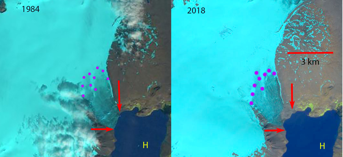
Norðurjökull in 1984 Landsat image and 2018 Sentinel image. Red arrows indicate the margins of the glacier in 1984. Purple dots indicate the snowline.
Langjökull is the second largest icecap in Iceland with an area of 920 square kilometers (Jóhannesson (2009). One of the main outlet glaciers of Langjökull is the Norðurjökull which has terminated in Hvítárvatn. Hvítárvatn is a large lake that recieves 70% of its inflow from Langjökull (Flowers et al, 2007). The lake has a maximum depth of 84 m and a surface area of 30 square kilometers.
The mass balance of Langjökull has been reported to the since 1997. The mass balance has been negative in 20 of the 21 years of reported data, with a loss of 18 m of water equivalent since 1997 (VAT). This is 8-10% of the volume of the ice cap (Guðmundsson et al, 2008). Pope et al (2010) observed that Langjökull has lost an area of 3.42.5 square kilometers/year over the decade.
Here we examine the changes in Norðurjökull from remote sensing imagery from 1984, 1994, 2006, 2014 and 2018. In 1984 the glacier terminated in Hvítárvatn along a width of 1100 m and the snowline is at 800 m. In 1994 the width of the terminus front in the lake has increased by 100 m indicating a small advance. By 2006 the width of the glacier front in Hvítárvatn has been reduced to 600 m and the snowline is at 1000 m. By 2014 this connection with the lake is just 300 m. In the two Sentinel images from 2018 the terminus no longer reaches the shore of Hvítárvatn. Iceberg calving will no longer be a consideration at this outlet glacier. The snowline on 8/11/2018 is at 800 m rising to ~950 m by 8/25/2018. The retreat of this glacier is like that of other Langjökull outlets Hagafellsjokull and nearby Porisjokull. The retreat has been less significant than the thinning, Pope et al (2016) illustrated this for the 1994-2007 period.
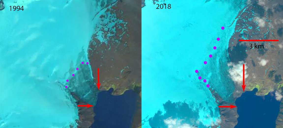
Norðurjökull in 1994 Landsat image and 2018 Sentinel image. Red arrows indicate the margins of the glacier in 1984. Purple dots indicate the snowline.
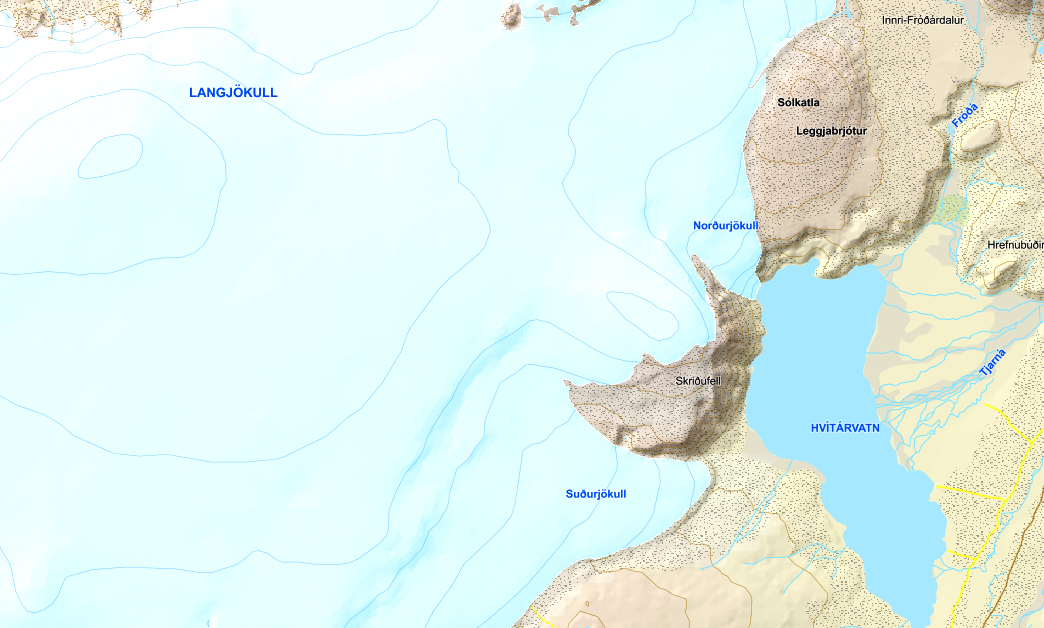
Langjökull map showing terminus.
Aug. 1, 2019 Landsat image indicating the snowline reached the crest of the icecap at Norðurjökull in 2019.
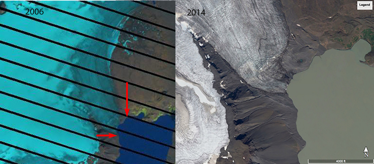
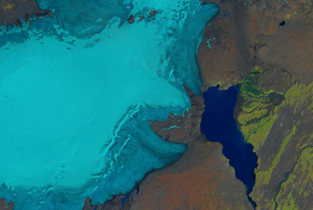
Norðurjökull in 2006 Landsat image and 2014 Digital Globe image. Glacier still in contact with the lake.
 Dean of Academic Affairs at Nichols College and Professor of Environmental Science at Nichols College in Massachusetts since 1989. Glaciologist directing the North Cascade Glacier Climate Project since 1984. This project monitors the mass balance and behavior of more glaciers than any other in North America.