
November 14, 2016
Hagafellsjokull, Iceland Reflects Langjokull Thinning & Retreat
Posted by Mauri Pelto
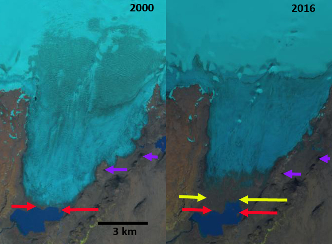
Landsat comparison of the terminus of Hagafellsjökull from 2000 and 2016. The red arrows are the 2000 terminus, the yellow arrows the 2016 terminus. Purple arrows indicate upglacier thinning.
Langjökull is the second largest iceap in Icalnd with an area of over 900 square kilometers. The mass balance of the icecap has been reported since 1997 and his lost over 1 m per year during this period (WGMS, 2016). Pope et al (2010) noted that the icecap has lost an area of 3.4 ± 2.5 km2 yr-1 over the decade from 1997-2007. Pope et al (2010) noted that the loss of ice volume confirms previously published predictions that Langjökull will likely disappear within the next 200 years if current trends continue. A key outlet of Langjökull is Hagafellsjökull which terminates in Hagvatn. Hagafellsjökull ended a sustained post Little Ice Age retreat in 1970. The ensuing advance of approximately 1 km ended by 2000. Here we examine Landsat imagery from 2000-2016 to identify recent changes in this outlet glacier.
In 2000 the glacier terminated on an island in Hagavatn, red arrow. The east margin of the glacier featured several locations where secondary termini overflowed a low ridge on the east side of the glacier. By 2006 the glacier had retreated 500-600 m from the island. By 2016 the terminus had retreated across its entire width by 800-850 m, 50 m/year, yellow arrows. A closeup view from the Iceland online map application illustrates the 2014 terminus red dots. The end of the glacier has a low slope, low velocity and is debris covered. The western side has terminated on land during this entire period and has approximately the same retreat rate as the eastern half that still ends in the expanding lake. There is little evidence of iceberg release into the lake, which helps explain the similar retreat rate. The low slope and upglacier thinning noted at the purple arrows indicate the retreat will continue. In 2014 the transient snowline reached near the head of the glacier at over 1100 m. In 2000, 2006 and 2016 the snowline with several weeks left in melt season ranged from 859-950 m. The retreat is similar to that of Norðurjökull another outlet of the Langjökull and Porisjokull.
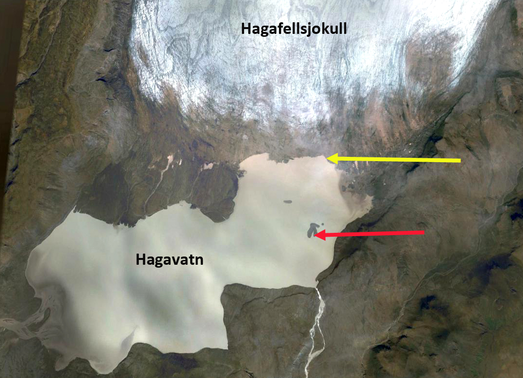
Google Earth view of the terminus of Hagafellsjökull in 2014. Red arrow is the 2000 terminus position and yellow arrow the 2014 position.
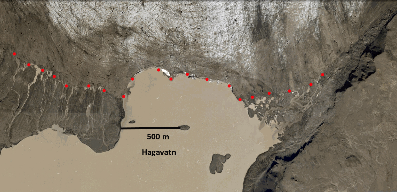
Online Iceland Map Viewer indicating the terminus of Hagafellsjökull in 2014, red dots.

2006 and 2014 Landsat images of Hagafellsjökull indicating the transient snowline off the image in 2014 and at 850 m in 2006.
 Dean of Academic Affairs at Nichols College and Professor of Environmental Science at Nichols College in Massachusetts since 1989. Glaciologist directing the North Cascade Glacier Climate Project since 1984. This project monitors the mass balance and behavior of more glaciers than any other in North America.