
July 25, 2018
Bas d’Arolla Glacier, Switzerland No Longer Reaches Valley
Posted by Mauri Pelto
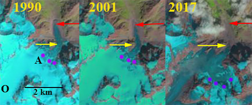
Bas d’Arolla Glacier in Landsat images from 1990, 2001 and 2017. Red arrow is 1985 terminus, yellow arrow 2017 terminus location, purple dots annual snowline. A=Bas d’Arolla O=Otemma
Bas D’Arolla Glacier is one of the glaciers where the terminus is monitored annually by the Swiss Glacier Monitoring Network (SCNAT). Here we examine changes in this glacier from 1985 to 2017 including changes in the terminus, snowline elevation and tributary connection during this period using Landsat Imagery. SCNAT reports that the glacier advanced 136 m from 1972-1987, retreated at a rate of 17.6 m/year from 1987-2001, and 23 m/year from 2001-2017. The main accumulation zone between Pigne d’Arolla and Mont Collon extends from 2900 m to 3400 m, with a saddle to Otemma Glacier at 3000 m. An icefall extends from 2400 m to 2900 m. In 1985 the glacier had a low elevation terminus tongue extending from the base of an icefall at 2400 m to just below 2200 m (see map below).
In 1985 the glacier terminates at the red arrow at an elevation of 2160 m and the snowline is at 2940 m. In 1990 the terminus had advanced slightly up to 1987 and then retreated slightly with not significant overall change and the snowline is again at 2940 m. By 2001 the glacier has retreated 220 m, and the snowline is at 2900 m. In 2015 the snowline is at 3100 m with the saddle to Otemma Glacier not in the accumulation zone. This saddle should always be snow-covered. In 2017 the snowline is at 3200 m, the saddle with Otemma Glacier is again exposed and is in fact glacier ice, indicating that snow and firn has been lost and this is no longer part of the persistent accumulation zone. The main terminus tongue in 1985 that occupied the valley floor and extended 500 m from 2400 m to the terminus is gone, with a total retreat of 600 m since 1985. The glacier retreat is similar to that of neighboring Otemma Glacier and more substantial than Gietro Glacier, and reflects an annual snowline that is too high to maintain the glacier terminus tongue. the Bas d’Arolla valley floor is now glacier free. The river discharges into the Rhone River Basin, which has substantial hydropower south of Lac Geneva. Schaefli et al (2018) observe that of the 50% of Swiss power that comes from hydro, glacier mass loss alone has provided 3-4% of the total, not a sustainable model. Bliss et al (2014) indicate that the Swiss Alps have passed peak glacier runoff.
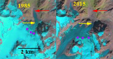
Bas d’Arolla Glacier in Landsat images from 1985 and 2017. Red arrow is 1985 terminus, yellow arrow 2017 terminus location, purple dots annual snowline. A=Bas d’Arolla O=Otemma
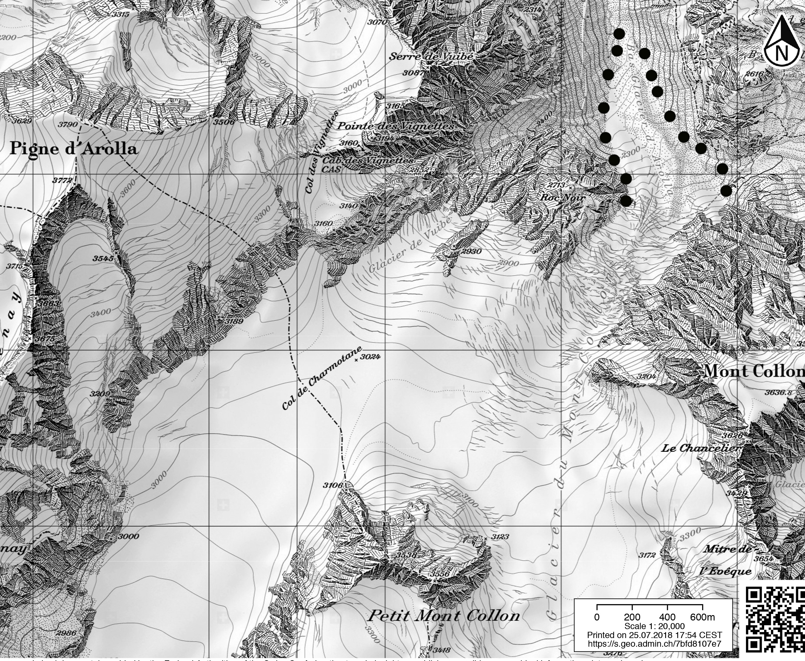
Map of the Bas d’Arolla Glacier and Mont Collon area, from Swisstopo
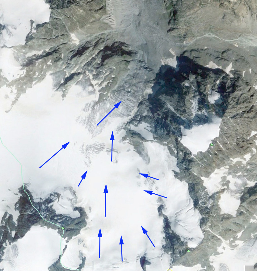
Google Earth image indicating flow, and the fact that the glacier now terminates in the icefall region, no longer reaching the valley floor.
 Dean of Academic Affairs at Nichols College and Professor of Environmental Science at Nichols College in Massachusetts since 1989. Glaciologist directing the North Cascade Glacier Climate Project since 1984. This project monitors the mass balance and behavior of more glaciers than any other in North America.