
July 18, 2018
Mount Tanggula Glaciers, China Thin and Separate
Posted by Mauri Pelto
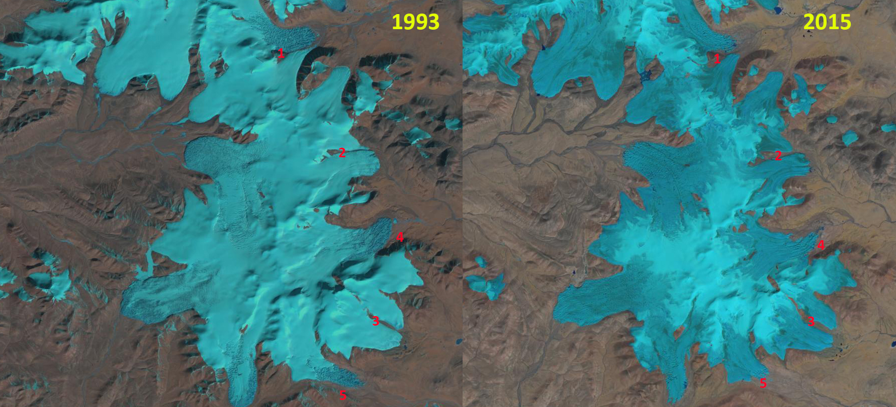
Changes in outlet glaciers of Tanggula Shan in Landsat images from 1993 and 2015.
The Tanggula Shan is in the Qinghai-Tibet Plateau at the headwaters of the Yangtze River and host approximately 1000 square kilometers of glaciers. Ke et al (2017) examined glaciers in the Dongkemadi Region of the Qinghai-Tibet Plateau revealed glacier thinning of 0.56 m/year from 2003-2008. The area loss of −0.31 km2/ year from 1976-2013, a 13% change int total area of the glaciers. Chao et al (2017) examined glaciers in the Geladandong region of the Qinghai-Tibet Plateau and found thinning rates of 0.16 m/year from 2003-2009. The thinning was a consequent of temperature increases. Inglis (2016) reported on the ongoing retreats impact on water resources for the Yangtze River.
Here we examine Landsat imagery from 1993-2017 to identify changes at five locations around the Tanggula Icefield. In 1993 outlet glaciers merge at Point 1 and 2. At Point 2 there is a narrow separation between two outlet glaciers. At Point 4 and 5 there is considerable terminus recession of the stagnant hummocky ice (developed in a sublimating environment). Below is a Google Earth image of the glacier at Point #1 illustrating the hummocky nature, Inglis (2016) also provide imagery of this hummocky ice. In 2015 the snowline is high at 5900 m, in this early November image. The terminus of most glaciers is at 5400 m and the head of the glaciers at 6100 m. In November of 2017 the snowline is at 5600 m. The retreat has been significant, but not rapid in this area. This is similar to the retreat of the Suhai Hu Ice Cap in the Qilian Mountains.

Changes in outlet glaciers of Tanggula Shan in Landsat images from 1995 and 2017. 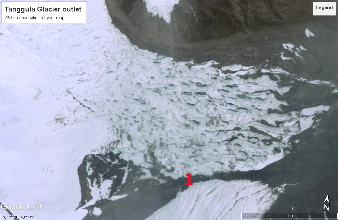
Google Earth image of Tanggula Glacier outlet, Point #1.
 Dean of Academic Affairs at Nichols College and Professor of Environmental Science at Nichols College in Massachusetts since 1989. Glaciologist directing the North Cascade Glacier Climate Project since 1984. This project monitors the mass balance and behavior of more glaciers than any other in North America.