3 July 2016
The Science Behind That Awesome Photo You Saw on Twitter or Facebook
Posted by Dan Satterfield
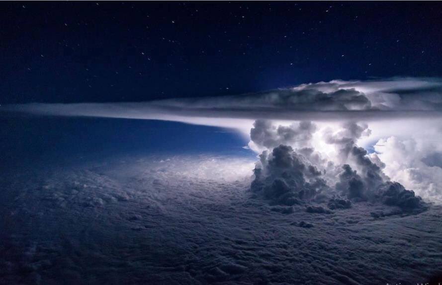
This image was posted to Twitter by Super Célula, and has gone viral for good reason: It’s beautiful.
Meteorologist see a whole lot more in this image however, and it even shows the promise of better warnings of severe weather. This is especially true for rural areas/ poor nations that have only a rudimentary severe weather warning system in place. The image was apparently taken from an airliner over the Pacific. You’re looking at a very intense thunderstorm, with an updraft of air that towers into the stratosphere (over 15 km above the ocean). Look at the image below, where I’ve added some information to the image.
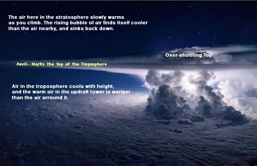
Because the air warms with height, the stratosphere is a very unfriendly place for clouds. For an overshooting top to develop, it must be a very intense updraft, and the storm is likely strong or severe.
Weather satellites can detect overshooting tops using visible imagery, and thermal IR images, but many times these signatures appear suddenly, and here in the U.S. we usually get an image from the GOES just 4 times per hour. This is helpful, but what we need is something on the order of 1-5 minutes, like the radar network is now.
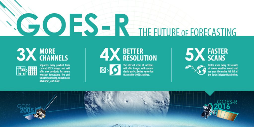
That will indeed happen this fall when GOES-R launches: It will send back images every 5 mins. and if storms are developing in a certain region, we will get images every 30 seconds.
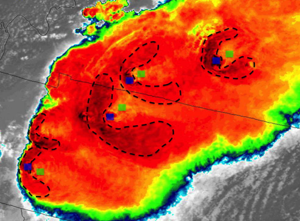
This image is from the GOES R proving ground and shows the testing of algorithms to spot overshooting tops. (Blue dots). An enhanced “V” signature is also present. Note: The link here will take you to an exc. resource for learning more about satellite meteorology.
A lot of science has been done to write algorithms that can automatically detect these overshooting tops, and in countries where few people have reliable electricity, warnings can be given over mobile phones, which almost everyone has in these places! To detect these overshooting tops on satellites requires better resolution than our present GOES satellites can provide, but GOES-R will have much higher resolution… up to 4 times better spatial resolution. Japan, and Europe, already have satellites in orbit that are very similar to what GOES-R will do, so we are on the cusp of an era where people over a huge swath of the planet, can be warned of a dangerous storm, even if they are in a poor country with no weather radar network!
 There is still a lot of research underway, and there are actually several different methods to spot these overshooting tops, and improvements are constantly underway. On IR images they show up as pixels of extremely cold cloud tops (They are often at temps below -75C), and they can be seen on visible images as well. We know the new satellite data at such an improved temporal and spatial resolution will change severe weather forecasting, but we also know that we are going to see things we had no idea of and perhaps use them to produce even more accurate warnings of severe storms and flooding.
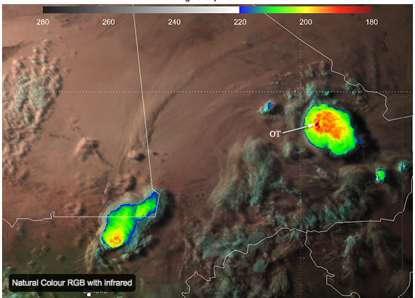
The cloud temp. of this overshooting top was measured at -94C by the European MSG2 satellite. Click the image to learn more from EUMETSAT.
Combining all this with the ability to measure the lightning in these storms (all of of it, not just the cloud to ground strikes) will revolutionize our knowledge of severe storms, and make dramatic improvements in severe storm nowcasting world-wide. I had two severe weather events here on the Delmarva Peninsula this week and one produced over 8.58 inches of rain on the Eastern Shore of Virginia (in just a few hours) and it caused caused major flooding. Earlier in the week, we had nearly 7 inches of rain just west of Salisbury Maryland, about 60 miles away! These storms developed quickly, caused major disruption, and are hard to warn for, until the flooding is underway. Combining real time radar/lightning/satellite data is the future of real time severe weather warnings.
The future is coming though, and I’m glad I’ll be here to see it!
*Some links to more info about GOES-R/overshooting tops, and the new lightning detection that GOES-R will have:
Click on the images you are interested in-
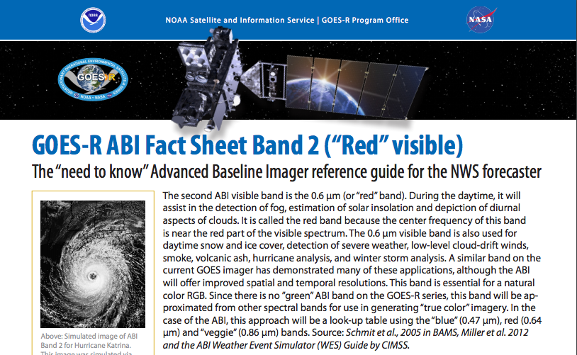
Why do satellites need imagers that can see in so many different wavelengths? This material from NASA GOES-R will explain why. The new GOES-R will be able to see many more wavelengths than the present GOES.
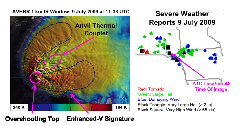
This is a nice discussion on the topic, but mainly for weather geeks. If you’re fascinated by this subject, it’s a must read.


 Dan Satterfield has worked as an on air meteorologist for 32 years in Oklahoma, Florida and Alabama. Forecasting weather is Dan's job, but all of Earth Science is his passion. This journal is where Dan writes about things he has too little time for on air. Dan blogs about peer-reviewed Earth science for Junior High level audiences and up.