
21 December 2010
GoSF3: Chert
Posted by Callan Bentley
“GoSF” = Geology of San Francisco
I’m taking this week to write up my three field trips examining the geology of San Francisco and neighboring areas. My plan is to cover:
Deep sea chert (today)
Kirby Cove, Marin Headlands
(wildlife interlude)
Graywacke turbidites
Serpentinite and mélange
Fractures and the chemistry along them
Pleistocene dunes
The San Andreas Fault and Mussel Rock
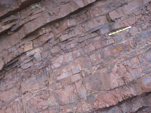
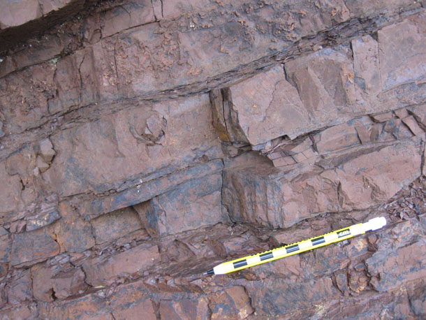
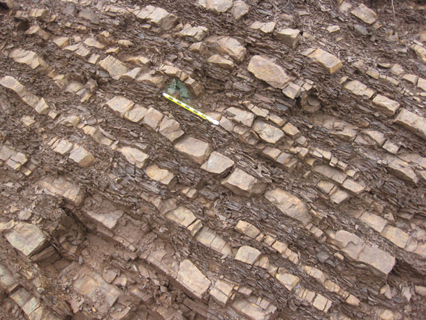
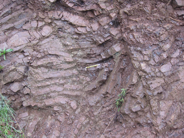
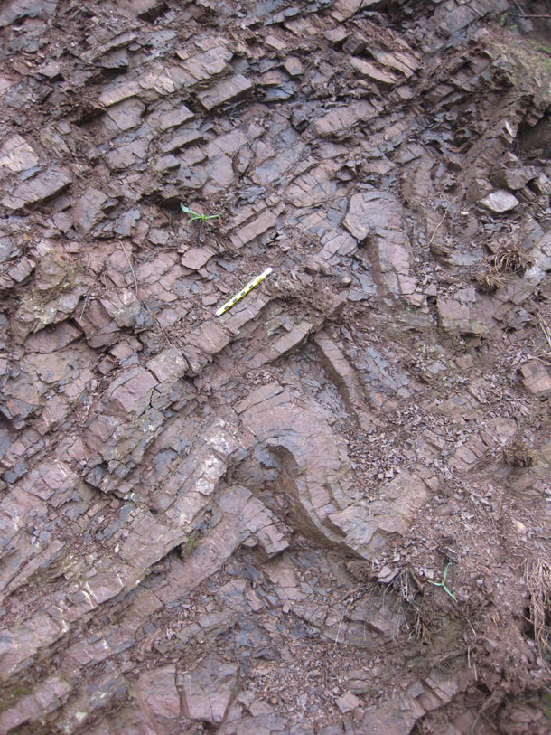
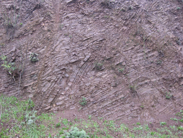
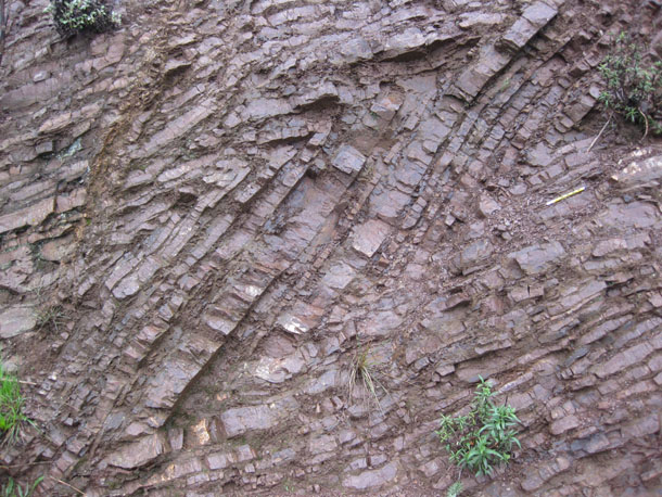
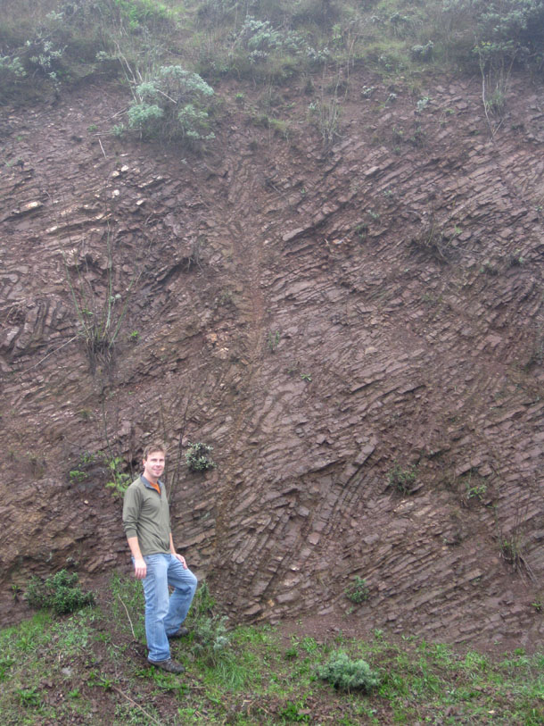
Here’s a few looks at outcrops of this chert. In most of these photos, my cm-denominated EmRiver mechanical pencil serves as scale:

Here’s an example of where it’s more dominated by chert, with only a minimal amount of shale interbeds:
Closer in to this same outcrop:
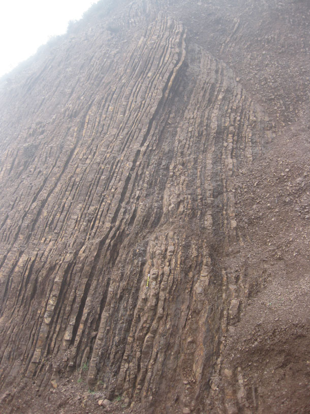
In contrast, here’s an outcrop with a lot more of the shale in between the chert layers:
Chert is a microcrystalline sedimentary rock, in this case made of gazillions of little dead radiolaria (silica-shelled plankton). The shale is made of silt and clay blown out to sea from a source on land, and gradually settling down through kilometers of water to drape the seafloor.
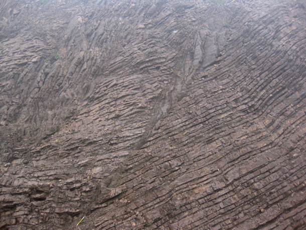
You’ll notice that these beds are dipping at a gentle angle, and also weathered out in blocky patterns which are ideal for exploring the difference between apparent dip and true dip:
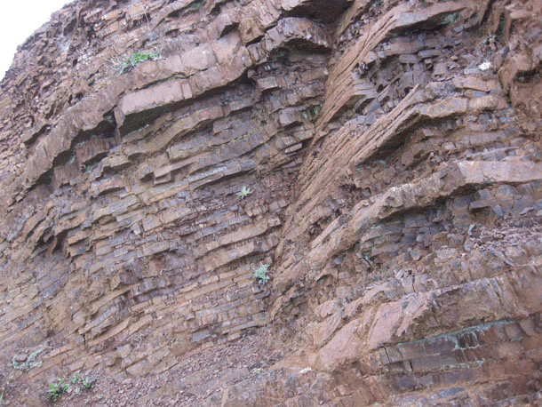
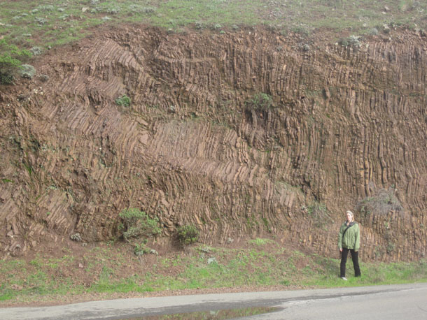
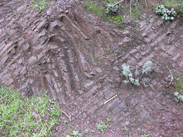
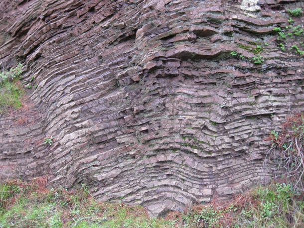
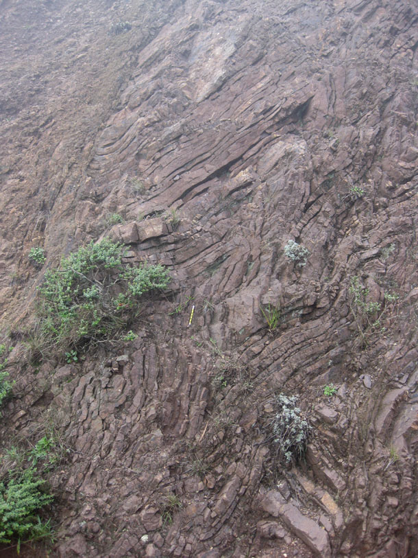
But much of the chert in Marin Headlands terrane is not horizontal or gently dipping but boldly upright, in a position never imagined by the dead radiolarians raining down on the seafloor:
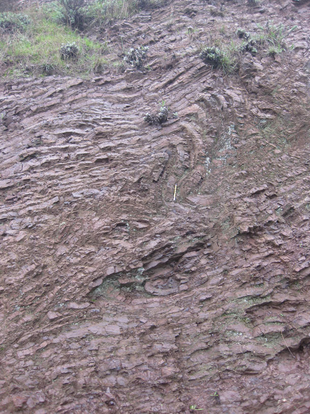
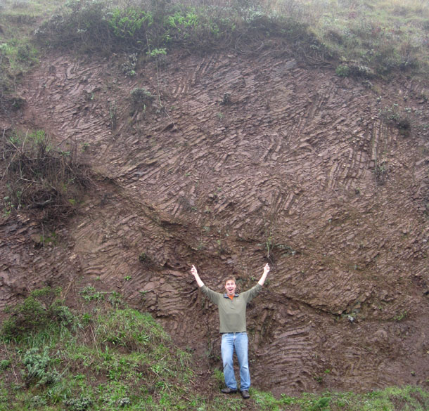
Here’s Lily against a similar looking outcrop of vertical chert beds… but notice that there are a few pointy folds in there too:
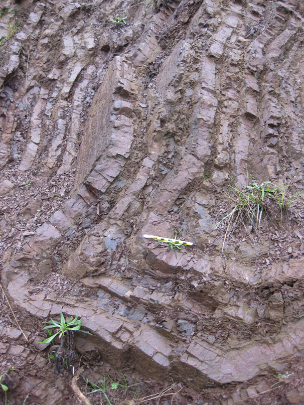
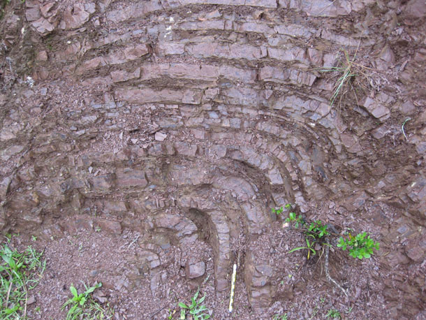
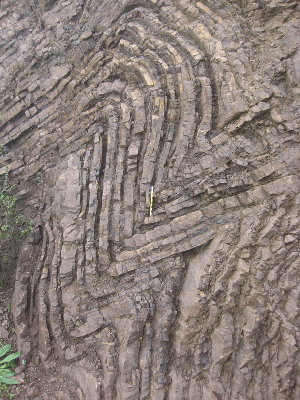
And that brings us to what I really wanted to see at Marin Headlands (on Kim Hannula’s recommendation): chevron folds in chert!
Closer in:
Closer in:
A neighboring exposure, with Wahrhaftig’s (1984) Streetcar to Subduction for scale::
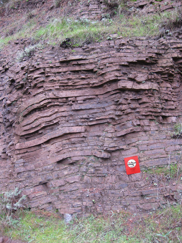
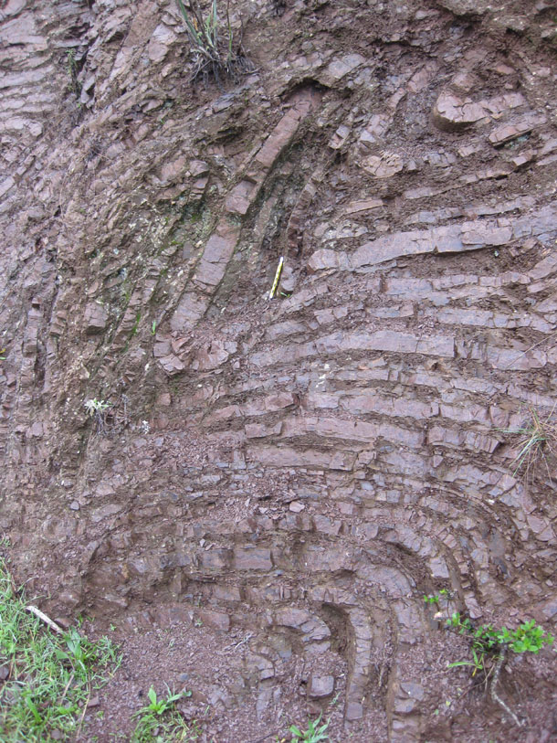
You’ll no doubt have noticed that this chevrons are frequently asymmetric (limbs of different lengths) and/or overturned to the right (which is east in these photos, as most of them are taken looking towards the north at south-facing outcrop surfaces).
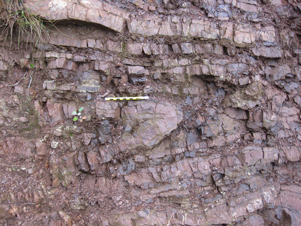
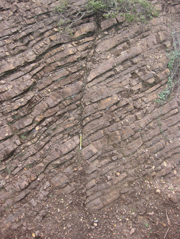
This next photo is one of my favorite shots, as it shows the difference in rheology between the relatively competent chert and the relatively incompetent (squishy) shale, as the shale tends to pile up in the hinge area of the fold, while the chert exhibits a more “concentric” geometry. The photo also shows well the resistance of the chert to weathering, while the shale is more easily etched away:
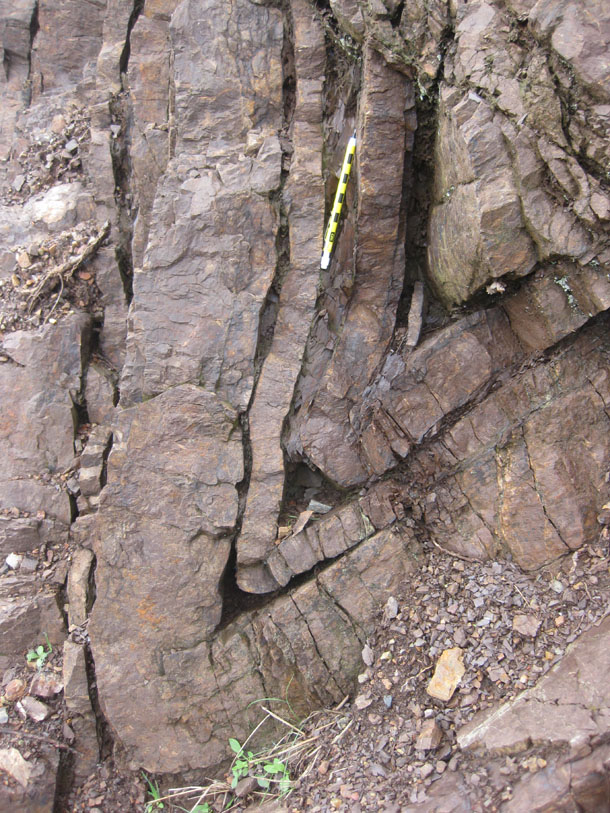
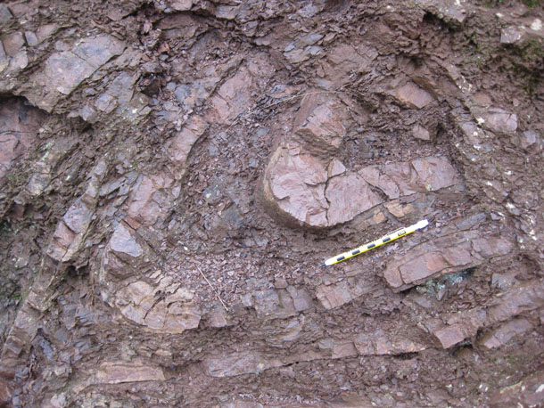
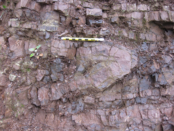
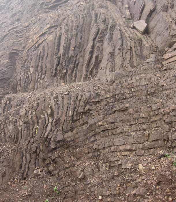
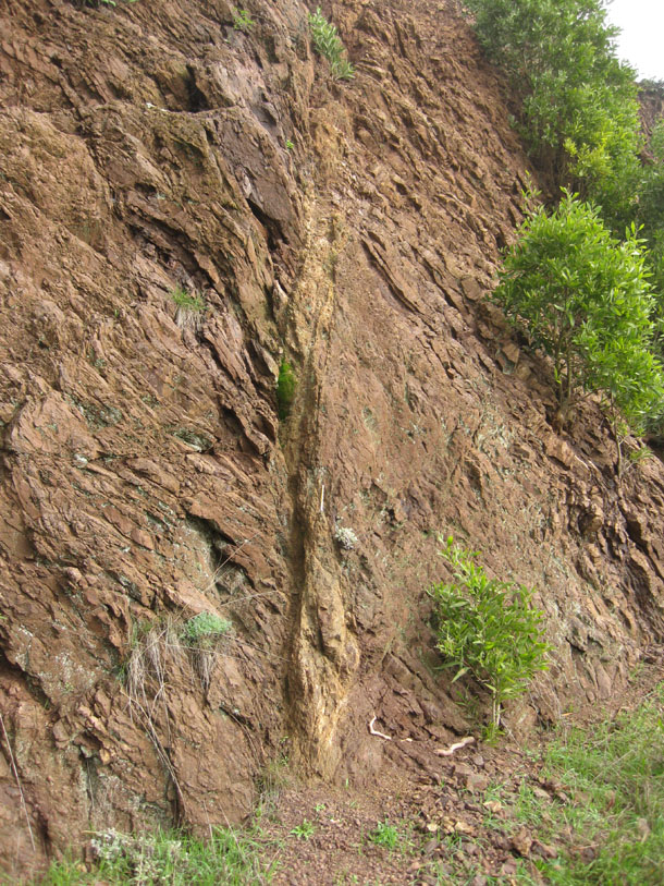
Indurated fault zone (pencil for scale at center lower middle):
And check this out!…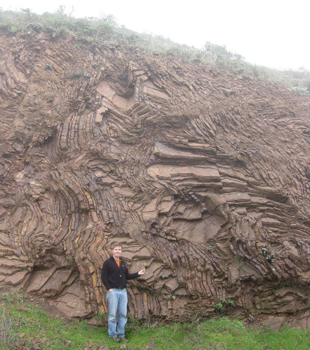
Ka-pow! (Notice that I am holding the cm-marked pencil for scale!)
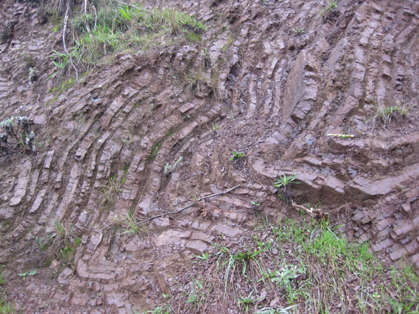
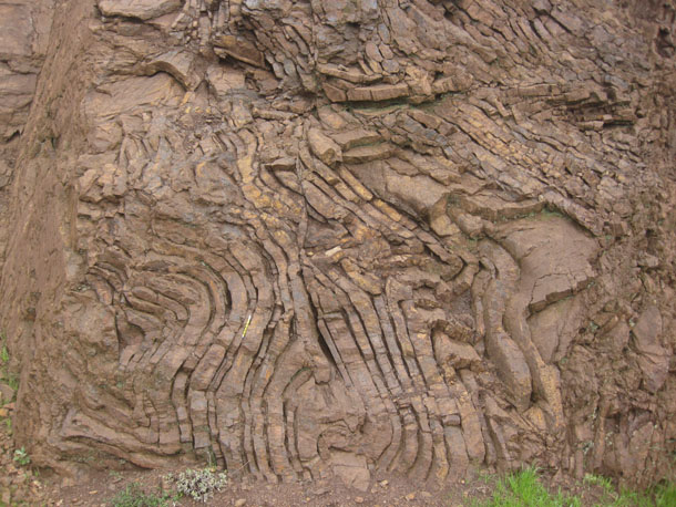
Close by to the above outcrop, here’s one of the most intensely-folded sections that I observed:
That’s 33 images of chert and shale, folded and not, and probably enough for one day…
 Callan Bentley is Associate Professor of Geology at Piedmont Virginia Community College in Charlottesville, Virginia. He is a Fellow of the Geological Society of America. For his work on this blog, the National Association of Geoscience Teachers recognized him with the James Shea Award. He has also won the Outstanding Faculty Award from the State Council on Higher Education in Virginia, and the Biggs Award for Excellence in Geoscience Teaching from the Geoscience Education Division of the Geological Society of America. In previous years, Callan served as a contributing editor at EARTH magazine, President of the Geological Society of Washington and President the Geo2YC division of NAGT.
[…] Deep sea chert […]
Thanks for the great images, Callan! These images are a great reminder of what got me interested in structural geology in the first place.
[…] This post was mentioned on Twitter by Am Geophysical Union and Chris Rowan, Callan Bentley. Callan Bentley said: Part 3 of my geology of San Francisco series: CHERT http://bit.ly/i9Tqs0 […]
Wow, those are spectacular pictures. I’m sure I would’ve had a full on geogasm if I saw those folds in person.
Fantastic shots; those last two are definitely “geogasm” material. There’s a spot on the Rogue River a short drive off I-5 where there are somewhat similar folds in turbidites. It’s kind of odd because it’s so restricted- someone has suggested it might be an olistostrome, not the direct result of tectonic deformation.
PS, I’ve been having problems getting this page to open- have tried several times this afternoon. Not sure whether the problem is at AGU’s end or my end, though I haven’t been having problems with other pages.
The outcrops along Conzelman Road are very fresh these days as a road widening project has renewed them. I need to get out there soon myself.
Great shots! I have to admit I love my local geology, but I haven’t been to the spot in the last two photos. Where is that?
It’s along that main road which goes west from the Golden Gate bridge’s northern parking area towards Point Bonita. Across from a big tree, as I recall.
Beautiful…
Your “this..” photo has the look of terrace padi fields in Bali or South China.
[…] Recall there are more chert folds from the other side of the Golden Gate Bridge featured here. […]
Thin-skinned tectonics at it’s best. Anyone care to postulate the rate at which this folding took place? This is the creamy Oreo filling close-up.
[…] They look a lot like the chevron-folded cherts near San Francisco. Same age, […]
[…] They look a lot like the chevron-folded cherts near San Francisco. Same age, […]
Thanks to google street i was able to locate the above mention site from here in India. Thumbs up to technology !!