
22 August 2014
10% of Iceland Closed as Concern Over Volcano Grows
Posted by Dan Satterfield
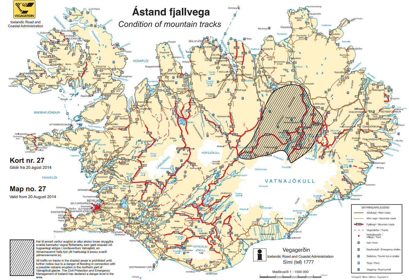
The evacuation zone in Iceland is in the shaded area.
Concern is increasing tonight that the Bararbunga (BOWR-Thar Boon-Ka) volcano may be getting ready to erupt. Earthquakes continue, and these type of quakes indicate that magma (Lava with high pressure gases) is moving beneath the volcano, which is much larger than the one that caused serious air travel disruptions a few years ago. Late today, Icelandic officials declared about 10% of Iceland off-limits, and is evacuating residents, hikers and campers from the no-go zone.
There is an excellent piece on The Daily Kos about the situation (also here), and it’s well worth a read. I’m not an expert on Volcanology, but unless an expert tells me otherwise, this piece seems accurate (and is well done science journalism). I do know that if we start seeing quake above magnitude 4 that could be bad news, and that this volcano in the past has produced eruptions large enough to affect the entire planet’s weather in a BIG way.
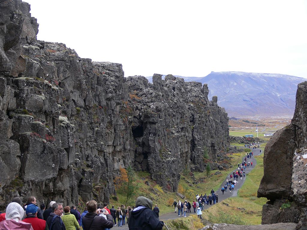
You can walk along the the Mid-Atlantic ridge in Iceland. The edge of the North American Plate is on the left. From P Marshall (Wikipedia)
There is just no way of knowing right now if this volcano will erupt, or if it does, how big an eruption it could be, but there is plenty to be worried about. Iceland itself is splitting apart, because it’s on the mid-Atlantic ridge. The ridge is basically a crack in the Earth that goes right down the middle of the Atlantic. New sea floor is being created here and that is spreading Europe and North america apart by about two inches per year. If you flew to London in 1994 from New York, then your trip was shorter by about 1 meter than it would be now. (somehow I do not hin this explains the rise in trans-atlantic airfares!).
You can monitor the size and position of the quakes under Bararbunga here. (Remember, quakes that are more frequent and larger could mean an imminent eruption). The Link to the Daily Cos story has a map showing how the magma is moving beneath the surface as well.
 Dan Satterfield has worked as an on air meteorologist for 32 years in Oklahoma, Florida and Alabama. Forecasting weather is Dan's job, but all of Earth Science is his passion. This journal is where Dan writes about things he has too little time for on air. Dan blogs about peer-reviewed Earth science for Junior High level audiences and up.
And here we’ve been speculating about a big Kelvin wave in the Pacific Ocean and what it might mean for an El Niño later this year, which does affect the climate for a year or two. But this sounds like we could be headed for a very cold northern winter followed by another 1816 Year Without a Summer. The Deniers will have a field day.
A moderate or strong Modoki El Nino could very well lead to a cold winter in the Eastern U.S. but globally it would likely be just the opposite.
A little clarification: the 2.5 cm/yr half-spreading rate estimate is an average of the whole Mid-Atlantic Ridge over geologic time. In the context of individual segments along the ridge that value tends to change. For instance seafloor half-spreading rates around Iceland are a bit slower than average, around 17-18 mm/yr (see figure 19 of DeMets, et al. 2010). It’s also worth noting that seafloor spreading rate calculations usually aren’t made on decadal time-scales because the rate isn’t constant– especially for a slow spreading center like the Mid-Atlantic Ridge. Spreading along ridges happens in volcanic fits and starts. Thus the need for averaging over long periods. Nitpicks aside, very interesting post!
Thnx! Good info!