
2 January 2014
Cold and Snow, and High Winds As Well For Northeast USA. Storms Threaten UK Again as Well.
Posted by Dan Satterfield
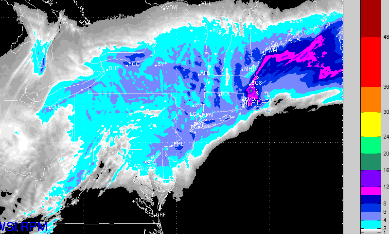
Vortex Model run at WSI Corp. shows snow from Maryland to Maine. This model tends to have a good track record with snow accumulations. It looks basically correct from my perspective (otherwise I wouldn’t have posted it here).
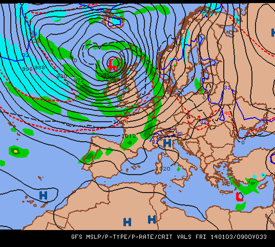
Euro model forecast for the UK Friday. The low pressure will be intense and 60-70 mph winds are possible, and perhaps higher on Sunday.
A strong winter storm will hit the NE later tonight and this one will have bitter cold and high winds. Note the predicted wind gusts at sunrise Friday from the European Model, and because of this Gale Warnings are in effect for waters from the Chesapeake Bay to Maine and into Atlantic Canada.
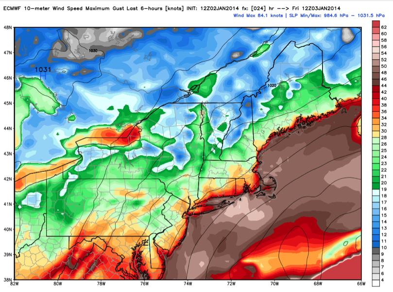
Max wind gusts from the ECMWF Model. The high winds and bitter cold will bring wind chills down to below zero for much of the region. (Image ctsy. WX Bell)
Rawinsonde balloons this morning show a jet stream approaching 180 knots heading into the Atlantic, and this will set the stage for another series of storms to hit the UK as well. The UK Met Office is already warning of more flooding and high winds. The model guidance shows two storms, one Friday and another Sunday.
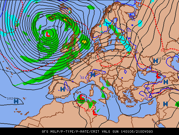
Sunday night’s storm may be a doozy across the British Isles
Caveat Emptor
On air and NWS meteorologists have been dealing with a new social media phenomenon: Amateur weather forecasters who have learned to read some numerical guidance and post end of the world forecasts online! We then get inundated with messages asking why we aren’t forecasting a foot of snow for (insert your town here). A word to the wise, that model guidance is just that: GUIDANCE. Beware of anyone who tells you snow amounts more than 36 hours ahead of a storm. They will almost certainly be wrong, or just lucky. Find someone you trust with a good track record (and a real science background) for weather information. I can tell you that on air mets with an AMS seal will work closely with their NWS counterparts to give you the best possible forecast.
There is responsibility on the consumer’s part as well. One to three inches means that an inch only is possible, many folks only remember the high number, and you’d likely be shocked at how often your local meteorologist gets blamed for someone else’s bad forecast! Forecasting accumulations can be very difficult, probably the most difficult of all forecasts actually, because there isn’t much difference between 1mm and 10 mm of rainfall. However, if it comes as snow, then the difference is a dusting to 5 inches!
 Dan Satterfield has worked as an on air meteorologist for 32 years in Oklahoma, Florida and Alabama. Forecasting weather is Dan's job, but all of Earth Science is his passion. This journal is where Dan writes about things he has too little time for on air. Dan blogs about peer-reviewed Earth science for Junior High level audiences and up.