
5 January 2014
All Covered With Snow and Now Comes The Siberian Blast
Posted by Dan Satterfield
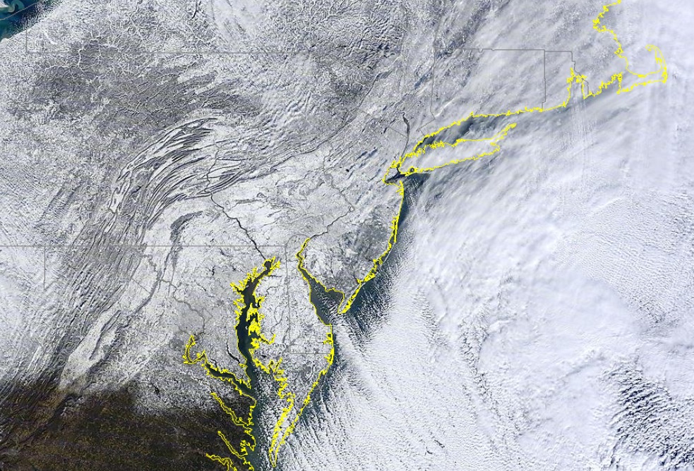
The NASA Aqua satellite sent back this true colour image from midday Friday showing a very snowy NE U.S. Click for a much larger version.
Afternoon temps. under the 1051 millibar Arctic high that is about to drop into the Eastern USA were -41°C!
(about the same in the old Fahrenheit scale. Map below is in degrees F)

NOAA Surface chart.Click to see larger version. Red numbers are temp and green are dewpoint.
Sub zero (°F) weather will cover much of the Midwest and NE by sunrise Tuesday.
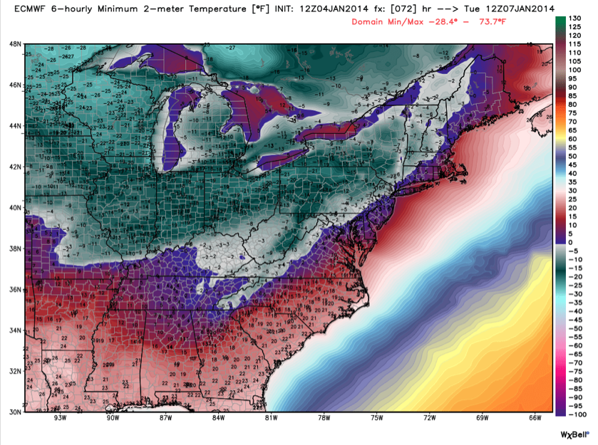
From WX Bell European Model in hi res. Green is below zero! I think this will likely be very close to what we will see.
Below is a pic from my Canon 5D of the snow here in Maryland:

No such thing as too much snow in my book!
 Dan Satterfield has worked as an on air meteorologist for 32 years in Oklahoma, Florida and Alabama. Forecasting weather is Dan's job, but all of Earth Science is his passion. This journal is where Dan writes about things he has too little time for on air. Dan blogs about peer-reviewed Earth science for Junior High level audiences and up.