
29 May 2022
Accretionary wedge turbidites from the Lost Coast
Posted by Callan Bentley
My wife just got back from a backpacking trip along the Lost Coast of California, from Mattole to Shelter Cove.
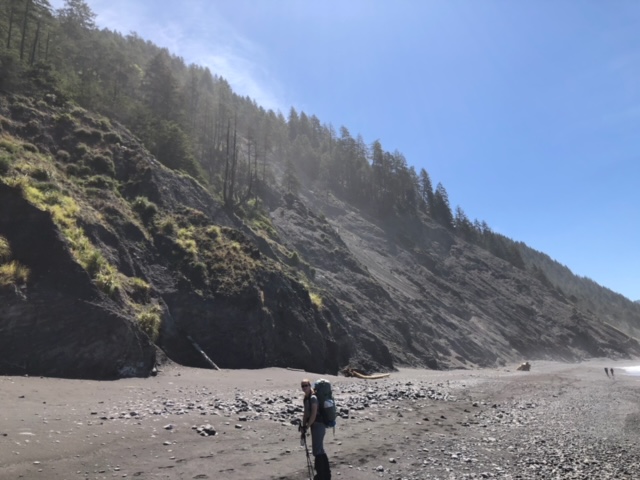
This is along the northern stretch of the San Andreas Fault, just south of the tectonic triple junction at Cape Mendocino.
My wife was kind enough to document some of the geology along the coast there, and to allow me to share the images here…
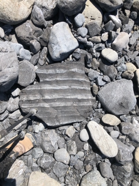
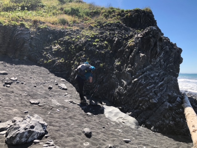
The local rocks are siliciclastic turbidites, shales and graywackes mainly – with a bit of conglomerate thrown in. These were deposited in deep water due to density currents (underwater avalanches called turbidity currents), which drop their load of grains in order of the particles’ weight, as this boulder of stacked graded beds shows:
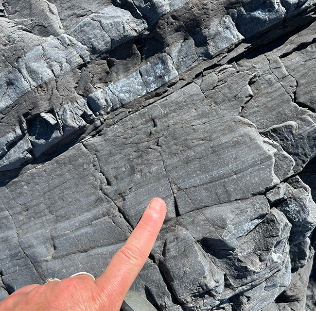
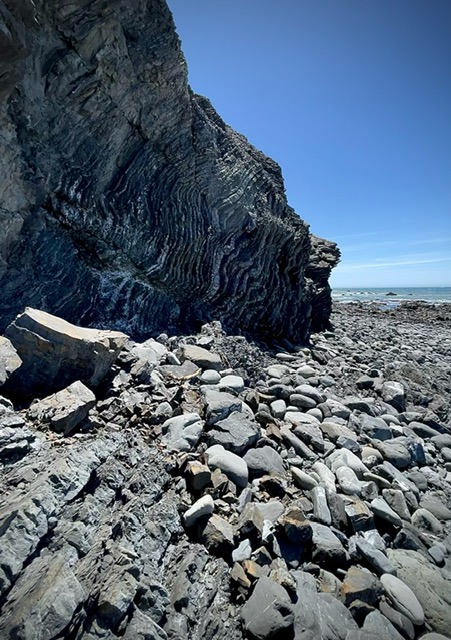
A couple of close-ups of laminations and cross-bedding within the sandier turbidites, again showing a fining-upward pattern:
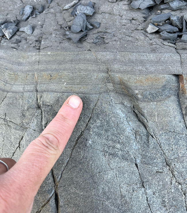
Here’s a muddier package, interspersed with sandy layers:
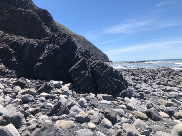
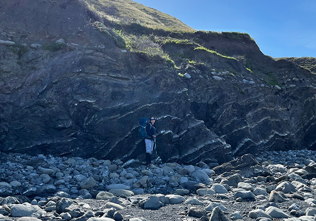
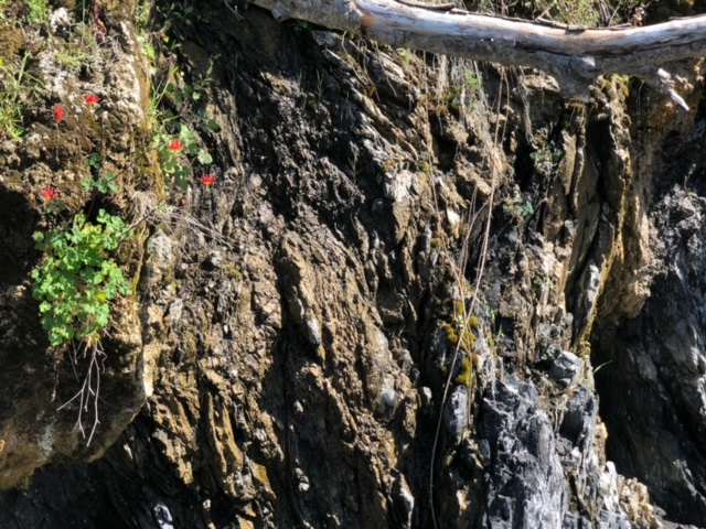
These deep sea sediments were scraped off the subducted Farallon Plate during the Mesozoic, and were crumpled and deformed as they joined the accretionary wedge. The contrast of the light sands and dark muds shows off the resulting deformation well:
Is it a fold or a fault?
…Yes!
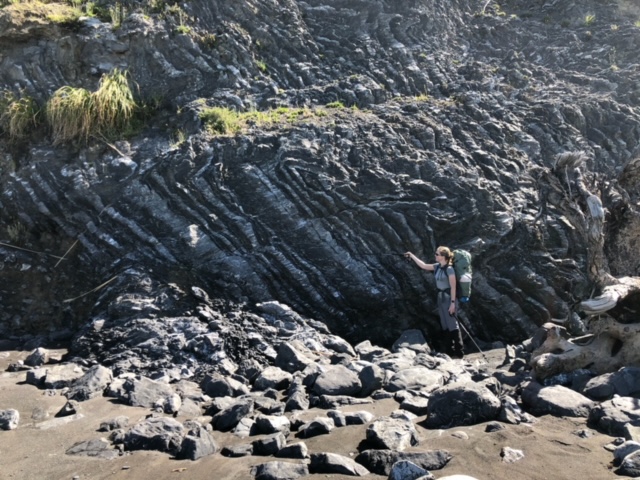
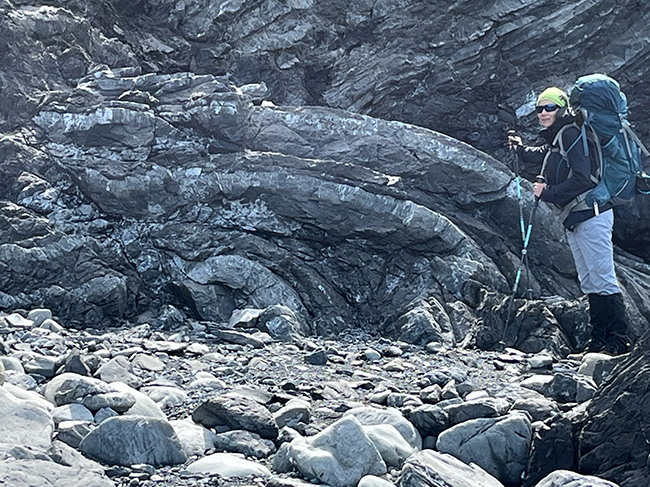
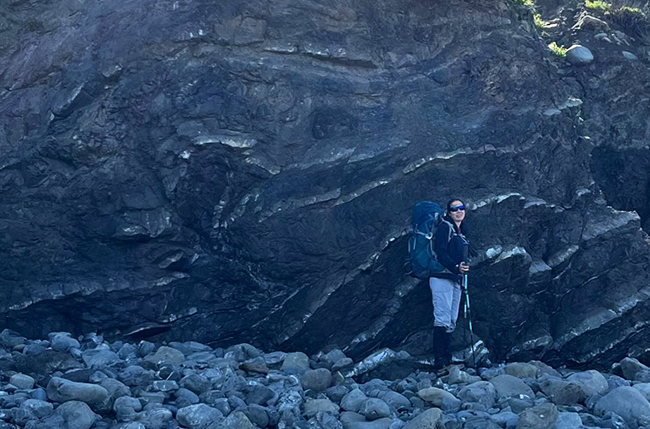
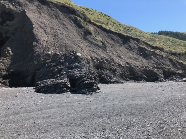
This is my favorite of the photos my wife brought back: Our friend Kristie stands in front of a shale-dominated outcrop, but the handful of graywacke layers show a neat pop-up feature (to her left):
Let’s zoom in:
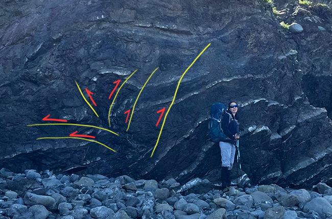
Annotated, with faults in yellow and kinematic indicator arrows in red:
This outcrop shows a scaly pattern, with a vertical foliation, suggesting it was a more dispersed zone of deformation, a shear zone within the subducted sediments.
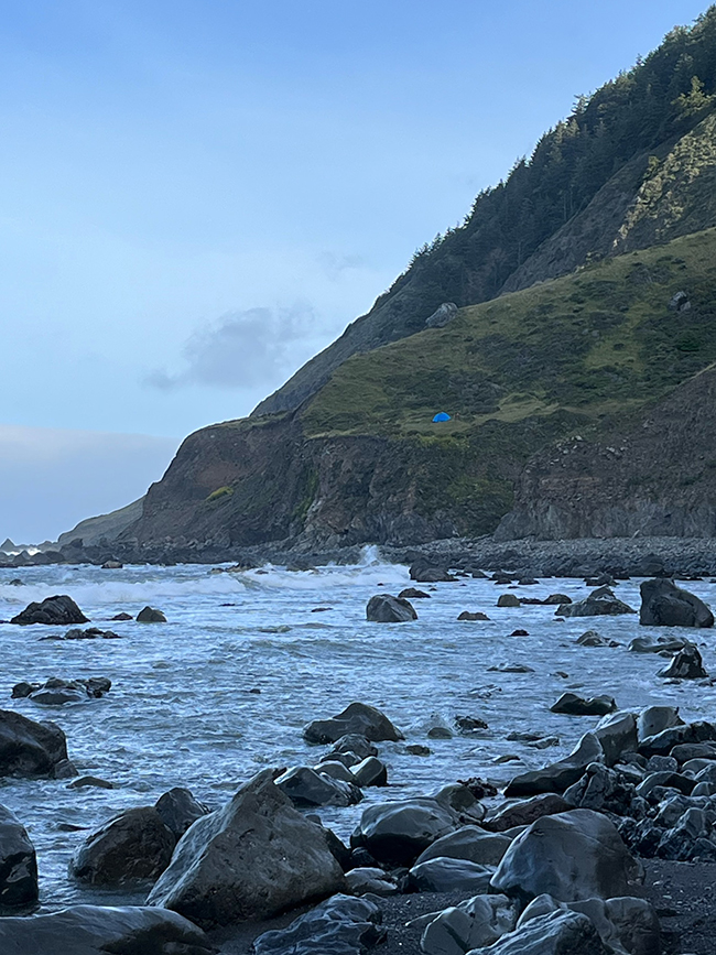
Like much of coastal northern California, the Lost Coast has experienced uplift. Once the downward drag of subduction was relaxed, it allowed the flexible edge of California to bob upward. As evidence of that, consider this angular unconformity:
The lower half of that outcrop is tilted, folded, and faulted turbidites like those we have been looking at, but then there is a prominent line of light-colored boulders marking an ancient erosional surface, probably a wave-cut platform. Above that, plenty of beach gravels to a thickness of many meters, much like the modern beach in the foreground. All that was at or below sea level, and now has been lofted well above the reach of the waves.
This recent uplift is preserved in the shape of the land, too, like the two prominent marine terraces seen in this oblique shot along the coast:
Inspiring geology can be found along the Lost Coast.
 Callan Bentley is Associate Professor of Geology at Piedmont Virginia Community College in Charlottesville, Virginia. He is a Fellow of the Geological Society of America. For his work on this blog, the National Association of Geoscience Teachers recognized him with the James Shea Award. He has also won the Outstanding Faculty Award from the State Council on Higher Education in Virginia, and the Biggs Award for Excellence in Geoscience Teaching from the Geoscience Education Division of the Geological Society of America. In previous years, Callan served as a contributing editor at EARTH magazine, President of the Geological Society of Washington and President the Geo2YC division of NAGT.
Fantastic! Enjoyed it, thanks for sharing!
Nice Photos!
There are far more of those marine terraces than most realize. I recall once seeing a map that identified a remnant terrace about 400 feet above MSL along the Sonoma coast, and there are multiple terraces offshore: http://ccom.unh.edu/publications/correlating-sea-level-rise-still-stands-marine-terraces-and-undiscovered-submerged
Thank you! I live in this area & really appreciate your explanation. Up north of this location is Moonstone Beach in Trinidad. On the north end of the beach is a cliff that has agatized sea shells 100 feet up the cliff. Was this caused by a seismic up lift and how many years ago did this event occur. Was there an event around 12000 years ago that could of caused this geological formation. I chatted with some Humboldt State University students up on the cliff one day & they said their professor said the shells were 12000 years old, but I’ve been unable to find any literature on the topic. Thank you!
Sounds like uplifted marine deposits; I don’t know about the age of the site you mention, but I would suggest that the uplift wouldn’t have been in one giant ‘event.’ It’s far more likely to have been gradual and slow, either through isostatic uplift, or through subduction-induced arching of the edge of the plate (because Trinidad is in a different setting than the Lost Coast south of Cape Mendocino).
Thanks, I’ve been to the Sinkyone many times. Come up the Eel river to Covelo ,would like to know more about this undamaged river and its geology….jrpattee