13 October 2011
Superior Craton trip, stop 1
Posted by Callan Bentley
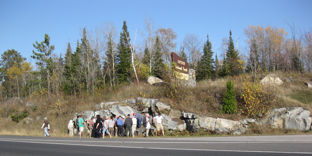
The first stop on our pre-GSA field trip to the subprovince boundaries of the Superior Craton was a place just north of Virginia, Minnesota, where the Mesabi Iron Ranges are mined (same Proterozoic banded iron formations that were portrayed as the backdrop of the mining activity depicted in the film North Country). The pull-off is locally known (to geologists) as “Confusion Hill,” but marked on the roadside sign as the “Laurentian Divide.” Here’s a map to show where it is located on the North American continent:
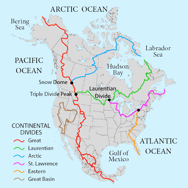
(Map modified from an original version I scored from Wikimedia Commons)
The location is a drainage “triple point, with some water draining down into the Great Lakes watershed, other water heading south towards the Mississippi watershed, and still other water draining down a different slope towards the Hudson Bay watershed. But we weren’t there for the surficial hydrology. We were a group of structural geologists, and we wanted rock.
We stopped, and did what geologists do in these circumstances – immediately headed for the outcrops, where we clustered around to discuss:
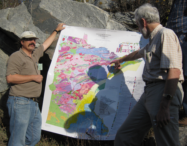
Here, trip leaders Basil Tikoff and Peter Hudleston, give us an introduction to the geology of Minnesota, supplemented by a lovely new geologic map of the state:
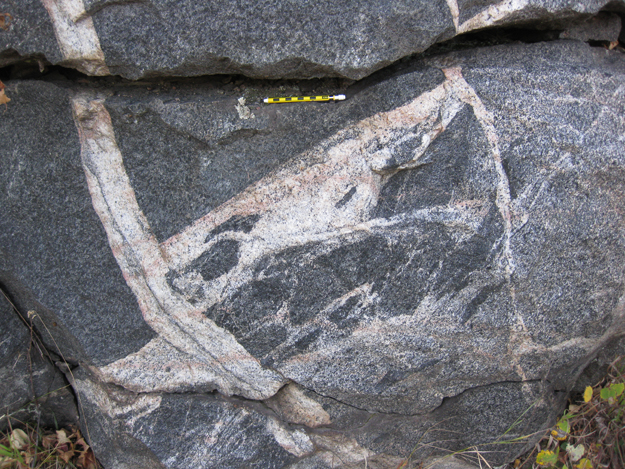
The rocks exposed at “Confusion Hill” are rocks of the Giants Range Batholith, an interesting intrusive complex that includes a half dozen different compositional variations. Here, the evidence of the different compositions was manifest: there was evidence (inclusions, cross-cutting relationships) that suggested felsic intruded mafic, and also evidence that showed mafic intruding felsic. Hence the name, “Confusion Hill.”
Here’s an example of the complex relations, with a cm-demarcated pencil for scale:
A vertical train of what appear to be (older) mafic xenoliths, again with the cm-demarcated pencil for scale::
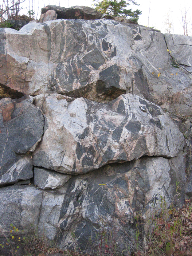
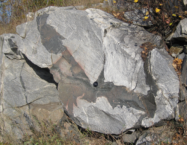
Here’s a particularly confusing expression, with a 55 mm diameter lens cap for scale:
There’s some crazy stuff going on in that previous image. Stare at it a while and see if you can figure out whether the felsic rock is older or younger than the mafic rock. It’s perplexing, and Peter attributed some of these complications to probable magma mingling during the emplacement of the batholith during the Archean.
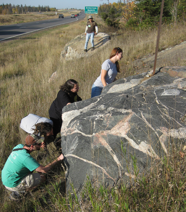
Here, some geologists who participated in the trip eagerly examined the rocks for themselves:


 Callan Bentley is Associate Professor of Geology at Piedmont Virginia Community College in Charlottesville, Virginia. He is a Fellow of the Geological Society of America. For his work on this blog, the National Association of Geoscience Teachers recognized him with the James Shea Award. He has also won the Outstanding Faculty Award from the State Council on Higher Education in Virginia, and the Biggs Award for Excellence in Geoscience Teaching from the Geoscience Education Division of the Geological Society of America. In previous years, Callan served as a contributing editor at EARTH magazine, President of the Geological Society of Washington and President the Geo2YC division of NAGT.
Great pics, Callan.
I’m not as familiar with US geology as UK – those continental divides represent geographical features, right?
If so – is there any relationship to cratonic boundaries? (I see the Great divide seems to correspond loosely to the Mesozoic terranes and the Eastern divide to the Palaozoic.
There is no hard and fast rule that the drainage divides conform to the geologic boundaries beneath them, but in some cases it acts as a dominant control. Not sure if it’s just coincidence here that it happens very close to the boundary between the Archean Superior Craton and the Proterozoic Animikie Basin to the south.
Thanks, Callan.
Canada is a big, ancient, jumbled geological mystery to me.
There seems to be a hard and fast rule that ancient crust (the most interesting) is also the most inaccessible! (Canada, Greenland, Scotland, S. Africa, W. Australia, etc.)
The Great Divide is a bit east of the edge of cratonic North America (which runs through the middle of Utah, about at the eastern edge of the Great Basin divide). The divides in the Appalachians are also a bit further into the continent than the tectonic boundaries are.
I suspect that the location of the Laurentian Divide is controlled in part by post-glacial rebound. (In the eastern US, there are also drainages that flowed south during glaciation but flow north now; Lake Champlain’s drainage is the best example.) Maybe Anne Jefferson (as a hydro/geomorph person with Minnesota roots) will drop by and say something about it.
Awesome stuff. Where’s the first map from? I’ve been looking for a simple continental-scale map like that.
Oops; forgot to credit that – got it from Wikimedia Commons and then modified it in Photoshop.
-C.
cool, thanks
[…] geologists are all participants on a pre-GSA-annual-meeting field trip to the Superior Craton, a chunk of ancient crust at the “nucleus” of the North American […]