
7 August 2017
Vacationing at volcanoes: Mount Sibayak
Posted by Jessica Ball

Mount Sibayak viewed from Gundaling Hill in Berastagi
Berastagi, a city in northern Sumatra, is a great place for volcanoes, because it has two active ones: Mount Sibayak and Mount Sinabung. Active takes on a different context here; in a place that has Sinabung, a volcano that is currently in a cycle of dome-building-and-destroying eruptions that produce plumes and pyroclastic flows, the geologists’ definition of ‘active’ gets passed over in favor of a shorter-term definition. To the locals, Sinabung is active, and dangerous; Sibayak, which hasn’t erupted in living memory, is not.
To put these two volcanoes in a broader context, you also need to look at them in a geographically broader one. Berastagi is located within the Singkut caldera, of which Sibayak and Sinabung are related stratovolcanoes. Sinabung is currently erupting, but Sibayak last erupted in 1881, and is a regularly-visited tourist attraction.

On the summit of Mount Sibayak, with Mount Sinabung in the background, in a rare moment free of gas plumes
This is not to say that Sinabung is dangerous and Sibayak is ‘safe’. As was dramatically demonstrated at the Dieng Volcanic Complex in Central Java, even volcanoes that haven’t erupted new magma in some time can still experience hydrothermal explosions. And Sibayak has a very active hydrothermal system, as you can see if you make the one-hour hike to the crater.
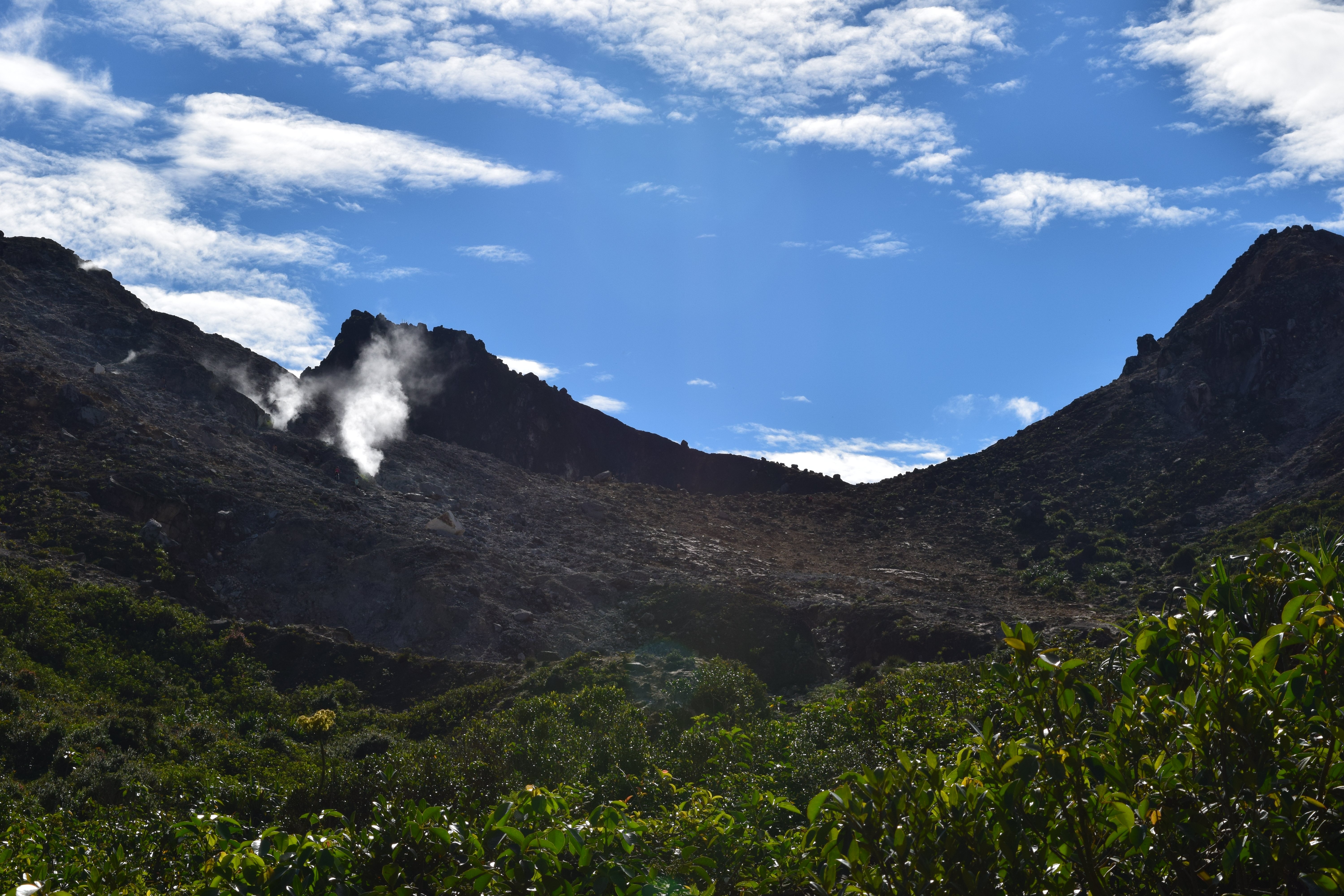
Entering the crater of Mount Sibayak
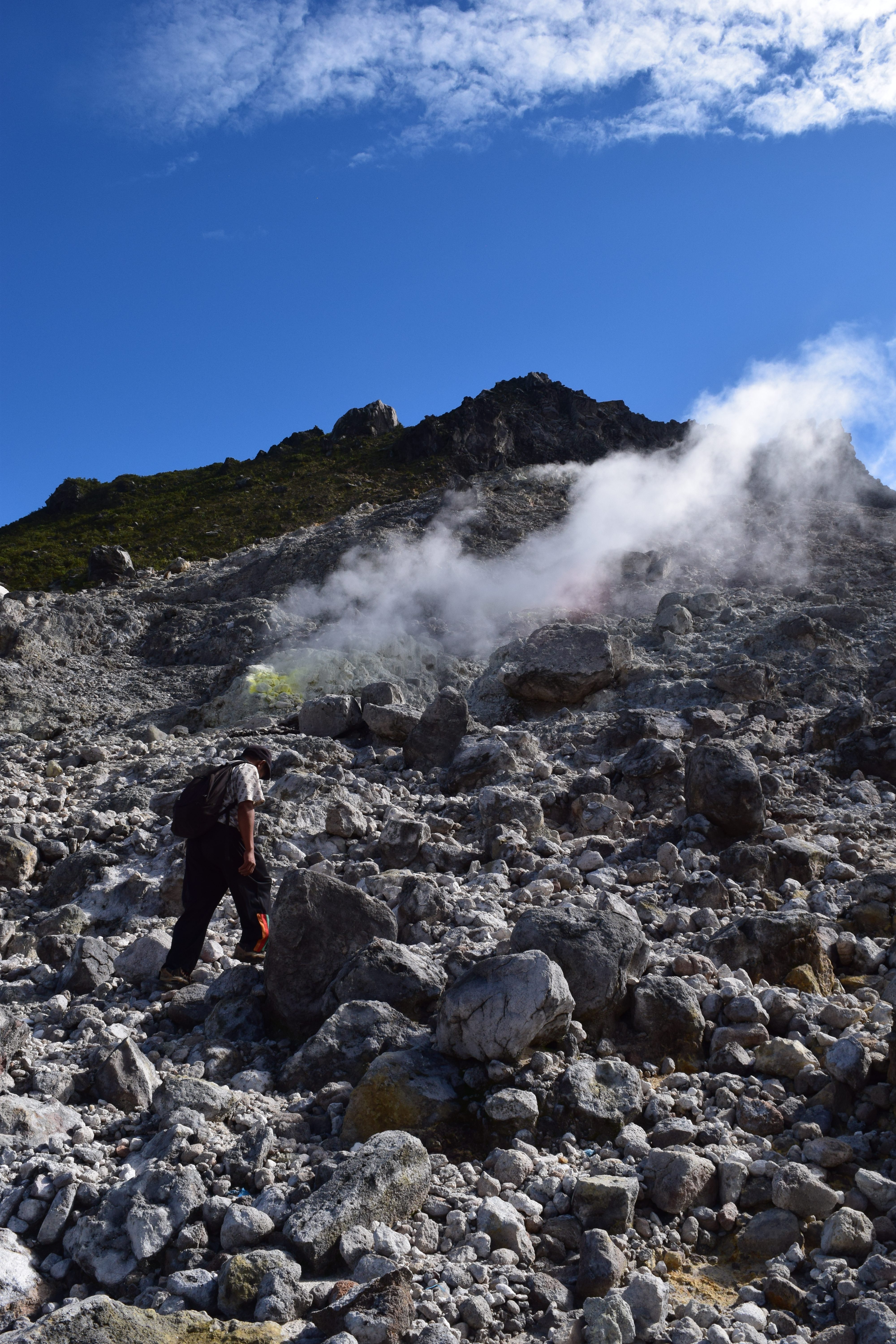
I’ve worked quite a bit around hydrothermal systems, so I know what it’s like to navigate this kind of ground and I feel comfortable doing it. And, by dint either of long experience or a decent background in practical geology, most of the guides who go to the crater do as well. While we were there, I listened in on another guide and was pleasantly surprised to find him correctly explaining the reason gas was venting from the ground. It’s not a technically difficult hike, but it’s useful to have a guide along who knows the terrain.
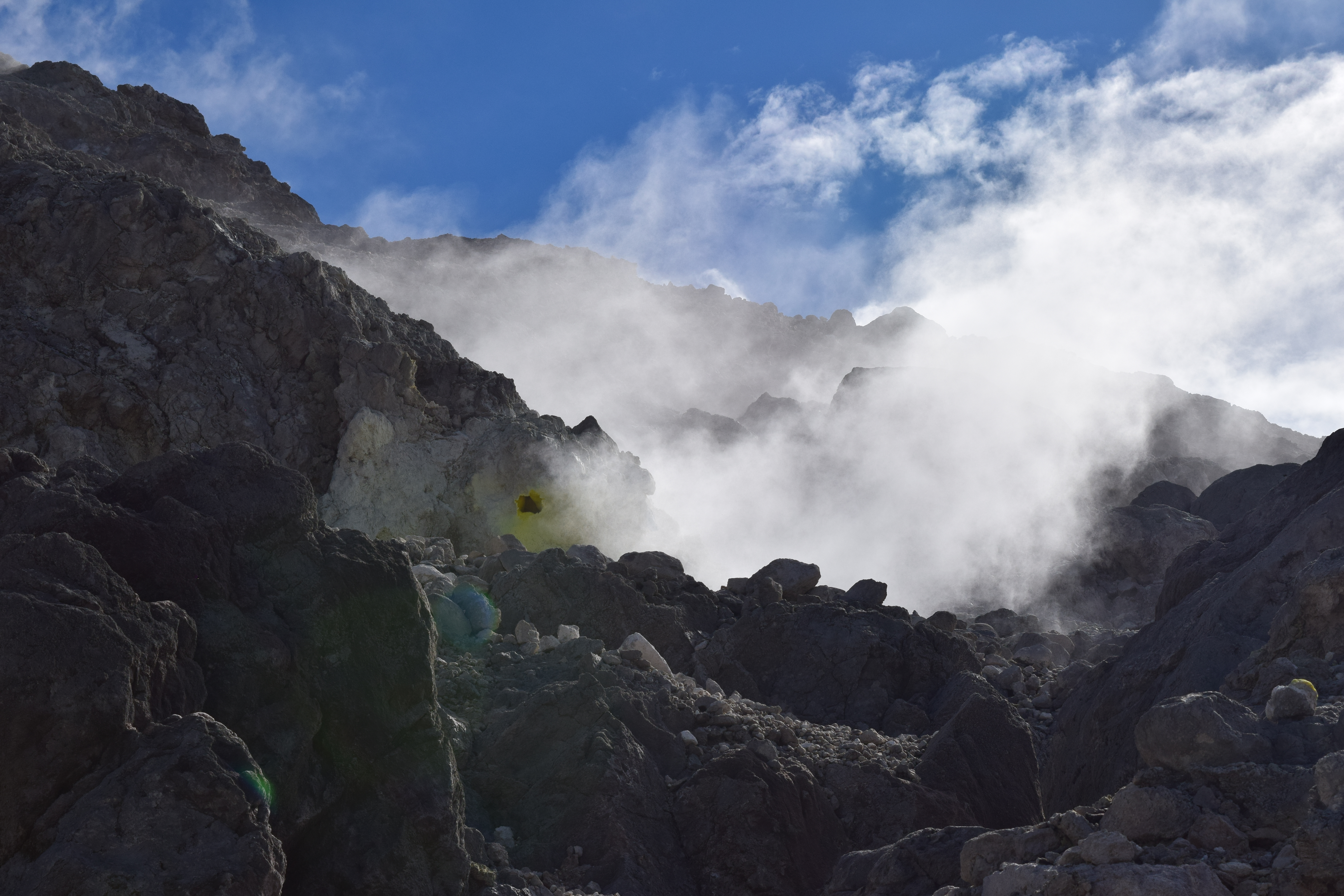
Fumaroles – the fancy name for gas vents – are easy to avoid, but unstable ground is somewhat less obvious, and the trails can be tricky to pick out.
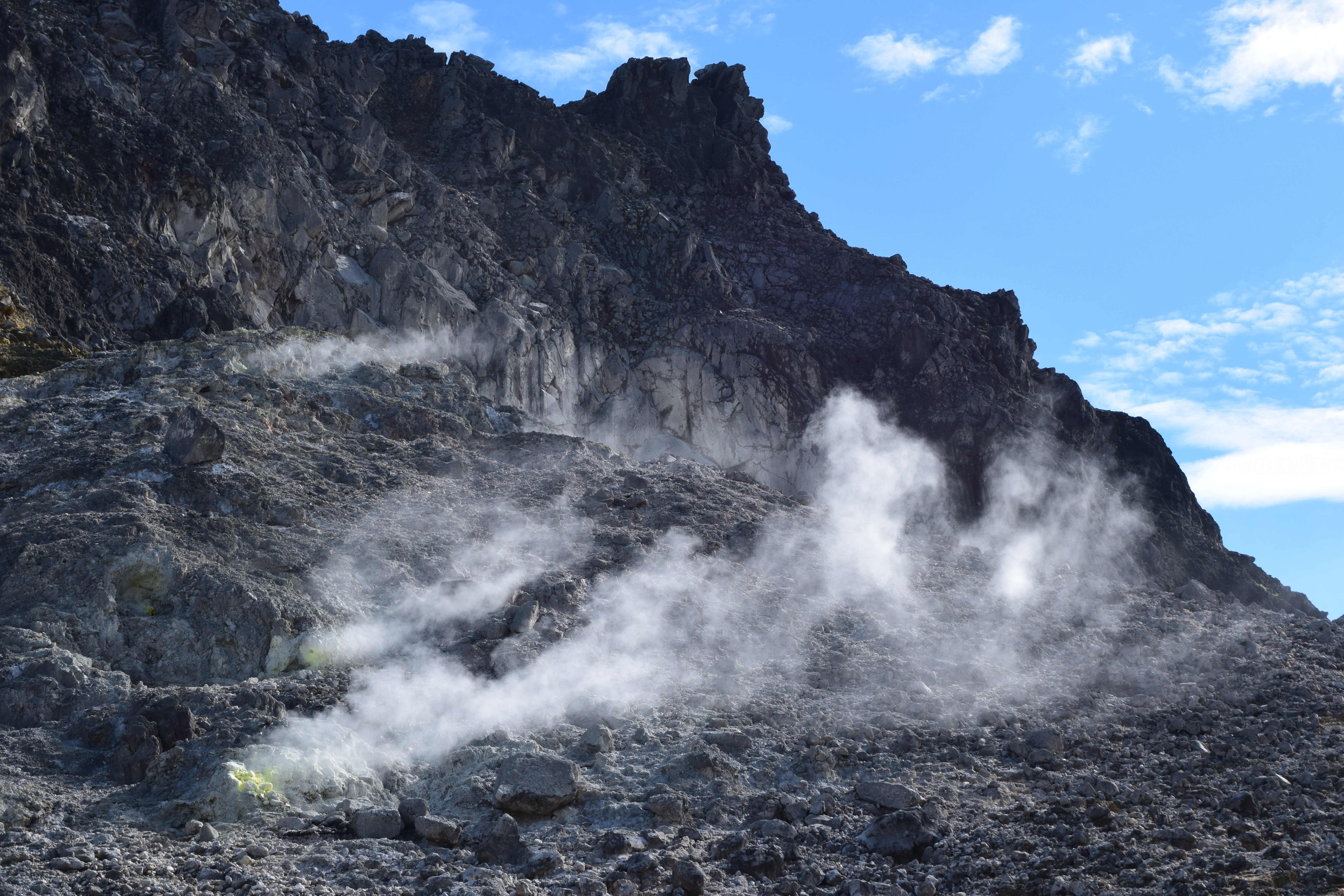
Fumaroles in the crater
Our hiking guide showing us some of the more active fumaroles
One of the really interesting things about these fumaroles is that some of them are loud. Really loud, like there’s a steam engine down there.
Most are surrounded by beautiful elemental sulfur crystals as well. It’s the two of these things together that tells a volcanologist that the volcano still has magma at relatively shallow levels below it; you need both heat and sulfur dioxide to drive fumaroles like this. This doesn’t necessarily mean the volcano will erupt – the magma body could be “stalled” because it didn’t have enough gas to erupt completely the last time around – but it does mean that meteoric water is reaching a hot magma body, turning into steam, and picking up acid gas coming out of the magma.

An currently inactive fumarole encrusted with native sulfur
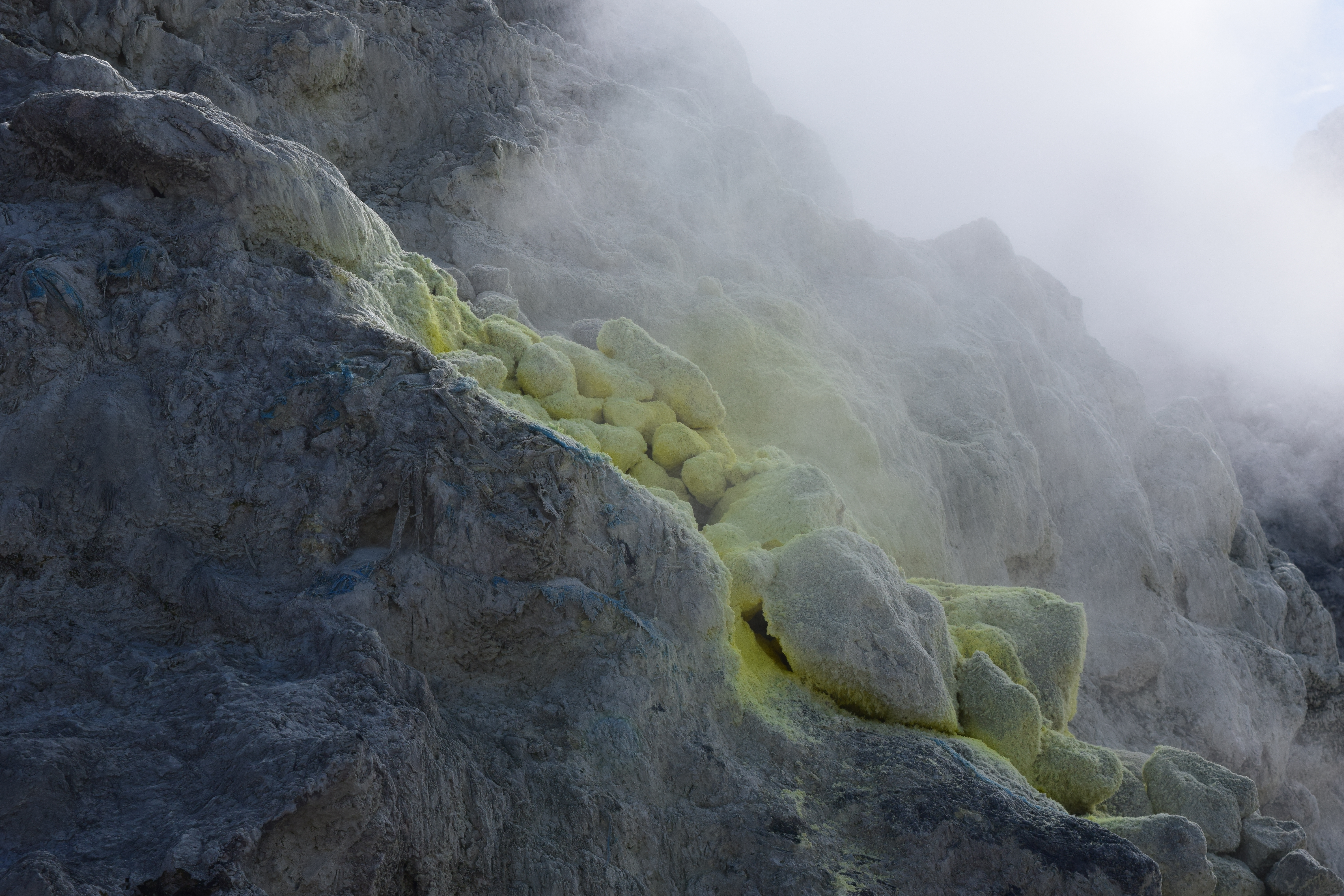
More native sulfur (this photo and other close-ups were taken with a zoom lens to avoid getting too close to the gas).
Another good sign of this is the crater lake you can see near the summit. The lake seems to be intermittent – probably it’s deeper during the rainy season – but you don’t get water that color without some sort of pH change going on. I suspect that it’s very acidic, and that the rock graffiti down there was created during a dry spell. It would not be my first choice for a dip!
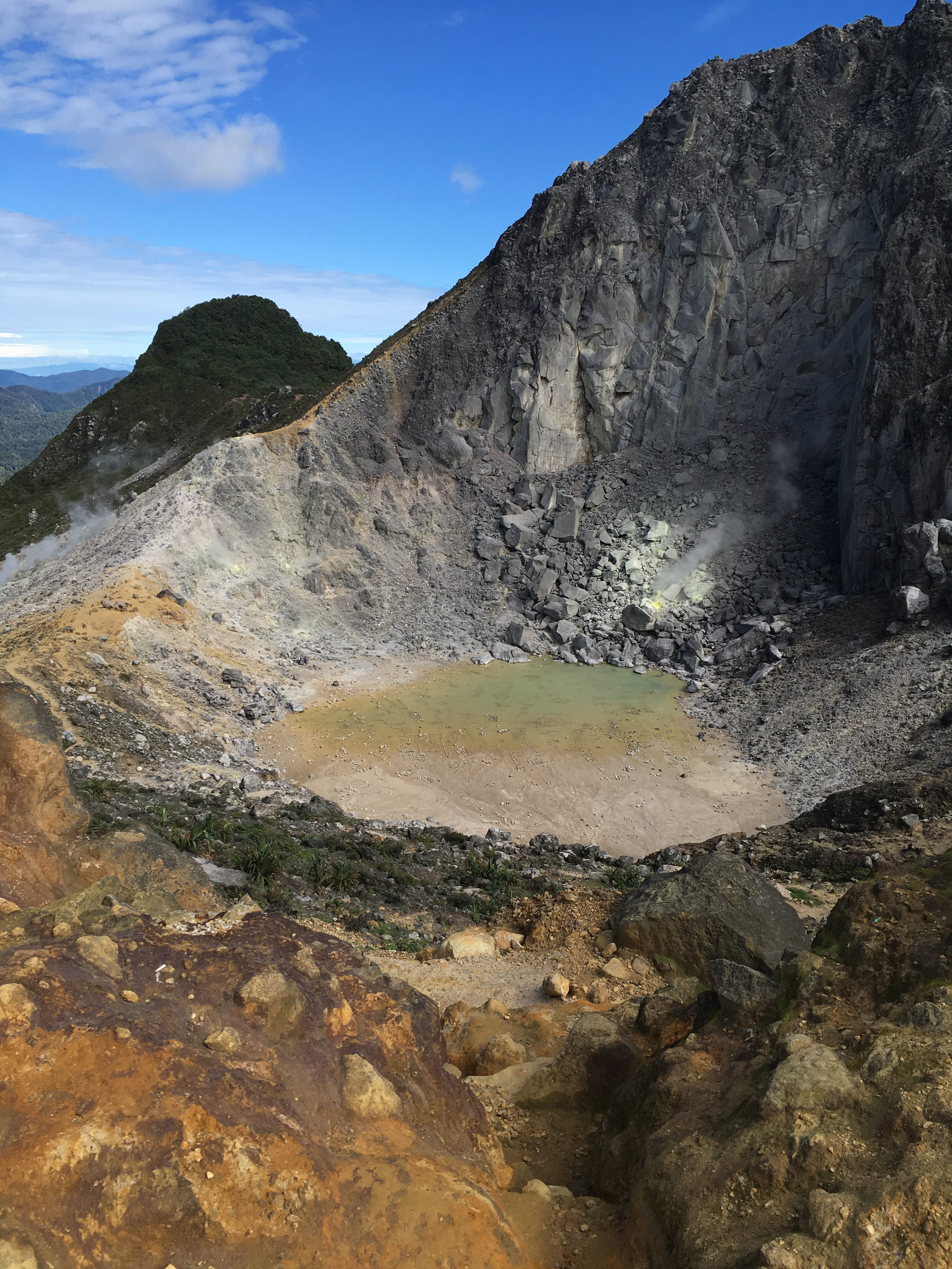
The crater lake of Mount Sibayak
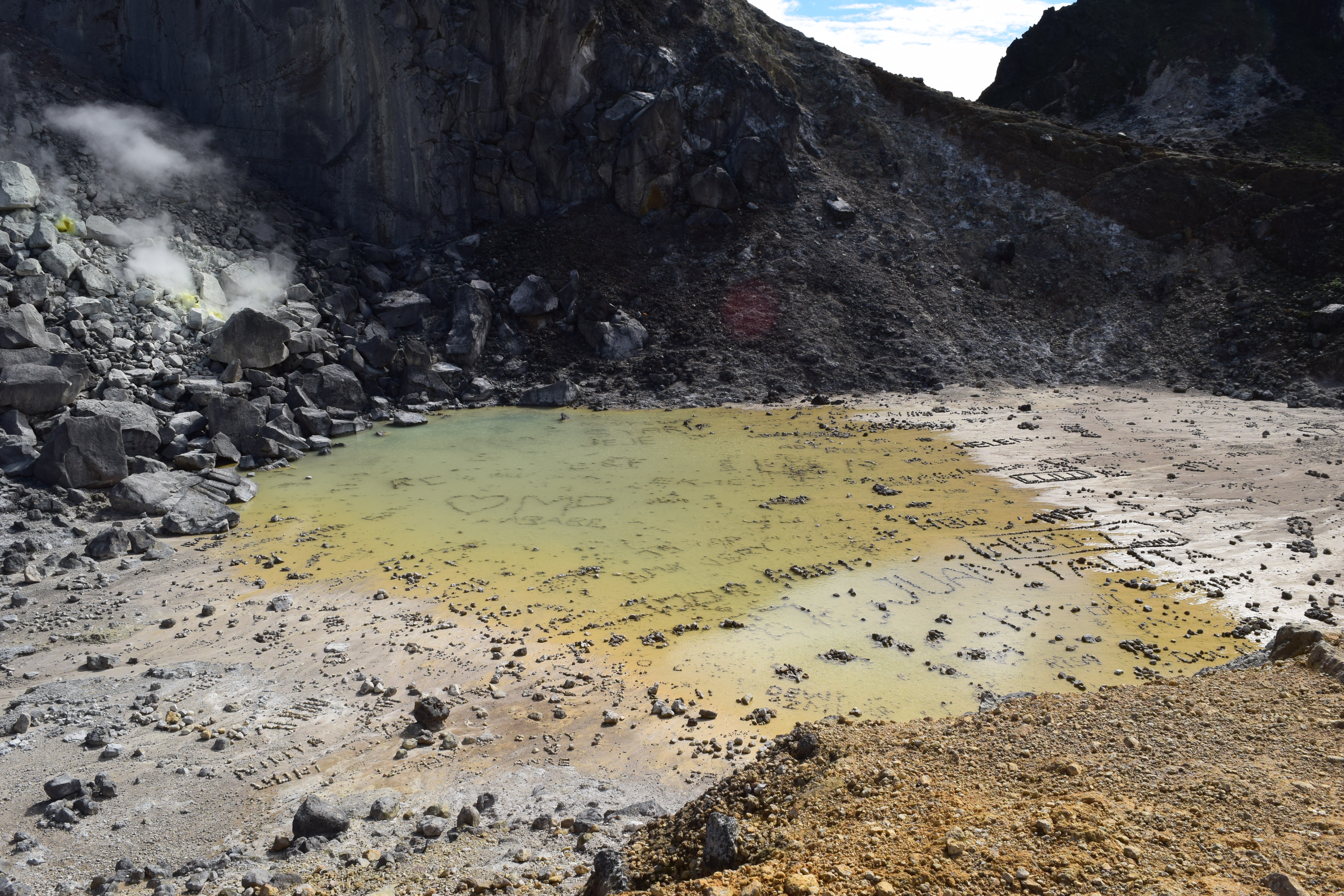
Another view of the crater lake, with rock “graffiti.”
One of the important things to remember around active fumaroles is that the gases coming out of them is toxic. Sulfur dioxide is nasty in and of itself – it always makes me cough, and it can damage your throat and lungs if you breathe too much of it – but if there’s hydrogen sulfide coming out as well, it can actually be deadly. Dawn and I wore face masks the whole time we were walking around, and I would have been even happier with a mask that had filters instead of the N95 I had on.

Volcano selfie! This was immediately followed by a coughing fit when the wind shifted.
Gas, gas, everywhere
It was windy enough to disperse the worst of the gas plumes, but if the wind shifted and you got caught in one, you were guaranteed a coughing fit.
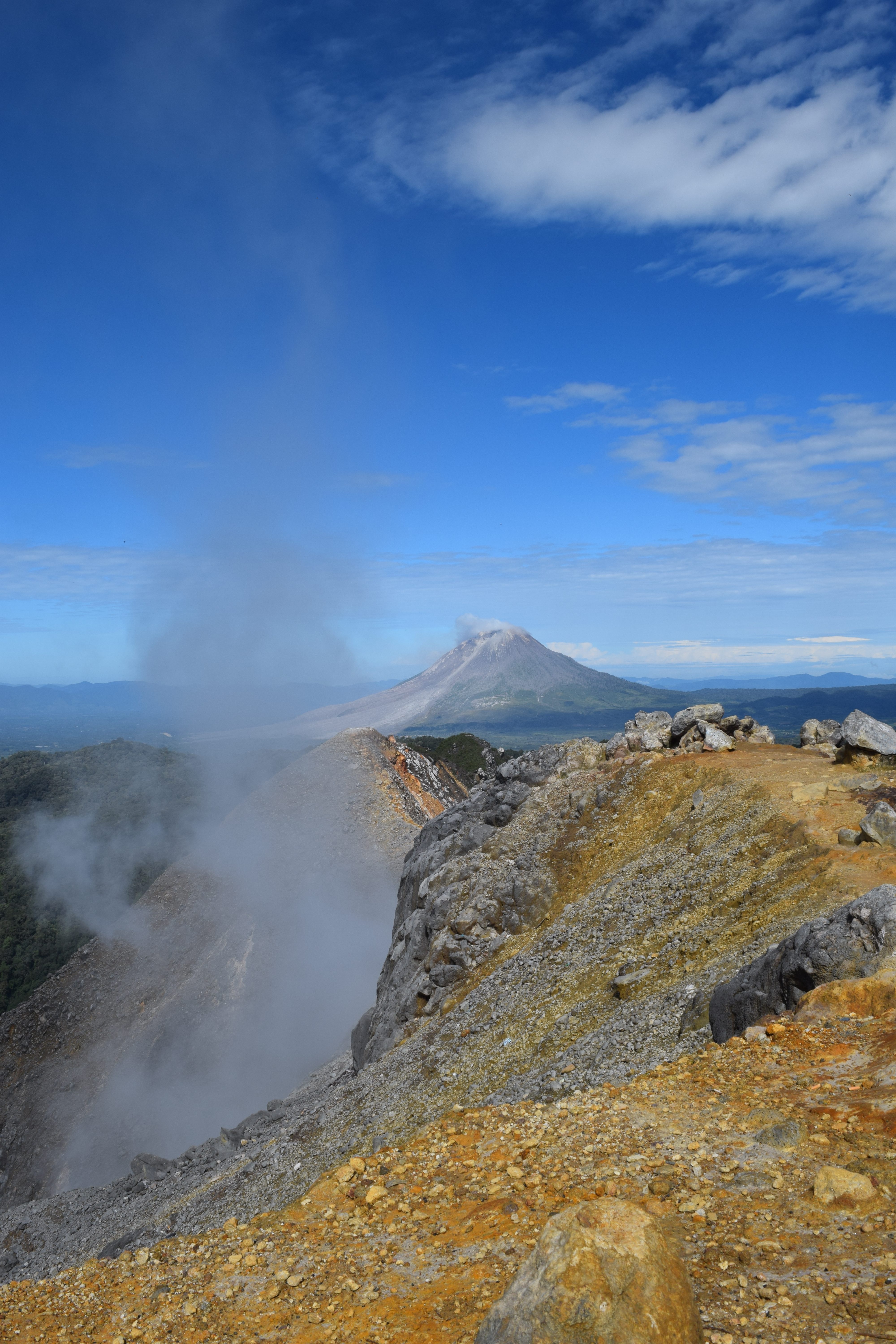
Sibayak’s gas plume with Mount Sinabung in the background. The rock in the foreground has been intensely altered from its original grey color to brown and yellow clays.
Because of the intense hydrothermal activity, many of the rocks on the volcano have been altered by gas and acid fluids, which means that their original minerals have either changed to new ones or been eaten away entirely. In most areas this means the rocks turn to clay or other secondary minerals, but in some of them so much of the original rock is altered that the only thing left is a silica rind.

A heavily-altered rock where a xenolith has been turned mostly to clay
Because of all this hot water and steam, the area around Sibayak has at least one hydrothermal power plant and a number of hot springs that have been built up to varying degrees. After the hike, our guide took us to one that’s used as a kind of community pool / tourist attraction, where you can soak in warm and hot sulfur-y water. It was an excellent (if mildly stinky) way to end the hike!
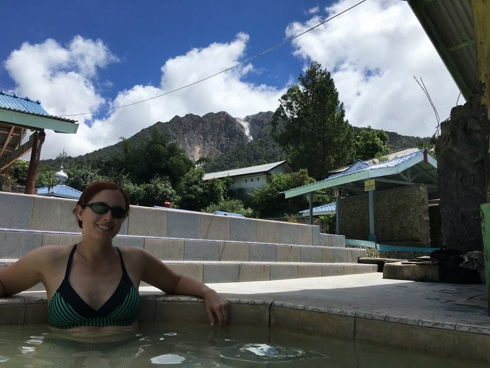
Relaxing in a hot spring-fed pool beneath Sibayak
To close, I wanted to include some cautions. As a someone who has experience on volcanoes with active hydrothermal systems, I was relatively comfortable visiting the crater of Sibayak. However, I also understood that there was a level of risk associated with the trip. As the hydrothermal explosion at the Dieng Volcanic Complex demonstrated recently, even a relatively quiet volcano like Sibayak can still change moods. The hike Dawn and I went on was a popular one with tourists, but just because nothing has happened there in the past doesn’t mean something can’t happen in the future. Volcanoes are natural systems and have some inherent level of unpredictability, and even the most well-monitored volcano can surprise you.
As volcanologists, we knew better than most what kinds of hazards we might have to deal with, and we were prepared to the extent we felt necessary. This meant that we had safety gear, a well-stocked first-aid kit and good boots; we carried food, water and extra clothing in case we got stuck somewhere; and there were people who knew where we planned to go and when we ought to be back. I consider this to be the bare minimum of precautions for a hike anywhere, but it’s especially important when you’re visiting volcanic areas. Also, my level of comfort in those places is different than, say, my parents might experience – so it’s also important to gauge the comfort level of your group before embarking on a volcano hike. In the end, it will keep you safer and happier!
 Jessica Ball is a volcanologist at the U.S. Geological Survey, researching volcanic hydrothermal systems and stability, and doing science communication for the California Volcano Observatory. She previously worked at the Geological Society of America's Washington DC Policy Office, learning about the intersection of Earth science and legislative affairs. Her Mendenhall postdoc and PhD focused on how water affects the stability of volcanoes, and involved both field investigations and numerical modeling applications. Her blogging covers a range of topics, from her experiences in academic geosciences to science outreach and communication to her field and lab work in volcanology.
A beautiful trip, congratulations!
Super nice photos and good advice.
Your notes and observations are always a pleasure to read for anyone interested in geology and vulcanology as myself.
Thank you very much!
Regards from South America.
Gonzalo
Does the Singkut caldera have any connection with Toba?
If there is, I haven’t been able to find much about it. They’re quite close to each other and the Sumatran Fault Zone, but there doesn’t seem to be enough geochronology available for Singkut to say whether it shares any part of a magmatic system with Toba.
Really nice explanation about Sibayak !
My girlfriend and I went to Sibayak last January and we were really lucky to have seen the eruption of Sinabung. It was amazing !
I was quite amazed by the level of hydrothermal activity in Sibayak, especially the fumaroles. It reminded me a little bit about Ijen Crater in East Java, but less active.
What factor could cause a volcanic region to be so abundant in sulfur deposits but not the other ones ? Especially in a ‘calm’ volcano.
Sounds like you’ve made some great trips! I’ve heard people talk about Ijen but never visited myself. Next trip!
A ‘calm’ volcano can still have a magma body beneath it, which is where those gases come from. It might not erupt because it doesn’t have enough gas to drive an eruption, but if it’s relatively shallow (maybe a few km below the surface) then it could still be losing sulfurous gases that create those deposits. It’s a good indicator that there’s magma somewhere, but we need deformation and seismic monitoring to tell us what else is going on in the volcano’s ‘plumbing’ before we can tell if that magma is likely to erupt.