1 February 2023
The 15 September 2022 Jiujiawan landslide in Qinghai province, China
Posted by Dave Petley
The 15 September 2022 Jiujiawan landslide in Qinghai province, China
A new paper in the journal Landslides (Wang et al. 2023) describes the 15 September 2022 Jiujiawan landslide in Qinghai province in China. This was a large rainfall triggered failure that blocked the high speed Lanzhou-Xinjiang Railway, as well as destroying a number of roads.
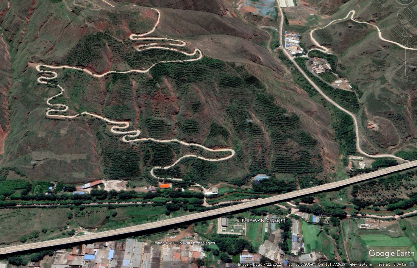
The location of the landslide is 36.680, 101.772 (once again the coordinates given in the paper are slightly incorrect). This is the site of the landslide in a Google Earth image collected in July 2022:-

The site of the 22 September 2022 Jiujiawan landslide in China, as shown in a Google Earth image dated 22 July 2022.
.
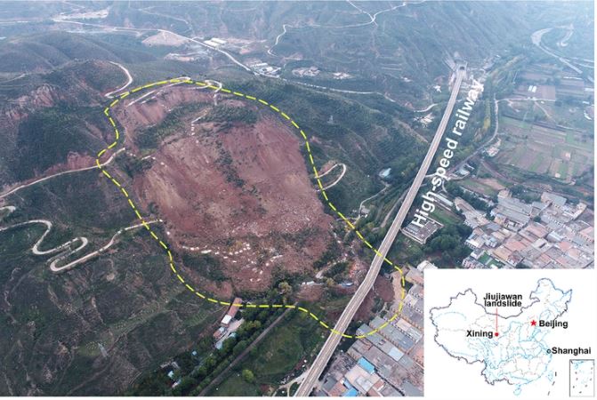
Wang et al. (2023) includes an image of the aftermath of the landslide:-

The 22 September 2022 Jiujiawan landslide in China (Wang et al. 2022, taken by Y. Chen).
.
According to the authors, the landslide occurred in sandy mudstone interbedded with gypsum at the end of an abnormal period of rainfall, although the level of precipitation on the day of the failure was low. The failure is rotational – to me it appears that there were two blocks. The first, smaller, block has disintegrated to form the debris pile at the toe of the slope. The second remains intact, with several metres of displacement, forming the large scarp at the crown of the landslide. This displaced block will require careful management.
The major economic impact of the landslide was damage to the high speed railway. As the image above shows, the track was on an elevated section at the toe of the slope. The landslide hit five of the piers, one of which was displaced 7 metres, breaking away from its foundation. The line was closed in the vicinity of the landslide; satellite images suggest that this might still be the case today.
Fortunately there were no fatalities associated with the Jiujiawan landslide.
.
Reference
Wang, F., Chen, Y. & Yan, K. 2023. A destructive mudstone landslide hit a high-speed railway on 15 September 2022 in Xining city, Qinghai province, China. Landslides. https://doi.org/10.1007/s10346-022-02016-0


 Dave Petley is the Vice-Chancellor of the University of Hull in the United Kingdom. His blog provides commentary and analysis of landslide events occurring worldwide, including the landslides themselves, latest research, and conferences and meetings.
The reason Co-ordinates and Map are off (and in regards to google image maps) of China is simply (and unfortunately) due to their governments paranoia. There’s a Wikipedia article called Restrictions on geographic data in China if you want more info on it.
But to sum it up, its basically illegal to make maps that are accurate to more that 50 meters horizontal and 100 metes vertical.
Satellite images also have to be vetted before being allowed to be used on public mapping apps/devices. These are run through an image manipulator that distorts the image further affecting any co-ordinates or accuracy (it’s why the roads also tend to be miss-aligned when displayed on the image as those are altered by a different algorithm) .
And then, there’s also the fact that they use a different gps co-ordinate system to the rest of the word, which is (and you’ve probably guessed by now) completely incompatible with the rest of the worlds GPS system which just compounds on top of all the rest.
Why they seem to be so paranoid about tourists/everyday people trying to find a takeaway/restaurant I have no idea XD, because I doubt the other military superpowers would use Google Earth, they would have there own maps to use. XD