20 July 2021
Hulunbuir: a very serious double dam failure in China on 18 July 2021
Posted by Dave Petley
Hulunbuir: a very serious double dam failure in China on 18 July 2021
There has been surprisingly little international reporting of a very serious double earthen dam failure in the Hulunbuir area of Inner Mongolia in northern China on Sunday 18 July 2021. This looks to have been one of the most serious dam failure events in recent years, with 46 million cubic metres of water having been released, causing massive flooding. Reuters has a report of the event, but there are few other outlets providing much attention to it.
The dams in question are called Yong’an Dam and Xinfa Dam, located in Morin Dawa Daur. There is dramatic footage of the collapse of the Xinfa Dam on Youtube (apologies for the awful music):-
.
This dam is located at 48.609, 124.241. This is a Google Earth image in happier times:-
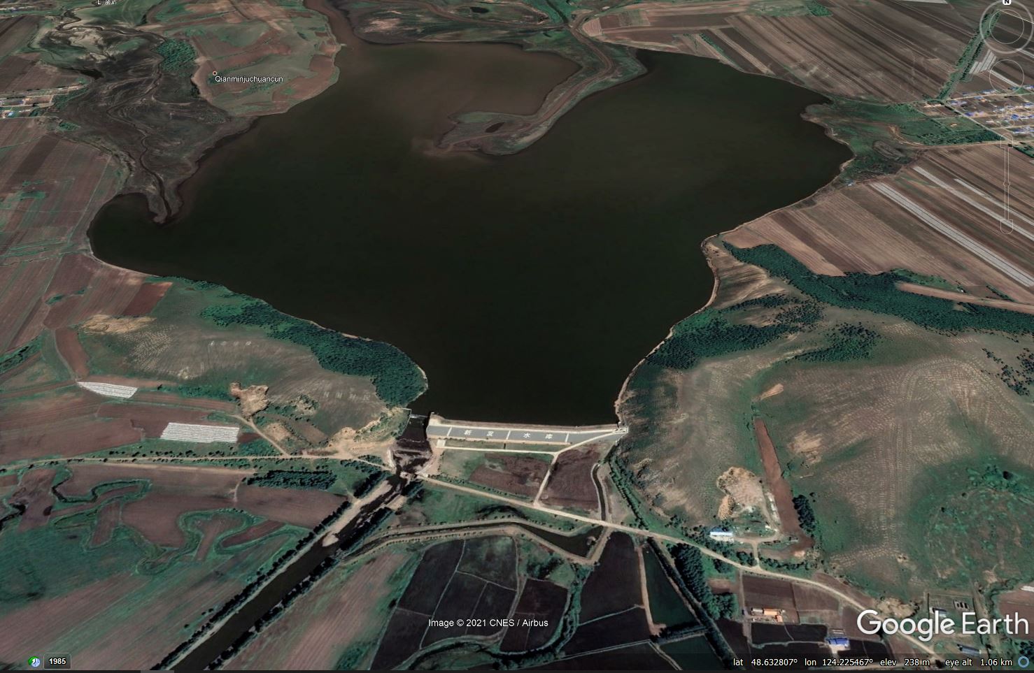
Google Earth image of the Xinfa Dam in Hulunbuir, Inner Mongolia, China, which collapsed on 18 July 2021.
.
Note that this dam has a substantial spillway structure, so overtopping is surprising. However, the video of the collapse shows that a very substantial volume of water had already overtopped the structure:-
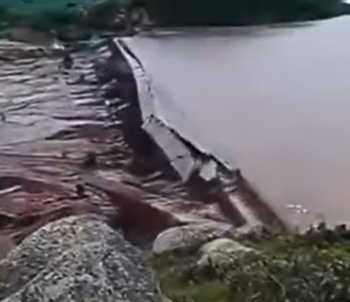
The collapse of the Xinfa Dam in China, as captured in a video posted to Youtube.
.
A good working hypothesis is therefore that this dam was affected by the collapse of the Yong’an Reservoir, which would have released a catastrophic volume of water. About 10 km upstream of the Xinfa Dam there is another dam, located at 48.675, 124.327. The Google Earth image below shows the comparative position of these two structures. Interestingly the adjacent town is called Yongfu:-
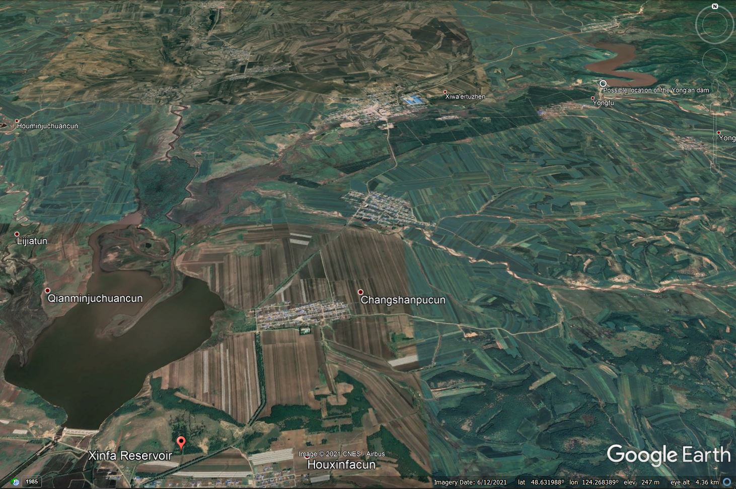
Google Earth image of the Xinfa Dam and the possible Yong-an Dam in Hulunbuir, Inner Mongolia, China, which collapsed on 18 July 2021.
.
One of the videos of the dam collapses, posted to twitter, appears to show the failure of a structure that is definitely not the Xinfa Dam:-
https://twitter.com/tw_tomy_/status/1416949532810637314
.
This is a still from this video:-
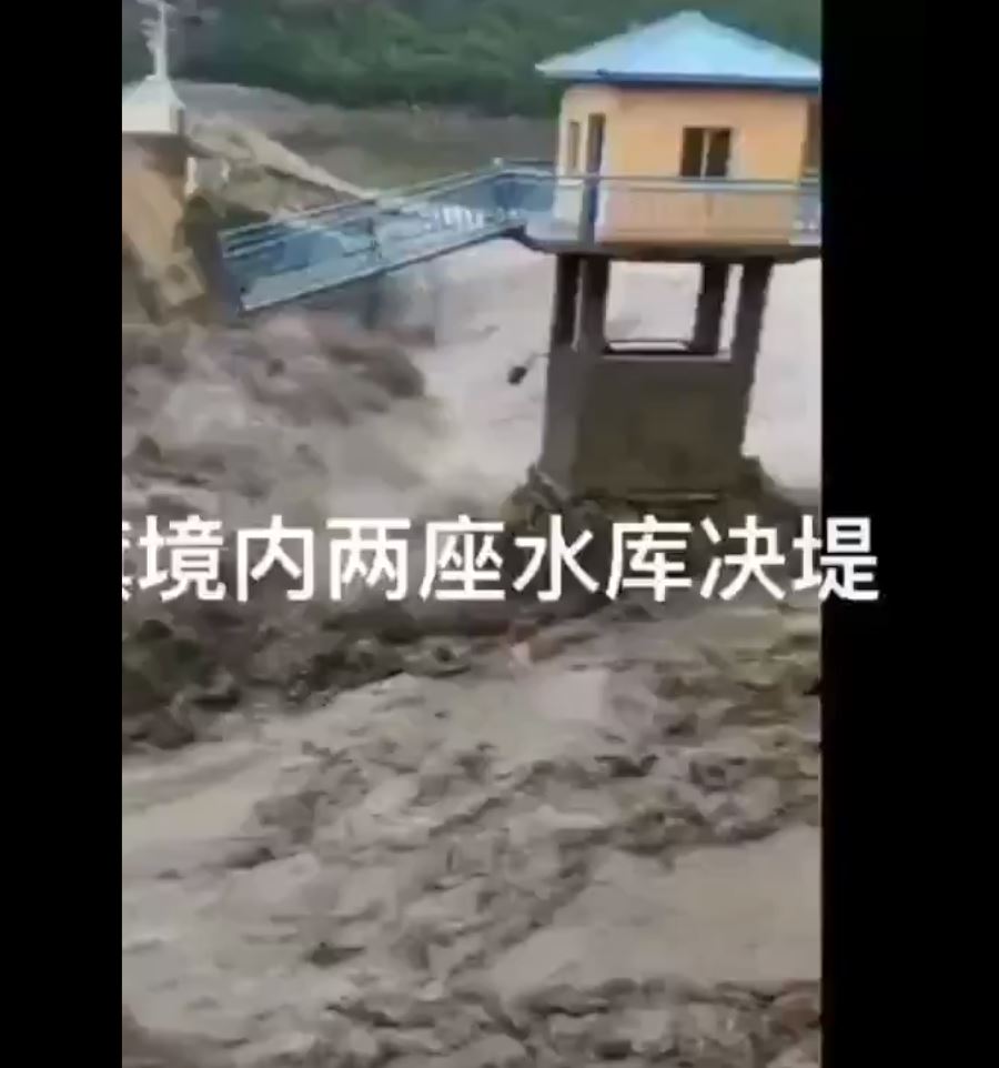
A still from a video posted to Twitter showing the collapse of the Yong’an dam in Hulunbuir, China on 18 July 2021.
.
I’m reasonable confident that this is the dam located upstream of the Xinfa Dam – the configuration looks to be identical. Edit: indeed this is now the confirmed location of the Yong’an Dam – see comments below:-
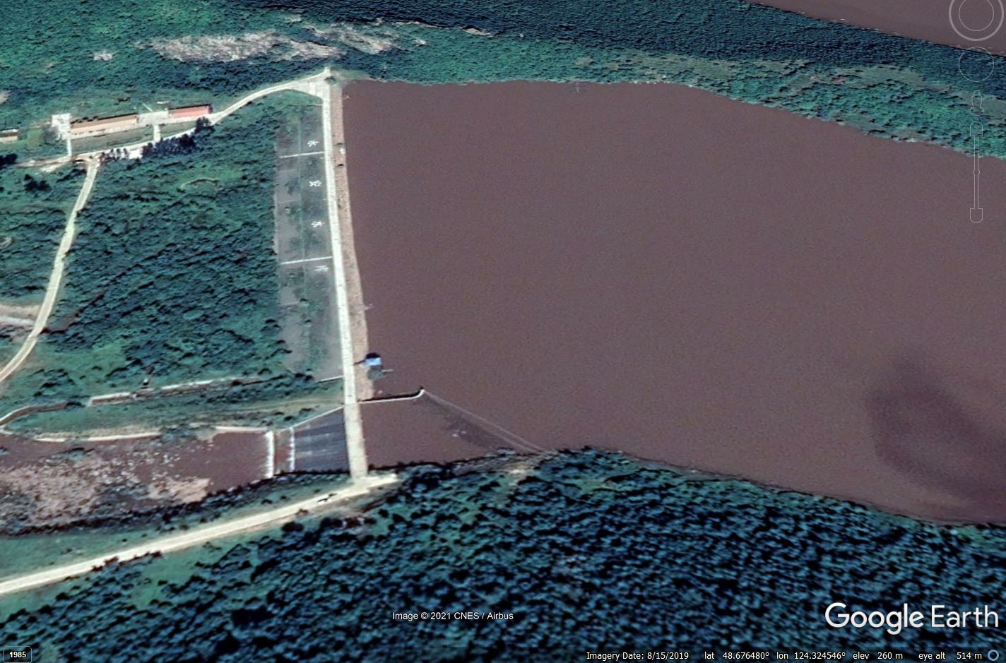
Google Earth image showing detail of the possible Yong’an Dam in Hulunbuir, China.
.
Thus, my hypothesis (untested at the moment) is that the Yong’an Dam failed due to the intense rainfall, which released a huge wave of water that overtopped and failed the Xinfa Dam, releasing a far greater volume to inundate the surrounding area.
There are images and videos online showing very extensive and damaging flooding from this event, such as this:-
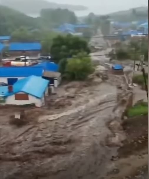
Flooding from the dam collapses in Hulunbuir in China on 18 July 2021. Still from a video posted to Youtube.
.
A report on Apollo News details the damage (I have edited lightly to improve the English):
“16,660 people were affected; 325,622 mu [21,775 hectares] of farmland was flooded; 22 bridges, 124 culverts, and 15.6 kilometres of highway were destroyed….Casualties are unknown.”
Given the sale of the disaster it would be surprising if there were no human casualties although the Reuters report claims that there were no casualties. In the past such reports from China have not been reliable, so the jury is still out.
Large-scale dam collapses such as this are rare but very serious. Interestingly, the Reuters reports includes the following:
China has more than 98,000 reservoirs used to regulate floods, generate power and facilitate shipping. More than 80% of them are four decades old or older, and some pose a safety risk, the government has acknowledged.
Given the rate of change of intense rainfall events, this must be of great concern.


 Dave Petley is the Vice-Chancellor of the University of Hull in the United Kingdom. His blog provides commentary and analysis of landslide events occurring worldwide, including the landslides themselves, latest research, and conferences and meetings.
A translated Openstreetmap cartography on https://en.mapy.cz/zakladni?x=124.2799608&y=48.6535005&z=13&l=0 confirms your localization of the Yong’an dam.
Thanks for your blog!
Opening the view of the map shows the huge dam to the east on the Nen River (cities of Morin Dawa and Nirgi at the mouth of it). That would be catastrophic to fail.
A cruel example of infamous ‘Domino Failure Mode’…
So far, so bad but, as TCS notes, losing the Nen River dam would be truly catastrophic…
Yes, it seems to share at least part of the same watershed as the two failed dams noted above. I can only imagine the surge of water it’s received during this same time period.
Your interpretation seem validated by these fresh Sentinel-1 and Sentinel-2 images.
Sentinel-2 animation: https://www.sentinelvision.eu/hyperlook/ac4727fdf58f4d14af7c0a0e0999a69c
Sentinel-1 animation: https://www.sentinelvision.eu/hyperlook/da3138b6a3b04199837525851c6b18ac
Both the Xinfa and the upper Yog’an dams show the dam to be slightly curving out from the reservoir. Maybe the slight curvature is due to the spherical shape of the earth! The dam wall should be arched such that the curvature should be into the reservoir. The Idukki dam is a double curvature arch dam at Kerala, India and the horizontal curvature into the reservoir can be easily seen. https://en.wikipedia.org/wiki/Idukki_Dam
Yong’an dam picture with slight inward curvature and outward curvature. Did it collapse at the outward curve point? https://drive.google.com/file/d/1N26kpL6Z5T6QOD32NC9jh36GM9SKAg82/view?usp=sharing
Wow that’s a incredible collapse, excellent film footage,
@K Vinod Kumar – You need to take google Sat images of China with a pinch of salt, Google only shows images of countries that have been released by said country. Most just erase military/sensitive sites and the like from them before releasing them (or just release old out of date by a decade images), but China also runs theirs through a program that distorts the images.
It’s why the road/rail lines NEVER match up with the visible roads/rail lines. Anyone in China that wants access to ANY maps have to download an approved Government app that can ‘fix’ the distorted sat images (whilst tracking them using it). Because, ya’know, can’t let those dangerous foreigners find where the local restaurant is.