
27 April 2021
Great Whale River: a very large, low-angled landslide in Canada on 22 April 2021
Posted by Dave Petley
Great Whale River: a very large, low-angled landslide in Canada on 22 April 2021
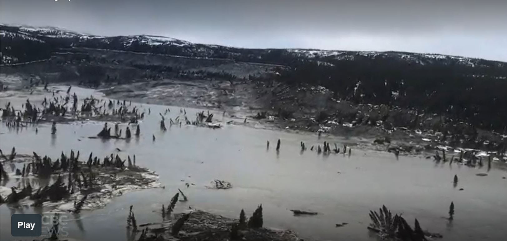
On 22 April 2021 a very large landslide occurred on the Great Whale River, upstream from the upstream of the villages of Kuujjuaraapik and Whapmagoostui in Quebec, Canada. Nunatsiaq News has this dramatic image of the landslide:-
The 22 April 2021 landslide on the Great Whale River in Quebec, Canada. Image by the Whapmagoostui First Nation, via Nunatsiaq News.
.
The landslide is located at 55.298, -77.638. It is clearly visible on the Planet Labs image taken on 23 April 2021:-
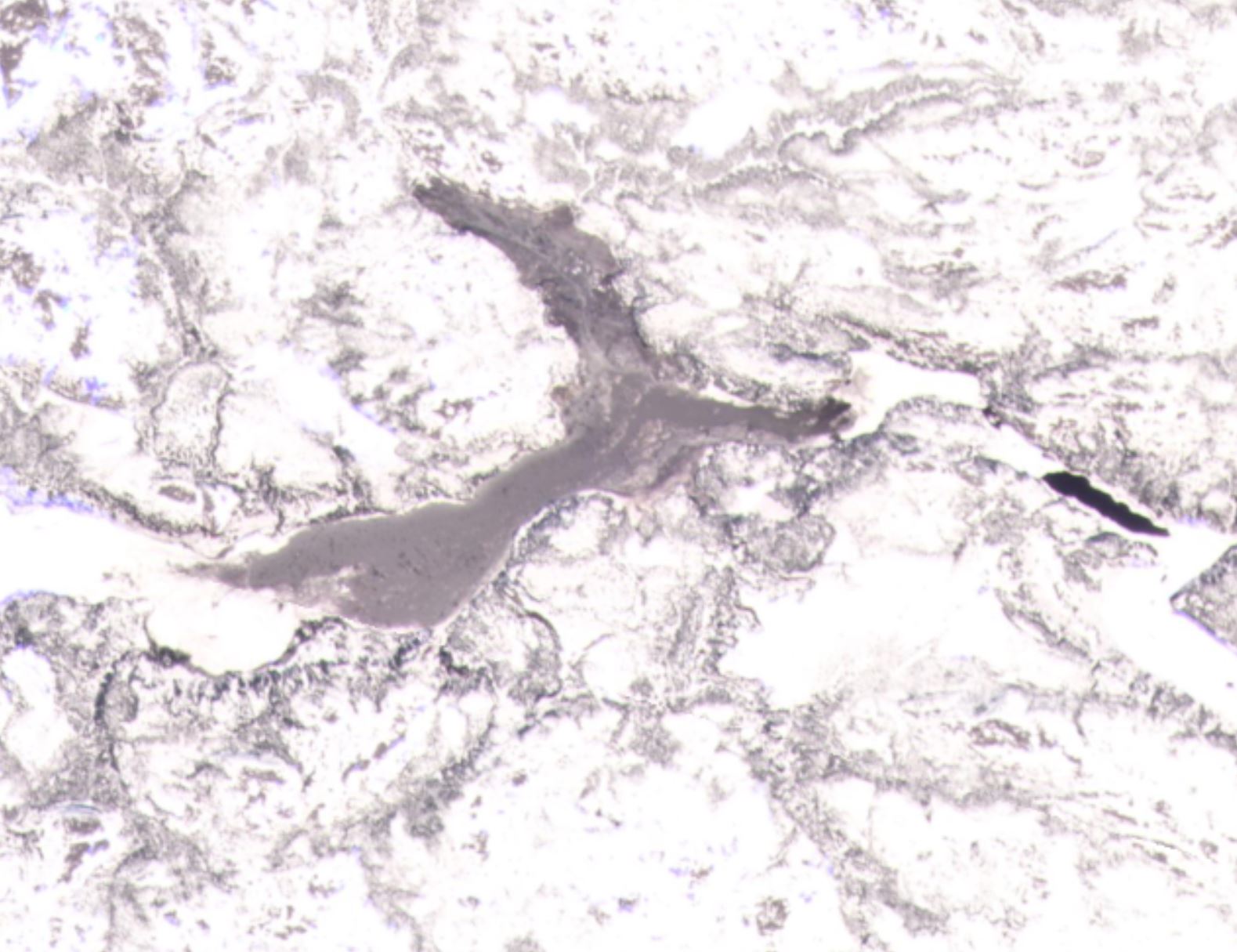
Planet Labs image of the landslide on the Great Whale River. Image copyright Planet Labs, used with permission.
.
The slide is large – from the crown to the channel it is about 1.6 km, and from the crown to the toe it is about 4 km.
The landslide is not thought to pose a direct threat to the communities downstream, fortunately, although there is some risk to users of the river as break-up of the ice is now unpredictable.
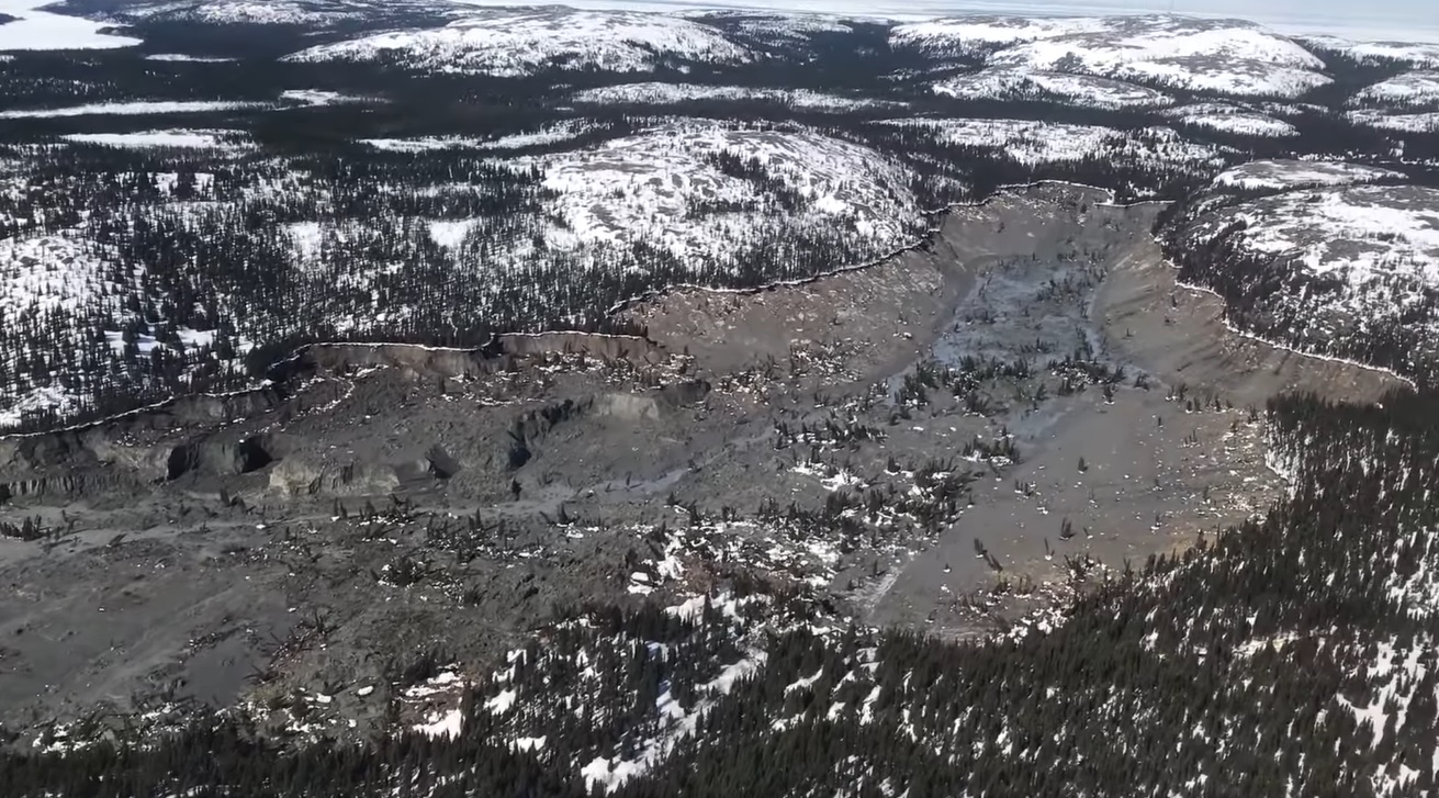
The news reports describes this as having occurred in an area of clay. The form of the landslide suggests that it could be a quick clay / sensitive clay failure. CBC has a splendid video shot from a helicopter that flew the length of the landslide. This is a still from that video:-
The landslide on the Great Whale River. Still from a video posted by CBC.
.
The video suggests that the downstream deposit is highly liquid mud with rafts of trees. Note that many are still standing upright. This is indicative of a quick clay landslide. The landslide itself appears to be quite deep-seated, probably reflecting a thick clay deposit. This implies that the volume of the landslide on the Great Whale River is likely to be in the millions of cubic metres.
There is little information as to the likely trigger at this point, but large landslides often occur in the spring as melt occurs.
.
Reference
Planet Team (2021). Planet Application Program Interface: In Space for Life on Earth. San Francisco, CA. https://www.planet.com/
 Dave Petley is the Vice-Chancellor of the University of Hull in the United Kingdom. His blog provides commentary and analysis of landslide events occurring worldwide, including the landslides themselves, latest research, and conferences and meetings.
Wow! It looked huge but I didn’t realize the scale of it until the bottom picture. You state that there are rafts of trees and I kept looking at the picture and seeing broken stubs of trees/branches until I realized those were fully grown trees.
Is there anything that triggered the quick clay landslide?
Ask for tremor-faults and hydrology by wide time and erosion-faults perspective. There is a volcano and at least a “river-fissure” and/or a lahar. This could also contain chemical explaining, hereby a comparative answer wether to evacuate or guard. They live in the middle is also an interesting comparative point. What is looking a volcano field may be there too. This can change the behaviour still looking the same upon. What I also remember is the local and surrounding cracks, deep though. Sorry if my info is old or wrong. Perhaps my work has a report.
The upper reaches of the slide shown in the CBC article look like they evacuated (50-70m?) down to bedrock. Topo suggests a broad glacially excavated valley that was later backfilled w/the deposits that just now failed. This will be an interesting one to follow up on in several months.