1 February 2021
Rat Creek: a large washout generated by an atmospheric river in California
Posted by Dave Petley
Rat Creek: a large washout generated by an atmospheric river in California
Last week a large atmospheric river rainfall event struck California. It dumped large amounts of rainfall on several of the large areas affected by the terrible 2020 wildfire season. As I have noted previously, heavy rainfall shortly after a wildfire is a recipe for damaging mudflows. This time was no exception.
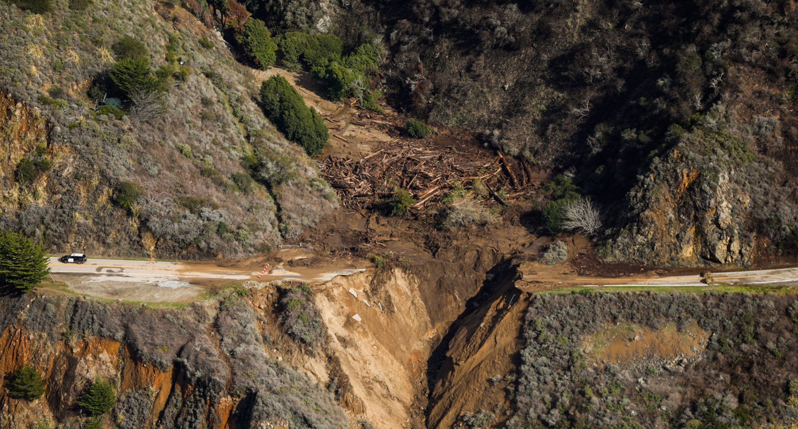
The most dramatic event occurred at Rat Creek in the Big Sur, on State Highway 1 between San Francisco and Los Angeles. The best image that I have found of this event is this one:-

The washout at Rat Creek on State Highway 1 in California. Image published by the San Francisco Chronicle.
.
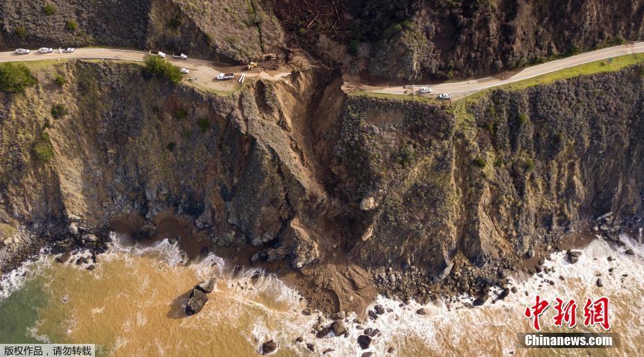
China News has also published a good overview of the washout:-

Overview of the washout at Rat Creek in California. Image published by China News.
.
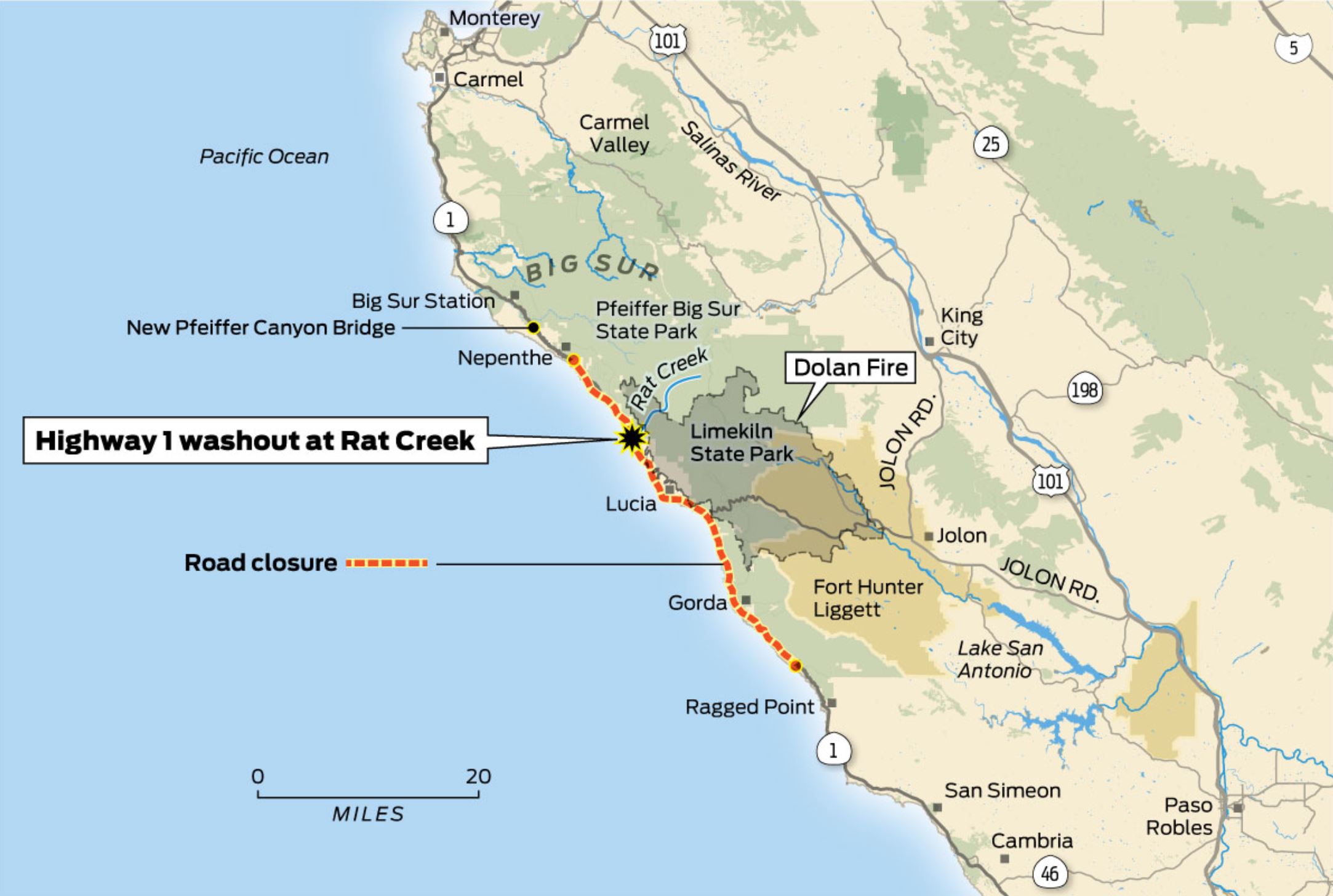
The San Francisco Chronicle has a really high quality pictorial explanation for the washout at Rat Creek. Upstream of the site of the washout is a large area burnt by the fire:-

The location of the washout at Rat Creek. Map published by the San Francisco Chronicle.
.
The Dolan Fire burnt an area of about 52,000 hectares, starting on 18 August 2020. It burnt for many weeks; on 8 September 2020 15 firefighters were severely injured whilst fighting the fire. There is a high probability that the fire was started deliberately. As the map above shows, Rat Creek drains an area partially burnt by the fire. The images of the aftermath of the washout show large volumes of timber, which would be as expected for a post-wildfire mudflow.
Of course the amount of overland flow generated in wildfire areas means that the gully will have dealt with a larger than normal volume of flow, with a higher density, generating the unusual level of erosion. The road bed was on erodible material, possibly weathered rock and some fill?
The road will be closed to allow repairs to be completed. No estimate has yet been provided as to how long this will last.


 Dave Petley is the Vice-Chancellor of the University of Hull in the United Kingdom. His blog provides commentary and analysis of landslide events occurring worldwide, including the landslides themselves, latest research, and conferences and meetings.
In the second picture, it looks like there are large cracks to the left of the slide – below the road, but also one above it. But when I look back at the top, it looks like an older runoff area. Would these be weak areas they have to watch out for while repairing the road?
The roadbed was completely fill, with a culvert that likely got plugged. The first image of this post shows the area behind the roadway filled in with debris. See the link at the bottom for a Google Map image.
Coordinates of washout:
36.092174, -121.618570
Link with Google Maps images :
https://imgur.com/a/ZsZeuDK
Dear all,
The consequences are visible owing to Sentinel-2 images acquired on 29 January.
On this 3D animation, I also added images relative to the wildfire for outreach purpose: https://www.sentinelvision.eu/hyperlook/4299ab82ce3446d38caa55560f7ee54b
I’ll give it a try in radar, next ascending and descending Sentinel-1 acquisitions should both happen on Wednesday.
Guillaume Aurel
Cal Trans drone video at https://twitter.com/hashtag/Hwy1?src=hashtag_click
If you check the footprint of the Marble Cone and Kirk Fires, you will see an overlap with the Dolan Fire. This area is prone to high fire frequency.
PS: Page 6 of the report indicates that 57% of this small watershed had a Moderate to High burn intensity and flows were expected to increase by appx. 250% (increase from 12 to 29 cfs). Even if the culvert had been designed for this, it would take a bridge to pass the logs visible in the photo.
Roads can often be dipped and armored on the downhill side to accommodate blockage and overflow events such as this, but the steep slope below the road makes this infeasible.