
23 June 2020
The Gjerrild Klint landslide on the east coast of Jutland, Denmark
Posted by Dave Petley
The Gjerrild Klint landslide on the east coast of Jutland, Denmark
Guest post by Gregor Luetzenburg, Kristian Svennevig & Marie Keiding
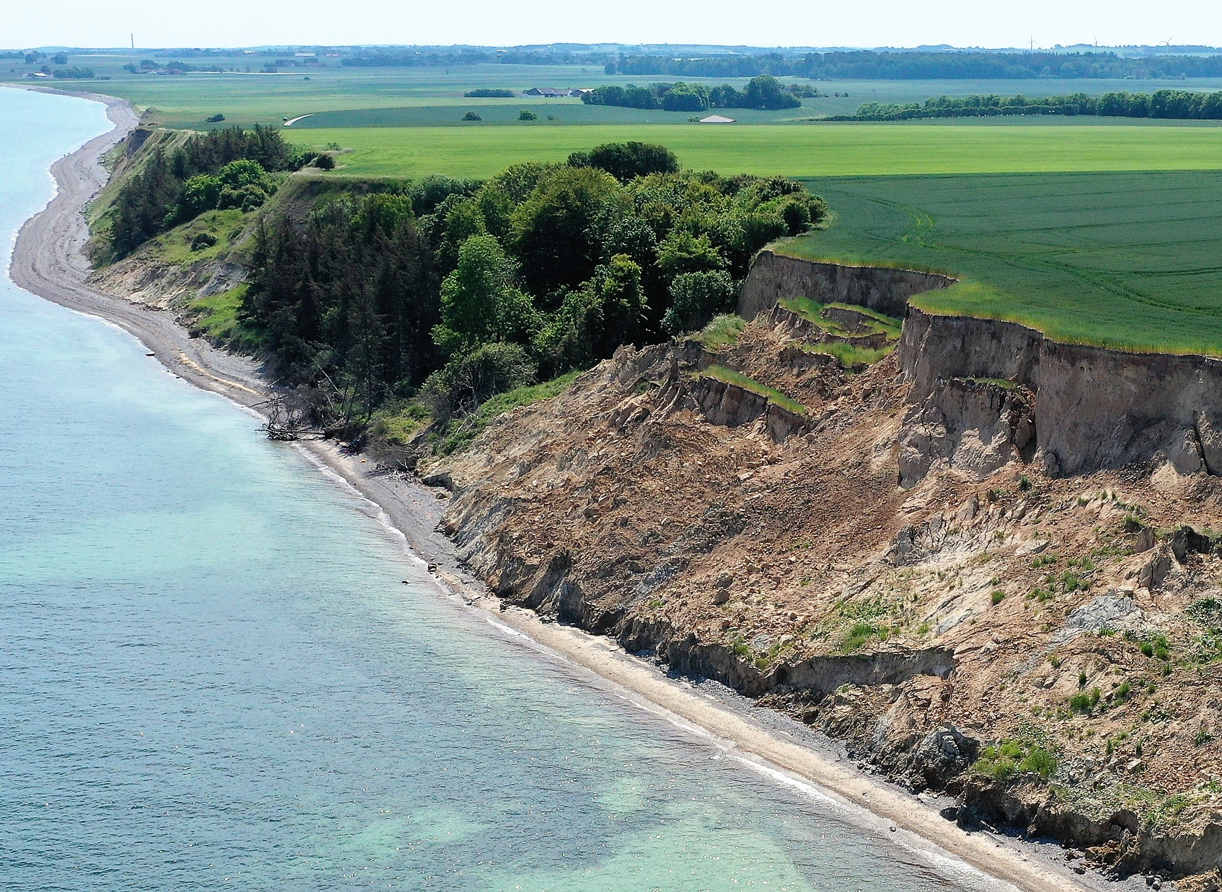
Overview of the Gjerrild Klint landslide. The cliff is around 25 m high. Older vegetated, but still active, landslides can be seen in the background. Photo: Kristian Svennevig
.
Researchers from the University of Copenhagen and the Geological Survey of Denmark and Greenland were recently informed about a landslide at Gjerrild Klint at the Danish Kattegat coast north of the City of Aarhus (56.513 N, 10.865 E). Based on observations made in PlanetScope and Sentinel 2 scenes, the landslide most probably occurred at the beginning of March 2020, but was first discovered and reported by locals about three months later. A period of unusually low precipitation from March to June 2020 preserved most of the distinct young morphological features in the soft glacial till, such as pinnacles on the main body of the slide.
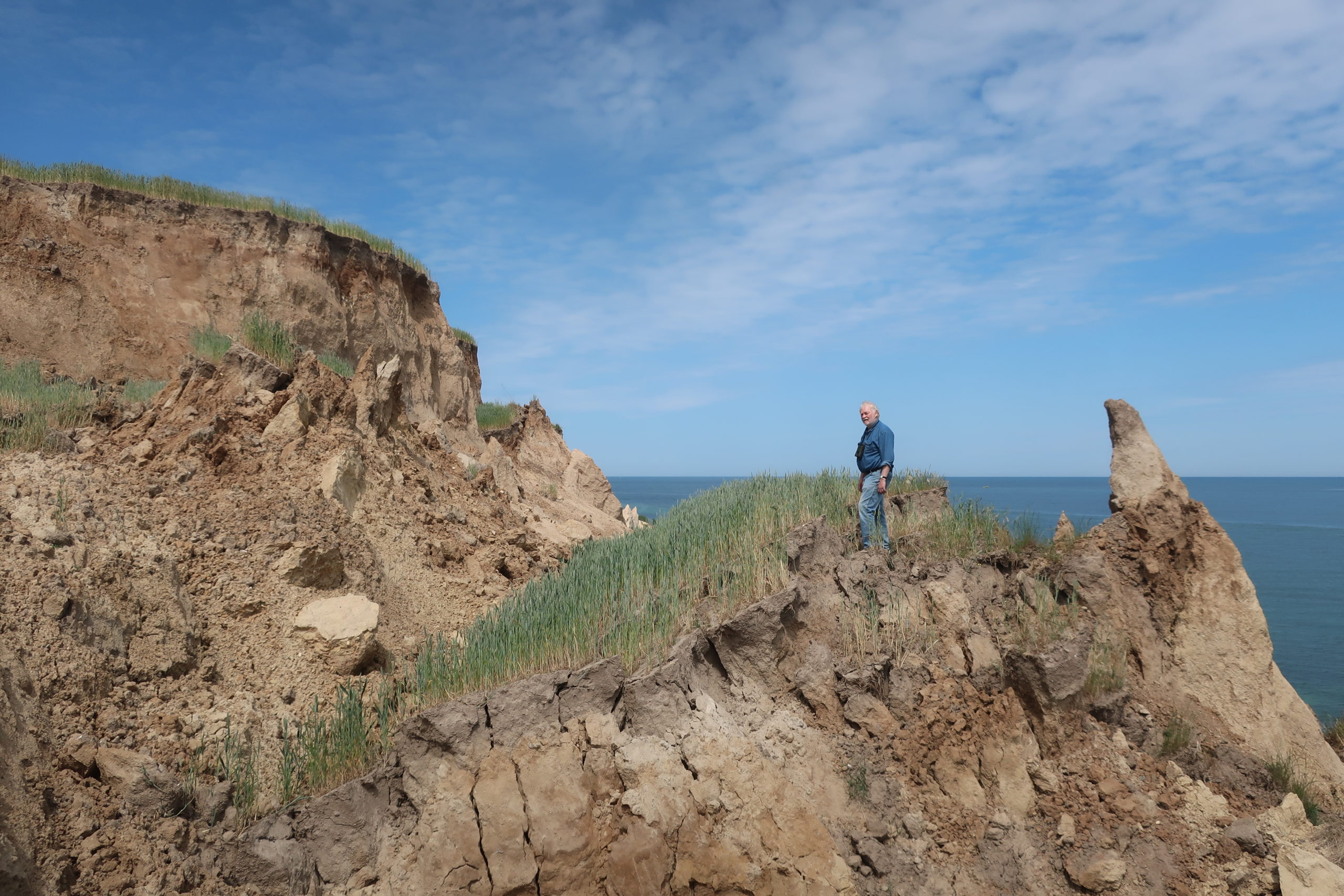
Interior hummocky morphology of the slide with pinnacles and displaced, rotated blocks at the head of the slide. Photo: Kristian Svennevig
.
Landslides occur regularly in Denmark, but fortunately most occur as earth slides and flows along the sparsely populated coastline, and thus do not lead to fatalities. Most damage reported is to holiday homes, which are common along the coast. This specific landslide is a good opportunity for us to investigate the complex interplay of geology, hydrology, climate, wave erosion and land use leading to slope failure.
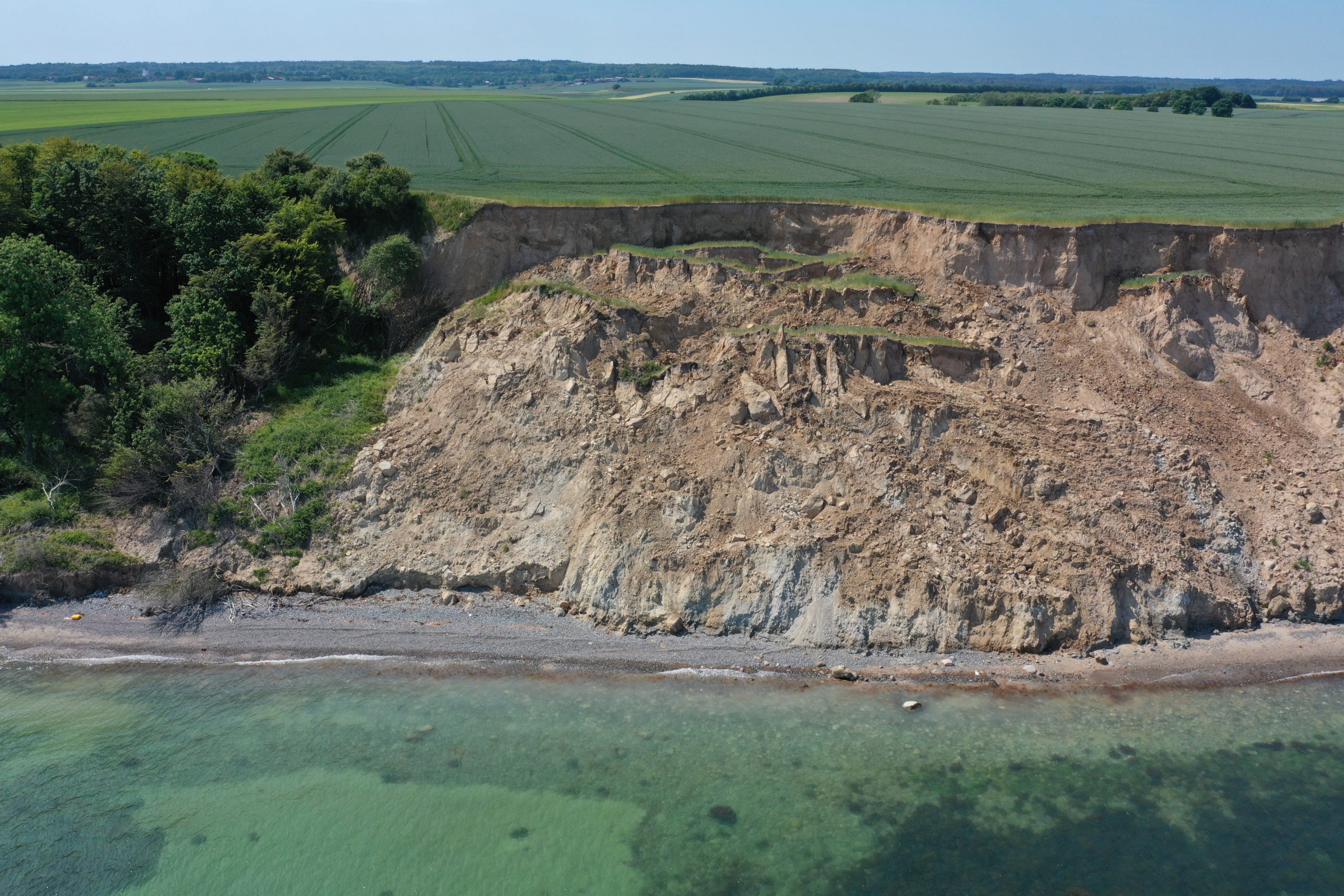
Frontal view of the Gjerrild Klint slide illustrating the main features of a rotational coastal landslide. Photo: Kristian Svennevig
.
The area covered by the landslide is around 2,500 m² (70 x 35 m). The height of the cliffs on the coast is around 25 m. Having the shape of a textbook landslide, the Gjerrild Klint landslide features the main characteristics of a rotational landslide. A clearly definable crown at the top of the cliff with smaller crown cracks covered by the surrounding crops can be observed. The head of the slide, beneath the main scarp, is characterized by parallel displaced and rotated blocks with minor scarps in between. At these blocks the topsoil is still intact allowing the remaining crops to continue to grow.
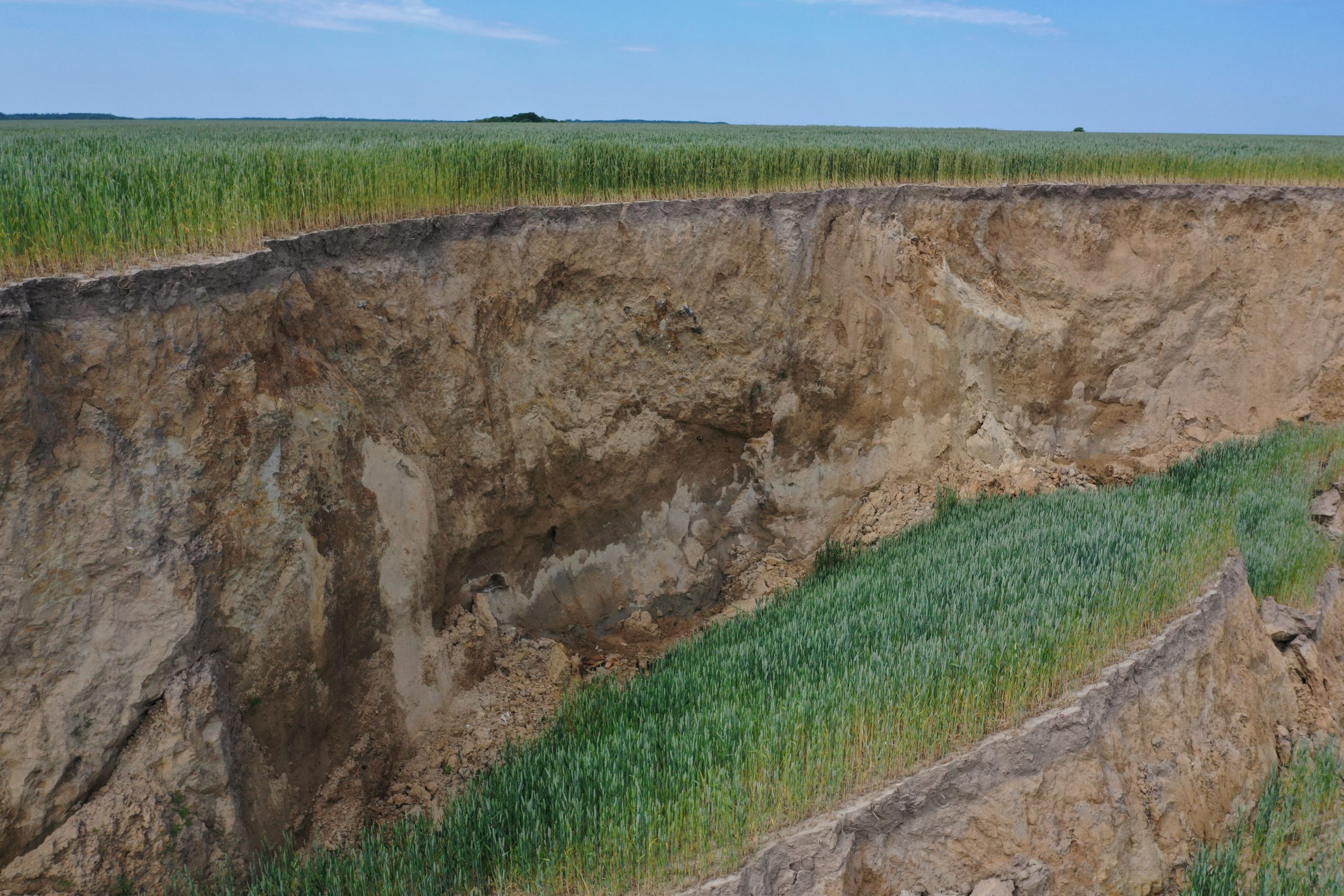
The main scarp of the slide with water seeping out of the soil. The scarp is around 5 m high here. Photo: Kristian Svennevig
.
Water supply to the slide is increased by the broken artificial drainage system of the overlying cultivated field. However, drainage of the slide’s surface is poor leading to ponding in the back-tilted areas. Further down, the slide shows minor scarps and transverse cracks. At the foot of the slide, waves have already started to erode the toe. Uplifted beach deposits can be seen demonstrating the rotational process of movement of the slide. Several minor toe collapse slides can be observed as well.
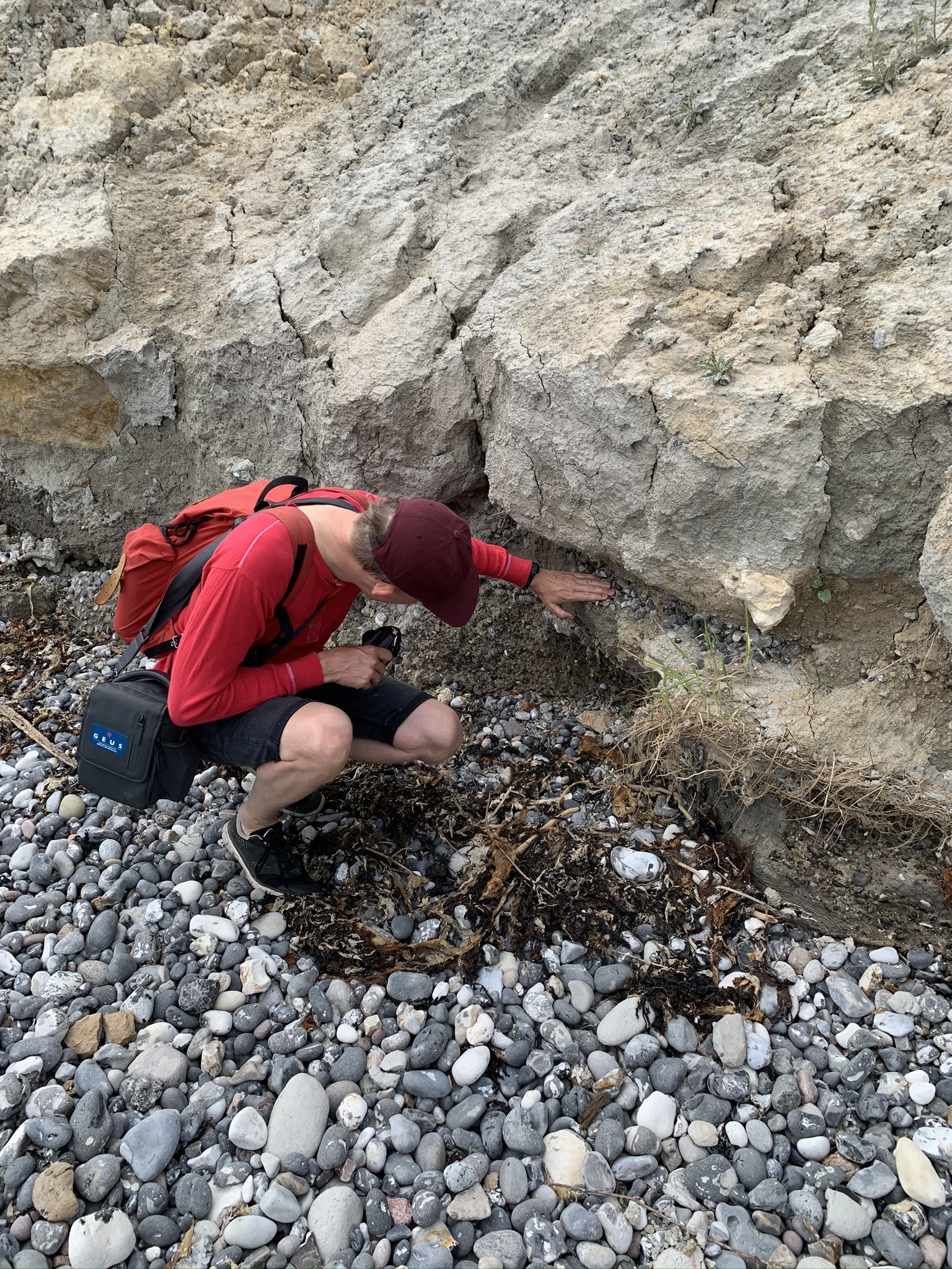
Uplifted layers of beach gravels (at the hand) in the toe of the slide, indicating a rotational movement. Photo: Gregor Luetzenburg
.
The cliff at Gjerrild Klint consists of alternating layers of glacial till and clay and several older vegetated slides can be seen next to the new one. This indicates that the Gjerrild Klint slide is one of many in a long sequence of rotational slides, forming the local coastline by occasional but consecutive mass movements. The main conditioning factor here is probably a local glaciolacustrine clay unit located just at sea level and observed in the slide toe on several places, probably acting as the sliding plane. Intense agricultural land use and manmade drainage systems may further precondition landslide processes, by redirecting the naturally vertical flow of water laterally towards the cliff. Moreover, wave erosion at the toe of the cliff is constantly removing material, destabilising the prevailing equilibrium. February 2020 provided optimal conditions for triggering the landslide with 103 mm of precipitation during the month in the area of the Gjerrild Klint landslide – a record for the highest amount of rainfall since the beginning of the measurements in 1874. The slide was thus most probably activated by water infiltration into the glaciolacustrine clay reducing the friction. Shifting towards a surge in weather extremes and rising sea levels under a warming climate, Denmark is likely to experience an increase in this type of landslide activity in the next years and decades.
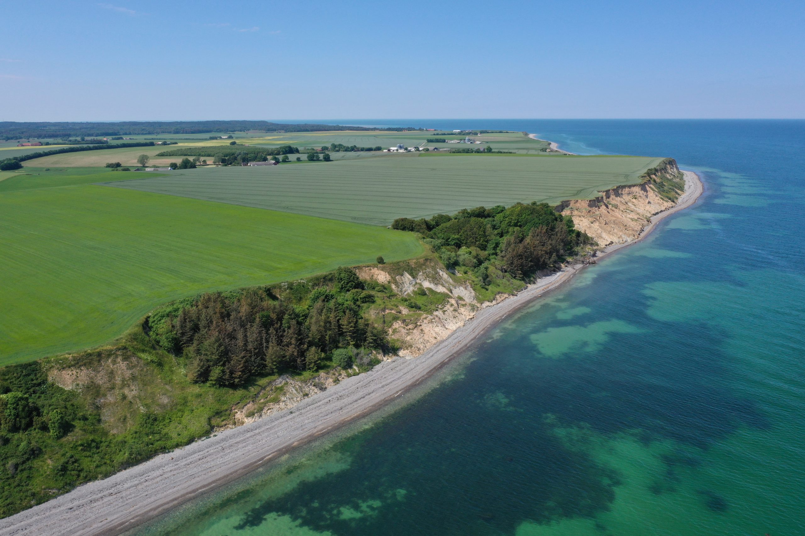
The Gjerrild Klint coastline with a sequence of landslides. Photo: Kristian Svennevig
.
On reflection 1: Recent landslides in Darjeeling
The wonderful Save the Hills blog has a good post about landslides triggered by heavy rainfall on 11 – 13 June 2020 in Darjeeling, highlighting the role of humans in increasing landslide susceptibility in this area.
.
On reflection 2: The summer monsoon is rapidly developing across South Asia
As the rainy season gets under way across South Asia, landslides are starting to inflict losses. In the last day or so three people (including two children) were killed in a landslide in Sikkim in India, three people were killed in a landslide in Palpa in Nepal and cross-border trade between Tibet and Nepal has been halted by landslides near to Tatopani.
 Dave Petley is the Vice-Chancellor of the University of Hull in the United Kingdom. His blog provides commentary and analysis of landslide events occurring worldwide, including the landslides themselves, latest research, and conferences and meetings.
Looks like that Denmark coast has problems: ‘Soft’ shore, outside Skand isostatic rebound zone, sea-levels rising, plus vulnerable to base instability due rain-storms…
I saw this on the Wunderground Cat6 blog. I don’t know how else to send to you.
https://twitter.com/Weather_West/status/1275922742672420864/photo/1?ref_src=twsrc%5Etfw%7Ctwcamp%5Etweetembed%7Ctwterm%5E1275922742672420864%7Ctwgr%5E&ref_url=https%3A%2F%2Fdisqus.com%2Fembed%2Fcomments%2F%3Fbase%3Ddefaultf%3Dwundt_i%3Dwww2Fcat62Fcategory-6-sets-its-sights-over-the-rainbowt_u%3Dhttps3A2F2Fwww.wunderground.com2Fcat62Fcategory-6-sets-its-sights-over-the-rainbowt_e%3DCategory20620Sets20Its20Sights20Over20the20Rainbowt_d%3DCategory20620Sets20Its20Sights20Over20the20Rainbowt_t%3DCategory20620Sets20Its20Sights20Over20the20Rainbows_o%3Ddefaultversion%3D1799fdfd5fbe62e18668aa208e73c21f