4 February 2019
The speed of the Brumadinho tailings dam landslide
Posted by Dave Petley
The speed of the Brumadinho tailings dam landslide
The two important videos showing the Brumadinho tailings dam landslide allow some estimates to be made of the speed of the movement. Both videos are time-stamped, allowing some parameters to be deduced.
The video showing the collapse itself is available here:-
.
The failure process is first visible at 12:28:25:-
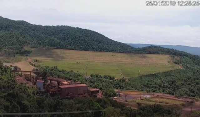
The initiation of the failure that generated the Brumadinho tailings dam landslide. Still from a Youtube video.
.
Incidentally, I have seen some suggestion that the failure initiated at the toe. I see no evidence for this in the video, as the image above shows. The dark line at the crest of the dam is the first sign of the rear scarp opening as the main portion of the dam subsides. There is no obvious failure event in the toe at this point (though it was undoubtedly moving):-
The still below shows the front of the Brumadinho tailings dam landslide / debris avalanche reaching a fairly distinctive structure below the dam:-
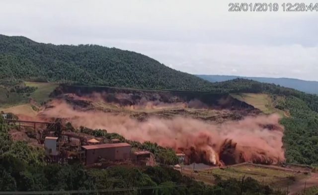
The passage of the Brumadinho tailings dam landslide. Still from a Youtube video.
.
This structure can be clearly seen in the Google Earth image below:-
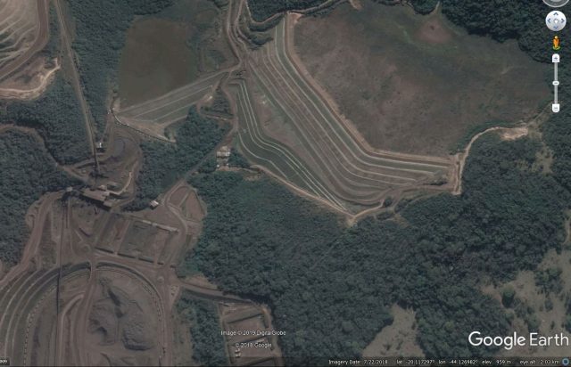
Google Earth image of the location of the Brumadinho tailings dam landslide
.
The distance from the toe of the dam to this point is about 300 metres, the imagery suggests that the landslide covered this distance in about 9 seconds, giving a velocity at this point of about 33 m/sec, or about 120 km/h. This is a very rapid acceleration, suggesting extremely rapid weakening of the debris mass. This seems to point to a liquefaction mechanism.
The next video shows the front of the flow arriving in the processing area below the dam. This is the video:-
.
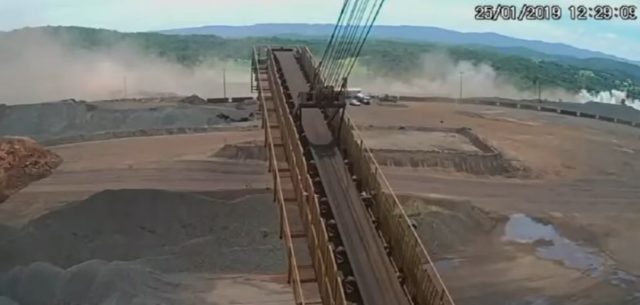
The arrival of the Brumadinho tailings dam landslide at the processing plant. Still from a Youtube video.
.
This site can also be clearly seen in the Google Earth imagery:-
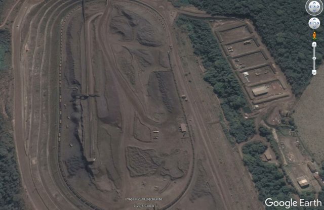
Google Earth image of the location of the processing plant shown in the Brumadinho tailings dam landslide video.
.
The direct line distance from the structure below the dam considered above is about 460 m (total distance from the dam toe is about 760 m), and the time stamp is 12:29:09. Thus, in this second phase the landslide traveled 460 m in the time between 12:28:44 and 12:29:09, i.e. 25 seconds. This indicates an average velocity of about 18.4 m/sec, or 66 km/h. Thus, this was still a very rapid landslide, although as the video shows it had slowed appreciably by this point. The structure of the landslide mass at this point is quite interesting, as the still below shows:-
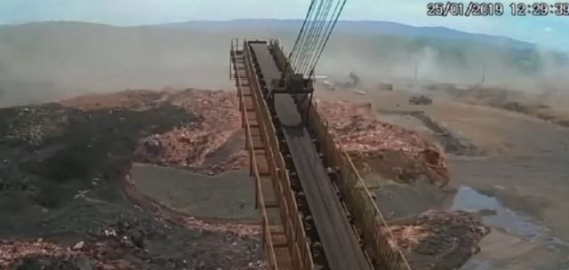
The structure of the Brumadinho tailings dam landslide at the processing plant. Still from a Youtube video.
.
The red mass is undoubtedly the tailings, whilst the grey is probably the remains of the starter embankment (and perhaps other embankments) at the toe. If so the deposit has remained well segregated, which may tell us something about the failure process.
There has been a lot of speculation in the media about the activities of the people who were on the dam at the time of the failure. Vale has released a statement saying that they were undertaking routine work:
“In the specific case of the footage broadcast by the media on Friday (01/02), which showed the exact moment when the Dam I breached at the Córrego do Feijão mine in Brumadinho, the professionals who appear in the footage in the dam area were performing routine tasks. One of the activities performed included the collection of data for compliance with legal requirements, as determined by the Brazilian Mining Agency. It is important to highlight that no construction works were being carried out at Dam I.”
The footage suggests that this is true. There does appear to be some coring activity though, with the rig being visible on the footage:-
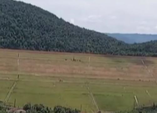
Possible coring activity prior to the initiation of the Brumadinho tailings dam landslide. Still from a Youtube video.
.
And there is an article online that describes the experiences of the operator of this rig (who, amazingly, survived the landslide, though his colleagues did not). This includes this image of the equipment on the dam:
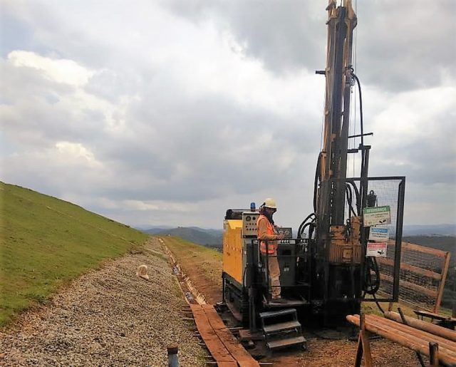
A coring rig on the tailings dam at Brumadinho. Photo: Arquivo personal / Lieuzo Luiz dos Santos, via Globo.
.
Apparently, this was being used as follows:-
“The drilling is responsible for drilling and monitoring the movement of dams. On the day of the tragedy, Lieuzo had just drilled to install a gauge that would gauge the pressure of the dam.”
I am reminded of the Rissa quick clay landslide in Norway in April 1978. Famously, this landslide of about 5 million cubic metres was triggered by a farmer undertaking a small excavation of a pit as part of the construction of a new barn. Is it possible that this landslide was so close to failure that minor disturbance from the drilling triggered a runaway liquefaction event, and thus the collapse? If so this of course would not the fault of the individuals operating the equipment, it would simply be the straw the broke the camel’s back.


 Dave Petley is the Vice-Chancellor of the University of Hull in the United Kingdom. His blog provides commentary and analysis of landslide events occurring worldwide, including the landslides themselves, latest research, and conferences and meetings.
Hi Dave,
Thanks for the update on this terrible failure.
Do you have any thoughts on the events on the background of the second video? There are both clouds of dust in the valley(?) behind the foreground, progressing to the right, with quite a few damages on the edge of the foreground. Looks like parts of the landslide already hade moved through the image field of view before the clip stared.
Movements of some of the train carriages may show other mass movements from the right side of the image in the reverse direction than the visible mass.
Looking at the video of the initial collapse again, it’s deeply disturbing to see the workers running for their lives on the face of the dam near the toe, as well as those on the small structures downstream, with all overcome by the wave.
Here’s the original video screencaptured in the link abiove: https://www.youtube.com/watch?v=q_T2PnYErGA
The GoogleEarth image shows clearly two distinct tailings structures. A portion of the original design is visible to the left of the failed dam.
I am a mining engineer and have study tailings dam construction.
I believe an expansion/addition was placed on top of an original structure. The original design would not have incorporated such additional loading and mining co’s do not over-build by much (ie small safety factor in load design). A cursory review of the original design shortcoming would be “cured” by the significant (flat zone visible from above ) setback of the second tier.
The large over-pressure on the original tails would push on the clay-capped toe like toothpaste in a tube and the cap was the lower structure. The compacted, dry, heavy clay would act much like a projectile.
The reddish colored material would be dam construction material while the dark material would be tails. The compacted clay-based dam material would be considered impermeable and I believe it would tend to stay consolidated. The saturated tails from iron-ore is much heavier than the dry dam material so mixing would be less likely. I believe the much less dense dam material would essentially float forming a debris front.
[Are you sure? Take a look at these images of the Samarco failure: https://blogs.agu.org/landslideblog/2015/11/08/samarco-1/ The dam appears to be the grey material and the tailings are the red, iron-stained fines. D]
More velocity estimation: It would be good to find an earlier portion of the conveyor belt video because there is a rapidly moving dust cloud at the far right of the image that looks to be the head of the flow appx. 500 feet south of the the location of the “Google Earth” stamp in your processing plant image above. More facility buildings there based on the apparent field of view from the conveyor camera.
PS: look at the 7-21-18 Google photo and you will see what appears to be a dry pond northeast of the drill rig at the head of the future failure. 10-10-17 Google photo shows standing water clearly. I also note that there is no sidehill access road for the rig in the latest photo.
PPS: In that regard – All the scattered brush visible in the latest Google photo is gone and replaced with a uniform grass cover in the failure video. The earlier face was relatively smooth, but many parallel sidehill benches are visible on the face below the rig in the video indicating this area had been regraded and seeded w/ grass for erosion control prior to failure.
More on grading: the brush and pond I mentioned earlier are actually growing on the flat surface of the tailings pond at the time the photos was taken. Back up in time w/the photos and this will become evident.
However, I cannot reconcile the appearance of the tailings retention structure in the recent video, and the latest July 2018 Google photo. It appears to me in the video that the drill rig was working at the top of a relatively continuous, graded, benched surface that sloped up from the base of the dam, extending to the tree line along the hill-front.
However, this tree line appears to be different in the older Google photo, as are access roads and other landmarks along either margin. It suggests to me that the height of the structure was increased significantly over a short period of time by backfilling and facing the entire area until they ran out of room at the hillside at the rear.
Dave, my comment wasn’t clear. The initial surge of reddish material seems to be clay cap but yes, the thick reddish paste in later shots is iron tails. A later picture shows definite stratification with a thinner layer of black material on top the red tails.
Perhaps the black material is tails (slimes) from the agglomeration plant associated with the dam.
VALE SA is not on Toronto exchange so there is no NI 43-101 for the operation.
Typical taconite requires High-Pressure Grind to achieve a P80 of 500 screen mesh US. That particle size 0.025mm is roughly 1/3 the size for gold tailings so this is why I believe the event is an extrusion/blow-out.
Using valley fill for iron tails without paste-thickening those tails is a recipe for disaster.