24 February 2018
Pasir Panjang: a major flow type landslide in Indonesia on 22nd February
Posted by Dave Petley
Pasir Panjang: a major flow type landslide in Indonesia on 22nd February
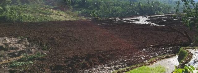
On 22nd February 2018 a major landslide struck the village of Pasir Panjang in Brebes in Indonesia. The landslide, which was triggered by heavy rainfall, flowed from a steep upland catchment onto farmland on the lower slopes. The latest reports (in Indonesian) suggest that seven people are known to have died, with 13 still missing. Five people were rescued with injuries. Images of the landslide suggest that this was a flow type landslide in deeply weather soils and regolith:-

The lower sections of the Pasir Panjang landslide in Brebes, Indonesia on 22nd February 2018. Image via The Watchers.
.
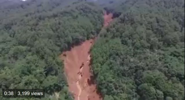
I would note that many of the images of the landslide have shown previous events in Indonesia and elsewhere. The best imagery that I have seen of the landslide is in the form of two tweets from Sutopo Purwo Nugroho, who is the spokesman of BNPB, which I believe is the National Board for Disaster Countermeasures, the Indonesian board for natural disaster affairs. In one tweet he included a drone video of the upper reaches of the landslide. Unfortunately I cannot embed this, but it worth a look. The accompanying text explains that the landslide was nothing to do with “illegal logging, deforestation and land conversion”. This is a still from the video:

The upper reaches of the Pasir Panjang landslide. Still from a drone video tweeted by Sutopo Purwo Nugroho.
.
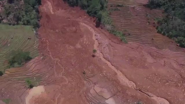
The drone video of the lower sections shows that the flow spread across the farmland once it emerged from the channel:

The lower reaches of the Pasir Panjang landslide in Indonesia. Still from a video tweeted by Sutopo Purwo Nugroho.
.
What will be interesting is to see the event (or events) that triggered this flow high on the channel. The landslide appears to have been channelised and to have entrained large amounts of debris from within the channel, so the initial event may have been quite small. Sadly, the prospects for those missing are not good.


 Dave Petley is the Vice-Chancellor of the University of Hull in the United Kingdom. His blog provides commentary and analysis of landslide events occurring worldwide, including the landslides themselves, latest research, and conferences and meetings.