13 November 2017
The M=7.3 Halabjah earthquake in Iraq and Iran: potential landslides
Posted by Dave Petley
The M=7.3 Halabjah earthquake in Iraq and Iran: potential landslides
The M=7.3 Halabjah earthquake in Iraq and Iran yesterday occurred at an estimated depth of 23.2 km, according to the USGS. An event of this magnitude and at this depth has the potential to generate significant numbers of landslides if the topography is available. As the region affected by the most intense shaking is very remote, reports will take some time to emerge, but some early reports indicate that they have occurred. Thus, for example, Xinhua reports that:
Four people were killed and nearly 50 others injured by the damage of the houses, in addition to a landslide in a mountain adjacent to the Darbandikhan Dam, according to the report.
Whilst Sky News reports that:
The quake triggered landslides in the mountainous region along the Iran-Iraq border, also destroying buildings, shattering windows and sending people running for safety.
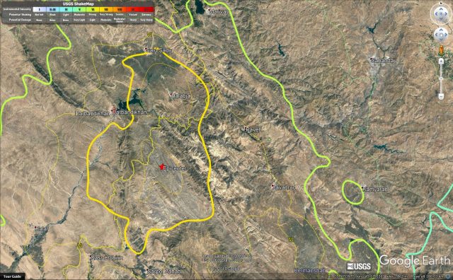
The Google Earth image below displays the USGS intensity contours on the terrain, and I have also highlighted the location of the Darbandikhan Dam:

Google Earth image that overlays the USGS intensity contours over the terrain for the M=7.3 Halabjah earthquake
.
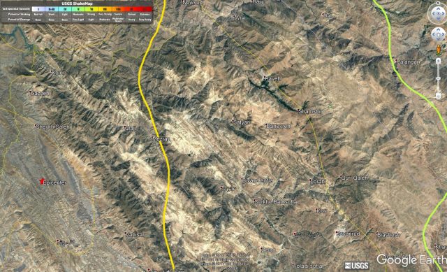
The Google Earth imagery certainly suggests that landslides are possible for this event, and it would be unsurprising to find multiple slips on cut slopes, especially on poorly engineered roads in the mountains. The area to the east of the epicentre, shown below, looks particularly susceptible:-

Google Earth imagery of the area east of the epicentre of the Halabjah earthquake
.
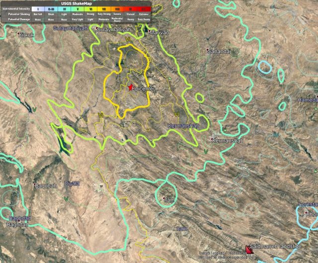
However, at this stage it is very difficult to know what will have happened in terms of landslides. The first is that the landslide consequence of a an oblique-thrust faulting event is not obvious to me; much will depend on the peak ground accelerations observed across the landscape. The second is that we have few records of the ways in which earthquakes in very arid mountain areas trigger landslides. In some previous events, such as the Sierra Cucapah earthquake in Mexico in 2010, landslide initiation was surprisingly low. On the other hand, the event yesterday was only 250 km from the extraordinary Saidmareh landslide, one of the largest known failures on the planet, and which is likely to have been triggered by a previous earthquake (see image below). The likelihood of such a landslide in this earthquake is very low, but it does illustrate the uncertainties in terms of the landslide distribution that we may observe.

Google Earth image showing the location of the Saidmareh landslide in Iraq relative to the Halabjah earthquake in Iraq
The first satellite images of the area affected by the earthquake are likely to be collected today, so within a couple of days we should start to get an idea of the impacts.


 Dave Petley is the Vice-Chancellor of the University of Hull in the United Kingdom. His blog provides commentary and analysis of landslide events occurring worldwide, including the landslides themselves, latest research, and conferences and meetings.
Has there been any exposure dating on the Saidmareh slide?
[Not as far as I am aware. D]
Do not you know when the earthquakes are over?