8 March 2017
Bucium Hill in Romania – an interesting landslide problem on a major road
Posted by Dave Petley
Bucium Hill in Romania – an interesting landslide problem on a major road
A very interesting landslide problem has developed on the AA1 motorway at Bucium Hill in the Transylvanian hills of in Romania. This section of road, was built between April 2011 and November 2014, In includes a very substantial cutting through Bucium Hill, with then transitions into a major viaduct, as seen below (via Youtube):
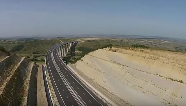
The cutting at Bucium Hill in Romania, via Youtube
.
Instability quickly developed in the slopes of the embankment, and the road was closed between September 2015 and October 2016. To deal with the problem the slope appears to have been successively regraded to a lower angle. The video below shows the site in September 2015 after substantial works on the north side of the road.
.
There is a series of these videos, from June 2016, December 2016 and February 2017. The most recent one, from last month, is embedded below:
.
This appears to show that the regraded slope is undergoing substantial deformation, and when compared with the video from December 2016 it appears that there has been considerable recent movement. There appear to be multiple types of landsliding occurring here. The most substantive movement appears to be occurring in the section shown below:
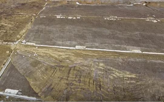
A section of deformed slope at Bucium Hill, via Youtube
.
This image captures the toe bulge of the landslide, driven by substantial deformation at the crest:
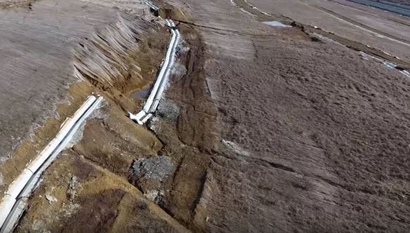
Slope deformation at Bucium Hill in Romania, via Youtube
.
Further along the slope there seems to be a much larger area of instability developing, albeit at an earlier stage:
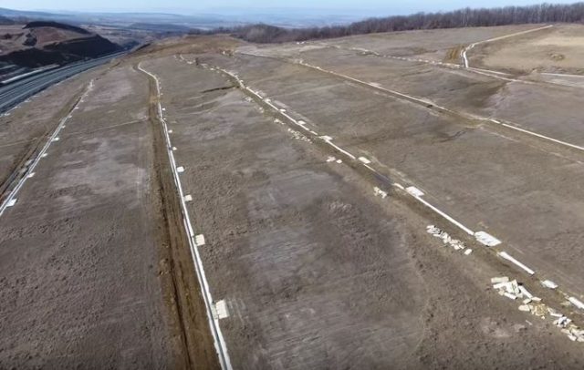
Possible signs of instability across the slope at Bucium Hill in Romania, via Youtube
.
These appear to be large, shallow failures in sandy materials. It is impossible to forecast behaviour without a detailed investigation of both the site and the materials – I assume that this is ongoing. It is slightly surprising to see no obvious signs of monitoring on the slope, but perhaps I have missed this. To my way of thinking, with major capital asset at the toe of the slope this is a site that deserved detailed investigation and observation.
I would welcome views and thoughts on the hazard, especially in light of how close some of the deformation appear to be to the edge of the road:
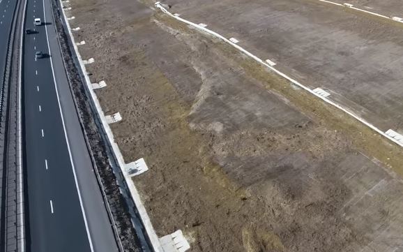
Deformation close to the edge of the road at Bucium Hill


 Dave Petley is the Vice-Chancellor of the University of Hull in the United Kingdom. His blog provides commentary and analysis of landslide events occurring worldwide, including the landslides themselves, latest research, and conferences and meetings.
Interesting. Did not realize that this could happen when you stop letting out water.
http://www.sfchronicle.com/bayarea/article/Riverbanks-collapse-after-Oroville-Dam-spillway-10976144.php
http://www.sfchronicle.com/bayarea/article/Riverbanks-collapse-after-Oroville-Dam-spillway-10976144.php
interesting
http://www.sfchronicle.com/bayarea/article/Riverbanks-collapse-after-Oroville-Dam-spillway-10976144.php
interesting
The conditions appear similar to what I frequently encountered in Sonoma Co., CA, where ANY level of remolding caused instability and displacement by either seepage, or rain. Of course, the flatter the slope, the deeper equipment traffic remolded the soil and rock. The plus for me was, I worked with some exceptionally good engineering geologists over about a 40-year period. [Never trust a silt.]
already some movements in 2012 and 2014 during excavation, extending between this period, as seen on google earth 45.818341°, 23.877799°, pretty close to the toe of the actual slope.
oups, during… looks like bas sediment anyway, possibly loess
last one, bad.