4 October 2016
The Sucun Village landslide in China and prospects for landslides in Haiti from Hurricane Matthew
Posted by Dave Petley
The Sucun Village landslide in China
On Wednesday of last week a major mass movement, the Sucun Village landslide, was triggered by rainfall brought by typhoon Megi in Zheiang Province, eastern China. The landslide was in part captured in a remarkable video, although the clarity of the images is not particularly high. The amount of dust that this landslide generated is quite interesting.
.
Interestingly, the second part of this news report also appears to have a video of the landslide from a different angle:
.
The best image of the Sucun Village landslide that I have seen is this one, from JSChina:
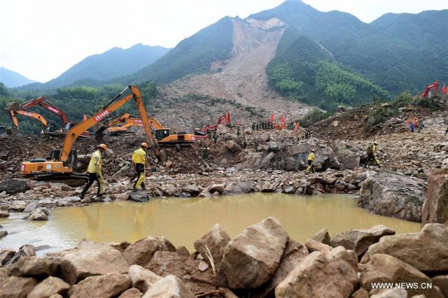
The Sucun Village landslide in Zhejiang Province, eastern China, via JSChina and English.news.cn
.
According to Xinhua:
“Rainstorms triggered by Typhoon Megi caused about 350,000 cubic meters of debris to slide down nearby mountains, burying 20 houses in Sucun Village, Suichang County on Wednesday. More than 1,460 residents living nearby have been evacuated.”
I tracked the location of the landslide down to 28.778 N, 119.300 E, a location that has an excellent Google Earth image from 2013:
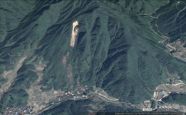
Google Earth image from 2013 showing the location of the Sucun village landslide in China
.
The key feature here needs no explanation of course – the site of the landslide had an active slide, perched high above the village, in 2013. Note the areas bare of vegetation between the slide and the town – close inspection suggests that these are areas of rockfall deposits. Note how close they are to the village:
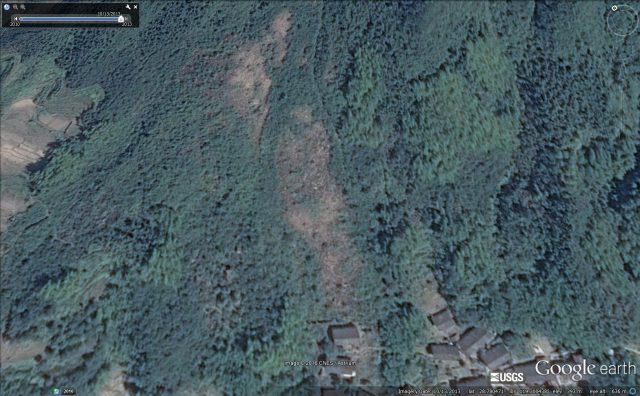
An area of colluvium above the village at the site of teh Sucun landslide in China
.
The most depressing aspect of this landslide is the obvious progression to failure that the images display. This is the Google Earth image from 2010 – compare it with the one three years later. It is clear that the slope had evolved considerably. This should have been a warning sign:
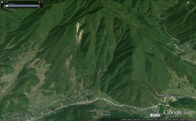
The location of the Sucun landslide in 2010 via Google Earth
.
This feels like a disaster that was avoidable.
Hurricane Matthew
On a similar note, I am deeply concerned about Haiti as it is struck by Hurricane Matthew. This large storm is a strong rainmaker. The biggest landslide disasters occur when tropical cyclones move slowly – and this one is doing exactly that:-
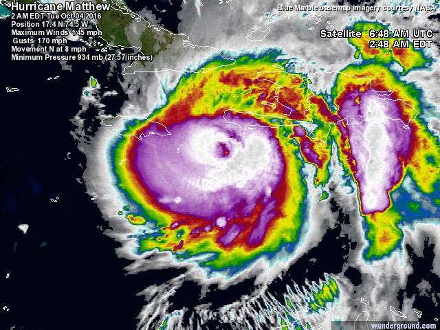
Satellite image of Hurricane Matthew, via Weather Underground
.
I blogged about the vulnerability of Haiti to hurricane rainfall right back in 2008. I wrote:
The landscape has little capacity to intercept and store water, and once flows across the surface begin the landscape rapidly erodes. The hills are clearly suffering from extreme deforestation. In September 2004, Hurricane Jeanne triggered mudslides and debris flows from these hills that killed over 3000 people in the city [of Gonaives]. Bearing in mind the fact that Haiti should be densely vegetated with tropical forest, the disaster that is the landscape in this country is all to clear to see. Unfortunately, posts about landslide disasters in Haiti will be a feature of this blog in the late summer for years to come.
Since then Haiti has suffered a major earthquake, and this is the first very extreme rainfall event since. The scene is set for a disaster, sadly.
Similar posts that might be of interest:
- Hurricane landslides in Haiti
- Deforestation, erosion and Cholera in Haiti
- Images of landslides triggered by the Haiti earthquake
- So just how bad was the debris flow at Barangay Andap during typhoon Bopha / Pablo ?
- Typhoon Bopha – a very real landslide threat for the Philippines
- Landslides in Japan from typhoon Talas
- Landslides from typhoon Megi in Taiwan


 Dave Petley is the Vice-Chancellor of the University of Hull in the United Kingdom. His blog provides commentary and analysis of landslide events occurring worldwide, including the landslides themselves, latest research, and conferences and meetings.
Interesting slide analysis!, A disaster can be avoided if you have a good study and knowledge of the area.