3 July 2016
Lamplugh Glacier rock avalanche: A massive new landslide in Alaska on Tuesday
Posted by Dave Petley
Lamplugh Glacier rock avalanche: A massive new rock landslide
The media in Alaska is reporting a find by a local pilot, Paul Swanstrom of Mountain Flying Service, of a huge new landslide, the Lamplugh Glacier rock avalanche, which occurred in Alaska on Tuesday. This is yet another enormous event in this area of North America – this is an image that he took of the landslide, which is posted on his company Facebook Page:
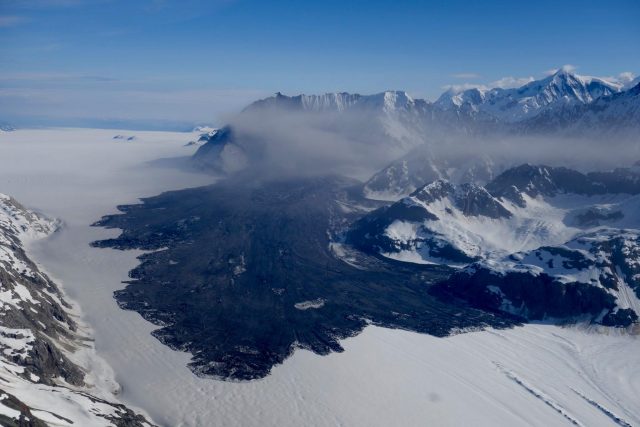
The Lamplugh Glacier rock avalanche via Paul Swanstrom
.
Paul estimates that the runout of the landslide is about 6 miles (i.e. about 10 km). In a KHNS Radio article about the landslide, Colin Stark of Colombia University estimates that the volume is about 150 million tonnes, presumably based upon an initial analysis of the seismic catalogue. The landslide appears to be recorded in the Alaska Earthquake Center catalogue as a M=2.9 event on 23rd June 2016 at 08:20 local time:
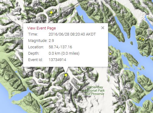
The Alaska Earthquake Center record of the possible seismic event generated by the Lamplugh Glacier rock avalanche
.
The landslide appears to be a very deep-seated, ridge crest to slope toe failure of unusually large proportions:
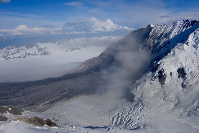
The source of the Lamplugh Glacier rock avalanche, via Paul Swanstrom
.
The landslide appears to have generated a highly mobile, broad and long landslide deposit on a comparatively low angled slope, probably consistent with flow of debris over an ice bed. The landslide has developed complex structures at the toe, probably associated with the final creeping stage of movement:
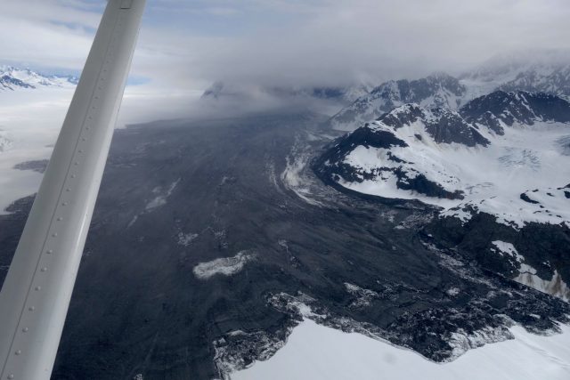
Flow structures in the Lamplugh Glacier rock avalanche deposit, via Paul Swanstrom
.
This is not an area with particularly good Google Earth imagery, but I think that this is the slope that failed:
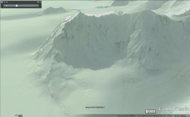
The probable site of the Lamplugh Glacier rock avalanche, via Google Earth
.
The crest of the slope appears to be at about 2030 metres elevation, and the break at the foot of the slope at about 875 m, giving a vertical extent of about 1155 metres. The toe of the deposit is at about 550 metres elevation, which means that the runout lost about 225 metres elevation over 10,000 metres, giving a travel angle of about 1.3 degrees. This is exceptionally low.
This part of Alaska is now firmly established as the global hotspot for rock avalanche activity. Recent events include the Tyndall Glacier Rock Avalanche, the Ferebee rock avalanche, the Mount La Perouse rock avalanche, the Mount Jarvis Rock avalanche and the Mount Lituya Rock Avalanche. A detailed study is urgently needed to understand why this area is so active at present.


 Dave Petley is the Vice-Chancellor of the University of Hull in the United Kingdom. His blog provides commentary and analysis of landslide events occurring worldwide, including the landslides themselves, latest research, and conferences and meetings.
Questions/thoughts on why so many large landslides in my backyard (Glacier Bay/St Elias Mountains) recently. First, are there really more, or has new technology (seismic detection followed by quick aircraft/satellite location) found more than before? Second, glacial retreat seems like an obvious culprit, but most of these seem to start well above where glaciers have not been for a long time. Third, it seems (I have not looked closely) but most of these occur in spring or summer and on generally south-facing slopes. How about the influence of the sun and possible melting/freezing of water in the rock? I’d love to hear other thoughts on these questions.