
8 March 2016
Kalimpong Day 4 part 1: An interesting and deadly roadside landslide
Posted by Dave Petley
Kalimpong Day 4 part 1: An interesting and deadly roadside landslide
On Kalimpong Day 4, part of our UKIERI supported trip to the town of Kalimpong, I spent the morning with Major Joshi and colleagues from the Border Roads Organisation looking at a landslide on State Highway 31A, the road to Gangtok. This is a valley floor road, located on the banks of the Teesta River. Earlier this year there was a significant landslide on this road that killed two people and injured several others. Save the Hills covered this landslide in detail at the time – this is one of the images from their post. Note the truck precariously balanced close to the edge of the road.
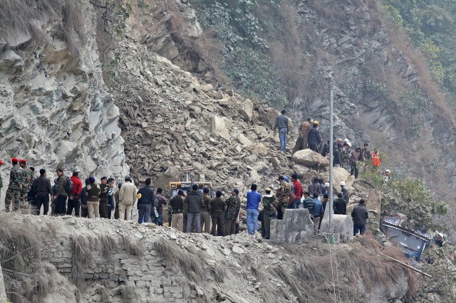
Image of the fatal landslide on State Highway 31A in January 2016. Courtesy of Save the Hills
.
The road is now clear but remains dangerous. This is an image of the site as of the time of my visit:
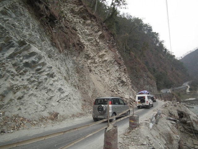
Kalimpong Day 4: The SH31A slope on the Teesta River
.
The source of the January 2016 landslide is located above the white 4×4. Beyond that is another unstable and obviously deformed mass that is waiting to fail. The risk to road users is very clear. This is a classic rock joint controlled instability; this image shows the joint pattern in the unstable rock mass:
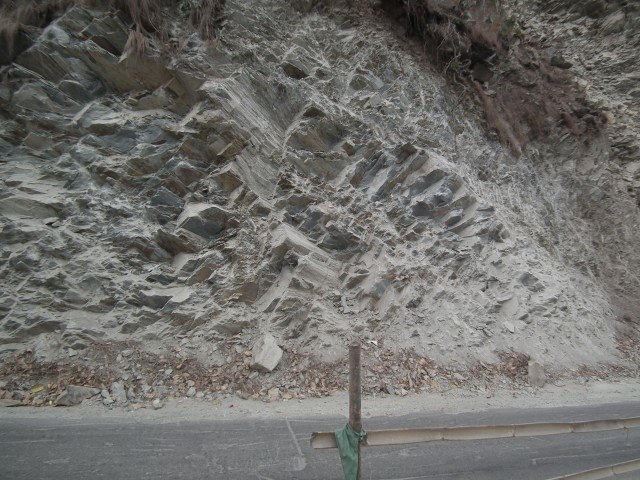
Kalimpong Day 4: Joints in the slope on State Highway 31A
.
There are two major joint sets visible, both steeply inclined. On the image one is diagonal from top right to bottom left, and the other top left to bottom right. These provide the surface to allow a wedge failure. The release surface is the foliation that forms the schistosity, which creates a surface that runs parallel to the road but dips steeply into the slope. This is best seen just to the left of the centre of the image, three quarters of the way up the slop. Here the two steeply dipping joints and the foliation have formed a classic wedge failure from which a block has detached, Once you have your eye in yo can see that these features occur all over the slope.
A little further along the slope this joint pattern changes, such that the instability in the slope is greatly reduced:
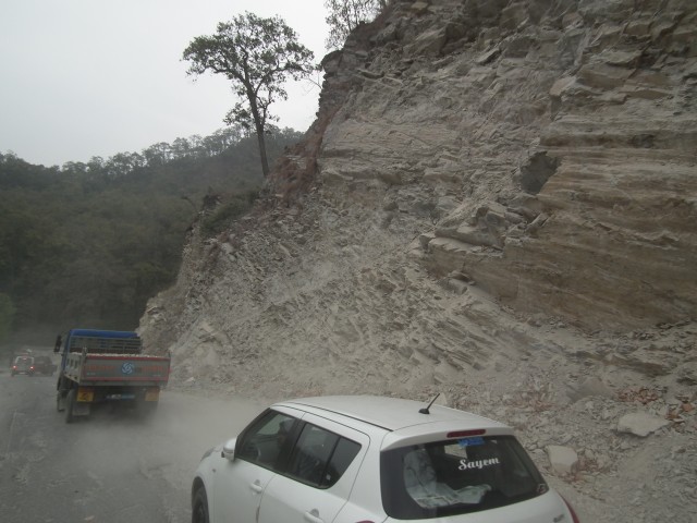
Kalimpong Day 4: Lower levels of instability with a more advantageous joint set
.
These do not look like large failures, and indeed they are not, but the force that they can exert is remarkable. This is the remains of an excavator that was caught in the January 2016 landslide. Note the damage to the boom and to the cab. The driver escaped:
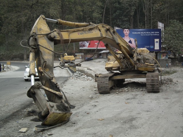
Kalimpong Day 4: Damage to an excavator associated with a landslide in January 2016
.
As the SW monsoon approaches, this slope is extremely hazardous. For non-technical reasons it does not seem possible to blast this rock mass to reduce the hazard, so the only option is to monitor it and close the road when instability is noted. This is not a trivial task. I suspect we will hear more about this slope in the months ahead.
 Dave Petley is the Vice-Chancellor of the University of Hull in the United Kingdom. His blog provides commentary and analysis of landslide events occurring worldwide, including the landslides themselves, latest research, and conferences and meetings.