20 October 2015
The Mount Steele rock avalanche: more details from the seismic data
Posted by Dave Petley
The Mount Steele rock avalanche
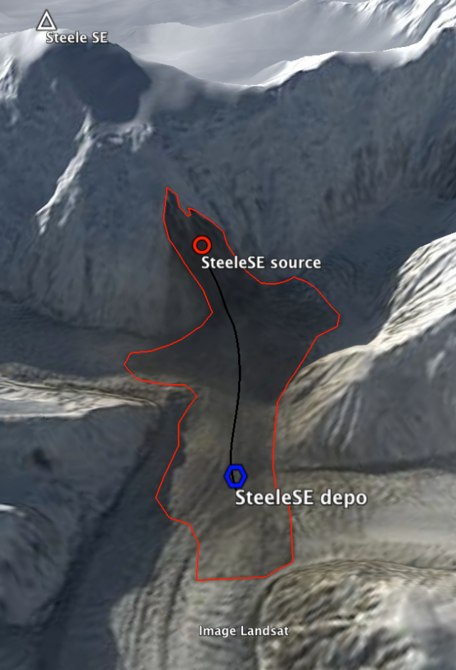
Further analysis by Colin Stark and Goran Ekstrom has yielded more detail on the Mount Steele rock avalanche in the Yukon of Canada last week. This zoomed in perspective view of the satellite image provides greater detail:-

Landsat 8 image of the Mount Steele Rock Avalanche, provided by Colin Stark, with the landslide trajectory overlain.
.
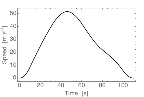
The analysis now suggests a mass of the Mount Steele rock avalanche of 45 to 50 million tonnes, which would equate to about 20 million cubic metres, with a runout time of about 110 seconds. This is the velocity profile from the seismic data – note the comparatively rapid acceleration phase and a more leisurely deceleration:

Velocity – time plot for the Mount Steele Rock Avalanche, provided by Colin Stark, deduced from the seismic data
.
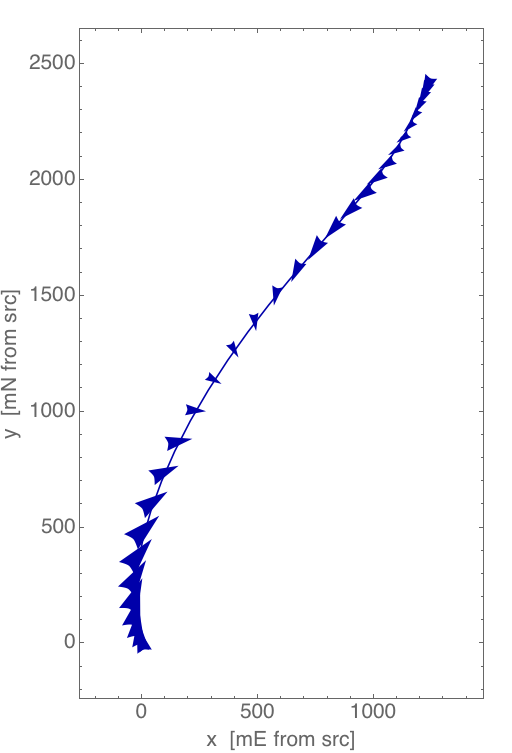
Whilst this is a chart of the track of the landslide with the acceleration vectors overlain. The landslide starts in the bottom left corner on this plot:

The planform trajectory of the Mount Steele Rock Avalanche, provided by Colin Stark, with the acceleration vectors overlain
.
And finally, this is the long profile of the landslide track from the seismic data. The arrows indicate the velocity of the landslide at each point.

Long profile of the Mount Steele Rock Avalanche, provided by Colin Stark. The arrows indicate the landslide velocity.
.
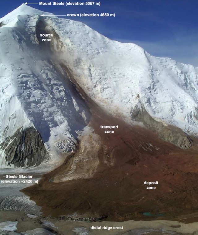
Interestingly, this is second giant landslide in the St Elias area this year alone. On 11th August there was another event that dropped about 40 million tonnes of rock onto the Turner Glacier, not far away from this event. In addition, in July 2007 there was another large rock avalanche from the flanks of Mount Steele. This landslide, which is reported in Lipovsky et al. (2008) [note this paper is available online here], was even larger, with a volume of about 108 million cubic metres. This is an image of the landslide from the paper:

The 2007 Mount Steele rock avalanche from Lipovsky et al. (2008)
.
Reference
Lipovsky, P.S., Evans, S.G., Clague, J.J.., Hopkinson, C., Couture, R., Bobrowsky, P., Ekström, G., Demuth, M.N., Delaney, K.B., Roberts, N.J., Clarke G., and Schaeffer, A. 2008. The July 2007 rock and ice avalanches at Mount Steele, St. Elias Mountains, Yukon, Canada. Landslides. 5 (4):445-455.


 Dave Petley is the Vice-Chancellor of the University of Hull in the United Kingdom. His blog provides commentary and analysis of landslide events occurring worldwide, including the landslides themselves, latest research, and conferences and meetings.