3 October 2014
Prehistoric rockfalls in Christchurch, New Zealand
Posted by Dave Petley
Prehistoric rockfalls in Christchurch, New Zealand
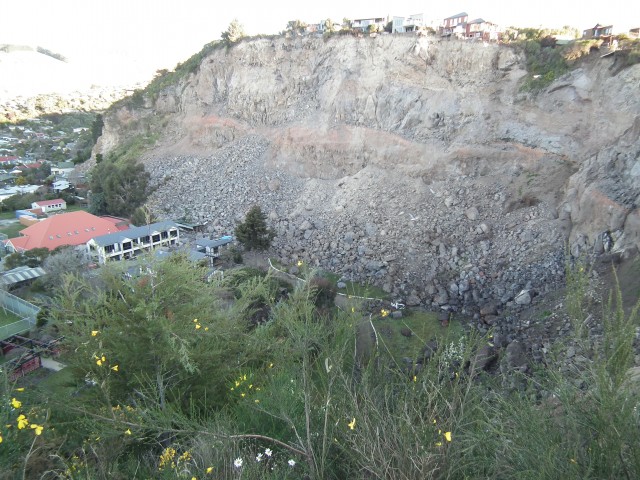
One of the most interesting aspects of the Canterbury (Christchurch) earthquake sequence of 2010-2011 was the rockfalls that the shaking triggered in the Port Hills area on the edge of the city. I’ve covered those impressive and highly destructive events on a number of occasions. The great challenge after the earthquake was assessing the future rockfall hazard; a task that was undertaken with impressive rigour by GNS Science.
.
In assessing future rockfall hazard, a key element is evaluating the likely occurrence of the various trigger events. In Christchurch there were three key processes under consideration – a repeat of a local earthquake like the Canterbury sequence; a distant but larger earthquake, which in South Island is most likely to be a rupture on the Alpine Fault; or a large rainfall event. In each case much work has been undertake to evaluate the return periods of these trigger events, but for the Alpine Fault earthquake a key question was the degree to which a large earthquake would induce collapse events. This is challenging – we would expect that a distant very large earthquake would induce less intense shaking but for a longer duration when compared with a local event, but to what extent is this likely to trigger a large-scale rockfall?
Dating prehistoric rockfalls
In a paper that is in press for Geology, but is available for download from the author’s website, Benjamin Mackey and Mark Quigley from the University of Canterbury have tried to address this problem by dating prehistoric rockfalls at a site in Rapaki in the Port Hills. This site was one of the locations in which rockfalls caused eyebrow-raising damage, in particular when a boulder went straight through a house, out the other side and on down the hill. Interestingly, the slope was also littered with other boulders from previous rockfalls. Mackey and Quigley identified boulders from previous rockfalls that were of a similar size to those that detached in 2011 and undertook a dating exercise on them. The approach used is new and novel dating technique that gives a duration over which a rock surface has been exposed to cosmic rays. The reasoning is that a boulder is shielded from cosmic rays until the rockfall event. From this point onwards the top surface is bombarded; the dating system allows this length of time to be determined. Whilst that might sound trivial, in reality the technique is very challenging and experimental.

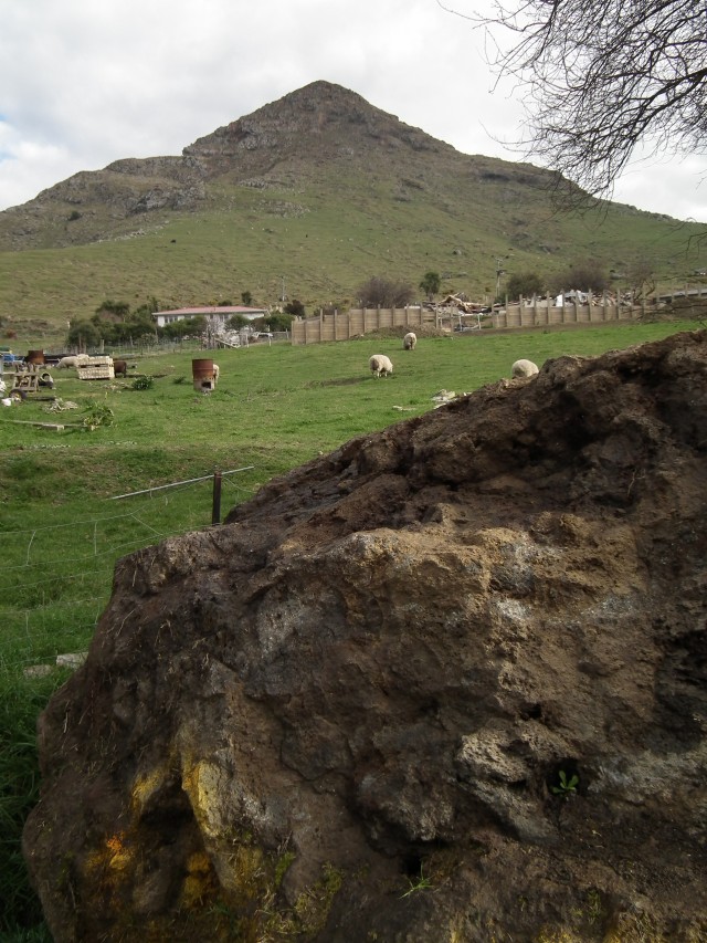
The Rapaki site studied in this research. The boulder in the foreground originated from the bluff in the distance, passing through a house (now demolished) and fance (visible in the image) en route
.
The results are really interesting. In essence the technique suggests that the last big rockfall event at this site occurred about 7,000 years ago, with the possibility of an earlier one at about 13,000 years ago. Earlier rockfall events than this are likely to have occurred, but these boulders are now buried in the slope. The big, distant earthquakes happen much more frequently than this – for example the Alpine Fault generates a large earthquake about every 300-400 years and the Porters Pass Fault generates one every 1500-2000 years. Thie implication is that none of these events in the last 7,000 years has generated wide scale rockfall activity at Rapaki.
So, it seems likely that the prehistoric rockfalls at Rapaki were generated by local earthquakes similar to the Canterbury earthquake sequence. And of course the data might indicate that these events only occur every 6,000 to 7,000 years on average, which is reassuring. Note however that a single site gives limited information about the seismic hazard as a whole – Mackey and Quigley point out that the fault generating a Mw=6.0 earthquake would have to be within 10 km and a Mw=7.0 within 20 km of the site to generate sufficient shaking to trigger rockfalls at Rapaki. Other faults in this area but beyond these distances would not generate enough shaking to generate rockfalls at Rapaki. So the return period of earthquakes of this size across the Canterbury area may be shorter than this if there are other active faults.
There is a news report about this research here. Mark Quigley should be congratulated or engaging with the comments at the foot of the article and for trying to explain his research. Some of the other comments are deeply frustrating.
Reference
Mackey, B., and Quigley, M., (2015 in press) Strong proximal earthquakes revealed by cosmogenic 3He dating of prehistoric rockfalls, Christchurch, New Zealand, Geology (PDF here)


 Dave Petley is the Vice-Chancellor of the University of Hull in the United Kingdom. His blog provides commentary and analysis of landslide events occurring worldwide, including the landslides themselves, latest research, and conferences and meetings.
The reference to the likelihood of an Alpine fault earthquake being able to trigger rockfalls requires comment. Until very recently,the Alpine fault dominated the thinking around South Island seismic risk; this is paricularly evident in the literature n west coast seimicity, whih has until very recently been almost completely attributed to putative Alpine fault ruptures. Evidence is now emerging to suggest – unsurprisingly – that many other active faults are present within the southern Alps and, obviously since Sept 2010, beneath the Canterbury Plains. As Mark Quigley has responded, it is now accepted that many such unknown faults exist along side the ones we do know about. Thus the real significance of the Mackey/Quigley paper is that no distal source caused the 7k an 14k BP rockfall events, rather than that they were not assciated with an Alpine fault event