31 July 2014
Malin landslide in Pune, India: a mass fatality mudslide yesterday
Posted by Dave Petley
Malin landslide
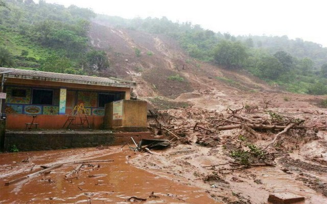
Early yesterday morning a very large landslide occurred in the village of Malin in Pune, western India. The landslide struck and effectively wiped out the village of Malin, located close to Bhimashankar in the western Ghats. It is thought that about 40 houses were buried – sadly the timing of the landslide meant that most would have been fully occupied and of course the darkness would have impeded any escape. Latest reports suggest that 28 bodies have been recovered to date, together with eight survivors, but a further 150 people may still be buried. As such this is the second worst landslide of the year to date, after the Afghanistan landslide of a couple of months ago.
There is only a limited number of images of the landslide on the web, most looking like this (source):
http://www.swadeshnews.com/national/pune-village-devastated-by-massive-landslide-at-least-10-dead-150-feared-trapped-see-pics
..
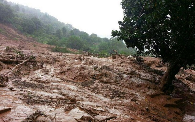
The debris pile at the foot of the slope appears to be exceptionally wet:
http://www.swadeshnews.com/national/pune-village-devastated-by-massive-landslide-at-least-10-dead-150-feared-trapped-see-pics
.
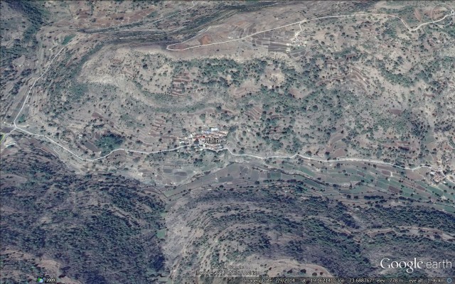
The site of the landslide is quite well covered on Google Earth – the location is (19.161, 73.688) if you wish to take a look. This is a perspective view of the village and slope:
Causes of the Malin landslide
Inevitably there is huge speculation in the Indian media about the causes and triggers of the Malin landslide. The trigger is clear – this area was affected by very strong monsoon rainfall in the two days prior to the landslide. The NASA TRMM landslide warning tool highlighted this as a zone that was very susceptible to landslides in light of this rainfall:
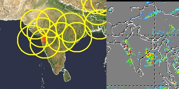
TRMM data for the Malin landslide, sourced 30th July. Left image is the landslide warning area, right is the measured precipitation
.
The TRMM data can also be used to generate a time series graph for rainfall in the area of the landslide:
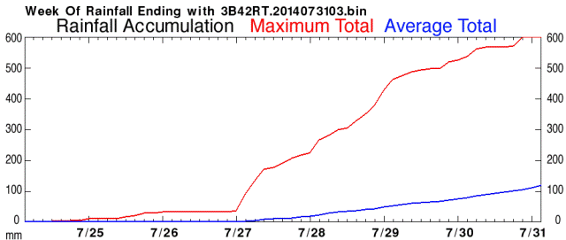
TRMM time series precipitation graph for the Malin landslide
.
The data suggests that as much as 600 mm of precipitation may have affected this area prior to the landslide occurring. In the media there is a great deal of speculation that the dam at Dimbhe, a few kilometres downstream may have been a factor. But given the distance to the reservoir, the fact that the dam was completed in 2000 and the type of landslide this is not immediately obvious to me. There is also discussion about the role of development and deforestation, which may be far more important. The landslide appears to be a mudslide in deeply weathered soils (there is no evidence of involvement of large amounts of bedrock), so this slope would be highly susceptible to disturbance. The investigation will need to look at this in detail.
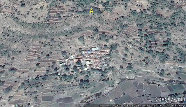
The Google Earth images are hard to interpret well because of the low resolution of the digital elevation model, but I have been looking at them to see if this slope could have been identified as being potentially dangerous. This is a more detailed Google Earth perspective view of the site:
The image appears to be dated from February this year. There is no obvious signs of cracking or suchlike that I can see, which is not unexpected for a soil slide. However, the feature that I have marked A above is interesting – this appears to be a large topographic hollow. Such features can have the effect of concentrating intense rainfall during overland and soil flow. If this occurs, then pore water pressures in the soil in the hollow can become very high, initiating failure. If I was investigating this landslide I would be very interested in this hollow. The location directly above the village is deeply unfortunate if this feature was a factor.


 Dave Petley is the Vice-Chancellor of the University of Hull in the United Kingdom. His blog provides commentary and analysis of landslide events occurring worldwide, including the landslides themselves, latest research, and conferences and meetings.
well this is 2018 and I am doing a project on landslides and I wanted to find a landslide that was really interesting but you did not really capture the real impact it had on the people of this particular village
This is so much better than wiki! Thanks for the google earth as well!
doesn’t fully help, but was helpful. I wish there was more about what caused it.