15 February 2013
New aerial photos of the Hatfield Stainforth colliery landslide
Posted by Dave Petley
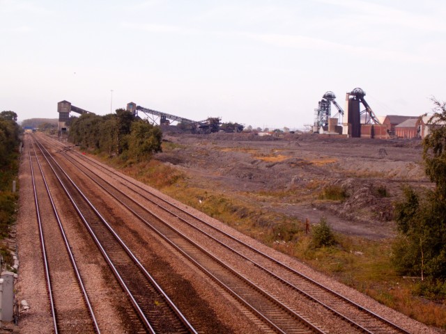
More information is now emerging about the Hatfield Stainforth landslide colliery landslide near to Doncaster in England. First, to help understand the timescale of the development of the site, this image has been provided by Richard Aspinall, a resident of the Stanforth area, before the spoil heap was developed:
The image was taken some years ago and shows that there was no slope present before the tip was created.
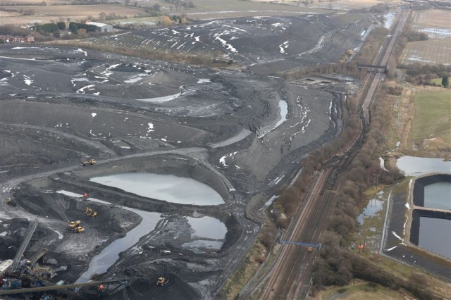
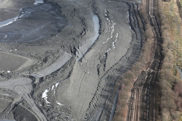
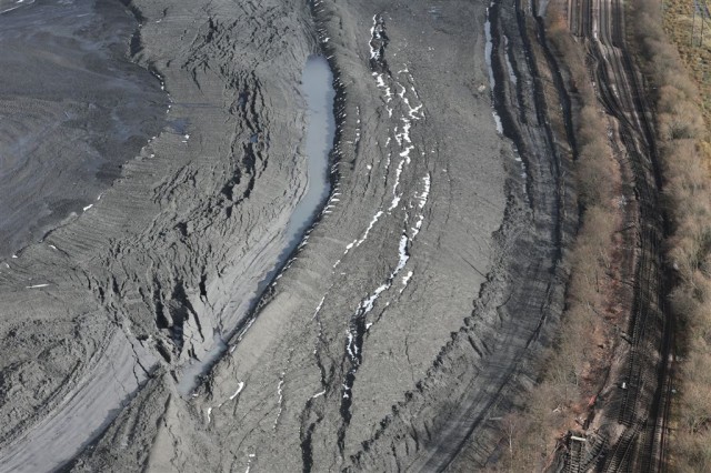
Meanwhile, it appears that Network Rail have been distributing a set of aerial images of the landslide, taken (I think) yesterday. Three of these are on the Railway Eye blog, and I reproduce them here with credit to them:
So what can we say about the landslide from this? Well, first the landslide has continued to develop and displace. The track has now moved considerably further, and indeed the deformation has extended into the field on the far side of the track (where there appears to be a power pylon).
A comparison of the latest images (bottom) with the earlier aerial image (top) is also really helpful:
It seems to me that the deformation at the toe now has a large horizontal component of movement, which probably reflects the weak nature of the materials involved. Thus, the landslide is not purely rotational as I suggested yesterday, but may well have a reasonably horizontal surface running through the alluvium. Similarly, the portion of the landslide near to the crown has also deformed plastically. Note that the rear tension cracks have moved towards the slope as well, and a depression has formed ahead of them that has now filled with water. This suggests that the water table may be very high. The material behind the rear tension cracks appears to have flowed towards the slope, which will not be helping with the stability of the system.
The lack of machines on the landslide suggests that the colliery is allowing the slope to stabilise before work starts to manage it. This is the right approach, and will be helped by the dry weather today.
Finally, the magnitude of the task facing those trying to manage the landslide should be clear. Removing the driving load from the top of the slope is far from easy when the material in the tip is deforming into it. Once that load has been removed the bulge at the toe can be excavated (very carefully), and the track can be reinstated. Given how far the track bed has removed, presumably this will be a substantial task.


 Dave Petley is the Vice-Chancellor of the University of Hull in the United Kingdom. His blog provides commentary and analysis of landslide events occurring worldwide, including the landslides themselves, latest research, and conferences and meetings.
SSR (Slope Stability Radar) and or WAM (Work Area Monitor) can be used as work starts — could have been an asset in itinerant study of impoundments and dumps .. etc .. as the environmental factors are known and ongoing — at other sites — where infrastructure and or people could be affected.
There is always an opportunity to manage the slope, safety, and operational support with real time data — it is affordable.
[email protected]
Fascinating article and aerial photos. Lucky a train wasn’t coming.
Tom Smithson
http://www.ukaerialphotos.com
Dr.Dave: It may not be obvious to all American readers that this is a coal mine operation. “Colliery” isn’t a common term here. Is it a strip mine, or is coal burned nearby and the ash slurry deposited in ponds? I might have missed the description, how would you characterize the spoil materials?
Try http://en.wikipedia.org/wiki/Hatfield_Colliery
I can say it is really a dangerous one. The tracks I think don’t have more traffic through these. These landslides are really dangerous and may lead to a disaster and may give arise to fatal conditions too. Just a show of the Nature.