
July 13, 2023
Loss of Conrad Glacier, Goat Rocks Wilderness, WA
Posted by Mauri Pelto
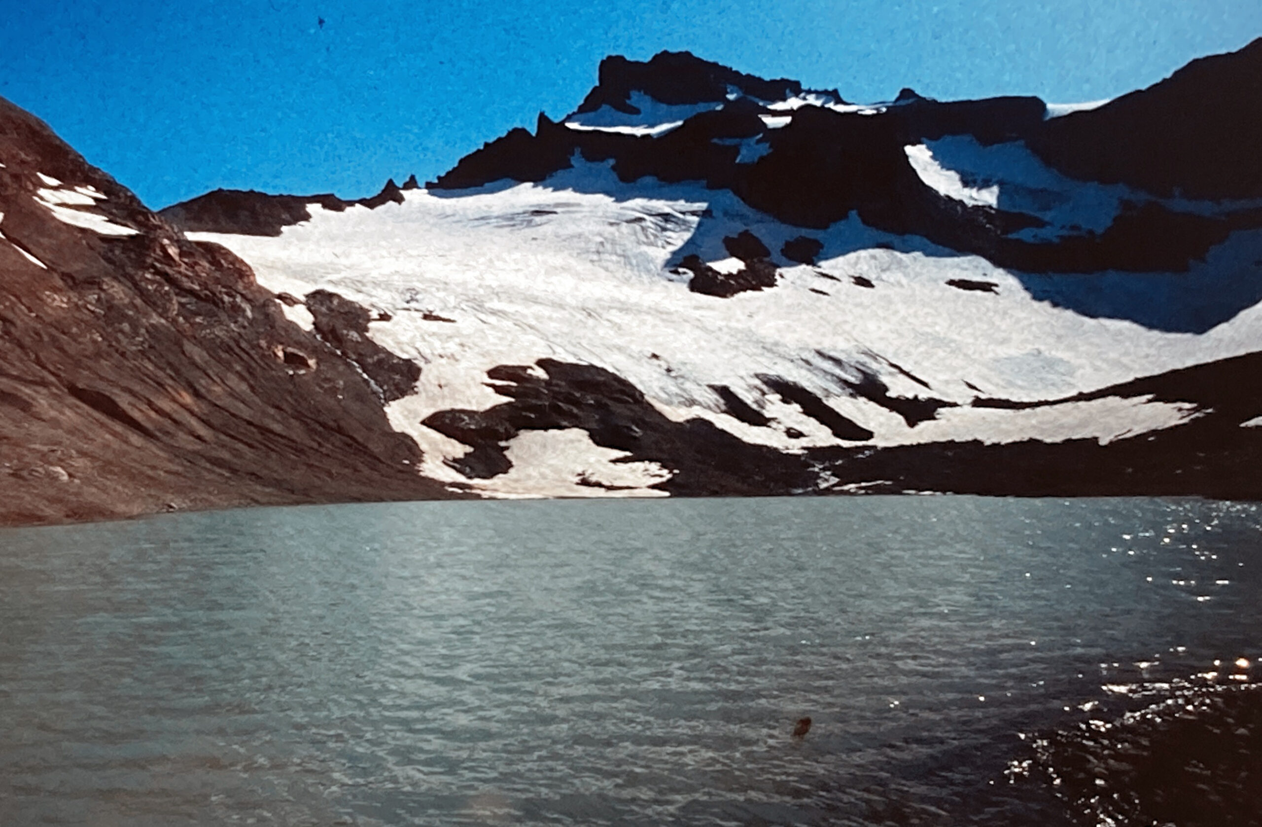
Conard Glacier looking south across Conrad Lake in 1993. Glacier terminates 193 m from lake.
In 1993 we surveyed the glaciers of the Goat Rocks Wilderness, Washington. Conrad Glacier was our main focus, we worked with a field class from Pacific Lutheran University to measure snowpack, area and runoff from the glacier. In 1958 the glacier reached Conrad Lake and had an area of 0.5 km². In 1993 at our first visit the glacier had retreated 193 m from the lake and had an area of 0.25 km². There was no movement on the lower glacier. In 1998 and 2006 we noted continued retreat and thinning with retreat from the lake of 495 m in and an area of 0.16 km² of the largest upper eastern segment. The western upper section had completely separated from the lower western part, and both had separated from the upper eastern segment. In 2015 the USGS inventory indicated an area of 0.13 km² for Conrad Glacier. The area of the largest ice mass (C1 and C2) had further declined by 2020 to 0.10 km². Summer of 2021 and 2022 were years of exceptional melt from Mount Shasta through southern British Columbia that further reduced the four glacier fragments by October 2022. The largest having an area of less than 0.04 km², too small to qualify as a glacier as this small area does not allow for movement. The combined area of all four fragments is less than 0.1 km². The loss of volume of this glacier parallels that of many North Cascade glaciers we have observed annually for 40 years including glaciers that have disappeared such as Hinman, Lewis, Lyall, Milk Lake and Spider Glacier.

Conrad Glacier in October 2022 false color Sentinel images indicating the four remaining fragments the largest C1 is less than 0.04 km².

Conrad Glacier in 2020 Google Earth image indicating the fragmentation that has occurred.

Conrad Glacier in 2006 Google Earth image indicating the retreat of the glacier and fragmentation. Glacier now terminates 495 m from lake.

Traversing the lower Conrad Glacier in 1993, notice the low slope of this section that melted away by 2006. The steeper slopes with blue ice are where C1 and C2 developed.

Conrad Glacier in 1958 USGS map when it connected to Conrad Lake.
 Dean of Academic Affairs at Nichols College and Professor of Environmental Science at Nichols College in Massachusetts since 1989. Glaciologist directing the North Cascade Glacier Climate Project since 1984. This project monitors the mass balance and behavior of more glaciers than any other in North America.
It has become exceedingly astonishing that we don’t seem to have qualified scientists that can meet with local, county, and state officials to sound an alarm to the loss of glacier ice that provide important water resources and that those water resources cannot be taken lightly and continue the extensive building of apartments that will only tax our current water resources. We need to do what Phoenx, AZ did, no more construction except for that which is already approved.
I have met with local officials many times to update them on what is happening. Locally they understand and are making management decisions based on that. The shortcoming is broader response.