
April 28, 2023
Jacobsen Glacier, BC Diminishes to Smallest Size in Thousands of Years
Posted by Mauri Pelto
Written with Dan Smith
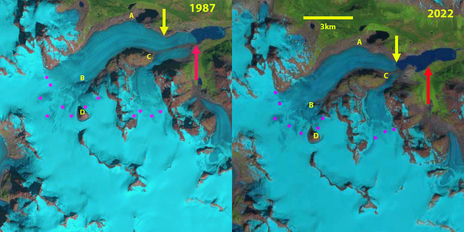
Jacobsen Glacier in Landsat images from 1987 and 2019. Red arrow 1987 terminus location, yellow arrow 2022 terminus location and purple dots the snowline. Point A indciates ice marginal lake in 1987, Point C is the glacier junction, Point B an emerging rock rib and Point D a nunatak.
Jacobsen Glacier is a large outlet glacier flowing from the Monarch Icefield in the Pacific Ranges of the British Columbia Coast Mountains. The glacier has sustained significant ongoing retreat and down wasting since achieving its Holocene maximum during the Little Ice Age (LIA) (Desloges and Ryder, 1990, Harvey and Smith 2013). The retreat and thinning of Jacobsen Glacier revealed a dendroglaciological samples that help identify periods of glacier advance and thickening over the last several thousand years. VanLooy and Forster (2008) noted that the glacier retreated at a rate of 30 meters/year from 1974 to 1992 and 47 meters/year from 1992-2000. Menounos et al (2018) identified a mass loss for glaciers in this region of ~0.5 m year from 2000-2018 which is driving retreat.
Meltwater from Jacobsen Glacier flows northward into Jacobsen Creek, which drains into the Talchako River to eventually join the Adnarko River to form the Bella Coola River. The Bella Coola River is a key salmon producing rivers on the British Columbia’s central coast, supporting large chinook and chum salmon populations, surveyed at 23k and 190k in surveys during the last decade (Pacific Salmon Foundation, 2021) The sockeye and pink salmon runs have largely collapsed this century (Pacific Salmon Foundation, 2021). In this post we examine Landsat satellite imagery from 1987-2022 to illustrate recent changes and field images from University of Victoria expeditions, provided by Dan Smith, in 2002 and 2010.
The historical terminal retreat and thinning of Jacobsen Glacier led to exposure of the remains of trees overwhelmed and buried by mid-Holocene glacier advances. Expeditions to the site in 2010 provided the opportunity collect samples of these remains for tree-ring analysis and radiocarbon dating. Lichenometric measurements in 2002 and 2010 were used to date the LIA moraine building episodes and to provide a record of the rates of deglaciation. Moraine building intervals were identified prior to 1280–1320 and 1490–1530 AD and describe early-LIA advances; whereas advances prior to 1680–1720 and 1820–1870 AD describe the results of late-LIA advances (Harvey et al 2012).
In 1987 Jacobsen Glacier terminated in a 1.8 km long proglacial lake at an altitude of ~1080 m . The north margin had a separate terminus in the proglacial lake at Point A. The terminus in the main proglacial lake was 900 m wide. At Point B there was an icefall, but no exposed bedrock. The snowline at this time was at 2050 m. By 1995 the glacier had retreated 500 m up valley. The glacier remained in contact with the proglacial lake at Point A and the snowline was at 2100 m. Due to thinning by 2000 the glacier had retreated from the proglacial lake at Point A and in 2016 the snowline was at 2150 m. By this time the glacier was separated from the proglacial lake at Point A by ~500 m and the southern tributary no longer reached the expanding proglacial lake. By 2018 bedrock was exposed at Point B and the snowline was at 2100 m.
The retreat and downwasting at Jacobsen Glacier continues at the present time. In 2022 the proglacial lake had expanded to a length of 3.6 km, a total retreat distance of 1800 m from 1987-2022. Lake area is 2.8km² in 2022, with the glacier calving front being 500 m long. The rate of terminal from 1987-2022 amounted to ~50 m/year, only a slightly change rate reported from 1990-2000 reported rate. In 2022, the local snowline was found at 2050 m. The reduced calving front length and likely lake water depth will reduce calving losses, surface mass balance losses will be the key driver of ongoing retreat. In 2010 the University of Victoria expeditions had noted the glacier had retreated to a point where it was smaller than it had been in 6000 years, exposing buried trees. Since then the retreat has continued likely exposing a few more buried treasures to be examined.
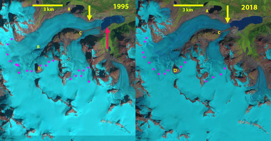
Jacobsen Glacier in Landsat images from 1995 and 2018. Red arrow 1987 terminus location, yellow arrow 2019 terminus location and purple dots the snowline. Point A indciates ice marginal lake in 1987, Point C is the glacier junction, Point B an emerging rock rib and Point D a nunatak.

Jacobsen Glacier in Landsat images from 2000 and 2016. Red arrow 1987 terminus location, yellow arrow 2019 terminus location and purple dots the snowline. Point A indicates ice marginal lake in 1987, Point C is the glacier junction, Point B an emerging rock rib and Point D a nunatak.
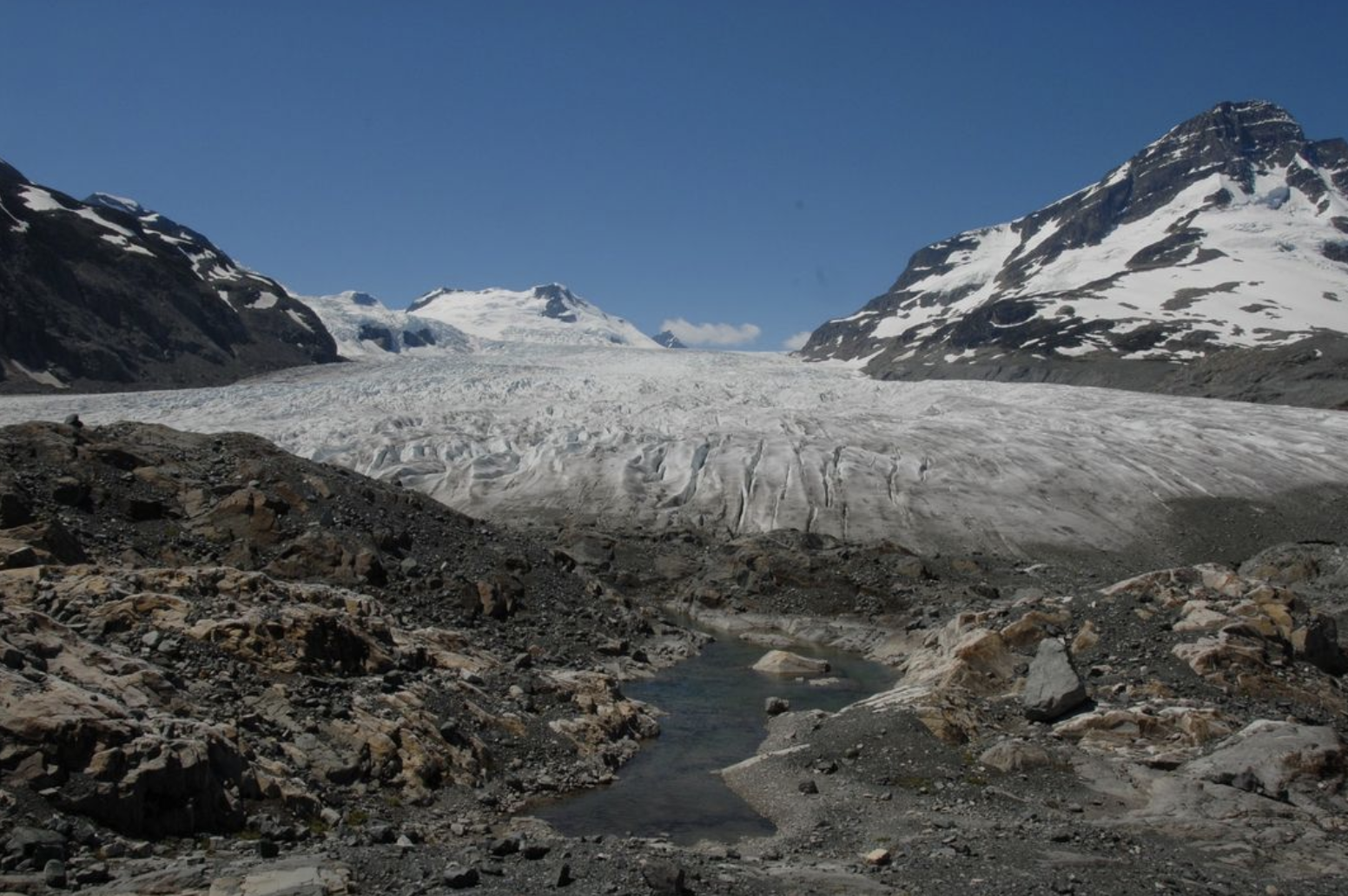
Recently deglaciated bedrock outcrops beside Jacobsen Glacier. Monarch Icefield area, Pacific Ranges, British Columbia Coast Mountains. (July 18, 2010)
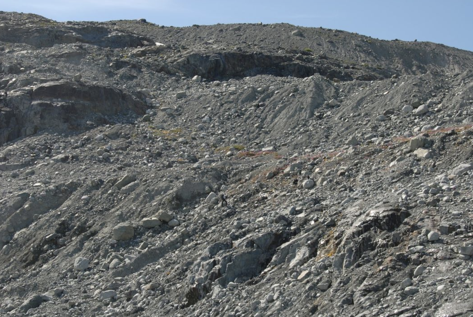
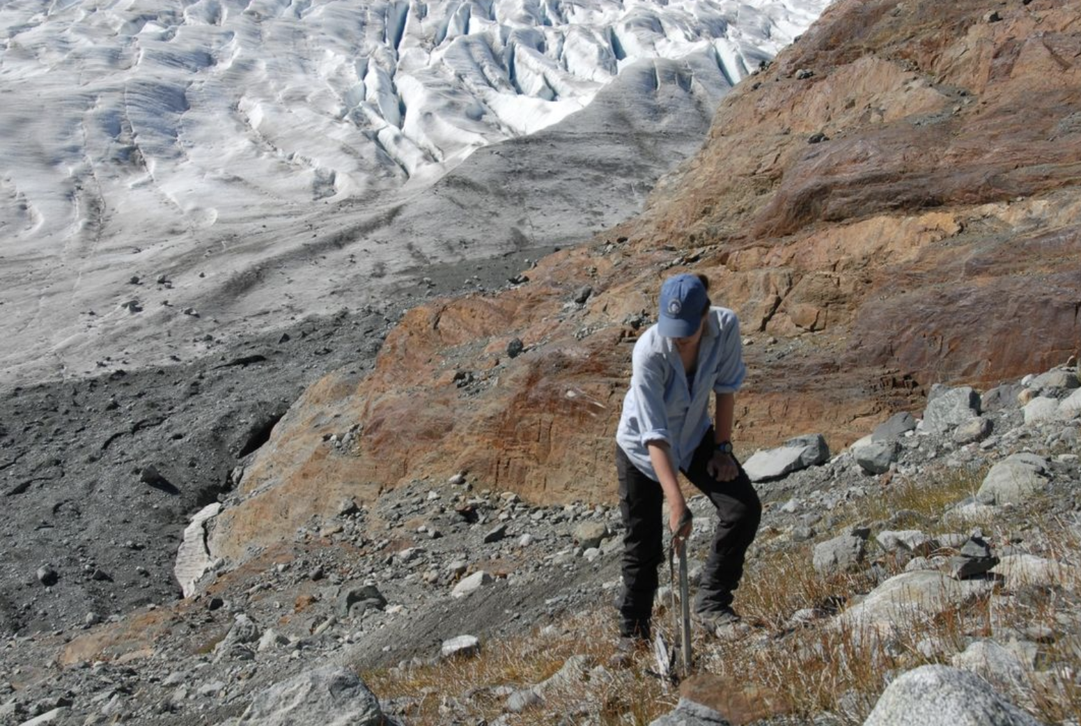
A dendroglaciological treasure located above Jacobsen Glacier. UVTRL Team member points to the detrital remains of a masticated tree stem plastered onto the moraine slope. One of many pieces of subfossil wood found in the general area, it proved to be the remains of a tree killed when the glacier was expanding up this slope 6500 years ago (July 17, 2010)

Jacobsen Glaciers western margin in 2010. Field team is resting on the recently deglaciated terrain in the lower left (July 17, 2010).

The diggers are excavating a rooted and sheared stump in growth position. Radiocarbon dating indicate the tree was killed as Jacobsen Glacier expanded some 6500 years ago. While the glacier unquestionably waxed and waned over those six millennia, this is the first time that it has shrunk to its contemporary size. (July 17, 2010)
 Dean of Academic Affairs at Nichols College and Professor of Environmental Science at Nichols College in Massachusetts since 1989. Glaciologist directing the North Cascade Glacier Climate Project since 1984. This project monitors the mass balance and behavior of more glaciers than any other in North America.